ATLAS of ANTIENT GEOGRAPHY by SAMUEL BUTLER 1843John McInnis Auctioneers,LLC4.6(502)See Sold PriceFeb 24, 2024
18TH C. ANTIQUE MAP: FRENCH & INDIAN WAR, FRAMEDThomaston Place Auction Galleries4.4(386)See Sold PriceFeb 24, 2024
Rand McNally Railroad Map Cabinet w/ 21 Railroad MapsRail & Road Auctions4.6(165)See Sold PriceMar 08, 2024
Keith Haring - Ink on New York Map, Best Buddies, Inscribed, Signed, and DatedSapphire Auction Gallery4(67)See Sold PriceMar 02, 2024
LATE 17TH C. FRENCH MAP OF THE NEW WORLD BY ALEXIS-HUBERT JAILLOT (1632-1712)Thomaston Place Auction Galleries4.4(386)See Sold PriceFeb 24, 2024
Central Railroad of New Jersey Map of Sandy Hook Route-ca. 1903JM Hobby Supply and Railroad Artifact Auctions4.4(126)See Sold PriceFeb 24, 2024
Lot of Six Mixed Atlas Box Cars-HO Scale-New in BoxJM Hobby Supply and Railroad Artifact Auctions4.4(126)See Sold PriceFeb 25, 2024
Rand McNally/Santa Fe Railroad Map of Iowa-1912JM Hobby Supply and Railroad Artifact Auctions4.4(126)See Sold PriceFeb 24, 2024
NICOLAES VISSCHER (NETHERLANDS, 1618-1709) MAP OF THE NEW WORLDThomaston Place Auction Galleries4.4(386)See Sold PriceFeb 24, 2024
17TH C. WORLD MAP BY NICOLAES VISSCHER (NETHERLANDS, 1618-1709)Thomaston Place Auction Galleries4.4(386)See Sold PriceFeb 24, 2024
Lot of Six Mixed Atlas Cabooses-HO Scale-New in BoxJM Hobby Supply and Railroad Artifact Auctions4.4(126)See Sold PriceFeb 25, 2024
SoldBOOKS: Morse 1802 Gazetteer COMPLETE 18 MapsBOOKS: Morse 1802 Gazetteer COMPLETE 18 Maps, Jedidiah Morse and Rev. Elijah Parish. A New Gazetteer of the Eastern Continent; or, A Geographical Dictionary: containing, in alphabetical order, a descrSee Sold Price
The American Gazetteer Second Edition, Revised, CoThe American Gazetteer, ... Second edition, revised, corrected, and enlarged.. Jedidiah Morse. Samuel Etheridge. Complete with six folding maps, contemporary calf. Binding rubbed with front hinge cracSee Sold Price
American Gazetteer Jedidaih Morse Maps Rare Book1804 edition of ''American Gazetteer'' by Jedidaih Morse. With six fold-out maps and a ''Full Account of the Civil Divisions, Rivers, Harbours, Indian Tribes, etc. of the American Continent, also of tSee Sold Price
American Gazetteer Jedidaih Morse Maps Rare Book1804 edition of ''American Gazetteer'' by Jedidaih Morse. With six fold-out maps and a ''Full Account of the Civil Divisions, Rivers, Harbours, Indian Tribes, etc. of the American Continent, also of tSee Sold Price
Book American Gazetteer Jedidaih Morse Maps Exploration1804 edition of ''American Gazetteer'' by Jedidaih Morse. With six fold-out maps and a ''Full Account of the Civil Divisions, Rivers, Harbours, Indian Tribes, etc. of the American Continent, also of tSee Sold Price
SoldBook: The Cyclist's Touring Maps and Gazetteer, withBook: The Cyclist's Touring Maps and Gazetteer, with complete section maps of the British Isles.See Sold Price
MAPS IN BOOK, Miscellaneous Books, MalhamComplete First Edition of Malham's Gazetteer. Miscellaneous Books. Rev. John Malham, [2 Volumes] The Naval Gazetteer; or, Seaman's Complete Guide. Containing a Full and Accurate Account..., 1795 (publSee Sold Price
SoldMap of North America, 1797Ca. late 18th c. engraved map, on laid paper. "A New Map of North America Shewing all the New Discoveries, 1797." Sheet 9.5" x 8.25". From Morse's Gazetteer of America.See Sold Price
SoldMap of the Northern United StatesCa. late 18th c. engraved map, on laid paper. B. Callender after Abraham Bradley. "Map of the Northern Part of the United States of America." Sheet 16.25" x 9.75". From Morse's Gazetteer of America.See Sold Price
The Traveler’s Guide or Pocket Gazetteer of the UnitedThe Traveler’s Guide or Pocket Gazetteer of the United States extracted from the latest edition of Morse’s Universal Gazetteer with an Appendix… Illustrated by a map.This 323-page book was publiSee Sold Price
Sold[S. America, New Guinea] MapsPair of engraved maps, circa late 18th century, on laid paper, from Morse's American Gazetteer. Includes: "West Indies, from the best Authorities" (sheet 13.25" x 8.25") and "Chart of Discoveries EastSee Sold Price
Sold1798 American Gazetteer ATLAS Map Georgia Indians1798 American Gazetteer ATLAS Map Georgia Native Americans RARE Jedidiah Morse Jedidiah Morse was an important and prominent geographer known for his American textbooks, books that earned him the nameSee Sold Price
Sold1950's Space Kit.Includes the original box, marked "Copyright 1954 McMahon & Morse, N. Y." Marked "Charter Member of the Interplanetary Space Squadron". Inside, which looks complete, are maps of the stars, a book abouSee Sold Price
Sold7V REVOLUTIONARY WAR IN NEW YORK STATE Antique7V REVOLUTIONARY WAR IN NEW YORK STATE Antique Decorative Gilt Leatherbound Dutchman’s Fireside James Kirke Paulding Complete Gazetteer Horatio Gates Spafford Fold‾Out Facsimile Map AnnalSee Sold Price
1823 ATLAS of UNITED STATES on IMPROVED PLAN 11 MAPS by MORSE antique AMERICANAATLAS of UNITED STATES on IMPROVED PLAN ; Consisting of TEN Maps, with Complete Index to Each and a General Map of the Whole Country by Sidney E Morse. New-Haven, engraved and published by N.& S.S. JoSee Sold Price
SoldThe American Gazetteer by Jedidiah Morse, 1797With 1797 Fold out Map inside. Book split in two and loose binding.See Sold Price
Stereo Cards by Underwood "Rome" with Book, 1902Stereo Cards by Underwood "Rome" with Book, 1902 Underwood and Underwood. Complete set with 46 stereo cards 9 x 18 cm with booklet and fold-out map. With underwood stereo viewer "System Holmes". StereSee Sold Price
SoldStereo Cards "Rome" by Underwood with Book, 1902Stereo Cards "Rome" by Underwood with Book, 1902 Underwood and Underwood. Complete set with 46 stereo cards 9 x 18 cm with booklet and fold-out map. With underwood stereo viewer "System Holmes". StereSee Sold Price
SoldBOOK-THE AMERICAN GAZETTEER, 1810, THIRD EDITION, BBOOK-THE AMERICAN GAZETTEER, 1810, THIRD EDITION, BY JEDIDIAH MORSE, 2 MAPS, BOARDS WORN, SCATTERED FOXINGSee Sold Price
SoldGroup of 8 Antique and Vintage Atlas/Geography BooksLargest is 11x14.75 inches. Watsons New and Complete Illustrated Atlas of the World (1885), Peerless Atlas of the World (1905), Colliers World Atlas and Gazetteer (1938) and more. Used to rough conditSee Sold Price
SoldREMNANTS OF JOHNSON'S ATLAS BOOKMissing complete cover and numerous pages still having several maps in good condition size 46 by 36 cm. (18 by 14 in)See Sold Price
SoldTHE OFFICIAL ATLAS OF KANSAS 1887 ILL. COMPLETEHas all original hand colored city and town maps, the first 4 pages are loose otherwise very good book measures 15 by 18 inches. G3See Sold Price
SoldBOOK-A NEW GAZETTEER OF THE EASTERN CONTINENT BY JBOOK-A NEW GAZETTEER OF THE EASTERN CONTINENT BY JEDIDIAH MORSE, 1808, SECOND EDITION, FOLD OUT MAPS, BOARDS WORN, SCATTERED FOXINGSee Sold Price
SoldAtlas - Hughes, William C1900 Clasical Atlas, 18 Maps"Philips' Handy Classical Atlas" by William Hughes. London: George Philip & Son, nd C1900. 8vo (220 x 155m) Burgundy cloth, very slight wear. Complete with 18 Maps. A few with light pencil notes, oneSee Sold Price
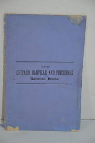
Chicago Danville and Vincennes RR Gold Bond Prospectus Book-1872JM Hobby Supply and Railroad Artifact Auctions4.4(126)See Sold PriceFeb 24, 2024
1818 RARE Geography Made Easy MAPS Jedidiah Morse Boston Indians Atlas AsiaSchilb Antiquarian Rare Books4.8(421)See Sold PriceMar 31, 2024
1887 Appletons' General Guide to the United State and Canada Part IIRail & Road Auctions4.6(165)See Sold PriceMar 08, 2024
Van Dongen. Les plus beaux contes de KIPLING, 1920. 23 pochoirs in color.TheRedFinch Auctions4.4(24)See Sold PriceFeb 29, 2024
Kent & Sussex.- Moss (W.G.) The History and Antiquities of the Town and Port of Hastings, 1824; andForum Auctions4.3(52)See Sold PriceFeb 29, 2024
Pablo Picasso - Peintre et modele aux cheveux longs, 1966 - Rare!NCAG4.4(32)See Sold PriceMar 10, 2024
Pablo Picasso - Peintre debout a son chevalet avec son modele, 1966 - Rare!NCAG4.4(32)See Sold PriceMar 10, 2024
Pablo Picasso - Sculpteur devant sa sellette, avec un spectateur barbu, 1966 - Rare!NCAG4.4(32)See Sold PriceMar 10, 2024


![[S. America, New Guinea] Maps (1 of 5)](https://p1.liveauctioneers.com/3532/176090/88636463_1_x.jpg?height=282&quality=70&version=1596942787)