ATLAS of ANTIENT GEOGRAPHY by SAMUEL BUTLER 1843John McInnis Auctioneers,LLC4.6(502)See Sold PriceFeb 24, 2024
18TH C. ANTIQUE MAP: FRENCH & INDIAN WAR, FRAMEDThomaston Place Auction Galleries4.4(386)See Sold PriceFeb 24, 2024
Rand McNally Railroad Map Cabinet w/ 21 Railroad MapsRail & Road Auctions4.6(165)See Sold PriceMar 08, 2024
Keith Haring - Ink on New York Map, Best Buddies, Inscribed, Signed, and DatedSapphire Auction Gallery4(67)See Sold PriceMar 02, 2024
LATE 17TH C. FRENCH MAP OF THE NEW WORLD BY ALEXIS-HUBERT JAILLOT (1632-1712)Thomaston Place Auction Galleries4.4(386)See Sold PriceFeb 24, 2024
Central Railroad of New Jersey Map of Sandy Hook Route-ca. 1903JM Hobby Supply and Railroad Artifact Auctions4.4(126)See Sold PriceFeb 24, 2024
Lot of Six Mixed Atlas Box Cars-HO Scale-New in BoxJM Hobby Supply and Railroad Artifact Auctions4.4(126)See Sold PriceFeb 25, 2024
Rand McNally/Santa Fe Railroad Map of Iowa-1912JM Hobby Supply and Railroad Artifact Auctions4.4(126)See Sold PriceFeb 24, 2024
NICOLAES VISSCHER (NETHERLANDS, 1618-1709) MAP OF THE NEW WORLDThomaston Place Auction Galleries4.4(386)See Sold PriceFeb 24, 2024
17TH C. WORLD MAP BY NICOLAES VISSCHER (NETHERLANDS, 1618-1709)Thomaston Place Auction Galleries4.4(386)See Sold PriceFeb 24, 2024
Lot of Six Mixed Atlas Cabooses-HO Scale-New in BoxJM Hobby Supply and Railroad Artifact Auctions4.4(126)See Sold PriceFeb 25, 2024
SoldEphemeral Map Lot (12)Twelve pieces of assorted maps including newspaper and magazine pull-outs. Mostly 1950's. All are in AS-IS condition. 16" x 24" and varying sizesSee Sold Price
SoldAlaska Ephemera Lot #12Alaska Ephemera Lot #12: Map of Alaska Showing Known Gold-Bearing Rocks with Descriptive Text Containing Sketches of Geography, Geology, and Routes to the Gold Fields, U.S. Geological Survey, Emmons SSee Sold Price
SoldMaps 1819-1911 Mixed Lot of 12 MapsIncl Rome, Yellowstone Park, Europe, Denmark, Switzerland, France, South Africa, West Africa, Austro-Hungary and Italy. Examples by Chambers, Encyclopaedia Britannica, Blackie/Weller, Sidney Hall andSee Sold Price
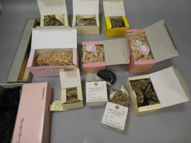
[WYLD, James] A lot of 12 maps and a title page[WYLD, James] A lot of 13 pieces, 12 of which are engraved and most hand coloured maps. Sold as a collection. James Wyld, the Younger (1812-1887) was a Geographer to the Queen and H.R.H PrinceAlbert.See Sold Price
SoldOKLAHOMA & INDIAN TERRITORY. Lot of 12 maps651. [MAPS]. OKLAHOMA & INDIAN TERRITORY. Lot of 12 maps, late nineteenth to early twentieth century, showing the transition from Indian Territory and Oklahoma Territory toSee Sold Price
SoldBartholomew, John 1922 Lot of 12 European MapsOne Map of Asia continent and the others of European Countries. Incl British Isles, Belgium/Holland, Spain/Portugal, North Italy/Austria, Greece, South Italy, Central European States, and Germany SoutSee Sold Price
SoldBrockhaus (Pub) 1890's Mixed Lot of 12 Antique MapsIncl Balkans, Central Asia, Asia Political, Holy Land/Persia, European Railway Development, German Republic Politica, Denmark/Sweden, North France, Historial Map of France, History of the Mapping of tSee Sold Price
SoldBartholomew, John 1922 Lot of 12 Large MapsIncl Scandinavia/Denmark, Poland/Czechoslovakia, Baltic States/East Prussia, Romania, Lower Ganges, North America Political, West Indies, South America Politcal, South America - Northern Section, SoutSee Sold Price
SoldWeller, F. S. C1890 Lot of 12 Antique MapsIncl German Empire, Switzerland, Holland/Belgium, Austria/Hungria, Russia, Asia, Africa, Sweden/Norway & Denmark, France, Australasia, Eastern Australia and New Zealand, and The World. Lot of 12 LithoSee Sold Price
SoldStaffordshire C1830-60 Lot of 12 Steel Engraved MapsSteel Engraved Maps (Incl some duplication) all of Staffordshire. One Lithographed. Examples by Orr, Parsons/James, Dawson, Dugdale/Archer, Lewis/Creighton/Walker, and Emslie/Reynolds. Paper Size: UpSee Sold Price
SoldMap LotMap lot including: "PARIS" (9 3/4" x 12 1/4"); "BAY OF BISCAY" (10 1/2" x 13"); "GEOGRAPHICAL AND HISTORICAL MAP OF THE ROMAN EMPIRE" (18 1/2" x 22 1/2"); "AMERICA SEPTEN / TRIONA" (18" x 23"); "VERBRSee Sold Price
SoldLot of Texaco Maps9” x 4” folded. Lot of Texaco Maps. 12 road maps in total, 11 Texaco and 1 Husky. For American States and Canadian Provinces. Condition: Very Good - Excellent.See Sold Price
Soldmaps, Asia, N. America, World(lot of 12) Unframed antique maps, including Asia, North America, several American States from Colton's, and others, largest overall: 17.5''h x 18''wSee Sold Price
SoldLot 12 Americana Military BooksLot of 12 books on Americana and Military History, including a 1850 pocket Boston Almanac with map, 1845 Army and Navy of America, Barnes' Naval Actions of the War of 1812, Sitting Bull and the IndianSee Sold Price
SoldMap LotLot (3) framed maps including "Carte De La Baye De Hudson" (sight 9 1/4" x 12 1/4"), "The River St. Laurence" (sight 10" x 14 1/2"), "A Plan of the City and Harbour of Louisburg" (sight 11" x 14 1/2")See Sold Price
SoldMap LotLot (2) maps including Ireland (G.W. Bacon & Co. sight 8 1/2" x 12"), and "BAVARIA-HESSE/US ZONE/WURTEMBERG BADEN" (sight 23" x 20").See Sold Price
Sold1802 MAP LOT GEORGIA FLORIDA NEW YORK & VERMONTFrom Jedediah Morse's Universal Geography published by Thomas & Andrews, includes Georgia and the 2 Florida's, New York, and Vermont, early engravings measuring 12 by 8 inches. All very good.See Sold Price
SoldMap LotLot three framed maps including Claverack (site 15" x 13"), Philmont (site 15' x 12") and Ghent (site 12" x 15").See Sold Price
Rock & Roll Ephemera. Collectors Mixed Lot (12)Autographs on a Buddy Holly Festival map of Texas including some of The Coasters and others; Worldwide Elvis magazine, 1997 Commemorative issue with photo cover and back; La Bamba sheet music, Almo MuSee Sold Price
SoldLot of 12 Early 19th Century MapsMostly by Jeffery's. Depicting the East Indies, Germany and surround, Asia, Africa, "Turky in Asia" , Italy and surround, Spain & Portugal, early North America, France, South America, Europe, and HungSee Sold Price
Sold(12) United States Scott C7-C9 F-VF+ OG NH SCV.$291+Post office fresh lot of (12)complete never hinged Maps & Planes airmail set, Scott C7-C9, Unused with F-VF or better centering, many VF+, never hinged original gum. Also comes with one LH set for a tSee Sold Price
SoldLot of 12 Silver Plate "Australia" Napkin RingsLot of 12 silver plate napkin rings. Engraved "Australia" with a map. 1 3/4" diameter x 1" W. Very good condition.See Sold Price
SoldHand Colored Map of Duchess, Putnam CountiesAfter David Burr, 1829. 20-1/2"h x 14-1/2"w. Provenance: Property from the Collection of Dr. Andrew and Ziva Dahl. Stair Galleries, lot 383, 12/7/2002.See Sold Price
SoldWWII ORIGINAL AERIAL SPY PHOTO LOT USA BOMBING MAPVERY RARE AND INTERESTING LOT OF 12 ORIGINAL PRESS PHOTOS AND SOME SPY AERIAL PHOTOS WITH HANDWRITTENED LOCATIONS FOR BOMB ATTACKS. OTHERS ARE "ROOSEVELTS AGRESSIONSPHANE IN SUDAMERIKA"; "ENGLANDS RAUSee Sold Price
Lot 12 NOS New in Boxes Assorted Doll Wigs Kais Wee 3 Monique Global Dolls etcLodestar Auctions4.7(394)See Sold PriceMar 03, 2024
Lot 12 Assorted Dolls Kewpie Troll Clown Paper Mache etcLodestar Auctions4.7(394)See Sold PriceMar 03, 2024
Lot 12 Vintage Assorted Dolls Barbie Baitz Marionette French etcLodestar Auctions4.7(394)See Sold PriceMar 03, 2024
Lot 12 Vintage Assorted Dolls Skipper Chavre Clo Pinn Disney etcLodestar Auctions4.7(394)See Sold PriceMar 03, 2024
Oyster Bay Long Island NY Vintage Color Reproduction Map 12 x 18Mynt Auctions4.6(680)See Sold PriceFeb 23, 2024
Lot 12 German Black Knight Porcelain PlatesLangston Auction Gallery4.7(504)See Sold PriceFeb 28, 2024
Map: A 19thC engraved and hand coloured map of South America. Published by the Society for theClaydon Auctioneers Ltd4.3(125)See Sold PriceFeb 26, 2024
Map: A 17thC engraved and hand coloured map of Bedfordshire after Robert Morden. Approx. 12 1/2" xClaydon Auctioneers Ltd4.3(125)See Sold PriceFeb 26, 2024
Map: An 18thC engraved and hand coloured map of North America and South America, titled DeClaydon Auctioneers Ltd4.3(125)See Sold PriceFeb 26, 2024
LESSING ROSENWALD COLLECTION of ANTIQUE BOOKS CATALOG illustratedJasper524.5(9.8k)See Sold PriceFeb 27, 2024
West Indies. Rand, McNally & Co.'S Indexed Atlas Map of the West Indies.Jasper524.5(9.8k)See Sold PriceFeb 27, 2024
SCIENCE, MEMORY, NATURE. 12 BOOKS SOLD TOGETHERToronto Book Auctions4.3(13)See Sold PriceMar 07, 2024
Lot of 12 Portraits - Emmanuel Pérès de Lagesse - Anton Van Dyck - George Howland BeaumontProverde Auctions4.3(3)See Sold PriceFeb 28, 2024
Photography - Lot of 12 Photo - People - Cars - Portraits - LandscapesProverde Auctions4.3(3)See Sold PriceFeb 28, 2024
Framed Vintage Map Of Le Port Au Prince In The Island Of Santo DomingoRapid Estate Liquidators and Auction Gallery4.5(1.1k)See Sold PriceMar 01, 2024


![[WYLD, James] A lot of 12 maps and a title page (1 of 1)](https://p1.liveauctioneers.com/1124/187577/94368903_1_x.jpg?height=282&quality=70&version=1607095126)