ATLAS of ANTIENT GEOGRAPHY by SAMUEL BUTLER 1843John McInnis Auctioneers,LLC4.6(502)See Sold PriceFeb 24, 2024
18TH C. ANTIQUE MAP: FRENCH & INDIAN WAR, FRAMEDThomaston Place Auction Galleries4.4(386)See Sold PriceFeb 24, 2024
Rand McNally Railroad Map Cabinet w/ 21 Railroad MapsRail & Road Auctions4.6(165)See Sold PriceMar 08, 2024
Keith Haring - Ink on New York Map, Best Buddies, Inscribed, Signed, and DatedSapphire Auction Gallery4(67)See Sold PriceMar 02, 2024
LATE 17TH C. FRENCH MAP OF THE NEW WORLD BY ALEXIS-HUBERT JAILLOT (1632-1712)Thomaston Place Auction Galleries4.4(386)See Sold PriceFeb 24, 2024
Central Railroad of New Jersey Map of Sandy Hook Route-ca. 1903JM Hobby Supply and Railroad Artifact Auctions4.4(126)See Sold PriceFeb 24, 2024
Lot of Six Mixed Atlas Box Cars-HO Scale-New in BoxJM Hobby Supply and Railroad Artifact Auctions4.4(126)See Sold PriceFeb 25, 2024
Rand McNally/Santa Fe Railroad Map of Iowa-1912JM Hobby Supply and Railroad Artifact Auctions4.4(126)See Sold PriceFeb 24, 2024
NICOLAES VISSCHER (NETHERLANDS, 1618-1709) MAP OF THE NEW WORLDThomaston Place Auction Galleries4.4(386)See Sold PriceFeb 24, 2024
17TH C. WORLD MAP BY NICOLAES VISSCHER (NETHERLANDS, 1618-1709)Thomaston Place Auction Galleries4.4(386)See Sold PriceFeb 24, 2024
Lot of Six Mixed Atlas Cabooses-HO Scale-New in BoxJM Hobby Supply and Railroad Artifact Auctions4.4(126)See Sold PriceFeb 25, 2024
SoldSDUK: Antique Map of Ancient Egypt, 1846Title/Content of Map: 'ANCIENT EGYPT' Nile Valley ancient names & sites. Original colour. Date Printed: This map was originally engraved in 1831. This date is printed on the map. This edition of the mSee Sold Price
SDUK: Antique Map of Ancient Asia Minor, 1846Title/Content of Map: 'ASIA MINOR [ANCIENT]' Turkey. Cappadocia Cyprus Galatia Phrygia. Date Printed: 1846 Image Size: Approx 32.5 x 41.5cm, 12.75 x 16.25 inches (Large) Type: Antique steel engraved mSee Sold Price
SDUK: Antique Map of Ancient Asia Minor, 1846TITLE/CONTENT OF MAP: 'ASIA MINOR [ANCIENT]' DATE PRINTED: 1846 IMAGE SIZE: Approx 32.5 x 41.5cm, 12.75 x 16.25 inches (Large) TYPE: Antique steel engraved map with original outline hand colouring CONSee Sold Price
SDUK: Antique Map of North Africa of Babrbary, 1846TITLE/CONTENT OF MAP: 'NORTH AFRICA OR BARBARY, V., PARTS OF TRIPOLI AND EGYPT' DATE PRINTED: 1846 IMAGE SIZE: Approx 34.5 x 41.5cm, 13.5 x 16.25 inches (Large) TYPE: Antique steel engraved map with oSee Sold Price
SoldMallet: Antique Map of Ancient Egypt & Nile Valley 1683Title of the Map: 'Aegypte Ancienne' Nile valley. Shows towns. Date Printed: 1683 Image Size: Approx Overall page size 13 x 21cm approximately (5 x 8 inches); image size 10.5 x 14.5cm approximately (4See Sold Price
Mallet: Antique Map of Ancient Egypt, 1683Title of the Map: 'Aegypte Ancienne' ANCIENT EGYPT. Nile valley. Shows towns. Date Printed: 1683 Image Size: Approx Overall page size 13 x 21cm approximately (5 x 8 inches); image size 10.5 x 14.5cm aSee Sold Price
SoldMortier: Antique Map of Ancient Egypt, 1705Map: Ancient Egypt by Mortier Date Printed: 1705-06 Cartographer: Pierre Mortier Material/Medium: Paper Size: 18" x 23 1/2" Original hand color. Copperplate engraved. Printed in Amsertdam. Published iSee Sold Price
SoldLattre: Antique Map of Ancient Egypt, 1791Map: Ancient Egypt by Lattre Date Printed: 1791 Cartographer: J Lattre Material/Medium: Paper Size: 8 1/2" x 12" Hand colored copperplate engraving. Published in Petit Atlas Moderne Ou Collection De CSee Sold Price
Sold1831 SDUK Map of Ancient Egypt -- Ancient EgyptTitle: 1831 SDUK Map of Ancient Egypt -- Ancient Egypt Cartographer: SDUK Year/Place: 1831, London Dimensions: 14.4 X 11.8 in. Description: This is a superb map of Egypt in the times of the Pharaohs.See Sold Price
SDUK: Antique Map of Ancient Africa (Libya) in 2 sheetsMap: Ancient Africa or Libya, parts I and II Cartographer: Society for the Diffusion of Useful Knowledge Place & Date: London / 1840/1852 Size: 15 1/4" x 12 3/8" (each map) Condition: b&w, overall ageSee Sold Price
Baldwin & Cradock / SDUK: Map of Ancient Egypt, 1831Ancient Egypt The fascinating and highly detaiiled ancient Egypt map from the SDUK atlas, with many geographical and historical notes, Cartographer: Baldwin & Cradock, Society for the Diffusion of UseSee Sold Price
SDUK: Antique Map of Ancient Asia Minor, 1844TITLE/CONTENT OF MAP: 'ASIA MINOR (ANCIENT)' Turkey. Cappadocia Cyprus Galatia Phrygia. DATE PRINTED: This map was originally published by Baldwin & Cradock in 1830; this date is printed on the map. TSee Sold Price
Arrowsmith: Antique Map of Ancient Egypt, 1828TITLE/CONTENT OF MAP: 'Aegyptus; Vel Regio, quam a Tachompso Insula ad Mare Internum Nilus interluit ' DATE PRINTED: 1828 IMAGE SIZE: Approx 31.0 x 25.5cm, 12.25 x 10 inches (Large) TYPE: Antique coppSee Sold Price
SDUK: Antique Map of Florida, 1846Title/Content of Map: 'NORTH AMERICA, XlV., Florida' showing Seminole Indian district & forts. Keys. Date Printed: 1846 Image Size: Approx 42.0 x 33.0cm, 16.5 x 13 inches (Large) Type: Antique steel eSee Sold Price
SDUK: Antique Map of Florida, 1846Title/Content of Map: 'NORTH AMERICA, XlV., Florida' showing Seminole Indian district & forts. Keys. Date Printed: 1846 Image Size: Approx 42.0 x 33.0cm, 16.5 x 13 inches (Large) Type: Antique steel eSee Sold Price
SDUK: Antique Map of Florida, 1846Title/Content of Map: 'NORTH AMERICA, XlV., Florida'. FLORIDA showing Seminole Indian district & forts. Keys. SDUK, 1846 antique map Date Printed: 1846 Image Size: Approx 42.0 x 33.0cm, 16.5 x 13 inchSee Sold Price
SDUK: Antique Map of Africa, 1846TITLE/CONTENT OF MAP: '[no title]' AFRICA South Europe Brazil Gnomonic Projection. Mountains of Kong. Marked on this map are the Mountains of Kong, a non-existent mountain range charted on English mapSee Sold Price
SDUK: Antique Three-sheet Map of Ancient Italy, 1832Map: Ancient Italy I, II, and III Cartographer: Baldwin & Cradock, Society for the Diffusion of Useful Knowledge Place & Date: London / 1832/1852 Size: 14 7/8" x 11 1/4" (largest of the three maps) CoSee Sold Price
SDUK: Antique Map of Africa, 1846Title/Content of Map: AFRICA South Europe Brazil Gnomonic Projection. Mountains of Kong. Marked on this map are the Mountains of Kong, a non-existent mountain range charted on English maps of Africa fSee Sold Price
SDUK: Antique Map of Quebec, 1846TITLE/CONTENT OF MAP: 'NORTH AMERICA, SHEET II., Lower Canada and New Brunswick with part of New York, Vermont and Maine' Québec Canada Montreal Three Rivers Maine New Brunswick. DATE PRINTED: 1846 ISee Sold Price
Delaporte: Antique Map of Ancient & Modern Egypt, 1878Map: Ancient and Modern Egypt by Delaporte Date Printed: 1787 Cartographer: Joseph Delaporte Material/Medium: Paper Size: 7 3/4" x 9 3/4" Copperplate engraved. Geographiques Pour L'Intelligence Du VoySee Sold Price
SDUK: Antique Map of Ohio, 1846Title/Content of Map: 'NORTH AMERICA, SHEET VIII., Ohio, with parts of Kentucky and Virginia' Date Printed: 1846 Image Size: Approx 39.5 x 34.0cm, 15.5 x 13.5 inches (Large) Type: Antique steel engravSee Sold Price
Malte-Brun: Antique Map of Ancient Asia, 1846Title/Content of Map: 'Asie ancienne' Ancient Asia, Original outline colour. Date Printed: c1846 Image Size: Approx 23.0 x 30.5cm, 9 x 12 inches (Large) Type: Antique engraved map with original outlinSee Sold Price
SoldSDUK: Antique Map of India, 1846TITLE/CONTENT OF MAP: 'INDIA II. Madras Presidency and Mysore' Chennai Canara Carnatic. DATE PRINTED: 1846. This date is printed on the map IMAGE SIZE: Approx 28.0 x 36.5cm, 11 x 14.25 inches (Large)See Sold Price
David Roberts - Obelisk of LuxorTrillium Antique Prints & Rare Books4.5(30)See Sold PriceFeb 24, 2024
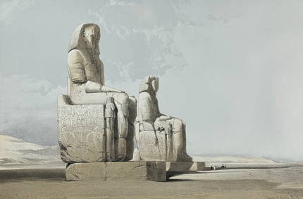
David Roberts - Approach of the Simoom, Desert of GizehTrillium Antique Prints & Rare Books4.5(30)See Sold PriceFeb 24, 2024
WEST AFRICA Explorers' routes Senegal Ashanti. Mountains of Kong. SDUK 1857 mapJasper524.5(9.8k)See Sold PriceFeb 28, 2024
AFRICA. Map pre-dating much exploration. Mountains of Kong. SDUK 1851 oldJasper524.5(9.8k)See Sold PriceFeb 28, 2024
NORTH AFRICA OF BABRBARY V Parts of Tripoli & Egypt. Libya Tribes. SDUK 1846 mapJasper524.5(9.8k)See Sold PriceFeb 28, 2024
NORTH AFRICA BARBARY. Parts of Tripoli (Libya) & Egypt. Tribes. SDUK 1844 mapJasper524.5(9.8k)See Sold PriceFeb 28, 2024
NORTH AFRICA BARBARY. Parts of Tripoli (Libya) & Egypt. Tribes. SDUK 1844 mapJasper524.5(9.8k)See Sold PriceFeb 28, 2024
NORTH AFRICA OF BABRBARY V Parts of Tripoli & Egypt. Libya Tribes. SDUK 1851 mapJasper524.5(9.8k)See Sold PriceFeb 28, 2024
NORTH AFRICA. Morocco Algeria Tunis Tunisia Egypt. Cairo. BARTHOLOMEW 1912 mapJasper524.5(9.8k)See Sold PriceFeb 28, 2024
NORTH AFRICA. Morocco Algeria Tunis Tunisia Egypt. Cairo. BARTHOLOMEW 1901 mapJasper524.5(9.8k)See Sold PriceFeb 28, 2024
NILE VALLEY. Upper & Lower. Egypt Sinai Nubia Sudan Abyssinia. BLACKIE 1882 mapJasper524.5(9.8k)See Sold PriceFeb 28, 2024
NORTH EAST AFRICA. Libya Egypt Sudan Ethiopia Ubangi-Shari Chad 1952 old mapJasper524.5(9.8k)See Sold PriceFeb 28, 2024
ANCIENT NORTH AFRICA. Greek colonies. "La Libye, L'Egypte…". TARDIEU 1830 mapJasper524.5(9.8k)See Sold PriceFeb 28, 2024
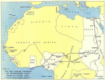
West Africa WW2 Nigeria Sudan Egypt. Takoradi air reinforcement route 1954 mapJasper524.5(9.8k)See Sold PriceFeb 28, 2024
NORTH AFRICA BARBARY. Parts of Tripoli (Libya) & Egypt. Tribes. SDUK 1848 mapJasper524.5(9.8k)See Sold PriceFeb 28, 2024
ANCIENT NORTH AFRICA Septentrionalis. Mauretania Tripolitana ARROWSMITH 1828 mapJasper524.5(9.8k)See Sold PriceFeb 28, 2024
NUBIA. 'Nubie'. Nile Valley. Sudan Ethiopia Egypt. MALLET 1683 old antique mapJasper524.5(9.8k)See Sold PriceFeb 28, 2024
SUB-SAHARAN AFRICA. 'Ancienne Ethiopie'. Ancient Ethiopia. MALLET 1683 old mapJasper524.5(9.8k)See Sold PriceFeb 28, 2024
Afrique Ancienne. Ancient North Africa. MALTE-BRUN c1871 old antique map chartJasper524.5(9.8k)See Sold PriceFeb 28, 2024
Egypte, Nubie et Abissinie. Egypt, Nubia & Abyssinia. Sudan. BONNE 1788 mapJasper524.5(9.8k)See Sold PriceFeb 28, 2024