ATLAS of ANTIENT GEOGRAPHY by SAMUEL BUTLER 1843John McInnis Auctioneers,LLC4.5(505)See Sold PriceFeb 24, 2024
18TH C. ANTIQUE MAP: FRENCH & INDIAN WAR, FRAMEDThomaston Place Auction Galleries4.4(394)See Sold PriceFeb 24, 2024
Rand McNally Railroad Map Cabinet w/ 21 Railroad MapsRail & Road Auctions4.6(165)See Sold PriceMar 08, 2024
Keith Haring - Ink on New York Map, Best Buddies, Inscribed, Signed, and DatedSapphire Auction Gallery4.1(67)See Sold PriceMar 02, 2024
LATE 17TH C. FRENCH MAP OF THE NEW WORLD BY ALEXIS-HUBERT JAILLOT (1632-1712)Thomaston Place Auction Galleries4.4(394)See Sold PriceFeb 24, 2024
Central Railroad of New Jersey Map of Sandy Hook Route-ca. 1903JM Hobby Supply and Railroad Artifact Auctions4.4(127)See Sold PriceFeb 24, 2024
Lot of Six Mixed Atlas Box Cars-HO Scale-New in BoxJM Hobby Supply and Railroad Artifact Auctions4.4(127)See Sold PriceFeb 25, 2024
Rand McNally/Santa Fe Railroad Map of Iowa-1912JM Hobby Supply and Railroad Artifact Auctions4.4(127)See Sold PriceFeb 24, 2024
NICOLAES VISSCHER (NETHERLANDS, 1618-1709) MAP OF THE NEW WORLDThomaston Place Auction Galleries4.4(394)See Sold PriceFeb 24, 2024
17TH C. WORLD MAP BY NICOLAES VISSCHER (NETHERLANDS, 1618-1709)Thomaston Place Auction Galleries4.4(394)See Sold PriceFeb 24, 2024
Lot of Six Mixed Atlas Cabooses-HO Scale-New in BoxJM Hobby Supply and Railroad Artifact Auctions4.4(127)See Sold PriceFeb 25, 2024
SoldUnique Color Map of Tunis and MarocColor map of Tunis et Tripoli and Empire of Maroc - Set on backing board and shrink wrapped. 14”W X 19.5”HSee Sold Price
Unique Color Map of Tunis and MarocColor map of Tunis et Tripoli and Empire of Maroc - Set on backing board and shrink wrapped. 14”W X 19.5”HSee Sold Price
Unique Color Map of Tunis and MarocColor map of Tunis et Tripoli and Empire of Maroc - Set on backing board and shrink wrapped. 14”W X 19.5”HSee Sold Price
Unique Color Map of Tunis and MarocColor map of Tunis et Tripoli and Empire of Maroc - Set on backing board and shrink wrapped. 14”W X 19.5”HSee Sold Price
Unique Color Map of Tunis and MarocColor map of Tunis et Tripoli and Empire of Maroc - Set on backing board and shrink wrapped. 14�W X 19.5�HSee Sold Price
Lot of Media Items from the Opening of the IndianaLot of Media Items from the Opening of the Indiana Jones Adventure. Lot of 10 items: 1. Unique full color map given to Press, 8 ½ x 11”, hand aged at the edges, featuring various elements oSee Sold Price
MAP - Northern Africa. Ortelius/GalleNorthern Africa. Ortelius/Galle, Carthaginis Celeberrimi Sinus Typus, 1590 (published). Hand Color. Miniature map showing Tunis and its surroundings. The sea is embellished with ships engaging in a spSee Sold Price
Rand McNally Map of Algeria, Morocco, and TunisRand McNally (Fl. 1870-1920's). Map of Algeria, Morocco, and Tunis. Lithograhped map with hand color from Rand, McNally & Co's Indexed Atlas of the World. Chicago: Rand McNally, 1894. 21 3/4" x 15 5/8See Sold Price
Sold1906 Algeria & Tunis AFRICA Color Illustrated Nesbitt1906 Algeria & Tunis AFRICA Color Illustrated Nesbitt MAPS Landscapes Costumes ‘Algeria and Tunis’ details an account of the cities of Algeria and Tunis and surrounding countryside with beautifullSee Sold Price
Sold1939 RED INDIAN PATHFINDER ROAD MAP McCOLL-FRONTENAC1939 RED INDIAN PATHFINDER ROAD MAP McCOLL-FRONTENAC OIL COMPANY, ONTARIO QUEBEC MARITIME PROVINCES, ADVERTISING RED INDIAN MOTOR OIL (UNIQUE COLOR) "FOR A THRILL SKY CHIEF GASOLINE", WRAPPED IN PLASTSee Sold Price
Sold2 Volumes, Frontier Forts of Western Pennsylvania2 Volumes, Frontier Forts of Western Pennsylvania, 1895 Leather Color Maps-- Dimensions: ---See Sold Price
SoldSmall 1873 Bible with decorative brass corners anSmall 1873 Bible with decorative brass corners and hinges. Interior has color maps.-- Dimensions: H: 7.75 inches: W: 4.75 inches --- US Shipping charge: $10See Sold Price
SoldThe Unique Map of California by Johnstone 1885Title: The Unique Map of California Author: Johnstone, E. Description: Color lithograph map of California, with several illustrations of various places of interest. 56x46 cm. (22x18"), plus margins.WiSee Sold Price
Sold1863 Valentine's Manual of NYC New York City, Map1863 Valentine's Manual of NYC New York City, Maps Color plates.-- Dimensions: ---See Sold Price
SoldLarge Collection of Maps of the Holy Land, Israelites'Large, unique collection of about 75 geographical maps, in color and black and white, of the Holy Land in the 16, 17 and 18th century. The maps were devotedly collected by a dedicated collector for alSee Sold Price
SoldPower Gasoline Montana Map This is a Montana map pThis is a Montana map produced by Power gasoline. This is a unique map with numerous illustrations depicting Montana regional attractions and attributes. The map shows great color and graphics. It isSee Sold Price
SoldLAPIE ORIGINAL ANTIQUE MAP ALGERIA TUNISIA TRIPOLI 1829Original Carte De La Barbarie -Maroc - D'Alger, De Tunis, De Tripoli 1829 SIZE: 25.5 X 20 INCHES APPROX. UNFRAMEDSee Sold Price
SoldAntique Coastal Oil Signed - TUNIS PONSENBeautiful / Talented Antique Coastal Oil (On Canvas) (18x24) signed "TUNIS PONSEN" (LL). Brilliant / Unique Style and Use of Colors. Painting remains in excellent condition. Colors remain viSee Sold Price
SoldAntique Coastal Oil Signed - TUNIS PONSENBeautiful / Talented Antique Coastal Oil (On Canvas) (18x24) signed "TUNIS PONSEN" (LL). Brilliant / Unique Style and Use of Colors. Painting remains in excellent condition. Colors remain viSee Sold Price
SoldKL Dachau Concentration Camp Area Map 1945!Very rare and unique KL Dachau concentration camp area map (1:5000) with different colors in 1945 showing the buildings of that infamous place. It was done in 1945 and it has text in Polish and EnglisSee Sold Price
Santini / Vaugondy: Antique Map of North Africa, 1784Title/Content of Map: 'Carte de la Barbarie contenant les Royaumes de Maroc, de Fez, d'Alger, de Tunis et de Tripoli, avec les déserts limitrophes de l'Intérieur de l'Afrique. Dressée sue les CarteSee Sold Price
1770 Bonne Map of Northern Africa -- Carte De La PartieTitle: 1770 Bonne Map of Northern Africa -- Carte De La Partie Septentionale D'Afrique, ou De La Barbarie; Contenant Les Royaumes De Tripoli, De Tunis, D'Alger, De Fez Et De Maroc Date: 1770 c., ParisSee Sold Price
Cincinnati Hamilton and Dayton RR Map -USGC 1889JM Hobby Supply and Railroad Artifact Auctions4.4(127)See Sold PriceFeb 24, 2024
Crams Railroad Map of New York-1881JM Hobby Supply and Railroad Artifact Auctions4.4(127)See Sold PriceFeb 24, 2024
Crams Township and Railroad Map of New York-1890JM Hobby Supply and Railroad Artifact Auctions4.4(127)See Sold PriceFeb 24, 2024
Hammonds Map of Kentucky and Tennessee Railroads-1910JM Hobby Supply and Railroad Artifact Auctions4.4(127)See Sold PriceFeb 24, 2024
Map of Missouri Highways and Railroads-1921JM Hobby Supply and Railroad Artifact Auctions4.4(127)See Sold PriceFeb 24, 2024
KOOLMOTOR THE PERFECT PENNSYLVANIA MOTOR OIL PORCELAIN SIGN.Dan Morphy Auctions4.2(1.3k)See Sold PriceFeb 24, 2024
COSDEN SPECIAL LIQUID GAS 13.5" GLOBE LENS W/ HORSE GRAPHICS AGS 95.Dan Morphy Auctions4.2(1.3k)See Sold PriceFeb 24, 2024
CADILLAC AUTOMOBILES PORCELAIN ATTACHMENT SIGN W/ CREST GRAPHIC.Dan Morphy Auctions4.2(1.3k)See Sold PriceFeb 24, 2024
RAMON'S LAXATIVE PILLS TIN GENERAL STORE THERMOMETER.Dan Morphy Auctions4.2(1.3k)See Sold PriceFeb 25, 2024
AMLICO PREMIUM GASOLINE PORCELAIN PUMP PLATE SIGN.Dan Morphy Auctions4.2(1.3k)See Sold PriceFeb 25, 2024
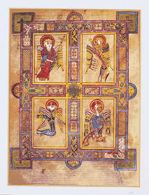
THE BOOK OF KELLS 3 x Limited Edition 30 Color Serigraph Prints Celtic ArtLuis Porretta Fine Arts4.3(10)See Sold PriceMar 02, 2024
Carte de la Barbarie… l'empire de Maroc… North Africa Morocco. LAPIE 1829 mapJasper524.5(9.9k)See Sold PriceFeb 28, 2024
États du Roi de Maroc… d’Alger, Tunis & Tripoli. North Africa. BONNE 1790 mapJasper524.5(9.9k)See Sold PriceFeb 28, 2024
Carte de la partie septentrionale d'Afrique, ou de la Barbarie… BONNE 1780 mapJasper524.5(9.9k)See Sold PriceFeb 28, 2024
États du Roi de Maroc… d’Alger, Tunis & Tripoli. North Africa. BONNE 1788 mapJasper524.5(9.9k)See Sold PriceFeb 28, 2024