The Official Map of Lewis & Clark County - Montana
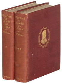
Official Railroad Map of Kansas-1907Feb 24, 2024DUNLEVIE c1856 Map Counties Of Gaspe & Bonaventure Quebec Canada SCARCE! #2Mar 02, 2024DUNLEVIE c1856 Map Counties Of Gaspe & Bonaventure Quebec Canada SCARCE! #1Mar 02, 20245.1/2" Section of River Coral found in Clark County Missouri Fossil .Feb 25, 2024Vintage County Map Of NY State Plate EngravingFeb 28, 2024Portfolio of 15 County Maps by Robert Morden (English 1650-1703)Feb 24, 2024FRAMED WARREN COUNTY MAPFeb 25, 20245 Folio Size Books about the West in Fine or Near Fine ConditionApr 20, 20242 15/16" Decatur Fractured Base. Lewis County, Ohio. Rogers COAMar 09, 20244" Clovis. Liberty County, Montana. Black Chert. Putty COAMar 09, 2024Arrowsmith & Lewis - Map of the United StatesFeb 24, 2024Assorted Tokens and Medals (23+)Feb 29, 2024Scarce 1812 Topog. descript. of Ohio and Indiana, CutlerFeb 27, 2024Rare Marin County CCC ephemeraMar 07, 2024First Edition of Lewis & Clark, 1814Mar 07, 2024Journals of Lewis & Clark Large Paper EditionMar 07, 2024The Trail of Lewis and Clark, 1804-1904Mar 07, 2024With folding map of Montana counties in 1908Mar 07, 2024Rand McNally & Co's Montana map 1880Mar 07, 2024Wall map of Solano County, California 1915Mar 07, 2024Grapho-Politico wall map of California 1902Mar 07, 2024Large Lot of Ephemera, 1918-1977Mar 03, 2024US Post Lewis And Clark First Day Stamp Sheet BundleFeb 29, 2024Polyconic Projection Retractable Chicago MapMar 09, 2024 


![Seth Bullock For Sheriff Handbill, c. 1873 [168284] (1 of 1)](https://p1.liveauctioneers.com/2699/299063/159201737_1_x.jpg?height=282&quality=70&version=1692048840)