ATLAS of ANTIENT GEOGRAPHY by SAMUEL BUTLER 1843John McInnis Auctioneers,LLC4.6(502)See Sold PriceFeb 24, 2024
18TH C. ANTIQUE MAP: FRENCH & INDIAN WAR, FRAMEDThomaston Place Auction Galleries4.4(386)See Sold PriceFeb 24, 2024
Rand McNally Railroad Map Cabinet w/ 21 Railroad MapsRail & Road Auctions4.6(165)See Sold PriceMar 08, 2024
Keith Haring - Ink on New York Map, Best Buddies, Inscribed, Signed, and DatedSapphire Auction Gallery4(67)See Sold PriceMar 02, 2024
LATE 17TH C. FRENCH MAP OF THE NEW WORLD BY ALEXIS-HUBERT JAILLOT (1632-1712)Thomaston Place Auction Galleries4.4(386)See Sold PriceFeb 24, 2024
Central Railroad of New Jersey Map of Sandy Hook Route-ca. 1903JM Hobby Supply and Railroad Artifact Auctions4.4(126)See Sold PriceFeb 24, 2024
Lot of Six Mixed Atlas Box Cars-HO Scale-New in BoxJM Hobby Supply and Railroad Artifact Auctions4.4(126)See Sold PriceFeb 25, 2024
Rand McNally/Santa Fe Railroad Map of Iowa-1912JM Hobby Supply and Railroad Artifact Auctions4.4(126)See Sold PriceFeb 24, 2024
NICOLAES VISSCHER (NETHERLANDS, 1618-1709) MAP OF THE NEW WORLDThomaston Place Auction Galleries4.4(386)See Sold PriceFeb 24, 2024
17TH C. WORLD MAP BY NICOLAES VISSCHER (NETHERLANDS, 1618-1709)Thomaston Place Auction Galleries4.4(386)See Sold PriceFeb 24, 2024
Lot of Six Mixed Atlas Cabooses-HO Scale-New in BoxJM Hobby Supply and Railroad Artifact Auctions4.4(126)See Sold PriceFeb 25, 2024
Mitchell: Antique Map of South American Countries, 1870Title/Content of Map: 1870 Mitchell Map of Venezuela, Columbia, Granada, Peru, Equador and part of Argentina -- Map of New Granada, Venezuela, Guiana, Peru, Equador and Argentine Confederation Date PrSee Sold Price
SoldMitchell: Antique Map of South American Countries, 1869Map: New Granada Venezuela Peru Ecuador Argentina Date Printed: 1869 Cartographer: Augustus S. Mitchell Material/Medium: Paper Size: 12 1/4" x 15 1/4" Hand colored engraved map. Printed in PhiladelphiSee Sold Price
1870 Mitchell Antique Map of Venezuela, ColumbiaTitle/Content of Map: 1870 Mitchell Map of Venezuela, Columbia, Granada, Peru, Equador and part of Argentina -- Map of New Granada, Venezuela, Guiana, Peru, Equador and Argentine Confederation Date PrSee Sold Price
Mitchell: Antique Map of Venezuela, Columbia, 1870Title/Content of Map: 1870 Mitchell Map of Venezuela, Columbia, Granada, Peru, Equador and part of Argentina -- Map of New Granada, Venezuela, Guiana, Peru, Equador and Argentine Confederation Date PrSee Sold Price
SoldMitchell: Antique Map of Southern United States, 1852Title/Content of Map: 1852 Mitchell Map of Southern United States -- No. 12 Map of the Chief Part of the Southern States and Part of the Western... Date Printed: 1852 Philadelphia Cartographer: S MitcSee Sold Price
SoldMitchell: Antique Map of South America, 1869Title/Content of Map: South America Date Printed: 1869 Cartographer: Augustus S. Mitchell Material/Medium: Paper Size: 12" x 15" Hand colored engraved Map. From 'Mitchell's New General Atlas.' PublishSee Sold Price
Mitchell: Antique Map of South America, 18621862 Mitchell Map of South America. Map of Sourth America Showing its Political Divisions. An attractive and carefully engraved map of South America from "Mitchell's New General Atlas, Containing MapsSee Sold Price
Mitchell: Antique Map of South America, 1852Title/Content of Map: 1852 Mitchell Map of South America -- South America Date Printed: 1852, Philadelphia Cartographer: S Mitchell Size: 10.4 x 8 in. A very nice and detailed map of South America froSee Sold Price
Mitchell: Antique Map of Brazil, Chile, etc., 1867Title/Content of Map: 1867 Mitchell: Brazil, Bolivia, Paraguay, Uruguay, Chile -- Map of Brazil, Bolivia, Paraguay and Uruguay [on sheet with] Map of Chili Date Printed: 1867, Philadelphia CartographeSee Sold Price
Mitchell: Antique Map of Venezuela Peru Argentina, 1860Title/Content of Map: 1860 Mitchell Map of Venezuela, Columbia, Granada, Peru, Equador and part of Argentina -- Map of New Granada, Venezuela, Guiana, Peru, Equador and Argentine Confederation Date PrSee Sold Price
Mitchell: Antique Map of South America, 1848South America by S. Augustus Mitchell, 1848. Dramatic, full engraved image with rich hand coloring. Mild edge toning (mostly at right edge). Couple of light color wash stains. 12.75 x 15.75 inches. SaSee Sold Price
Mitchell: Antique Map of South America, 1869Map: South America showing its political divisions Date Printed: 1869 Cartographer: Augustus S. Mitchell Material/Medium: Paper Size: 12" x 15 1/4" Hand colored engraved map. Printed in Philadelphia.See Sold Price
SoldMitchell: Antique Map of Florida & South Carolina, 1860Map: 1860 Mitchell Map of Florida and South Carolina -- County Map of Florida [on sheet with] County Map of South Carolina Date Printed: 1860, Philadelphia Cartographer: S Mitchell Size: 9.1 x 10.6 inSee Sold Price
Mitchell: Antique Map of Florida South & North CarolinaTitle/Content of Map: 1860 Mitchell Map of Florida, South and North Carolina -- County Map of Florida on page with Map of South Carolina, on page with County Map of North Carolina Date Printed: 1860,See Sold Price
SoldMitchell: Antique Map of Arizona and New Mexico, 1870Title/Content of Map: 1870 Mitchell Map of Arizona and New Mexico -- Arizona and New Mexico Date Printed: 1870, Philadelphia Cartographer: S Mitchell Size: 11.5 X 13.8 in. Handsome map of these two deSee Sold Price
SoldMitchell: Antique Map of Oregon Washington Idaho, 1870Map: Map of Oregon, Washington, Idaho, and Part of Montana Cartographer: S. A. Mitchell Place & Date: Philadelphia / 1870 Size: 13 3/8" x 10 7/8" Condition: full color; light overall age toning; someSee Sold Price
SoldMitchell: Antique Map of Arizona & New Mexico, 1870Map: Arizona and New Mexico Cartographer: S. A. Mitchell Place & Date: Philadelphia / 1870 Size: 14 1/8" x 11 1/2" Condition: full color; light overall age toning The beautifully detailed and coloredSee Sold Price
SoldMitchell: Antique Map of Kansas Nebraska Colorado, 1870Map: Map of Kansas, Nebraska and Colorado, Showing the Southern Portion of Dakotah Cartographer: S. A. Mitchell Place & Date: Philadelphia / 1870 Size: 11 1/2" x 14" Condition: full color; light overaSee Sold Price
Mitchell: Antique Map of Canadian Maritimes, 1870Map: County Map of Nova Scotia New Brunswick Cape Breton Id. and Pr. Edward's Id. Cartographer: S. A. Mitchell Place & Date: Philadelphia / 1870 Size: 10 5/8" x 13 3/8" Condition: full color; light ovSee Sold Price
SoldMitchell: Antique Map of Cincinnati, 1870Map: 1870 Mitchell Map of Cincinnati -- Plan of Cincinnati and Vicinity Cartographer: S. A. Mitchell Year / Place: 1870, Philadelphia Map Dimensions: 10.5 x 11 in. Condition: Very good; Good colors. SSee Sold Price
SoldMitchell: Antique Map of Pennsylvania, 1870Title/Content of Map: 1870 Mitchell Map of Pennsylvania -- County Map of the State of Pennsylvania Date Printed: 1870, Philadelphia Cartographer: S Mitchell Size: 14 X 21.5 in. A very nice large, pastSee Sold Price
Mitchell: Antique Map of Florida & the Carolinas, 1860Title/Content of Map: 1860 Mitchell Map of Florida, South and North Carolina -- County Map of Florida on page with Map of South Carolina, on page with County Map of North Carolina Date Printed: 1860,See Sold Price
Mitchell: Antique Map of Philadelphia, 1870Title/Content of Map: 1870 Mitchell Map of Philadelphia -- Plan of Philadelphia Date Printed: 1870, Philadelphia Cartographer: S Mitchell Size: 11 X 12.8 in. A very nice map of the City of Brotherly LSee Sold Price
Mitchell: Antique Map of Cincinnati, 1870Title/Content of Map: 1870 Mitchell Map of Cincinnati -- Plan of Cincinnati and Vicinity Date Printed: 1870, Philadelphia Cartographer: S. A. Mitchell Size: 10.5 x 11 in. Cincinnati's 20 wards identifSee Sold Price
MODERN AMERICAN HENS BRONZE BUST BY EDWARD HLAVKAAntique Arena Inc.4.5(852)See Sold PriceFeb 24, 2024
Mitchell - Map of the City of Washington (Washington, DC)Trillium Antique Prints & Rare Books4.5(30)See Sold PriceFeb 24, 2024
Carey, pub. 1796 - A Chart of the West IndiesTrillium Antique Prints & Rare Books4.5(30)See Sold PriceFeb 24, 2024
Carey, pub. 1796 - Map of the State of MarylandTrillium Antique Prints & Rare Books4.5(30)See Sold PriceFeb 24, 2024
Carey, pub. 1796 - Map of GeorgiaTrillium Antique Prints & Rare Books4.5(30)See Sold PriceFeb 24, 2024
Carey, pub. 1796 - Map of The State of South CarolinaTrillium Antique Prints & Rare Books4.5(30)See Sold PriceFeb 24, 2024
Carey, pub. 1796 - Map of KentuckyTrillium Antique Prints & Rare Books4.5(30)See Sold PriceFeb 24, 2024
Carey, pub. 1796 - Map of the Tennassee State formerly part of North Carolina (Tennessee)Trillium Antique Prints & Rare Books4.5(30)See Sold PriceFeb 24, 2024
1822 MAP of SOUTH AMERICA GEOGRAPHICAL STATISTICAL HISTORICAL antique 17.5x 22"Jasper524.5(9.8k)See Sold PriceFeb 27, 2024
1822 MAP of NORTH & SOUTH AMERICA GEOGRAPHICAL STATISTICAL HISTORICAL antiqueJasper524.5(9.8k)See Sold PriceFeb 27, 2024
NORTH AFRICA. 'Biledulgerid', a former North African country. MALLET 1683 mapJasper524.5(9.8k)See Sold PriceFeb 28, 2024
L'Afrique Françoise ou du Senegal'. French West Africa. DE L’ISLE 1727 mapJasper524.5(9.8k)See Sold PriceFeb 28, 2024
11 South American CoinsRapid Estate Liquidators and Auction Gallery4.5(1.1k)See Sold PriceFeb 26, 2024
T. Kelly - Plan of Bruseels - Battle of Waterloo, London - History of the French RevolutionProverde Auctions4.3(3)See Sold PriceFeb 28, 2024
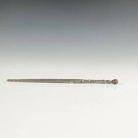
Antique South American Silver Judaica Torah PointerLion and Unicorn4.7(1.8k)See Sold PriceMar 14, 2024