MATTHEWS c1856 Map Of Upper Canada Ontario Indian Land Agency Divisions Scarce!Luis Porretta Fine Arts4.3(10)See Sold PriceMar 02, 2024
DEVINE c1856 Dr Salters Map Of Lake Huron Ontario Indian Lands etc. No. 7 ScarceLuis Porretta Fine Arts4.3(10)See Sold PriceMar 02, 2024
DUNLEVIE c1856 Map Counties Of Gaspe & Bonaventure Quebec Canada SCARCE! #1Luis Porretta Fine Arts4.3(10)See Sold PriceMar 02, 2024
DUNLEVIE c1856 Map Counties Of Gaspe & Bonaventure Quebec Canada SCARCE! #2Luis Porretta Fine Arts4.3(10)See Sold PriceMar 02, 2024
Map UNITED COUNTIES LEEDS & GRENVILLE by Walling 1861 Rare Canada Map 5ft x 5ftLuis Porretta Fine Arts4.3(10)See Sold PriceMar 02, 2024
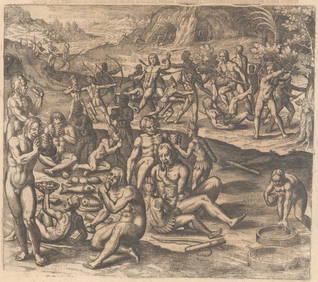
Ambroise TARDIEU c1822 Map Venice Napoleon Italian Campaign 17" x 11"Luis Porretta Fine Arts4.3(10)See Sold PriceMar 02, 2024
SoldColton: Antique Map of Mexico, 1861Title/Content of Map: Mexico Date Printed: 1861 Cartographer: J.H. Colton Material/Medium: Paper Size: 17 1/2" x 14" Hand colored, steel engraved. From 'Colton's General Atlas. Published in New York.See Sold Price
SoldColton: Antique Map of Mexico, 1859Title/Content of Map: Mexico by Colton Date Printed: 1859 Cartographer: H.J. Colton Material/Medium: Paper Size: 17 1/2" x 15" Hand colored, engraved Map. Published in New York in Colton's 'General AtSee Sold Price
Johnson: Antique Map of Mexico, 1861Nice example of Johnson's 1861 map of Mexico. Shows all of present day Mexico as well as most of Texas, Guatemala, Belize, and adjacent regions. Color coded according to Mexican estados. Includes inteSee Sold Price
SoldColton: Antique Map of Mexico, 1871Title/Content of Map: Mexico by Colton Date Printed: 1871 Cartographer: G.W. Colton Material/Medium: Paper Size: 17 1/4" x 14 1/2" Hand colored lithograph. From 'Colton's American Atlas'. Published inSee Sold Price
SoldColton: Antique Map of Boston, 1861Title/Content of Map: Boston by Colton Date Printed: 1861 Cartographer: J.H. Colton Material/Medium: Paper Size: 14" x 17 1/4" Hand colored, steel engraved. From Colton's 'General Atlas'. Published inSee Sold Price
SoldColton: Antique Map of Japan, 1861Map: Japan Date Printed: 1861 Cartographer: J. H. Colton Material/Medium: Paper Size: Approx 17 1/2" x 14 1/4" Condition: Excellent Hand colored, steel engraved. From Colton's General Atlas New York.See Sold Price
SoldColton: Antique Map of New Mexico & Utah, 1859Title/Content of Map: New Mexico & Utah with today's Arizona & Nevada Date Printed: 1859 Cartographer: H. J. Colton Material/Medium: Paper Size: 17 1/2" x 15" Hand colored engraved. Published in New YSee Sold Price
SoldColton: Antique Map of Pennsylvania, 1861Title/Content of Map: Colton's Pennsylvania Date Printed: 1861 Cartographer: J. H. Colton Material/Medium: Paper Size: 17 1/2" x 14" Condition: Excellent Hand colored, steel engraved. From 'Colton's GSee Sold Price
SoldColton: Antique Map of Iowa, 1861Title/Content of Map: Iowa by Colton Date Printed: 1861 Cartographer: J.H. Colton Material/Medium: Paper Size: 17" x 13" Hand colored, steel engraved. From 'Colton's General Atlas. Published in New YoSee Sold Price
SoldColton: Antique Map of Arkansas, 1861Title/Content of Map: Colton's Arkansas Date Printed: 1861 Cartographer: J.H. Colton Material/Medium: Paper Size: 17" x 13" Hand colored, steel engraved. From 'Colton's General Atlas. Published in NewSee Sold Price
SoldColton: Antique Map of Scotland, 1861Title/Content of Map: Scotland Date Printed: 1861 Cartographer: J. H. Colton Material/Medium: Paper Size: 14" x 17" Hand colored, steel engraved. From Colton's 'General Atlas.' Published in New York.See Sold Price
SoldColton: Antique Map of Asia, 1861Map: Colton's Asia Date Printed: 1861 Cartographer: J. H. Colton Material/Medium: Paper Size: 17 1/2" x 14" Condition: Excellent Hand colored, steel engraved. Printed in New York. From 'Colton's GenerSee Sold Price
SoldColton: Antique Map of Prussia, 1861Title/Content of Map: Prussia Date Printed: 1861 Cartographer: J. H. Colton Material/Medium: Paper Size: 17" x 14" Hand colored, steel engraved. From Colton's 'General Atlas.' Published in New York. JSee Sold Price
SoldColton: Antique Map of Connecticut, 1861Title/Content of Map: Connecticut by Colton Date Printed: 1861 Cartographer: J.H. Colton Material/Medium: Paper Size: 17 1/3" x 14" Hand colored steel engraved Map from 'Colton's General Atlas'. PubliSee Sold Price
Colton: Antique Map of Indiana, 1861Title/Content of Map: Indiana by Colton Date Printed: 1861 Cartographer: J.H. Colton Material/Medium: Paper Size: 17 1/2" x 13" Hand colored steel engraved Map from 'Colton's General Atlas'. PublishedSee Sold Price
SoldColton: Antique Map of Philadelphia, 1861Title/Content of Map: Philadelphia by Colton Date Printed: 1861 Cartographer: J. H. Colton Material/Medium: Paper Size: 14" x 17 Hand colored, steel engraved. From 'Colton's General Atlas. Published iSee Sold Price
SoldColton: Antique Map of Maine, 1861Title/Content of Map: Colton's Maine Date Printed: 1861 Cartographer: J.H. Colton Material/Medium: Paper Size: 14" x 17" Hand colored, steel engraved. From 'Colton's General Atlas. Published in New YoSee Sold Price
Colton: Antique Map of Russia, 1861Map: Russia by Colton Date Printed: 1861 Cartographer: J. H. Colton Material/Medium: Paper Size: 13 1/2" x 17 1/2" Condition: Excellent Hand colored, steel engraved. Printed in New York. From 'Colton'See Sold Price
Colton: Antique Map of Indiana, 1861Title/Content of Map: Indiana by Colton Date Printed: 1861 Cartographer: J.H. Colton Size: 15" x 17" Material/Medium: Paper Provenance: New York From 'Colton's General Atlas'. Hand colored steel engraSee Sold Price
Colton: Antique Map of Brazil, 1861Map: Coltons Brazil Date Printed: 1861 Cartographer: J.H. Colton Material/Medium: Paper Size: 14" x 17 1/4" Hand colored, steel engraved. Printed in New York. From Colton's 'General Atlas'. Joseph HutSee Sold Price
SoldColton: Antique Map of Russia, 1861Title/Content of Map: Russia by Colton Date Printed: 1861 Cartographer: J. H. Colton Material/Medium: Paper Size: 13 3/4" x 17 1/3" Hand colored. Steel engraved. From 'Colton's General Atlas.' PublishSee Sold Price
Colton: Antique Map of Missouri, 1861Title/Content of Map: Missouri by Colton Date Printed: 1861 Cartographer: J.H. Colton Material/Medium: Paper Size: 17 1/2" x 13" Hand colored steel engraved Map from 'Colton's General Atlas'. PublisheSee Sold Price
Colton: Antique Map of Boston, 1861Title/Content of Map: Colton's Boston Date Printed: 1861 Cartographer: J. H. Colton Material/Medium: Paper Size: 14" x 17" Hand colored, steel engraved. From 'Colton's General Atlas. Published in NewSee Sold Price
Colton: Antique Map of Indiana, 1861Title/Content of Map: Indiana by Colton Date Printed: 1861 Cartographer: J. H. Colton Material/Medium: Paper Size: 17" x14" Hand colored, steel engraved. From 'Colton's General Atlas. Published in NewSee Sold Price
17TH C. ANTIQUE MAP SIEGE OF LA ROCHELLE, FRANCE, FRAMEDThomaston Place Auction Galleries4.4(389)See Sold PriceFeb 24, 2024
18TH C. ANTIQUE MAP: FRENCH & INDIAN WAR, FRAMEDThomaston Place Auction Galleries4.4(389)See Sold PriceFeb 24, 2024
Framed Hand Colored Antique Map of the Department of Nord, FranceDonny Malone Auctions4.4(1.8k)See Sold PriceMar 04, 2024
AFRICA. Pre 'Scramble for Africa'. BARTHOLOMEW 1876 old antique map plan chartJasper524.5(9.8k)See Sold PriceFeb 28, 2024
West Africa. Liberia Sahara Senegambia Guinea. Mountains of Kong COLTON 1869 mapJasper524.5(9.8k)See Sold PriceFeb 28, 2024
North west Africa. Liberia inset. Sahara Senegambia Guinea. COLTON 1863 mapJasper524.5(9.8k)See Sold PriceFeb 28, 2024
Afrique…Nord-Ouest' & 'Inde' by Meissas. N Africa India Singapore 1861 old mapJasper524.5(9.8k)See Sold PriceFeb 28, 2024
PRE COLONIAL WESTERN AFRICA. Shows Mountains of Kong. Tribes. WELLER 1863 mapJasper524.5(9.8k)See Sold PriceFeb 28, 2024
Cooke, George 1801 Antique Map. United States of AmericaAlbion Auctions4.6(341)See Sold PriceMar 01, 2024
Cooke, George 1801 Antique Map. Italy, Sicily, Sardinia & CorsicaAlbion Auctions4.6(341)See Sold PriceMar 01, 2024
Francis McNally - Antique Map of Ohio, Indiana & KentuckyProverde Auctions4.3(3)See Sold PriceFeb 28, 2024
Francis McNally - Antique Map of Washington, Oregon, Idaho, Nevada, Utah & ArizonaProverde Auctions4.3(3)See Sold PriceFeb 28, 2024
Antique Map of Poland, 1700 by Guillaume De Lisle, ParisAntiques Online Auctions4.6(410)See Sold PriceMar 14, 2024