MATTHEWS c1856 Map Of Upper Canada Ontario Indian Land Agency Divisions Scarce!Luis Porretta Fine Arts4.3(10)See Sold PriceMar 02, 2024
DEVINE c1856 Dr Salters Map Of Lake Huron Ontario Indian Lands etc. No. 7 ScarceLuis Porretta Fine Arts4.3(10)See Sold PriceMar 02, 2024
DUNLEVIE c1856 Map Counties Of Gaspe & Bonaventure Quebec Canada SCARCE! #1Luis Porretta Fine Arts4.3(10)See Sold PriceMar 02, 2024
DUNLEVIE c1856 Map Counties Of Gaspe & Bonaventure Quebec Canada SCARCE! #2Luis Porretta Fine Arts4.3(10)See Sold PriceMar 02, 2024
Map UNITED COUNTIES LEEDS & GRENVILLE by Walling 1861 Rare Canada Map 5ft x 5ftLuis Porretta Fine Arts4.3(10)See Sold PriceMar 02, 2024
Ambroise TARDIEU c1822 Map Venice Napoleon Italian Campaign 17" x 11"Luis Porretta Fine Arts4.3(10)See Sold PriceMar 02, 2024
Mitchell: Antique Map of the American Republic, 1843Map: Mitchell's National Map of the American Republic first ed. Date Printed: 1843 Cartographer: Mitchell, Samuel Augustus Size: 47 x 37 inches Original hand color with varnish Engraver: J.H. BrightlySee Sold Price
SoldMitchell's National Map of the American Republic, 1843MITCHELL, Samuel Augustus (1792-1868). Mitchell's National Map of the American Republic. Philadelphia, 1843. Two folding maps, each 25 x 35 in. in dark green embossed folder, 4.75 x 5.5 in., gilt titlSee Sold Price
SoldAntique 1846 Mitchel's Wall Map of American RepublicAntique 1846 Mitchell national map of American Republic. This map was published by Samuel Augustus Mitchell in 1846 in Philadelphia. Mitchell started his working life as a teacher, but was inspired toSee Sold Price
SoldAntique wall map, "Mitchell's National Map of the AmeriAntique wall map, "Mitchell's National Map of the American Republic" published by S. Augustus Mitchell, Philadelphia 1844. Map from east to Indian Territory. Top wood dowel not attached, creases but nSee Sold Price
SoldMap: Mitchell's National Map, 1843"Mitchell's National Map of the American Republic; or, United States of North America, Together with Maps of the Vicinities of Thirty-two of the Principal Cities and Towns in the Union" (Philadelphia:See Sold Price
SoldFolding map of U.S. & cities 1843Heading: Author: Mitchell, Samuel Augustus Title: Mitchell's National Map of the American Republic or United States of North America. Together with Maps of the Vicinities of Thirty-Two of the PrincipSee Sold Price
SoldMitchell's 1843 National Map of the American RepublicHeading: Author: Mitchell, S. Augustus Title: Mitchell's National Map of the American Republic or United States of North America Place Published: Philadelphia Publisher:Mitchell Date Published:See Sold Price
Sold1843 UNITED STATES MAP1843 UNITED STATES MAP, hand-colored engraving on paper, titled "Mitchell's National Map of the American Republic or United States of North America.", published by S. Augustus Mitchell, 1843. Framed aSee Sold Price
SoldMitchell Wall Map of U.S. 1843Title: Mitchell's National Map of the American Republic or United States of North America. Together with Maps of the Vicinities of Thirty-Two of the Principal Cities & Towns in the Union... Author: MiSee Sold Price
Sold1843 UNITED STATES SCHOOL ROOM MAP BY MITCHELL"Mitchell's National Map of the American Republic or United States of America; Together with Maps of the Vicinities of Thirty-Two of the Principal Cities and Towns in the Union". Hand colored lithograSee Sold Price
Folding map of U.S. & cities 1843Heading: Author: Mitchell, Samuel Augustus Title: Mitchell's National Map of the American Republic or United States of North America. Together with Maps of the Vicinities of Thirty-Two of the PrincipSee Sold Price
SoldMitchell's National Map of the United States. 1843[America] "Mitchell's National Map of the American Republic or United States of North America." Together with Maps of the Vicinities of Thirty Two of the Principal Cities and Towns in the Union. Hand-See Sold Price
Folding map of U.S. & cities 1843Heading: Author: Mitchell, Samuel Augustus Title: Mitchell's National Map of the American Republic or United States of North America. Together with Maps of the Vicinities of Thirty-Two of the PrincipSee Sold Price
SoldMitchell's National Map of the American Republic of theMitchell's National Map of the American Republic of the United States of North America. Published by S. Augustus Mitchell, Phil. 1843. Drawn by J.H. Young, Engraved by J. H. Brightly. 39 1/2" x 49".See Sold Price
SoldMitchell Wall Map of AmericaMitchell’s National Map of the American Republic. Samuel Augustus Mitchell (1790-1860). Engraved map with original hand color in full. Philadelphia, 1843. 41 x 48 inches sheet, 48 x 55 inches framedSee Sold Price
Sold1847 MITCHELL’S NATIONAL MAP OF THE AMERICAN REPUBLIC1847 MITCHELL\'S NATIONAL MAP OF THE AMERICAN REPUBLIC. This impressive framed wall map was published by the S.A. Mitchell firm in both wall and folding pocket format from 1843 to 1850. Drawn by J.H.See Sold Price
[Antique Wall Map of the United States][Antique Wall Map of the United States], Mitchell's National Map of the American Republic or United States of North America, together with Maps of the Vicinities of Thirty Two of the Principal CitiesSee Sold Price
SoldSAMUEL AUGUSTUS MITCHELL (AMERICAN,1790-1868) FOLDINGSAMUEL AUGUSTUS MITCHELL (AMERICAN,1790-1868) FOLDING MAP OF THE UNITED STATES hand-colored engraving on paper, "National Map of the American Republic or United States of America", published 1843 in PSee Sold Price
SoldAN ANTIQUE LATE REPUBLIC OF TEXAS MAP, "New Map ofAN ANTIQUE LATE REPUBLIC OF TEXAS MAP, "New Map of Texas with the Contiguous American & Mexican States," PHILADELPHIA, 1845, engraved by J.H. Young, published by S. Augustus Mitchell, "Sold by MitchelSee Sold Price
SoldMitchell: Antique Map of South American Countries, 1869Map: New Granada Venezuela Peru Ecuador Argentina Date Printed: 1869 Cartographer: Augustus S. Mitchell Material/Medium: Paper Size: 12 1/4" x 15 1/4" Hand colored engraved map. Printed in PhiladelphiSee Sold Price
SoldMitchell Map of the American RepublicMITCHELL, S. Augustus (1790-1868).Mitchell's National Map of the American Republic, or United States of North America.Lithographed map with original hand color.Philadelphia: Mitchell, 1850. 49 1/4" xSee Sold Price
Mitchell: Antique Map of South American Countries, 1870Title/Content of Map: 1870 Mitchell Map of Venezuela, Columbia, Granada, Peru, Equador and part of Argentina -- Map of New Granada, Venezuela, Guiana, Peru, Equador and Argentine Confederation Date PrSee Sold Price
Sold1845 Augustus Mitchell National Map of the American1845 Augustus Mitchell National Map of the American Republic, on original rollers, 40 by 49 1/4 inchesSee Sold Price
SoldMITCHELL'S NATIONAL MAP OF THE AMERICAN REPUBLICMITCHELL'S NATIONAL MAP OF THE AMERICAN REPUBLIC, 1846. 40 X 50"See Sold Price
Peter Todd Mitchell (1924 - 1988) Antique Italian Street Scene Modernist Original Rare Oil PaintingCurated Gallery Auctions4.6(120)See Sold PriceFeb 25, 2024
Mitchell - Map of the City of Washington (Washington, DC)Trillium Antique Prints & Rare Books4.5(30)See Sold PriceFeb 24, 2024
Carey, pub. 1796 - Map of GeorgiaTrillium Antique Prints & Rare Books4.5(30)See Sold PriceFeb 24, 2024
Carey, pub. 1796 - Map of The State of South CarolinaTrillium Antique Prints & Rare Books4.5(30)See Sold PriceFeb 24, 2024
Carey, pub. 1796 - Map of KentuckyTrillium Antique Prints & Rare Books4.5(30)See Sold PriceFeb 24, 2024
Carey, pub. 1796 - Map of the Tennassee State formerly part of North Carolina (Tennessee)Trillium Antique Prints & Rare Books4.5(30)See Sold PriceFeb 24, 2024
De Jode, Rare, pub. 1593 - Map of the Czech Republic or Kingdom of Bohemia (Chorographia insignisTrillium Antique Prints & Rare Books4.5(30)See Sold PriceFeb 24, 2024
McKenney & Hall, Folio, Rare - 5 Native American LithographsTrillium Antique Prints & Rare Books4.5(30)See Sold PriceFeb 24, 2024
Audubon, Amsterdam Ed - American Robin. 131Trillium Antique Prints & Rare Books4.5(30)See Sold PriceFeb 24, 2024
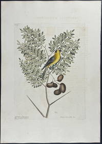
Catesby, Folio - American Goldfinch with Acacia. 1-43Trillium Antique Prints & Rare Books4.5(30)See Sold PriceFeb 24, 2024
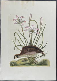
Catesby, Folio - American Partridge with Attamusco Lily. Sup-12Trillium Antique Prints & Rare Books4.5(30)See Sold PriceFeb 24, 2024
Audubon, Imperial Folio - American Cross Fox. 6Trillium Antique Prints & Rare Books4.5(30)See Sold PriceFeb 24, 2024
Afrique Pays… sud du Lac Tchad 30 Central African Republic VANDERMAELEN 1827 mapJasper524.5(9.8k)See Sold PriceFeb 28, 2024
GOOD MORNING Oil/Canvas, 1886, Cecil Romer Signed/DatedAntique Kingdom4.1(21)See Sold PriceMar 08, 2024
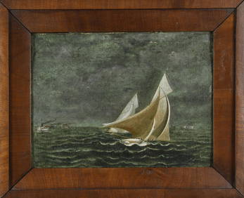
ANTIQUE AMERICAN SCHOOL OIL, RHODE ISLAND YACHT RACE.William Smith Auctions4.6(146)See Sold PriceMar 06, 2024


![[Antique Wall Map of the United States] (1 of 10)](https://p1.liveauctioneers.com/268/18175/6149871_1_x.jpg?height=282&quality=70)