ATLAS of ANTIENT GEOGRAPHY by SAMUEL BUTLER 1843John McInnis Auctioneers,LLC4.6(502)See Sold PriceFeb 24, 2024
18TH C. ANTIQUE MAP: FRENCH & INDIAN WAR, FRAMEDThomaston Place Auction Galleries4.4(386)See Sold PriceFeb 24, 2024
Rand McNally Railroad Map Cabinet w/ 21 Railroad MapsRail & Road Auctions4.6(165)See Sold PriceMar 08, 2024
Keith Haring - Ink on New York Map, Best Buddies, Inscribed, Signed, and DatedSapphire Auction Gallery4(67)See Sold PriceMar 02, 2024
LATE 17TH C. FRENCH MAP OF THE NEW WORLD BY ALEXIS-HUBERT JAILLOT (1632-1712)Thomaston Place Auction Galleries4.4(386)See Sold PriceFeb 24, 2024
Central Railroad of New Jersey Map of Sandy Hook Route-ca. 1903JM Hobby Supply and Railroad Artifact Auctions4.4(126)See Sold PriceFeb 24, 2024
Lot of Six Mixed Atlas Box Cars-HO Scale-New in BoxJM Hobby Supply and Railroad Artifact Auctions4.4(126)See Sold PriceFeb 25, 2024
Rand McNally/Santa Fe Railroad Map of Iowa-1912JM Hobby Supply and Railroad Artifact Auctions4.4(126)See Sold PriceFeb 24, 2024
NICOLAES VISSCHER (NETHERLANDS, 1618-1709) MAP OF THE NEW WORLDThomaston Place Auction Galleries4.4(386)See Sold PriceFeb 24, 2024
17TH C. WORLD MAP BY NICOLAES VISSCHER (NETHERLANDS, 1618-1709)Thomaston Place Auction Galleries4.4(386)See Sold PriceFeb 24, 2024
Lot of Six Mixed Atlas Cabooses-HO Scale-New in BoxJM Hobby Supply and Railroad Artifact Auctions4.4(126)See Sold PriceFeb 25, 2024
Cortambert: Antique Map of World in Hemispheres, 1880Mappemonde en deux Hémisphères; Ancien ou 1er. Continent; Nouveau ou 2me. Continent; Terms Géographiques et signes conventionnels; Golfe (Golfe de Gènes); Péninsule (Morée); Golfe de la Seine; OSee Sold Price
Antique Map of the World in Twin Hemispheres, 1880TITLE/CONTENT OF MAP: 'Mappemonde en deux Hémisphères; Ancien ou 1er. Continent; Nouveau ou 2me. Continent; Terms Géographiques et signes conventionnels; Golfe (Golfe de Gènes); Péninsule (MoréeSee Sold Price
SoldWalker, John 1815 Antique Map of World HemispheresCopper Plate Published 1815, London for "The Universal Gazetteer: Being a Concise Description" [Walker's Geography] by John Walker. Folds as issued. Paper Size: 15 x 8 inch (38 x 21cm) Minor toning/ofSee Sold Price
Bradford: Set of 2 Antique Maps, World in HemispheresTitle/Content of Map: Set of 2 Maps together World in globular projection by Bradford Date Printed: 1835 Cartographer: T.G. Bradford Material/Medium: Paper Size: 9 1/2" x 13" each A comprehensive AtlaSee Sold Price
SoldColored Antique Map World & Western Hemisphere 1898This colorful map came from Cram's 1898 Universal Atlas - Geographical, Astronomical and Historical. In 1869 the George F. Cram Company was born and the Cram name quickly became synonymous with accuraSee Sold Price
Colored Antique Map World & Western Hemisphere 1898 This colorful map came from Cram's 1898 Universal Atlas - Geographical, Astronomical and Historical. In 1869 the George F. Cram Company was born and the Cram name quickly became synonymous with accuraSee Sold Price
de la Tour: Antique Map of World in Hemispheres, 1771Mappe-Monde, dressée pour l'etude de la Géographie, rélativement aux auteurs les plus modernes. Revûë, corrigée et augmentée d'apres les Nouvelles Observations Astronomiques de Mrs. TchirikcowSee Sold Price
Homann Heirs: Antique Map of World in Hemispheres, 1746Map: Planiglobi Terrestris Mappe Monde Date Printed: 1746 Cartographer: Homann Heirs Material/Medium: Paper Size: 23" x 21 1/3" Condition: Excellent The World in double Hemispheres. Two proejctions shSee Sold Price
SoldBarlow 1807 Antique Map of The World HemispheresCopper Engraved Map Published 1807 by Brightly & Kinnersley, Bungay, England for "A General View of the World, Geographical, Historical and Philosophical" by The Rev. E. Blomfield. Maps Engraved by BaSee Sold Price
SoldDesnos/de la Tour: Antique Map of World in HemispheresTitle/Content of Map: 'Mappe-Monde, dressée pour l'etude de la Géographie, rélativement aux auteurs les plus modernes. Revûë, corrigée et augmentée d'apres les Nouvelles Observations AstronomiqSee Sold Price
Soldde la Tour: Antique Map of World; Twin Hemispheres 1777Title/Content of Map: 'Mappemonde' World twin hemispheres Date Printed: 1777 Image Size: Approx 18.5 x 16.5cm, 7.25 x 6.25 inches (Medium); Please note that this is a folding map. Type: Antique copperSee Sold Price
SoldBarlow 1807 Antique Map of The World HemispheresCopper Engraved Map Published 1807 by Brightly & Kinnersley, Bungay, England for "A General View of the World, Geographical, Historical and Philosophical" by The Rev. E. Blomfield. Maps Engraved by BaSee Sold Price
Malte-Brun: Antique Map of World in Hemispheres, 1846Title/Content of Map: 'Mappemonde en Deux Hémisphères' World, Twin Hemispheres. Mexican Texas. Date Printed: c1846 Image Size: Approx 28.0 x 47.5cm, 11 x 18.5 inches (Large); Please note that this iSee Sold Price
SoldBartholomew: Antique Map of World in Hemispheres, 1901The World-Bathy-Orographical; Western Hemisphere; Eastern Hemisphere; Northern Hemisphere; Southern Hemisphere' WORLD TWIN HEMISPHERES. Relief map. Mountains eclipses snowline seasons Date Printed: 19See Sold Price
Hall: Antique Map of World twin hemispheres, 1856TITLE/CONTENT OF MAP: 'The World: Western Hemisphere, Eastern Hemisphere' DATE PRINTED: 1856 IMAGE SIZE: Approx 25.0 x 40.5cm, 9.75 x 16 inches (Large) TYPE: Antique atlas map with original hand colouSee Sold Price
Malte-Brun: Antique Map of World, Twin Hemispheres 1846TITLE/CONTENT OF MAP: 'Mappemonde en Deux Hémisphères' Twin Hemispheres. Mexican Texas. DATE PRINTED: c1846 IMAGE SIZE: Approx 28.0 x 47.5cm, 11 x 18.5 inches (Large); Please note that this is a folSee Sold Price
SoldBartholomew: Antique Map of World in Hemispheres, 1898Title/Content of Map: 'The World; Western Hemisphere; Eastern Hemisphere; Northern and Southern Hemispheres; Land and Water Hemispheres' Seasons Populations areas planets Date Printed: 1898 Image SizeSee Sold Price
Hall: Antique Map of World Twin Hemispheres, 1856TITLE/CONTENT OF MAP: 'The World: Western Hemisphere, Eastern Hemisphere' DATE PRINTED: 1856 IMAGE SIZE: Approx 25.0 x 40.5cm, 9.75 x 16 inches (Large) TYPE: Antique atlas map with original hand colouSee Sold Price
Homann: Antique Map of the World in Hemispheres, 1720Map: Planiglobii Terrestris Cumutroo Hemisphaerio Celesti Date Printed: 1720 Cartographer: J. B. Homann Material/Medium: Paper Size: 21" x 24" Condition: Excellent One of the most decorative world mapSee Sold Price
Sidney Hall: Antique Map of the World in HemispheresTitle/Content of Map: 'The World: Western Hemisphere, Eastern Hemisphere' Date Printed: 1856 Image Size: Approx 25.0 x 40.5cm, 9.75 x 16 inches (Large) Type: Antique atlas map with original hand colouSee Sold Price
SoldBonne: Antique Map of the World in Hemispheres, 1780Title/Content of Map: 'L'Ancien Monde et le Nouveau en Deux Hemispheres' A map of the world in twin hemispheres Date Printed: 1780 Image Size: Approx 23.5 x 43.5cm, 9.25 x 17.25 inches (Large); PleaseSee Sold Price
Antique Map Print - World Map - Two Hemispheres - North America - South AmericaTitle/Artist: Antique Map Print - World Map - Two Hemispheres - North America - South America Date: 1778 Material: Paper Dimensions: 31,5 cm x 24 cm Additional Information: Original 1778 copper-engravSee Sold Price
de la Tour: Antique Map of the World, Twin HemispheresTitle/Content of Map: 'Mappemonde' World twin hemispheres Date Printed: 1777 Image Size: Approx 18.5 x 16.5cm, 7.25 x 6.25 inches (Medium); Please note that this is a folding map. Type: Antique copperSee Sold Price
Bartholomew: Antique Map of World in Twin HemispheresTITLE/CONTENT OF MAP: 'The World - Bathy-Orographical; Northern Hemisphere; Water Hemisphere; Land Hemisphere; Southern Hemisphere; Western Hemisphere; Eastern Hemisphere' Relief map. Mountains eclipsSee Sold Price
1849 Hand Colored Blair Map of World in HemispheresMatthew Bullock Auctioneers4.7(1.8k)See Sold PriceMar 02, 2024
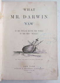
1880 WHAT MR. DARWIN SAW IN SHIP BEAGLE ANTIQUE DURING HIS WORLD TOURNY Elizabeth 4.3(84)See Sold PriceMar 03, 2024