ATLAS of ANTIENT GEOGRAPHY by SAMUEL BUTLER 1843John McInnis Auctioneers,LLC4.6(504)See Sold PriceFeb 24, 2024
18TH C. ANTIQUE MAP: FRENCH & INDIAN WAR, FRAMEDThomaston Place Auction Galleries4.4(389)See Sold PriceFeb 24, 2024
Rand McNally Railroad Map Cabinet w/ 21 Railroad MapsRail & Road Auctions4.6(165)See Sold PriceMar 08, 2024
Keith Haring - Ink on New York Map, Best Buddies, Inscribed, Signed, and DatedSapphire Auction Gallery4.1(67)See Sold PriceMar 02, 2024
LATE 17TH C. FRENCH MAP OF THE NEW WORLD BY ALEXIS-HUBERT JAILLOT (1632-1712)Thomaston Place Auction Galleries4.4(389)See Sold PriceFeb 24, 2024
Central Railroad of New Jersey Map of Sandy Hook Route-ca. 1903JM Hobby Supply and Railroad Artifact Auctions4.4(126)See Sold PriceFeb 24, 2024
Lot of Six Mixed Atlas Box Cars-HO Scale-New in BoxJM Hobby Supply and Railroad Artifact Auctions4.4(126)See Sold PriceFeb 25, 2024
Rand McNally/Santa Fe Railroad Map of Iowa-1912JM Hobby Supply and Railroad Artifact Auctions4.4(126)See Sold PriceFeb 24, 2024
NICOLAES VISSCHER (NETHERLANDS, 1618-1709) MAP OF THE NEW WORLDThomaston Place Auction Galleries4.4(389)See Sold PriceFeb 24, 2024
17TH C. WORLD MAP BY NICOLAES VISSCHER (NETHERLANDS, 1618-1709)Thomaston Place Auction Galleries4.4(389)See Sold PriceFeb 24, 2024
Lot of Six Mixed Atlas Cabooses-HO Scale-New in BoxJM Hobby Supply and Railroad Artifact Auctions4.4(126)See Sold PriceFeb 25, 2024
SoldAfter Thomas Jefferys (English), "Map of Pennsylvania,"After Thomas Jefferys (English), "Map of Pennsylvania," "Map of New York and New Jersey," "Map of Pennsylvania," "Map of New England," 1775, four 20th c. reproductions, (4 Pcs.), unframed, H.- 29 1/2See Sold Price
SoldVirgin Islands Carribbean Sea ChartThe Virgin Islands from English and Danish Surveys by Thomas Jefferys. English map. Sight 18 1/2" x 24 1/2".See Sold Price
SoldThomas Jefferys (English, 1719-1717) MapThomas Jefferys (English, 1719-1717), "The Coast of West Florida and Louisiana/ The Peninsula and Gulf of Florida or Channel of Bahama with the Bahama Islands", London, Robert Sayer, 1775, two-sheet eSee Sold Price
SoldThomas Jefferys (English, 1719-1771) MapThomas Jefferys (English, 1719-1771), "The Isthmus of Panama with the Coast from Great River on the Moskito Shore to Cartagena", London, Laurie & Whittle, 1794, from West India Atlas, 19 in. x 24 1/2See Sold Price
THOMAS JEFFERYS - MAP OF PENNSYLVANIA, 1776Thomas Jefferys - Map Of Pennsylvania, 1776 - Giclée On Canvas - 44 X 23 In. A Giclée Print Is The Highest Quality Print Available Today. Because There Is No Visible Dot Screen Pattern, The ResultinSee Sold Price
THOMAS JEFFERYS - MAP OF PENNSYLVANIA, 1776Thomas Jefferys - Map Of Pennsylvania, 1776 - 30 X 15 5/8 In. - This Giclée Print Is Gallery Stretched And Ready To Hang Or Lean Against A Wall, Or Display On An Easel. - A Giclée Print Is The HigheSee Sold Price
THOMAS JEFFERYS - MAP OF PENNSYLVANIA, 1776Thomas Jefferys - Map Of Pennsylvania, 1776 - 40 X 20 7/8 In. - This Giclée Print Is Gallery Stretched And Ready To Hang Or Lean Against A Wall, Or Display On An Easel. - A Giclée Print Is The HigheSee Sold Price
THOMAS JEFFERYS - MAP OF PENNSYLVANIA, 1776THOMAS JEFFERYS - MAP OF PENNSYLVANIA, 1776 - 36 x 18 3/4 in. - Museum Wrapped The Piece Of Art Is Ready To Hang Or Lean Against A Wall, Or Display On An Easel. - A Giclée Print Is The Highest QualitSee Sold Price
THOMAS JEFFERYS - MAP OF PENNSYLVANIA, 1776Thomas Jefferys - Map Of Pennsylvania, 1776 - 36 X 18 3/4 In. - Giclée Print - Gallery Stretched - Ready to hang.See Sold Price
THOMAS JEFFERYS - MAP OF PENNSYLVANIA, 1776Thomas Jefferys - Map Of Pennsylvania, 1776 - Giclée On Canvas - 36 X 18 3/4 In.~~A giclée print falls between serigraph and lithograph in quality. Although they can be made on paper, Giclees on canSee Sold Price
THOMAS JEFFERYS - MAP OF PENNSYLVANIA, 1776Thomas Jefferys - Map Of Pennsylvania, 1776 - 40 X 20 7/8 In. - This Giclée Print Is Gallery Stretched And Ready To Hang Or Lean Against A Wall, Or Display On An Easel. - A Giclée Print Is The HigheSee Sold Price
THOMAS JEFFERYS - MAP OF PENNSYLVANIA, 1776Thomas Jefferys - Map Of Pennsylvania, 1776 - Giclée On Canvas - 36 X 18 3/4 In.See Sold Price
Thomas Jefferys - Map Of Pennsylvania, 1776Thomas Jefferys - Map Of Pennsylvania, 1776 Size: 36 X 18 3/4 In. - This Is A Gallery Stretched Giclee Print On Canvas. The Piece Was Printed On High Quality Artist Grade 350 Gsm, Acid-free, ArchivalSee Sold Price
THOMAS JEFFERYS - MAP OF PENNSYLVANIA, 1776Thomas Jefferys - Map Of Pennsylvania, 1776 - 40 X 20 7/8 In. - This Giclée Print Is Gallery Stretched And Ready To Hang Or Lean Against A Wall, Or Display On An Easel. - A Giclée Print Is The HigheSee Sold Price
THOMAS JEFFERYS -MAP OF PENNSYLVANIA, 1776 - GICLÉE ONThomas Jefferys -map Of Pennsylvania, 1776 - Giclée On Canvas -40 X 20 7/8 In. - A Giclée Print Is The Highest Quality Print Available Today. Because There Is No Visible Dot Screen Pattern, The ResuSee Sold Price
THOMAS JEFFERYS - MAP OF PENNSYLVANIA, 1776Thomas Jefferys - Map Of Pennsylvania, 1776 - 36 X 18 3/4 In. - Giclée Print - Gallery Stretched - Ready to hang.See Sold Price
THOMAS JEFFERYS - MAP OF PENNSYLVANIA, 1776Thomas Jefferys - Map Of Pennsylvania, 1776 - 44 X 23 In. - This Giclée Print Is Gallery Stretched And Ready To Hang Or Lean Against A Wall, Or Display On An Easel. - A Giclée Print Is The Highest QSee Sold Price
THOMAS JEFFERYS - MAP OF PENNSYLVANIA, 1776Thomas Jefferys - Map Of Pennsylvania, 1776 - 36 X 18 3/4 In. - This Giclée Print Is Gallery Stretched And Ready To Hang Or Lean Against A Wall, Or Display On An Easel. - A Giclée Print Is The HigheSee Sold Price
THOMAS JEFFERYS - MAP OF PENNSYLVANIA, 1776Thomas Jefferys - Map Of Pennsylvania, 1776 - 44 X 23 In. - This Giclée Print Is Gallery Stretched And Ready To Hang Or Lean Against A Wall, Or Display On An Easel. - A Giclée Print Is The Highest QSee Sold Price
THOMAS JEFFERYS -MAP OF PENNSYLVANIA, 1776 - GICLÉE ONThomas Jefferys -map Of Pennsylvania, 1776 - Giclée On Canvas -44 X 23 In. - A Giclée Print Is The Highest Quality Print Available Today. Because There Is No Visible Dot Screen Pattern, The ResultinSee Sold Price
MAP OF PENNSYLVANIA, 1776…THOMAS JEFFERYSThomas Jefferys - Map Of Pennsylvania, 1776 - 40 X 20 7/8 In. - This Giclée On Canvas Is Gallery Stretched And Ready To HangSee Sold Price
SoldSCULL, William (after); and Thomas JEFFERYS. A MaSCULL, William (after); and Thomas JEFFERYS. A Map of Pennsylvania Exhibiting not only the Improved Parts of that Province, but also its Extensive Frontiers. [London: Sayer & Bennett, 1775].See Sold Price
SoldTHOMAS JEFFERYS (ENGLISH, C. 1710 TO 1771) MAP OFTHOMAS JEFFERYS (ENGLISH, C. 1710 TO 1771) MAP OF HONDURAS, hand-colored, on laid paper, lettered to upper margin "The BAY of HONDURAS. By Tho.s Jefferys Geographer to His Majesty", and to lower margiSee Sold Price
SoldTHOMAS JEFFERYS (ENGLISH, C. 1710 TO 1771) MAP OFTHOMAS JEFFERYS (ENGLISH, C. 1710 TO 1771) MAP OF HONDURAS, hand-colored, on laid paper, lettered to upper margin "The BAY of HONDURAS. By Tho.s Jefferys Geographer to His Majesty", and to lower margiSee Sold Price
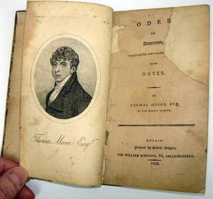
Rare 1803 Thomas Moore Odes of Anacreon 1st Edition Lodon PrintingLuis Porretta Fine Arts4.3(10)See Sold PriceMar 02, 2024
PAUL SANDBY Copperplate Mezzotint Landscape 1738 Framed & SuperbLuis Porretta Fine Arts4.3(10)See Sold PriceMar 02, 2024
THOMAS MOULE 1837 Colored Map of Warwickshire Framed vgcLuis Porretta Fine Arts4.3(10)See Sold PriceMar 02, 2024
Arrowsmith & Lewis - Map of PolynesiaTrillium Antique Prints & Rare Books4.5(30)See Sold PriceFeb 24, 2024
Arrowsmith & Lewis - Map of North AmericaTrillium Antique Prints & Rare Books4.5(30)See Sold PriceFeb 24, 2024
Arrowsmith & Lewis - Map of the World on Mercator's ProjectionTrillium Antique Prints & Rare Books4.5(30)See Sold PriceFeb 24, 2024
Arrowsmith & Lewis - Map of LouisianaTrillium Antique Prints & Rare Books4.5(30)See Sold PriceFeb 24, 2024
Arrowsmith & Lewis - Map of the United StatesTrillium Antique Prints & Rare Books4.5(30)See Sold PriceFeb 24, 2024
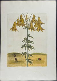
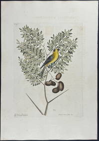
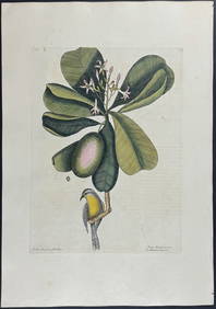
Catesby, Folio - Tumble-Turds (Dung Beetle) with Canada Lily. Sup-11Trillium Antique Prints & Rare Books4.5(30)See Sold PriceFeb 24, 2024
Catesby, Folio - American Goldfinch with Acacia. 1-43Trillium Antique Prints & Rare Books4.5(30)See Sold PriceFeb 24, 2024
Catesby, Folio - Bahama Titmouse with Seven Years Apple. 1-59Trillium Antique Prints & Rare Books4.5(30)See Sold PriceFeb 24, 2024
Catesby, Folio - American Partridge with Attamusco Lily. Sup-12Trillium Antique Prints & Rare Books4.5(30)See Sold PriceFeb 24, 2024
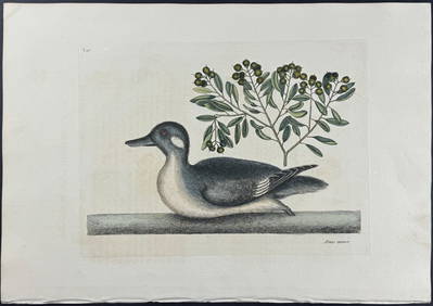
Catesby, Folio - Little Brown Duck with Soap-Wood. 1-98Trillium Antique Prints & Rare Books4.5(30)See Sold PriceFeb 24, 2024
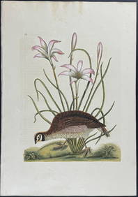
Catesby, Folio - Red Bellied Woodpecker & Hairy Woodpecker with Black Oak. 1-19Trillium Antique Prints & Rare Books4.5(30)See Sold PriceFeb 24, 2024
1855 NOTES ON CENTRAL AMERICA by E. G. Squier antique w/ MAPSJasper524.5(9.8k)See Sold PriceFeb 27, 2024
1856 ARCTIC EXPLORATIONS 2nd GRINNEL EXPEDITION 2 v. E.KANE antique ILLUSTRATEDJasper524.5(9.8k)See Sold PriceFeb 27, 2024
1900 THOMAS HENRY HUXLEY SKETCH OF HIS LIFE & WORK P. CHALMERS MITCHELL antiqueJasper524.5(9.8k)See Sold PriceFeb 27, 2024
1832 POETICAL WORKS of THOMAS MOORE antique POETRY PRINTED in PhiladelphiaJasper524.5(9.8k)See Sold PriceFeb 27, 2024
WEST AFRICA Explorers' routes Senegal Ashanti. Mountains of Kong. SDUK 1857 mapJasper524.5(9.8k)See Sold PriceFeb 28, 2024
WEST AFRICA explorers' routes. Beaufort Gray Park Dochard Caillie. SDUK 1874 mapJasper524.5(9.8k)See Sold PriceFeb 28, 2024