ATLAS of ANTIENT GEOGRAPHY by SAMUEL BUTLER 1843John McInnis Auctioneers,LLC4.5(505)See Sold PriceFeb 24, 2024
18TH C. ANTIQUE MAP: FRENCH & INDIAN WAR, FRAMEDThomaston Place Auction Galleries4.4(393)See Sold PriceFeb 24, 2024
Rand McNally Railroad Map Cabinet w/ 21 Railroad MapsRail & Road Auctions4.6(165)See Sold PriceMar 08, 2024
Keith Haring - Ink on New York Map, Best Buddies, Inscribed, Signed, and DatedSapphire Auction Gallery4(67)See Sold PriceMar 02, 2024
LATE 17TH C. FRENCH MAP OF THE NEW WORLD BY ALEXIS-HUBERT JAILLOT (1632-1712)Thomaston Place Auction Galleries4.4(393)See Sold PriceFeb 24, 2024
Central Railroad of New Jersey Map of Sandy Hook Route-ca. 1903JM Hobby Supply and Railroad Artifact Auctions4.4(127)See Sold PriceFeb 24, 2024
Lot of Six Mixed Atlas Box Cars-HO Scale-New in BoxJM Hobby Supply and Railroad Artifact Auctions4.4(127)See Sold PriceFeb 25, 2024
Rand McNally/Santa Fe Railroad Map of Iowa-1912JM Hobby Supply and Railroad Artifact Auctions4.4(127)See Sold PriceFeb 24, 2024
NICOLAES VISSCHER (NETHERLANDS, 1618-1709) MAP OF THE NEW WORLDThomaston Place Auction Galleries4.4(393)See Sold PriceFeb 24, 2024
17TH C. WORLD MAP BY NICOLAES VISSCHER (NETHERLANDS, 1618-1709)Thomaston Place Auction Galleries4.4(393)See Sold PriceFeb 24, 2024
Lot of Six Mixed Atlas Cabooses-HO Scale-New in BoxJM Hobby Supply and Railroad Artifact Auctions4.4(127)See Sold PriceFeb 25, 2024
SoldIndiana and Ohio Map EngravingProfessionally framed excellent condition 17" x 18.5" Provenance: The Larry & Julia Pollock collection of Shaker Hgts Ohio. Originally purchased from Through the Looking Glass in France .See Sold Price
SoldANTIQUE ENGRAVING ANCIENT EGYPTAntique Engraving. Size: 18.5 X 13.5 Inches Approx. Printed Circa 1730.See Sold Price
SoldJOAN BLAEU ATLAS MAIOR 1792 PRINTINGSold as a collection of maps, hand colored engravings. Text in Dutch. Contains 40 maps/plates. With original hand coloring. Dimensions: (Maps open) H 21.5" x W 25.25" Condition: As is. Varying damagesSee Sold Price
Seutter, Matthaus. Atlas of EuropeSeutter, Matthaus Atlas of Europe C. 1729-1731 Copperplate engraving; contemporary coloured Printed area: 55.2 x 34.4 cm; 21.7 x 13.5 in A collection of 26 double-page engraved regional maps and 26 enSee Sold Price
Sold18th Century French Maps of the United States andboth by Louis Brion de la Tour, Paris, circa 1790, copperplate engravings with outline color. In modern black wooden frames. DOA 11.5 x 14.5 in. From the Collection of Colette Gaudron, Southeast AsiaSee Sold Price
SoldA Collection of Five Hand-Painted Engravings, 19thA Collection of Five Hand-Colored Engravings, 19th Century, Depicting maps of France from the Atlas National Illustre series. Framed dimensions: h: 20.5 x w: 24 in.See Sold Price
SoldSouth America Antique Map 1826South America Map. Size: 11 X 8.5 inches approx. Unframed. Printed Circa 1826.See Sold Price
SoldCOLLECTION OF 18TH AND 19TH CENTURY MAPS.COLLECTION OF 18TH AND 19TH CENTURY MAPS. Comprised of fifteen maps varying from world maps, Asia, Africa, South America, and others. All engravings, some hand colored Largest: 11.5" x 19"See Sold Price
SoldFour 17th-18th C. Maps: Desing, Manesson-MallettCollection of four 17th and 18th European maps, Item 1: P. A. Desings map of the western hemisphere. Hand colored copper engraving published in 1741. 6 3/8" H x 5 3/4" W. Items 2 and 3: Two Manesson-See Sold Price
SoldAnonymous Mid-19th Century Map of the Carolinas andAnonymous Mid-19th Century Map of the Carolinas and Georgiacirca 1850s, engraving with outline color. Behind mat. Plate 8 x 10.5 in.; Sheet 10.5 x 13 in. From a private North Carolina collection AdditSee Sold Price
SoldAntique Map Armenia, Colchis, Iberia & AlbaniaSize: 11 X 8.5 inches approx. Unframed. Printed 1826.See Sold Price
SoldAntique Map of North America 1826Antique Map of North America. Size: 11 X 8.5 inches approx. Unframed. Printed 1826.See Sold Price
SoldLattre: Antique Map of Ancient Egypt, 1791Map: Ancient Egypt by Lattre Date Printed: 1791 Cartographer: J Lattre Material/Medium: Paper Size: 8 1/2" x 12" Hand colored copperplate engraving. Published in Petit Atlas Moderne Ou Collection De CSee Sold Price
SoldAntique Map SYRIA, MESOPOTAMIA, ASSYRIASize: 11 X 8.5 inches approx. Unframed. Printed 1826.See Sold Price
SoldAntique Map INSULE MARIS AEGEISize: 11 X 8.5 inches approx. Unframed. Printed 1826.See Sold Price
SoldMaps of China (2) (63218)1) China and Birmah by Tallis, ca. 1820. Engraving by J. Rapkin with vignettes by Wray and Allen. Approximately 14.5" x 10.75." 2) Chinese Empire Including Korea, ca. 1885. Engraving and color by lithSee Sold Price
SoldIreland Antique Map 1826Antique Map of Ireland. Size: 11 X 8.5 inches approx. Unframed. Printed 1826.See Sold Price
SoldNorth Italy & Switzerland Antique Map 1826Antique Map of North Italy & Switzerland. Size: 11 X 8.5 inches approx. Unframed. Printed 1826.See Sold Price
SoldBartholomew, John 1922 Lot of 5 Maps Egypt & Holy LandIncl Egypt and The Nile, Lower Egypt, Asia Minor/Syria/Mesopotamia, Palestine and Persia. Large Lithograph Maps Published 1922 by The Times, London for "The Times Survey Atlas of the World" Maps by JoSee Sold Price
SoldCollection of [5] Maps of the Middle East and Environs* Nuova Carta di Irak Arabi, Kurdistan Diarbek Turcomannia Siria, e Palestina, map of Iraq, Arabia, Diarbek, Turkmenistan, Syria and the Land of Israel. 1740, 30x35 cm. * Syria, Cyprus, Palestina, MesSee Sold Price
SoldSwitzerland.- Collection of 5 maps in cassetta-styleSwitzerland.- Collection of 5 maps in cassetta-style frames, including 'Des Kantons Lucern Nordlicher Theil', 'Der Kanton Solothurn', 'Basiliensis Territorii Descriptio Nova', Der Kanton Freyburg...',See Sold Price
1893 Map of Egypt/Arabia/AbissiniaTitle: 1893 Map of Egypt/Arabia/Abissinia Author: Pike Medium: Ink on Paper Dimensions: 11"X13.5" Map of Egypt, Arabia and Abyssinia(modern day Ethyopia and Eritrea) dated 1893. Published in the ColumSee Sold Price
SoldCOLLECTION OF 5 ORIGINAL ENGRAVINGS 1800sCOLLECTION OF 5 LARGE ENGRAVINGS CIR 1800s.See Sold Price
WILLIAM LOVETT Social & Political Morality c1853 1st EditionLuis Porretta Fine Arts4.3(10)See Sold PriceMar 02, 2024
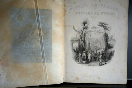
PAYNES UNIVERSUM ca1850 Calf 1st ed Travel 65 X Engravings China etc.Luis Porretta Fine Arts4.3(10)See Sold PriceMar 02, 2024
DAVID ROBERTS - Holy Land / Syria / Egypt etc. 3 x Folio Volumes 1849 Very RareLuis Porretta Fine Arts4.3(10)See Sold PriceMar 02, 2024
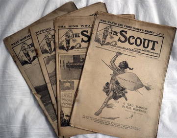
The SCOUT MAGAZINE Rare c1912 5 x Issues RARE!Luis Porretta Fine Arts4.3(10)See Sold PriceMar 02, 2024
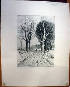
PAUL BERDANIER (1879-1961) Original Engraving Landscape Listed Artist CollectibleLuis Porretta Fine Arts4.3(10)See Sold PriceMar 02, 2024
ANATOLE KRASNYANSKY White Church Ukraine Embellished Serigraph Print FramedLuis Porretta Fine Arts4.3(10)See Sold PriceMar 02, 2024
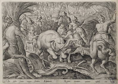
Philip Galle. 5 engravings. Hunting and fishing scenes. 4 from "Hunting Parties" after Jan StradanusTremont Auctions4.5(297)See Sold PriceFeb 25, 2024
Old Master portraits of notables. To include: 1) Scarce engraving of Henry Frederick Prince of WalesTremont Auctions4.5(297)See Sold PriceFeb 25, 2024
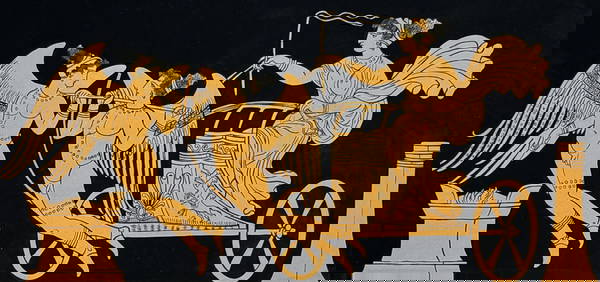
Hamilton - Engraving of a Painting from a Grecian Vase. 5Trillium Antique Prints & Rare Books4.5(32)See Sold PriceFeb 24, 2024
1816 MAP SOUTHERN PART OF RUSSIA or MUSCOVY in EUROPE copper engraving ANTIQUEJasper524.5(9.9k)See Sold PriceFeb 27, 2024
1816 MAP NORTHERN PART OF RUSSIA or MUSCOVY in EUROPE copper engraving ANTIQUEJasper524.5(9.9k)See Sold PriceFeb 27, 2024
Nottingham.- Ordnance Survey Office (publisher) Collection 8 geological maps on the environs ofForum Auctions4.3(53)See Sold PriceFeb 29, 2024
Framed Collection Engravings & A Map From The Excursions In The County Of Sussex Published In 1822Rapid Estate Liquidators and Auction Gallery4.5(1.1k)See Sold PriceMar 01, 2024
![A Collection [5] of Maps - Engravings. Egypt and First Image](https://p1.liveauctioneers.com/2398/106082/54328089_1_x.jpg?height=282&quality=95&version=1499076176&width=282)

![A Collection [5] of Maps - Engravings. Egypt and First Image](https://p1.liveauctioneers.com/2398/106082/54328089_1_x.jpg?height=282&quality=1&version=1499076176&width=282)


![Collection of [5] Maps of the Middle East and Environs (1 of 5)](https://p1.liveauctioneers.com/2398/129929/66072853_1_x.jpg?height=282&quality=70&version=1540446977)