ATLAS of ANTIENT GEOGRAPHY by SAMUEL BUTLER 1843John McInnis Auctioneers,LLC4.6(502)See Sold PriceFeb 24, 2024
18TH C. ANTIQUE MAP: FRENCH & INDIAN WAR, FRAMEDThomaston Place Auction Galleries4.4(386)See Sold PriceFeb 24, 2024
Rand McNally Railroad Map Cabinet w/ 21 Railroad MapsRail & Road Auctions4.6(165)See Sold PriceMar 08, 2024
Keith Haring - Ink on New York Map, Best Buddies, Inscribed, Signed, and DatedSapphire Auction Gallery4(67)See Sold PriceMar 02, 2024
LATE 17TH C. FRENCH MAP OF THE NEW WORLD BY ALEXIS-HUBERT JAILLOT (1632-1712)Thomaston Place Auction Galleries4.4(386)See Sold PriceFeb 24, 2024
Central Railroad of New Jersey Map of Sandy Hook Route-ca. 1903JM Hobby Supply and Railroad Artifact Auctions4.4(126)See Sold PriceFeb 24, 2024
Lot of Six Mixed Atlas Box Cars-HO Scale-New in BoxJM Hobby Supply and Railroad Artifact Auctions4.4(126)See Sold PriceFeb 25, 2024
Rand McNally/Santa Fe Railroad Map of Iowa-1912JM Hobby Supply and Railroad Artifact Auctions4.4(126)See Sold PriceFeb 24, 2024
NICOLAES VISSCHER (NETHERLANDS, 1618-1709) MAP OF THE NEW WORLDThomaston Place Auction Galleries4.4(386)See Sold PriceFeb 24, 2024
17TH C. WORLD MAP BY NICOLAES VISSCHER (NETHERLANDS, 1618-1709)Thomaston Place Auction Galleries4.4(386)See Sold PriceFeb 24, 2024
Lot of Six Mixed Atlas Cabooses-HO Scale-New in BoxJM Hobby Supply and Railroad Artifact Auctions4.4(126)See Sold PriceFeb 25, 2024
SoldHomann: Map of the Promised Land, 1720Map: Iudea seu Palaestina ob sacratissima Redentoris vestigia hodie dicta Terra Sancta Cartographer: Johannes Baptista Homann Place & Date: Nurnberg / 1720 Size: 22 1/2" x 19 1/4" Condition: light broSee Sold Price
Sold17th c. Map Promised Land by Juan Baptista Villalpando17th c. Map of the Promised Land Entitled TERRA PROMISSA IN SUAS TRIBUS PARTESQUE DIUISA [Promised Land Divided by Tribes]. Page 201. Blank verso | by Juan Baptista Villalpando (1552-1608) | Map is enSee Sold Price
SoldMap of Promised Land 1722Title: Carte de la Terre Promise Author: Calmet, Augutstin) Description: Copper-engraved map. 47x23.3 cm. (18½x8¼").The Promised Land, present Israel and Palestine, from Antioch in the north to theSee Sold Price
SoldJohann Baptist Homann, Map, c. 1720Homann, Johann Baptist , "Regni Mexicani seu Novae Hispaniae...Carolinae, Virginiae, et Pensylvaniae", Nuremberg, c. 1720, hand-colored engraved map, with vignettes of ships and trade with native inhaSee Sold Price
SoldMap of Promised Land 1722Title: Carte de la Terre Promise Author: Calmet, Augutstin Description: Copper-engraved map. 47x23.3 cm. (18½x8¼"). The Promised Land, presently Israel and Palestine, from AntiochSee Sold Price
Hondius: Antique Map of The Promised Land, 1633Map: Situs Terrae promissionis Cartographer: Hondius Place & Date: Amsterdam / 1633 Size: 19 3/8" X 14 5/8" Condition: b&w; overall age toning and some spotting; some see through of text verso; smallSee Sold Price
SoldMoll: Antique Map of Newfound Land, 1720Map: New Map of Newfound Land, Publication Date: 1720 ca. Cartographer: MOLL, H. Size: Octavo – 7.00 H x 10.10 W Inches New Scotland the isles of Breton, Anticoste, St. Iohns & c. Together with theSee Sold Price
1720 Homann Map of Denmark -- Regni Daniae in quo suntTitle/Content of Map: 1720 Homann Map of Denmark -- Regni Daniae in quo sunt Ducatus Holsatia et Slesvicum Insulae Danicae Provinciae Iutia Scania Blekingia Nova Tabula Date Printed: 1720 c Nurnberg CSee Sold Price
1720 Homann Map of Black Sea, Southern Russia andTitle/Content of Map: 1720 Homann Map of Black Sea, Southern Russia and Ukraine -- Tabula Geographica qua pars Russiae Magnae Pontus Euxinus seu Mare Nigrum et Tartaria Minor cum finitimis Bulgariae,See Sold Price
Harenburg / Homann: Map of Holy Land & Cyprus 1744Map: Palaestina seu Terra olim Sancta Cartographer: Harenburg/Homann Heirs Place & Date: Nurnberg / 1744 Size: 22" x 19 1/4" Condition: tribal areas in original wash color, the rest of the map and carSee Sold Price
SoldPromised Land Map LotLot of two maps of the Holy Land: 1. "A map of the Land of Promise Compiled by the Author out of the Book of Joshua". Hand-colored copperplate engraving. From: Calmet, Augustin Antoine. A historical,See Sold Price
Sold1720 Homann Map of Estonia and Latvia -- DucatuumReserve Reduced! Title/Content of Map: 1720 Homann Map of Estonia and Latvia -- Ducatuum Livoniae et Curlandiae cum vicinis Insulis Nova Exhibitio Geographica Date: 1720, Nurnberg Cartographer: J HomaSee Sold Price
Sold1720 Homann Map of Canada's Atlantic Provinces -- A.Title/Content of Map: 1720 Homann Map of Canada's Atlantic Provinces -- A. New Foundland, od. Terra Nova S. Laurentii Bay, die Fisch-Bank, Acadia, nebst einem Theil New Schotland Date Printed: 1720, NSee Sold Price
1720 Homann Map of Siege of Belgrade --Title: 1720 Homann Map of Siege of Belgrade -- Neu-Geographisch Vorgestelltes Ungarisches Kriegs-Theatrum in Servien und dem Bannat Temeswar ... 1716 und 1717 Cartographer: J Homann Year / Place: 1720See Sold Price
H. Moll: A New Map of Newfound Land, 1720Map: A New Map of Newfound Land, Publication Date: 1720 Author: MOLL, H. Size: Octavo – 7.00 H x 10.10 W Inches "New Scotland the isles of Breton, Anticoste, St. Iohns & c. Together with the fishingSee Sold Price
Sold1720 Homann Map of Netherlands, Belgium and LuxemburgReserve Reduced! Map Title/Content: 1720 Homann Map of Netherlands, Belgium and Luxemburg -- Tabula Generalis Totius Belgii qua Provinciae XVII. Infer. Germaniae olim sub S.R.I. Circulo Burgundiae…See Sold Price
SoldMap of the Promised Land, Augsburg, ca. 1725Map of the promised land divided among the 12 tribes: "Regio Canaan seu Terra Promissionis postea Iudaea vel Palaestina...". Hand-colored copperplate engraving, re-engraved by Matthaeus Seutter (a copSee Sold Price
1720 Homann Map od the Caspian Sea Region -- Provinciarum Persicarum Kilaniae nempe ChirvaniaeTitle: 1720 Homann Map od the Caspian Sea Region -- Provinciarum Persicarum Kilaniae nempe Chirvaniae Dagestaniae Cartographer: J Homann Year / Place: 1720, Nurnberg Map Dimension (in.): 19.2 X 22.8 iSee Sold Price
1720 Homann Map of Northwest Italy, the Alps and LakeTitle/Content of Map: 1720 Homann Map of Northwest Italy, the Alps and Lake District -- Regiae Celsitudinis Sabaudicae Status in quo Ducatus Sabaudiae Principatus Pedemontium et Ducatus Montisferrati�See Sold Price
1720 Homann Map of Siege of Belgrade --Title/Content of Map: 1720 Homann Map of Siege of Belgrade -- Neu-Geographisch Vorgestelltes Ungarisches Kriegs-Theatrum in Servien und dem Bannat Temeswar ... 1716 und 1717 Cartographer: J Homann YeaSee Sold Price
Sold1720 Homann Map of Black Sea, Southern Russia andTitle/Content of Map: 1720 Homann Map of Black Sea, Southern Russia and Ukraine -- Tabula Geographica qua pars Russiae Magnae Pontus Euxinus seu Mare Nigrum et Tartaria Minor cum finitimis Bulgariae,See Sold Price
SoldA 1720 HOMANN MAP OF FRANCONIA, GERMANY, BAVARIAA Copper-engraved map, hand-colored, 1720, Franconia (Bavaria), centered on Bamberg, Würtzburg and Nuremberg; Johann Baptist Homann, measures 22.5 x 19 inch sight size, 28 x 24.5 inch frame. We shiSee Sold Price
1720 Homann Map of Northwest Italy, the Alps and LakeTitle/Content of Map: 1720 Homann Map of Northwest Italy, the Alps and Lake District -- Regiae Celsitudinis Sabaudicae Status in quo Ducatus Sabaudiae Principatus Pedemontium et Ducatus Montisferrati�See Sold Price
1720 Homann Map of the Persian Empire -- Imperii Persici in Omnes suas ProvinciasTitle: 1720 Homann Map of the Persian Empire -- Imperii Persici in Omnes suas Provincias Cartographer: J Homann Year / Place: 1720, Nurnberg Map Dimension (in.): 19.2 X 23 in This is a superb map of tSee Sold Price
British Sovereignty Over Palestine - Poster - 1937Levy Auction House4.3(11)See Sold PriceFeb 27, 2024
ELVIS PRESLEY 45 BLUE SUEDE SHOES / PROMISED LAND BLUE VINYL 50TH ANNIVERSARY PB 13929King's Auctions Inc4.2(121)See Sold PriceMar 03, 2024
1872 Holy BIBLE & Hitchcock Analysis Gruden Concordance Theology MAPS Holy LandSchilb Antiquarian Rare Books4.8(421)See Sold PriceMar 31, 2024
Johann Homann Hand-Colored Map Engraving, c. 1730Auctions at Showplace4.5(726)See Sold PriceMar 17, 2024
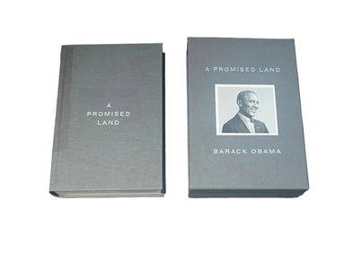
Barack Obama Signed A Promised Land Hardback Original Pressing BookShakespeare Auctions4.3(1)See Sold PriceFeb 25, 2024
1736 LARGE MAP OF SILESIA POLAND OPPAVIENSIS antique 25 by 34 3/4"Jasper524.5(9.8k)See Sold PriceFeb 27, 2024
1736 LARGE MAP OF SILESIA POLAND KARNOVIENSIS antique 25 x 4 3/4" Duchy of KrnovJasper524.5(9.8k)See Sold PriceFeb 27, 2024