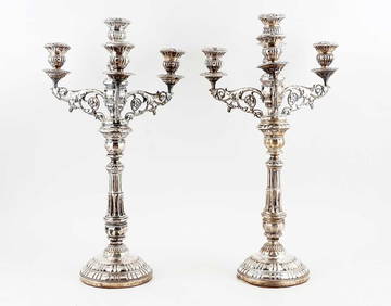
[Map] Jaillot, Charles Hubert Alexis. La Comte de[Map] Jaillot, Charles Hubert Alexis. La Comte de Bourgogne, our La Franche Comte, divisee en trois grand balliages… Paris, 1692. Engraved map with original hand-coloring in outline and later hand-cSee Sold Price
La Comte de Bourgogne, our La Franche Comte, divisee en[Map] Jaillot, Charles Hubert Alexis. La Comte de Bourgogne, our La Franche Comte, divisee en trois grand balliages… Paris, 1692. Engraved map with original hand-coloring in outline and later hand-cSee Sold Price
Jaillot (Alexis Hubert)Jaillot (Alexis Hubert) La Principauté de Piémont, Les Marquisats de Saluce et de Suze, les Comtés de Nice et d'Ast, le Montferrat &c, engraved map, with original hand-coloured outlines, 6See Sold Price
FFRAN Jaillot (Alexis, Hubert)FFRAN Jaillot (Alexis, Hubert) La Principauté de Piémont, Les Marquisats de Saluce et de Suze, les Comtés de Nice et d'Ast, le Montferrat &c, engraved map, with originSee Sold Price
(3) RARE 17TH C. SANSON MAPS OF GERMANYAlexis-Hubert Jaillot (c. 1632-1712); Nicolas Sanson (1600-1667). All single sheet, including: "Le Duce de Iuliers"; "l'Evesche de Munster"; Le Comte de la Marck", hand colored engravings, published 1See Sold Price
Sold(3) RARE 17TH C. SANSON MAPS OF GERMANYAlexis-Hubert Jaillot (c. 1632-1712); Nicolas Sanson (1600-1667). All single sheet, including: "Le Duce de Iuliers"; "l'Evesche de Munster"; Le Comte de la Marck", hand colored engravings, published 1See Sold Price
Sold[Map] Jaillot, Charles Hubert Alexis. La Bretagne[Map] Jaillot, Charles Hubert Alexis. La Bretagne. [Amsterdam], 1696. Engraved map of the Bretagne region of France, with original hand-coloring in outline and hand-colored cartouches. Cartouches featSee Sold Price
[Map] Jaillot, Charles Hubert Alexis. Le Duche de[Map] Jaillot, Charles Hubert Alexis. Le Duche de Pomeranie… Paris [Amsterdam], 1691 [but really 1696]. Engraved map with hand-coloring, showing from Rostock to Gdansk and south as far as Landsberg.See Sold Price
Jaillot Map of Eastern CanadaPartie de la Nouvelle France. Alexis Hubert Jaillot (1632-1712). Engraved map with hand color in outline. Paris, 1685 (first state). 20 x 27 inches sheet. Map of Canada by the French cartographer, focSee Sold Price
Sold1692 Le Comte De Zeelande MapUnframed c. 1692 steel engraved & colored 24 1/4" x 36 1/4" double folio map, "Le Comte De Zeelande" by Alexis Hubert Jaillot, depicting the Province of Zeeland in the Netherlands.See Sold Price
Jaillot Map of Canada and Hudson BayLa Canada ou Partie de la Nouvelle France. Alexis Hubert Jaillot (1632-1712). Engraving with original hand color in outline. Paris, 1696. 20 1/4 x 25 inches sheet. First state, dated 1696, of Jaillot�See Sold Price
SoldFrance.- Jaillot (Alexis-Hubert) Plan de la Ville,France.- Jaillot (Alexis-Hubert) Plan de la Ville, cité, université, et faubourgs de Paris…, engraved, hand coloured, vertical folds, slight staining, slight restoration, 52.5 x 107.5cm, Paris, cSee Sold Price
Wall map. JAILLOT. L’Asie,JAILLOT, Alexis-Hubert. L’Asie, divisée selon l’étendue de ses principales parties… Paris, Jaillot et Desnos, 1782 6 fogli uniti, complessivamente 1.230x1.145 mm. Carta murale intelaSee Sold Price
SoldMAP - Baltic Sea. JaillotBaltic Sea. Alexis-Hubert Jaillot, Carte de la Mer Baltique, Contenant les Bancs, Isles et Costes Comprises Entre l'Isle de Zelande et l'Extremite du Golfe de Finlande, 1693 (circa). Black & White. ThSee Sold Price
Sold[JAILLOT] MAP OF HUNGARY & SURROUNDINGS'Le Royaume De Hongrie Et Les Estats qui en ont este sujets....La Partie Septentrionale De La Turquie en Europe, by Alexis-Hubert Jaillot (ca. 1632-1712) and Guillaume Sanson (1633-1703), engraving wiSee Sold Price
2-sheet map: LE COMTE DE HOLLANDE. [Late 1600's].[Europe/Netherlands]. Alexis Hubert Jaillot after S. Sanson. LE COMTE DE HOLLANDE. 2 double-paged engraved maps, contemporary color, cartouche uncolored. 12” x 22 ¼” and 16 5/8” x 21 7/8”. [CSee Sold Price
SoldJaillot Map of New FranceJAILLOT, Alexis Hubert (1632-1712). Partie de la Nouvelle France. Engraved map with hand color in outline. Paris, 1685. 30" x 27" sheet.See Sold Price
Mortier & Jaillot Map of The Red SeaMORTIER, Pieter (1661-1711), after JAILLOT, Alexis-Hubert (1632-1712). Carte Particuliere de la Mer Rouge &c. Leve par Ordre Expres des Roys de Portugal sous qui on en a Fait la Decouverte. Engraved mSee Sold Price
Jaillot, A.H. Le Canada Dans l' AmeriqueJaillot, Alexis Hubert Le Canada ou Partie de la Nouvelle France Dans l'Amerique Septentrionale, Contenant la Terre de Labrador, la Nouvelle France... 1696 Copperplate engraving; outline coloured EachSee Sold Price
SoldCanada.- Jaillot (Alexis-Hubert) Le Canada ou Partie deCanada.- Jaillot (Alexis-Hubert) Le Canada ou Partie de la Nouvelle France dans l'Amerique Septentrionale, Contenant la Terre de Labrador, la Nouvelle France, les Isles de Terre Neuve, de Nostre Dame,See Sold Price
SoldEngland.- East Coast.- Jaillot (Alexis-Hubert) Carte deEngland.- East Coast.- Jaillot (Alexis-Hubert) Carte de l'Entree de la Tamise avec les Bancs, Passes, Isles et Costes Comprises Entre Sandwich et Clay, large chart of the eastern coastline of EnglandSee Sold Price
SoldEngland.- River Thames.- Jaillot (Alexis-Hubert) CarteEngland.- River Thames.- Jaillot (Alexis-Hubert) Carte de l'Entree de la Tamise avec les Bancs, Passes, Isles et Costes Comprises Entre Sandwich et Clay, sea chart of the eastern coastline of EnglandSee Sold Price
SoldJaillot PARTIE DE LA NOUVELLE FRANCE 1695 ImportantDetails: JAILLOT, Alexis Hubert (c.1632-1712). Partie de la Nouvelle France. Paris: 1695. Engraved map. Sheet size: 21 1/4 x 28 1/2 inches. An important French mapping of Canada during King William'sSee Sold Price
SoldJaillot (A H) Carte del L'Entrée de la Tamise[Jaillot (Alexis Hubert)] Carte del L'Entrée de la Tamise, engraved chart of the coasts of Kent, Essex, Suffolk and Norfolk, from Sandwich to Clay, inset map of the Thames Estuary to London, wSee Sold Price
LARGE LATE 17TH C. DUTCH CHART OF CANADA, GREAT LAKES, NEW FRANCE, LABRADOR, HUDSON BAY, BY PIERREThomaston Place Auction Galleries4.4(394)See Sold PriceFeb 24, 2024
LATE 17TH C. FRENCH MAP OF THE NEW WORLD BY ALEXIS-HUBERT JAILLOT (1632-1712)Thomaston Place Auction Galleries4.4(394)See Sold PriceFeb 24, 2024
RIGOBERT BONNE c1787 Original Colored Map Germany & Region 15" x 12"Luis Porretta Fine Arts4.3(10)See Sold PriceMar 02, 2024
Henri Charles Manguin (French, 1874-1949) - Les Pins Autour de la ServianneFreeman's | Hindman4.5(158)See Sold PriceFeb 27, 2024
Rand McNally Railroad Map Cabinet w/ 21 Railroad MapsRail & Road Auctions4.6(165)See Sold PriceMar 08, 2024
[MAPS]. DUFOUR, Auguste-Henri (1795-1865). Bound Volume of ...Potter & Potter Auctions4.6(550)See Sold PriceMar 07, 2024
"La Partie de Campagne", Charles Sorlier Litho.Direct Auction Galleries 4.7(339)See Sold PriceFeb 24, 2024
Coste Occidentale d’Afrique…' West Africa. Gulf of Guinea. BELLIN 1746 mapJasper524.5(9.9k)See Sold PriceFeb 28, 2024
Coste Occidentale d’Afrique…' Namibia South Africa Angola coast BELLIN 1746 mapJasper524.5(9.9k)See Sold PriceFeb 28, 2024
Lot of 20 Fashion Prints - Le Moniteur de la Mode - La Mode Artistique - Le Journal Pour RireProverde Auctions4.3(3)See Sold PriceFeb 28, 2024
Lot of 20 Fashion Prints - Le Moniteur de la Mode - La Mode Artistique - Le Journal Pour RireProverde Auctions4.3(3)See Sold PriceFeb 28, 2024
Paul Louis Oudart - Set of 3 Antique Prints - Herpetology, Reptile - Bernard Germain Etienne De LaProverde Auctions4.3(3)See Sold PriceFeb 28, 2024
Paul Louis Oudart - Set of 2 Antique Prints - Herpetology, Reptile - Bernard Germain Etienne De LaProverde Auctions4.3(3)See Sold PriceFeb 28, 2024


![[Map] Jaillot, Charles Hubert Alexis. La Comte de First Image](https://p1.liveauctioneers.com/928/104923/53749646_1_x.jpg?height=282&quality=95&version=1496865216&width=282)
![[Map] Jaillot, Charles Hubert Alexis. La Comte de (1 of 1)](https://p1.liveauctioneers.com/928/104923/53749646_1_x.jpg?height=282&quality=70&version=1496865216)
![[Map] Jaillot, Charles Hubert Alexis. La Comte de First Image](https://p1.liveauctioneers.com/928/104923/53749646_1_x.jpg?height=282&quality=1&version=1496865216&width=282)


![[Map] Jaillot, Charles Hubert Alexis. La Bretagne (1 of 1)](https://p1.liveauctioneers.com/928/104923/53749645_1_x.jpg?height=282&quality=70&version=1496865216)
![[Map] Jaillot, Charles Hubert Alexis. Le Duche de (1 of 1)](https://p1.liveauctioneers.com/928/104923/53749647_1_x.jpg?height=282&quality=70&version=1496865216)


![[JAILLOT] MAP OF HUNGARY & SURROUNDINGS (1 of 8)](https://p1.liveauctioneers.com/522/124271/63207925_1_x.jpg?height=282&quality=70&version=1530290718)
![2-sheet map: LE COMTE DE HOLLANDE. [Late 1600's]. (1 of 7)](https://p1.liveauctioneers.com/179/49347/23134561_1_x.jpg?height=282&quality=70&version=1388425910)


![[MAPS]. DUFOUR, Auguste-Henri (1795-1865). Bound Volume of ... (1 of 2)](https://p1.liveauctioneers.com/928/318880/171361279_1_x.jpg?height=282&quality=70&version=1707501302)