ATLAS of ANTIENT GEOGRAPHY by SAMUEL BUTLER 1843John McInnis Auctioneers,LLC4.6(504)See Sold PriceFeb 24, 2024
18TH C. ANTIQUE MAP: FRENCH & INDIAN WAR, FRAMEDThomaston Place Auction Galleries4.4(389)See Sold PriceFeb 24, 2024
Rand McNally Railroad Map Cabinet w/ 21 Railroad MapsRail & Road Auctions4.6(165)See Sold PriceMar 08, 2024
Keith Haring - Ink on New York Map, Best Buddies, Inscribed, Signed, and DatedSapphire Auction Gallery4.1(67)See Sold PriceMar 02, 2024
LATE 17TH C. FRENCH MAP OF THE NEW WORLD BY ALEXIS-HUBERT JAILLOT (1632-1712)Thomaston Place Auction Galleries4.4(389)See Sold PriceFeb 24, 2024
Central Railroad of New Jersey Map of Sandy Hook Route-ca. 1903JM Hobby Supply and Railroad Artifact Auctions4.4(126)See Sold PriceFeb 24, 2024
Lot of Six Mixed Atlas Box Cars-HO Scale-New in BoxJM Hobby Supply and Railroad Artifact Auctions4.4(126)See Sold PriceFeb 25, 2024
Rand McNally/Santa Fe Railroad Map of Iowa-1912JM Hobby Supply and Railroad Artifact Auctions4.4(126)See Sold PriceFeb 24, 2024
NICOLAES VISSCHER (NETHERLANDS, 1618-1709) MAP OF THE NEW WORLDThomaston Place Auction Galleries4.4(389)See Sold PriceFeb 24, 2024
17TH C. WORLD MAP BY NICOLAES VISSCHER (NETHERLANDS, 1618-1709)Thomaston Place Auction Galleries4.4(389)See Sold PriceFeb 24, 2024
Lot of Six Mixed Atlas Cabooses-HO Scale-New in BoxJM Hobby Supply and Railroad Artifact Auctions4.4(126)See Sold PriceFeb 25, 2024
SoldFlemming: Map Italien No. I. [Nord] | [Sud], 1847Map: Italien No. I. [Nord] | [Sud] Publication Date: 1847 ca. Authors: C. FLEMMING Publisher: C. FLEMMING Size: Folio – 11.75 H x 16.5 W Inches Two large scale detailed maps. Please note that this lSee Sold Price
Flemming: Antique Map of the United States, 1845Title/Content of Map: Vereinigte Staaten Von Nord-America Publication Date: 1845-1847 ca. Authors: DRUCK U. VERLAG V. C. FLEMMING, THEINERT, A. Publisher: DRUCK U. VERLAG V. C. FLEMMING Size: Folio âSee Sold Price
Sud-Italien Im Massstabe Von 1:1.850.000.Title/Content of Map: Sud-Italien Im Massstabe Von 1:1.850.000. Date: 1870 Cartographer: STIELER, ADOLF/A. PETERMANN/H.HABENICHT Size: 13.1Height - 15.75Width Publisher: JUSTUS PERTHES Von A. PetermanSee Sold Price
Flemming: Map of Herzogthum Steyermark, 1847Map: Herzogthum Steyermark Publication Date: 1847 ca. Authors: C. FLEMMING, F. Handtke with H. Kunsch Publisher: C. FLEMMING Size: Folio – 14.6 H x 13. W Inches Formerly a dukedom, a region in southSee Sold Price
SoldFlemming: Antique Map of Europe, 1847Map: Europa Publication Date: 1847 ca. Authors: C. Flemming Publisher: C. Flemming Size: Folio – 12.5 H x 14.75 W Inches Polar projected Please note that this lot has a confidential reserve. When yoSee Sold Price
SoldA REPUBLIC OF TEXAS MAP, "Nord America," CARL FLEMMING,A REPUBLIC OF TEXAS MAP, "Nord America," CARL FLEMMING, GLOGAU, CIRCA 1844, hand-colored lithograph on paper, Carl Flemming cartographer. 14" x 17 1/4" Note: Showing Houston and Galveston Bay in the GSee Sold Price
SoldJules Verne, Nord contre Sud, French Edition Au Globe DoreOutstanding volume from Hetzel Globe Dore French edition of the Voyages Extraordinaires by Jules Verne. It includes the novel Nord contre Sud with 85 illustrations by Bennet and one map.Type 3, EngelSee Sold Price
SoldEarly map of the United StatesHeading: (Map - United States) Author: Title: Neue Charte von Pensylvanien, Maryland, Nord und Sud-Carolina, Georgien, Florida u Luisiana Nach den Zeichnungen derer Herren W. Scull, I. Frey, P. YeffeSee Sold Price
Early map of the United StatesHeading: (United States) Author: Title: Neue Charte von Pensylvanien, Maryland, Nord und Sud-Carolina, Georgien, Florida u Luisiana Nach den Zeichnungen derer Herren W. Scull, I. Frey, P. Yefferson,See Sold Price
Sud-Italien in Maasstabe Von 1:1.850.000.Title: Sud-Italien in Maasstabe Von 1:1.850.000. Date: 1881 Cartographer: PETERMANN, A. Size: 13Height - 16Width Publisher:JUSTUS PERTHES Additional Info:From: Adolf Stieler's Handatlas uber alle TheiSee Sold Price
SoldWestern Hemisphere with California an IslandTitle: Der Neuen Welt Begriff, Bestehende in 2 Haubt Theilen als Nord America und Sud America... Author: Bodenahr, Gabriel Description: Copper-engraved map, hand-colored in outline. 10.3 cm. in diametSee Sold Price
Western Hemisphere with California an IslandTitle: Der Neuen Welt Begriff, Bestehende in 2 Haubt Theilen als Nord America und Sud America... Author: Bodenahr, Gabriel Description: Copper-engraved map, hand-colored in outline. 10.3 cm. in diametSee Sold Price
Sold1776 Zatta Map of the North Pole to America -- NuoveTitle: 1776 Zatta Map of the North Pole to America -- Nuove Scoperte de' Russi al Nord del Mare del Sud si nell' Asia, che nell' America Date: 1776 c., Venice Cartographer: A Zatta Size: 12 x 15.5 in.See Sold Price
1776 Zatta Map of the North Pole to America -- NuoveTitle/Content of Map: 1776 Zatta Map of the North Pole to America -- Nuove Scoperte de' Russi al Nord del Mare del Sud si nell' Asia, che nell' America Date: 1776 c., Venice Cartographer: A Zatta SizeSee Sold Price
1776 Zatta Map of the North Pole to America -- NuoveTitle/Content of Map: 1776 Zatta Map of the North Pole to America -- Nuove Scoperte de' Russi al Nord del Mare del Sud si nell' Asia, che nell' America Date: 1776 c., Venice Cartographer: A Zatta SizeSee Sold Price
SoldZatta map of Alaska region 1776Heading: Author: Zatta, Antonio Title: Nuove Scoperte de' Russi al Nord del Mare del Sud si nell' Asia, che nell' America Place Published: Venice Publisher: Date Published: 1776 DescriSee Sold Price
SoldZatta map of Alaska region 1776Heading: Author: Zatta, Antonio Title: Nuove Scoperte de' Russi al Nord del Mare del Sud si nell' Asia, che nell' America Place Published: Venice Publisher: Date Published: 1776 DescriSee Sold Price
1776 Zatta Map of the North Pole to America -- NuoveTitle/Content of Map: 1776 Zatta Map of the North Pole to America -- Nuove Scoperte de' Russi al Nord del Mare del Sud si nell' Asia, che nell' America Date: 1776 c., Venice Cartographer: A Zatta SizeSee Sold Price
SoldZatta map of American West and Bering StraitTitle: Nuove Scoperte de' Russi al Nord del Mare del Sud si nell' Asia, che nell' America Author: Zatta, Antonio Description: Copper-engraved map, hand-colored in outline & wash, hand-colored pictoriaSee Sold Price
SoldStieler, Adolph 1905 Pair of Maps of North & South Pole"Nord-Polar Karte" and "Sud-Polar Karte" Lithograph Maps Published 1905 by Justus Perthes, Gotha for "Stielers Hand-Atlas" by Adolf Stieler. Centre fold as published. Paper Size: 18.5 x 15.5 inch (48See Sold Price
SoldVereinigte Staaten Von Nord-AmericaReserve Reduced! Title: Vereinigte Staaten Von Nord-America Publication Date: 1845-1847 ca. Cartographer: THEINERT, A. Publisher: DRUCK U. VERLAG V. C. FLEMMING Size: 12.25 x 16.25 Map of U.S. dividedSee Sold Price
Vereinigte Staaten Von Nord-AmericaTitle/Content of Map: Vereinigte Staaten Von Nord-America Date Printed: 1850 ca. Cartographer: FLEMMING, C. Size: 12.25X16.25 Shows pre-Gadsden U.S. with unusual territory boundaries and excellent detSee Sold Price
SoldL'Institut de géographie de Paris. Amerique du SudL'Institut de géographie de Paris. Amerique du Sud; Amerique dur Nord,orthographic projections of the earth centered on Paraguay and Missouri, respectively, colour printed maps, finished by haSee Sold Price
de l'Isle: Antique Map North Pacific Discoveries, 1750Nouvelles decouvertes au nord de la Mer du Sud. North Pacific. This landmark map in the history of cartography shows "new discoveries" in the North Pacific Ocean by explorers seeking among other objecSee Sold Price
Central Railroad of New Jersey Map of Sandy Hook Route-ca. 1903JM Hobby Supply and Railroad Artifact Auctions4.4(126)See Sold PriceFeb 24, 2024
Rand McNally/Santa Fe Railroad Map of Iowa-1912JM Hobby Supply and Railroad Artifact Auctions4.4(126)See Sold PriceFeb 24, 2024
LATE 17TH C. FRENCH MAP OF THE NEW WORLD BY ALEXIS-HUBERT JAILLOT (1632-1712)Thomaston Place Auction Galleries4.4(389)See Sold PriceFeb 24, 2024
18TH C. ANTIQUE MAP: FRENCH & INDIAN WAR, FRAMEDThomaston Place Auction Galleries4.4(389)See Sold PriceFeb 24, 2024
MAP - Dufour, A. H. ( Malte / Brun ) :MAP - ESPAGNE PARTIE SUD DIVISEE EN PROVINCES ANCIENNES ( MAPLuis Porretta Fine Arts4.3(10)See Sold PriceMar 02, 2024
Keith Haring - Ink on New York Map, Best Buddies, Inscribed, Signed, and DatedSapphire Auction Gallery4.1(67)See Sold PriceMar 02, 2024
Rand McNally Railroad Map Cabinet w/ 21 Railroad MapsRail & Road Auctions4.6(165)See Sold PriceMar 08, 2024
Framed Hand Colored Antique Map of the Department of Nord, FranceDonny Malone Auctions4.4(1.8k)See Sold PriceMar 04, 2024
Putnam - First Map of the State of Ohio by Rufus PutnamTrillium Antique Prints & Rare Books4.5(30)See Sold PriceFeb 24, 2024
Karl Bodmer - A Young Mandan Indian. 24Trillium Antique Prints & Rare Books4.5(30)See Sold PriceFeb 24, 2024
Karl Bodmer - Assinboin Indians. 32Trillium Antique Prints & Rare Books4.5(30)See Sold PriceFeb 24, 2024
Karl Bodmer - Scalp Dance of the Minatarres. 27Trillium Antique Prints & Rare Books4.5(30)See Sold PriceFeb 24, 2024
Afrique…Nord-Ouest' & 'Inde' by Meissas. N Africa India Singapore 1861 old mapJasper524.5(9.8k)See Sold PriceFeb 28, 2024
James Ridgway (1815 - 1847) - Antique Fruit Print of CherryProverde Auctions4.3(3)See Sold PriceFeb 28, 2024
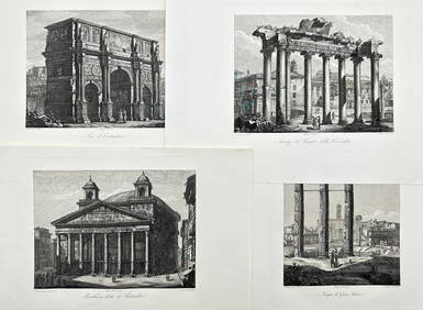
Domenico Amici - Set of 4 prints - Tempio di Giove Statore - Arco di Costantino in Rome, ItalyProverde Auctions4.3(3)See Sold PriceFeb 28, 2024
Jules Verne, L'Etoile du Sud, Hachette & Cie, Red CoverLion and Unicorn4.8(1.9k)See Sold PriceMar 10, 2024
Jules Verne, L'Etoile du Sud, Au Steamer Red MacaronLion and Unicorn4.8(1.9k)See Sold PriceMar 10, 2024
![Flemming: Map Italien No. I. [Nord] | [Sud], 1847 First Image](https://p1.liveauctioneers.com/5584/103865/53175773_1_x.jpg?height=282&quality=95&version=1494612774&width=282)

![Flemming: Map Italien No. I. [Nord] | [Sud], 1847 First Image](https://p1.liveauctioneers.com/5584/103865/53175773_1_x.jpg?height=282&quality=1&version=1494612774&width=282)


![Flemming: Map Italien No. I. [Nord] | [Sud], 1847 (1 of 2)](https://p1.liveauctioneers.com/5584/103865/53175773_1_x.jpg?height=282&quality=70&version=1494612774)