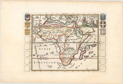
ATLAS of ANTIENT GEOGRAPHY by SAMUEL BUTLER 1843John McInnis Auctioneers,LLC4.6(502)See Sold PriceFeb 24, 2024
18TH C. ANTIQUE MAP: FRENCH & INDIAN WAR, FRAMEDThomaston Place Auction Galleries4.4(386)See Sold PriceFeb 24, 2024
Rand McNally Railroad Map Cabinet w/ 21 Railroad MapsRail & Road Auctions4.6(165)See Sold PriceMar 08, 2024
Keith Haring - Ink on New York Map, Best Buddies, Inscribed, Signed, and DatedSapphire Auction Gallery4(67)See Sold PriceMar 02, 2024
LATE 17TH C. FRENCH MAP OF THE NEW WORLD BY ALEXIS-HUBERT JAILLOT (1632-1712)Thomaston Place Auction Galleries4.4(386)See Sold PriceFeb 24, 2024
Central Railroad of New Jersey Map of Sandy Hook Route-ca. 1903JM Hobby Supply and Railroad Artifact Auctions4.4(126)See Sold PriceFeb 24, 2024
Lot of Six Mixed Atlas Box Cars-HO Scale-New in BoxJM Hobby Supply and Railroad Artifact Auctions4.4(126)See Sold PriceFeb 25, 2024
Rand McNally/Santa Fe Railroad Map of Iowa-1912JM Hobby Supply and Railroad Artifact Auctions4.4(126)See Sold PriceFeb 24, 2024
NICOLAES VISSCHER (NETHERLANDS, 1618-1709) MAP OF THE NEW WORLDThomaston Place Auction Galleries4.4(386)See Sold PriceFeb 24, 2024
17TH C. WORLD MAP BY NICOLAES VISSCHER (NETHERLANDS, 1618-1709)Thomaston Place Auction Galleries4.4(386)See Sold PriceFeb 24, 2024
Lot of Six Mixed Atlas Cabooses-HO Scale-New in BoxJM Hobby Supply and Railroad Artifact Auctions4.4(126)See Sold PriceFeb 25, 2024
Juan de la Cosa "Map of the New World 1500"Item: Juan de la Cosa "Map of the New World 1500" Description: Vintage reproduction map drawn by Juan De La Cosa By American Heritage, the magazine of history Dimensions: 24” x 18” Please note thaSee Sold Price
Juan De La Cosa: Map of the New WorldVintage reproduction map drawn by Juan De La Cosa. Title: "The New World Map 1500”- by American Heritage, the magazine of history. Measurement approximate: 24” x 18”. Please note that this lotSee Sold Price
Sold4 Replica Antique Maps, American Heritage Maps4 Replica Antique Maps, American Heritage Maps: Juan de La Cosa Map of Carribbien, New World 1600, New Netherlands and New England, 1635. Battle of Yorktown Map. First Three Framed with Glass, 17" x 2See Sold Price
Juan De La Cosa REPRO MAP OF THE NEW WORLD 1500Reproduction antique map entitled \"The New World Map 1500 drawn by Juan De La Cosa\". It’s a reproduction by American Heritage, the magazine of history. It measures approximately 24” x 18”. ShiSee Sold Price
SoldAntique map of Juan de la Cosa, late 19th Century facsimileLate 19th Century facsimile of the map of Juan de la Cosa is a world map that includes the earliest known representation of the New World and the first depiction of the equator and the Tropic of CanceSee Sold Price
Antique map of Juan de la Cosa, late 19th Century facsimileLate 19th Century facsimile of the map of Juan de la Cosa is a world map that includes the earliest known representation of the New World and the first depiction of the equator and the Tropic of CanceSee Sold Price
Juan De La Cosa: Map of The World, 1500Map: Reproduction Map of The World 1500 Maker: Juan De La Cosa For American Heritage Magazine of History Please note that this lot has a reserve. When you leave a bid in advance of the auction, submitSee Sold Price
The Oldest Known Map of the New World PrintPrint reproduction of "The Oldest Map of the New World" by 15th century cartographer Juan de la Casa, framed under glass. Frame measures 19-1/2" in height by 24-3/4" in width by 3/4" in depth with theSee Sold Price
SoldThe Oldest Known Map of the New World PrintPrint reproduction of "The Oldest Map of the New World" by 15th century cartographer Juan de la Casa, framed under glass. Frame measures 19-1/2" in height by 24-3/4" in width by 3/4" in depth with theSee Sold Price
SoldThe Oldest Known Map of the New World PrintPrint reproduction of "The Oldest Map of the New World" by 15th century cartographer Juan de la Casa, framed under glass. Frame measures 19-1/2" in height by 24-3/4" in width by 3/4" in depth with theSee Sold Price
HUMBOLDT. Atlas géographique et physique....Humboldt’s Scientific Discovery of America With the First Printing of the Juan de la Cosa Map—Believed to be “the earliest extantSee Sold Price
SoldJuen De La Cosa: The Oldest Map of the WorldThe oldest map of the world. "painted by Juen de la cosa 1493 - 1496. 21 x 18 inches Please note that this lot has a confidential reserve. When you leave a bid in advance of the auction, submit your mSee Sold Price
SoldSigned work on early map of AmericasHeading: Author: Nunn, George E. Title: The Mappemonde of Juan De La Cosa: A Critical Investigation of its Date Place Published: Jenkintown, Pennsylvania Publisher:George H. Beans Library Date PSee Sold Price
MAP - New England US. Brion de la TourColonial New England United States. Louis Brion de la Tour, Carte de la Nouvelle Angleterre, Comprenant les Etats de Massachusets Bay, N. Hamp Shire, Connecticut et Rhode Island..., 1782 (published).See Sold Price
Map entitled "Histoire De La Decouverte Des MondesMap entitled "Histoire De La Decouverte Des Mondes Mouveau et Inconnu" (Translates to "History of the discovery of the New and Unknown Worlds". One of 17 terrestrial & celestial engravings. This one hSee Sold Price
Map entitled "Histoire De La Decouverte Des MondesMap entitled "Histoire De La Decouverte Des Mondes Mouveau et Inconnu" (Translates to "History of the discovery of the New and Unknown Worlds". One of 17 terrestrial & celestial engravings. This one hSee Sold Price
Map entitled "Histoire De La Decouverte Des MondesMap entitled "Histoire De La Decouverte Des Mondes Mouveau et Inconnu" (Translates to "History of the discovery of the New and Unknown Worlds". One of 17 terrestrial & celestial engravings. This one hSee Sold Price
Map entitled "Histoire De La Decouverte Des MondesMap entitled "Histoire De La Decouverte Des Mondes Mouveau et Inconnu" (Translates to "History of the discovery of the New and Unknown Worlds". One of 17 terrestrial & celestial engravings. This one hSee Sold Price
SoldKaarte van de Golf van Mexico en het Zuyd-America waarBy: Daniel de la FeuilleDate: 1747 (Published) AmsterdamDimensions: 19.5 x 22.5 inches (50 cm x 57 cm)This is an extremely rare and highly unusual map by the cartographer Daniel de la Feuille, and engSee Sold Price
SoldCarte de la Situation du Paradis TerrestreCarte de la Situation du Paradis TerrestrePrinted in Amsterdam, this is a highly colorful and detailed map of the Holy Land and it’s surroundings. In the center we see Babilonia and Eden, withSee Sold Price
Carte Generale de la Cote du Nord-Ouest deCarte Generale de la Cote du Nord-Ouest de L’Amerique, 1787A large map depicting the Pacific Northwest coast of California by Naval Officer and explorer, Jean-Francois de Galaup de la Perouse.See Sold Price
1755 Carte de La Louisiane et Des Pays Voisins Dediee aBy: Jacques Nicolas BellinDate: 1755 (dated) ParisDimensions: 19.5 x 24 inches (49.5 x 61 cm)This is an authentic antique map showing of North America from the eastern seaboard to the Rocky Mountains.See Sold Price
1710 Etat Abrege de la Maison du Grand Seigneur, ViewsThis lovely hand-colored authentic antique map by Chatelain depicts Constantinople in the early years of the eighteenth century with special attention paid in the first illustration to the Serai (PalaSee Sold Price
1710 Etat Abrege de la Maison du Grand Seigneur, [ViewsThis lovely hand-colored authentic antique map by Chatelain depicts Constantinople in the early years of the eighteenth century with special attention paid in the first illustration to the Serai (PalaSee Sold Price
Jules Verne, De La Terre a La Lune, Au Steamer Red MacaronLion and Unicorn4.7(1.8k)See Sold PriceMar 10, 2024