Sold1758 Gentlemans Magazine with Maps of EuropeMaps“Old Map of the Continent" & other Maps December 1758, THE GENTLEMAN’S MAGAZINE, London, England, Choice Extremely Fine. 8” x 5,” 2-column layout, pp. 559-614. By SylvanusSee Sold Price
DEC 1758 GENTLEMAN'S MAGAZINE by S URBAN LONDON ANTIQUEDEC 1758 GENTLEMAN'S MAGAZINE by S URBAN LONDON ANTIQUE NEWSPAPER w MAPS AMERICA DEC 1758 GENTLEMAN'S MAGAZINE by S URBAN LONDON ANTIQUE NEWSPAPER w MAPS AMERICA Description EARLY ANTIQUE NEWSPAPER; "See Sold Price
1758 Gentlemans Magazine, London"Old Map of the Continent" & other Maps December 1758, THE GENTLEMAN'S MAGAZINE, London, England, Choice Extremely Fine. 8" x 5," 2-column layout, pp. 559-614. By Sylvanus Urban, "Printed by D. HenrySee Sold Price
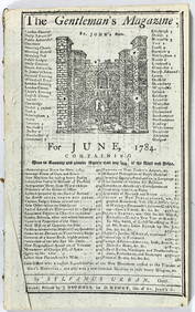
SoldGentleman’s Magazine Map of the New Continent, 1758Map: A Map of the New Continent according to its greatest diametrical Length from the River la Plata to beyond the Lake of the Assiniboits Maker: Gentleman's Magazine Place & Date: London / 1758 Size:See Sold Price
Sold1756, GENTLEMANS MAGAZINE, MAP: Caribbee IslandsHistoric Maps Map of the “Caribbee Islands” - Carved Up by Europe August 1756, THE GENTLEMAN’S MAGAZINE,With Map, London, England, Very Fine. By Sylvanus Urban, “Printed by D. Henry and R. CavSee Sold Price
Sold1756, GENTLEMANS MAGAZINE, MAP: Caribbee IslandsPrints Map of the “Caribbee Islands” - Carved Up by Europe August 1756, THE GENTLEMAN’S MAGAZINE,With Map, London, England, Very Fine. By Sylvanus Urban, “Printed by D. Henry and R. Cave, at SSee Sold Price
1760 Folding Map of Eastern EuropeFolding map of Eastern Europe, circa 1760, printed for Gentleman’s Magazine, engraved by J. Gibson, Very Good, measures 15 x 10.5”. Please note that this lot has a confidential reserve. When you lSee Sold Price
Scots Magazine (1758)Sand, Donaldson, Murray & Cochran Edinburgh 1sr Edition Full year including appendix 708 pages plus index. Volume 20 6 maps, plans & engravings. Lacking maps of Europe & Scotland. & pages 181-196.. .NSee Sold Price
Sold1760 Folding Map of Eastern Europe Zittau1760 map of Eastern Europe, in great detail, including the areas south of Zittau. Printed for Gentleman’s Magazine, Very Good, measures 15 x 10". Please note that this lot has a confidential reserveSee Sold Price
1760 Map Brandenburg East EuropeC1760 Map of Eastern Europe around Brandenburg from Gentleman’s Magazine. Measures 10.5 x 8”. Light crop to top margin. Measuring 10.5 x 8”.See Sold Price
1758 Map of Country Round Dresden“A Map of the Country Round Dresden with the Towns and Fortresses…”, 1758, printed for Gentleman’s Magazine, Fine, measures 11 x 9”. Free shipping within the continental USSee Sold Price
Sold9 Antiqe MapsIncludes: 1) A Map of a New Continent according to its Greatest Diametrical Length from the River la Plata to beyond the lake of Assiniboits. Gentleman's Magazine. London 1758. Eng. John Gibson afterSee Sold Price
Three Maps - 1770Newspaper, an authentic issue of Gentleman’s Magazine, 32pp., disbound, with three foldout maps, VG."A New and Accurate Map of TURKEY IN EUROPE Drawn from the Best Authorities...1770", 11 x 9-1/2,��See Sold Price
d'Anville & Bowen 1758 Map of River Sanaga, Africa"A General Map of the River Sanaga or Senegal" Copper Engraved Map Published 1758, London. Engraved Bowen after d'Anville. Probably from the Gentleman's Magazine, Universal Magazine or London MagazineSee Sold Price
SoldGENTLEMAN'S MAGAZINE FOR MARCH 1759Includes: "Of the Treaty of Peace with the Indians in 1758", "Death of King Charles I", Map of Martinico and Guadaloupe. by Sylvanus Urban London.See Sold Price
SoldEurope.- Gentleman's Magazine, The For the year 17Europe.- Gentleman's Magazine, The For the year 1772,vol. 42, including 6 fold-out plans of English river canals, a fold-out map of Poland, and various other engraved plates, some spotting andSee Sold Price
1756, Gentleman's Magazine, LondonMap of the "Caribbee Islands" - Carved Up by Europe August 1756, THE GENTLEMAN'S MAGAZINE, London, England, Very Fine. By Sylvanus Urban, "Printed by D. Henry and R. Cave, at St. John's Gate," disbounSee Sold Price
Gentlemans Magazine: Map of Delaware Bay, 1779Title/Content of Map: Revolutionary War era chart of Delaware Bay and River Date Printed: 1779 Cartographer: Gentlemans Magazine Size (inches): 9 x 7 Old hand-color Small antique chart of Delaware BaySee Sold Price
1786 Gentleman's Magazine Map of Cossack Region by the Volga and Don Rivers -- Chart of the CourseTitle: 1786 Gentleman's Magazine Map of Cossack Region by the Volga and Don Rivers -- Chart of the Course of the Don & Volga through the Region of the Kosaks. Cartographer: Gentleman's Magazine Year /See Sold Price
1758 Gentleman's Magazine ScienceThe Supplement to the Gentleman’s Magazine for the Year 1758, printed at London. 24 pages plus index for the year. Interesting content briefs on Terra Australis and geography and science. Magazine nSee Sold Price
1786 Gentleman's Magazine Map of Cossack Region by theTitle: 1786 Gentleman's Magazine Map of Cossack Region by the Volga and Don Rivers -- Chart of the Course of the Don & Volga through the Region of the Kosaks. Cartographer: Gentleman's Magazine Year /See Sold Price
1786 Gentleman's Magazine Map of Cossack Region by theTitle: 1786 Gentleman's Magazine Map of Cossack Region by the Volga and Don Rivers -- Chart of the Course of the Don & Volga through the Region of the Kosaks. Cartographer: Gentleman's Magazine Year/PSee Sold Price
1786 Gentleman's Magazine Map of Cossack Region by theTitle: 1786 Gentleman's Magazine Map of Cossack Region by the Volga and Don Rivers -- Chart of the Course of the Don & Volga through the Region of the Kosaks. Cartographer: Gentleman's Magazine Year /See Sold Price
1758 Gentleman's Magazine Science Terra AustralisThe Supplement to the Gentleman’s Magazine for the Year 1758, printed at London. 24 pages plus index for the year. Interesting content briefs on Terra Australis and geography and science. Magazine nSee Sold Price
1787 George Washington American Florida Shakespeare Tobacco Gentlemans MagazineSchilb Antiquarian Rare Books4.8(422)See Sold PriceMar 31, 2024
Numismatic Books - Snelling - A View of the Silver Coin and Coinage of England, From the NormanTimeLine Auctions Ltd.4.6(182)See Sold PriceMar 09, 2024
Hand Colored Engraved Map of Europe, Jean Baptiste Bourguignon Anville 1754Global Auctions Company4.3(36)See Sold PriceMar 03, 2024
Two (2) Antique 18th C. Copper Engraved Framed Maps - America & EuropeMagnusson Art Group4.5(50)See Sold PriceMar 14, 2024
Carey, pub. 1796 - Map of the Tennassee State formerly part of North Carolina (Tennessee)Trillium Antique Prints & Rare Books4.5(30)See Sold PriceFeb 24, 2024
1758 MAP PARTIE DE LA MER GLACIALE contenants La Nouvelle Zemble RUSSIA antiqueJasper524.5(9.8k)See Sold PriceFeb 27, 2024
Clarke & Neele 1815 Map. Europe - Recent Political ChangesAlbion Auctions4.6(341)See Sold PriceMar 01, 2024
June 1784 Tells of a Balloon Launch Page 433, 434Grant Zahajko Auctions, LLC4.7(1k)See Sold PriceMar 06, 2024