Sold1852 Canandaigua County NY WALL MAP Geneva NaplesTitle: Ontario County, New York Draughtsman/Cartographer/Surveyor: H. F. Walling Publisher: John E. Gillette Printing Year: 1852 Dimensions: 48 inches x 41 inches Condition/Details: ThisSee Sold Price
Sold1855 Jefferson County, NY Wall MapJ.B. Shields Publisher. 55" x 54". In poor condition with staining and roughness along edges. Perimeter shows important buildings around the county at that time. From Col. Elisha Camp's Federal Home iSee Sold Price
Sold1856 Clinton County NY WALL MAP Plattsburgh ChazyTitle: Clinton County, New York Draughtsman/Cartographer/Surveyor: A. Ligowsky Publisher: O. J. Lamb (Philadelphia) Printing Year: 1856 Dimensions: 50 inches x 56 inches Condition/Details:</See Sold Price
Sold1853 Westchester County NY WALL MAP Mount VernonTitle: Map of the Southern Part of West-Chester County, New York Draughtsman/Cartographer/Surveyor: R. F. O. Connor Publisher: M. Dripps (New York) Printing Year: 1853 Dimensions: 51 inches x 44See Sold Price
Sold1858 Oneida County NY WALL MAP Utica Rome BeersTitle: Oneida County, New York Draughtsman/Cartographer/Surveyor: J. H. French, S. N. & F. W. Beers, and D. J. Lake Publisher: John E. Gillette (Philadelphia) Printing Year: 1858 Dimensions: 64 iSee Sold Price
Sold1855 Jefferson County NY WALL MAP Thousand IslandTitle: Jefferson County, New York Draughtsman/Cartographer/Surveyor: Morris Levey Publisher: J. B. Shields Printing Year: 1855 Dimensions: 54 inches x 55 inches Condition/Details: This lSee Sold Price
Sold1863 Cortland Chenango County NY WALL MAP CuylerTitle: Chenango and Cortland Counties, New York Draughtsman/Cartographer/Surveyor: S. N. & F. W. Beers, A. & C. S. Warner, and B. Nichols Publisher: A. Pomeroy & S. W. Treat (Philadelphia) Printing YSee Sold Price
Soldc1850 Dutchess County NY WALL MAP PoughkeepsieTitle: Dutchess County, New York Draughtsman/Cartographer/Surveyor: J. C. Sidney Publisher: John E. Gillett Printing Year: c1850 Dimensions: 42 inches x 58 inches Condition/Details: ThisSee Sold Price
Sold1865 Yates County NY WALL MAP Penn Yan DundeeTitle: Yates County, New York Draughtsman/Cartographer/Surveyor: S. N. & D. G. Beers assisted by A. B. Prindle and H. A. Hawley Publisher: Stone & Steward (Philadelphia) Printing Year: 1865 DimensionSee Sold Price
Sold1856 Greene County NY WALL MAP Coxsackie CatskillTitle: Greene County, New York Draughtsman/Cartographer/Surveyor: Samuel Geil Publisher: E. A. Balch (Philadelphia) Printing Year: 1856 Dimensions: 55 inches x 39 inches Condition/Details:</See Sold Price
SoldDutchess County NY wall map published by John E.Dutchess County NY wall map published by John E. Gillette, Philadelphia 1858 - some fraying of paper near top, otherwise good condition.See Sold Price
SoldAntique 1858 Wall Map,Dutchess County,NY Rhinebeck,EtcAntique 1858 Wall Map,Dutchess County,NY Rhinebeck,Etc. This Large detailed antique map of Dutchess county New York is dated 1858. This large map has lots of great little details including drawings anSee Sold Price
Sold1829 David Burr Map of the County of Essex, NY h/c wall1829 David Burr Map of the County of Essex, NY h/c wall map- plate size 23” x 19”See Sold Price
Canvas wall map of Dutchess County NY, published byCanvas wall map of Dutchess County NY, published by John E. Gillette, Philadelphia, 1858. Losses to lithograph paper mostly in the top right corner. See photos for more details. Size 58" x 62".See Sold Price
SoldLarge frame wall map of Delaware County NY dated 1Large frame wall map of Delaware County NY dated 1856, published by Collins G. Keeney, Phila. 56" x 56"See Sold Price
SoldWall Map of N.Y. State Counties. "Concise, ReadyWall Map of N.Y. State Counties. "Concise, Ready Reference. Counties, County Seats, Cities, Post Offices, Rail Stations, Villages etc... Color Good, Condition Poor. 40"h x 50"wSee Sold Price
SoldAntique 1858 Wall Map of Columbia County,NY New YorkLarge antique c.1858 map of Columbia county New York. This large map has lots of great details. It is perfect for anyone interested in local Hudson Valley history. The dimensions are 57in x 66in x 1.5See Sold Price
Two 19th C. Hanging Wall Maps, NY & PennsylvaniaBeers Lake and Beers wall map of Columbia County, NY, Philadelphia,1858, and Smith, Gallup and Co. wall map of Northampton County, PA, Philadelphia, 1860. Each in fair to poor condition with staining,See Sold Price
SoldGroup of New York State Historical MapsGroup of New York State Historical Maps. Map of Orleans County, NY, 1852 (40" x 47"); Map of Village of Albion, NY, 1857 (40" x 47"); Map of the State of New York, 1833 (21" x 25 1/2").. The RochesterSee Sold Price
SoldANNALS OF NEWTOWN IN QUEENS COUNTY, N.YANNALS OF NEWTOWN IN QUEENS COUNTY, N.Y., RIKER, 1852, (FOLD OUT MAPS) REBOUNDSee Sold Price
SoldDolph & Stewart 30s Map Columbia County NY Large FolioMap of Columbia County with Eastern part of Greene County, New York, by Dolph & Stewart, circa 1930s. This is a oversized hardcover bound version of what would be tiles from a large wall-mounted mSee Sold Price
SoldLarge Antique Hanging Map of Columbia County NY 1858Large Antique Hanging Map of Columbia County New York from 1858. Shows details and insets of towns and villages in Columbia county. Has a top piece made to hang on the wall. Has a beautiful patina andSee Sold Price
Sold(5) pc.misc. estate lot to include handmade wall hanging with figures, painted bark cloth (?) panel,(5) pc.misc. estate lot to include handmade wall hanging with figures, painted bark cloth (?) panel, (2) large oil paintings & frame Dutchess County, N.Y. map. Good lot for a dealer….See Sold Price
SoldDolph & Stewart 30s Map Columbia County NY Large FolioMap of Columbia County with Northern part of Greene County, New York, by Dolph & Stewart, circa 1930s. This is a oversized hardcover bound version of what would be tiles from a large wall-mountedSee Sold Price
Rand McNally County/Township/Railroad Map of Kansas-1911JM Hobby Supply and Railroad Artifact Auctions4.4(126)See Sold PriceFeb 24, 2024
Rand McNally Railroad Map of Arizona-1909JM Hobby Supply and Railroad Artifact Auctions4.4(126)See Sold PriceFeb 24, 2024
Rand McNally Township County and Railroad Map of Illinois-1879JM Hobby Supply and Railroad Artifact Auctions4.4(126)See Sold PriceFeb 24, 2024
Rand McNally Township County and Railroad Map of Indiana-1880JM Hobby Supply and Railroad Artifact Auctions4.4(126)See Sold PriceFeb 24, 2024
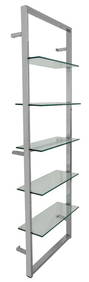
Streamline Moderne Chrome Wall Mounted EtagereAuctions at Showplace4.5(726)See Sold PriceMar 03, 2024
1853 Steuben County NY History Leather Bound Book.Palmer's Auction Co4.5(48)See Sold PriceFeb 24, 2024
Vintage County Map Of NY State Plate EngravingThe Benefit Shop Foundation Inc.4.3(2.9k)See Sold PriceFeb 28, 2024
Portfolio of 15 County Maps by Robert Morden (English 1650-1703)Nadeau's Auction Gallery4.7(401)See Sold PriceFeb 24, 2024
ANDREW RAYMOND JANSON OIL ON BOARD ADIRONDACKSCharleston Estate Services Ltd.4.5(58)See Sold PriceMar 03, 2024
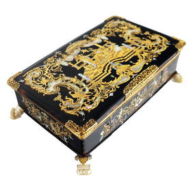
THREE AMERICAN CARVED WOODEN DANCING MEN.Amelia Jeffers, Auctioneers & Appraisers4.6(101)See Sold PriceMar 09, 2024
3 Vintage The World Lithographs, By JanssonThe Benefit Shop Foundation Inc.4.3(2.9k)See Sold PriceMar 13, 2024
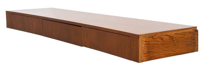
FEDERAL HUDSON VALLEY NY FIGURED MAPLE SIDEBOARD.William Smith Auctions4.6(146)See Sold PriceMar 06, 2024