ATLAS of ANTIENT GEOGRAPHY by SAMUEL BUTLER 1843John McInnis Auctioneers,LLC4.6(502)See Sold PriceFeb 24, 2024
18TH C. ANTIQUE MAP: FRENCH & INDIAN WAR, FRAMEDThomaston Place Auction Galleries4.4(386)See Sold PriceFeb 24, 2024
Rand McNally Railroad Map Cabinet w/ 21 Railroad MapsRail & Road Auctions4.6(165)See Sold PriceMar 08, 2024
Keith Haring - Ink on New York Map, Best Buddies, Inscribed, Signed, and DatedSapphire Auction Gallery4(67)See Sold PriceMar 02, 2024
LATE 17TH C. FRENCH MAP OF THE NEW WORLD BY ALEXIS-HUBERT JAILLOT (1632-1712)Thomaston Place Auction Galleries4.4(386)See Sold PriceFeb 24, 2024
Central Railroad of New Jersey Map of Sandy Hook Route-ca. 1903JM Hobby Supply and Railroad Artifact Auctions4.4(126)See Sold PriceFeb 24, 2024
Lot of Six Mixed Atlas Box Cars-HO Scale-New in BoxJM Hobby Supply and Railroad Artifact Auctions4.4(126)See Sold PriceFeb 25, 2024
Rand McNally/Santa Fe Railroad Map of Iowa-1912JM Hobby Supply and Railroad Artifact Auctions4.4(126)See Sold PriceFeb 24, 2024
NICOLAES VISSCHER (NETHERLANDS, 1618-1709) MAP OF THE NEW WORLDThomaston Place Auction Galleries4.4(386)See Sold PriceFeb 24, 2024
17TH C. WORLD MAP BY NICOLAES VISSCHER (NETHERLANDS, 1618-1709)Thomaston Place Auction Galleries4.4(386)See Sold PriceFeb 24, 2024
Lot of Six Mixed Atlas Cabooses-HO Scale-New in BoxJM Hobby Supply and Railroad Artifact Auctions4.4(126)See Sold PriceFeb 25, 2024
SoldAntique Map of Scotland, Henry Teesdale 1831Antique Map of Scotland, Henry Teesdale 1831 Approx 65.0 x 52.5cm, 25.75 x 20.75 inches (Large) Scotland' The top image on the right hand side shows the entire map. To view a close up of the map showiSee Sold Price
Antique Map Of Ireland By Henry Teesdale 1831Antique Map Of Ireland By Henry Teesdale 1831 Old Plan Chart. Approx 66.0 x 53.5cm, 25.75 x 21.25 inches (Large); Please note that this is a folding map. Antique hand-coloured copperplate map Please nSee Sold Price
Antique County Map of Berkshire, Henry Teesdale 1831Antique County Map of Berkshire, Henry Teesdale 1831 Approx 35.0 x 42.5cm, 13.75 x 16.75 inches (Large) 'Berkshire' The top image on the right hand side shows the entire map. To view a close up of theSee Sold Price
Sold1831 Teesdale Map of Scotland -- ScotlandTitle/Content of Map: 1831 Teesdale Map of Scotland -- Scotland Date: 1831, London Cartographer: H Teesdale Size: 16.1 X 13.2 in. This is a very nice and detailed map of Scotland.Plenty of details areSee Sold Price
1831 Teesdale Map of Scotland -- ScotlandTitle/Content of Map: 1831 Teesdale Map of Scotland -- Scotland Date: 1831, London Cartographer: H Teesdale Size: 16.1 X 13.2 in. This is a very nice and detailed map of Scotland. Plenty of details arSee Sold Price
SoldAntique Map of Cambridgeshire England 19th CenturyPublished in London by Henry Teesdale, dimensions 13.5" by 17"See Sold Price
Antique Map of Cambridgeshire England 19th CenturyPublished in London by Henry Teesdale, dimensions 13.5" by 17"See Sold Price
Antique Map of Cambridgeshire England 19th CenturyPublished in London by Henry Teesdale, dimensions 13.5" by 17"See Sold Price
Antique Map of Cambridgeshire England 19th CenturyPublished in London by Henry Teesdale, dimensions 13.5" by 17"See Sold Price
SoldMap of Asia From a 19th Century British AtlasMap of Asia From a 19th Century British Atlas(London: Henry Teesdale, n.d., 1831), steel engraving with outline color. Presented in silver toned wooden frame. DOA 22.75 x 25.5 in. Additional high-resSee Sold Price
Sold1831 Map Ancient Roman Empire by Henry TeesdaleDESCRIPTION: 1831 handcolored map of the Ancient Roman Empire. Published by Henry Teesdale, London in March 1831. From A New General Atlas of the World published by John Dower, page 45. Matted and fraSee Sold Price
SoldTeesdale (Henry) Improved Edition of the New BritiTeesdale (Henry) Improved Edition of the New British AtlasContaining a Compleat Set of County Maps, engraved title page, 3 large folding maps of England, Scotland and Ireland, 2 folding mapsSee Sold Price
SoldIreland.- Teesdale & Co. (Henry) Ireland, [circaIreland.- Teesdale & Co. (Henry) Ireland, detailed map showing counties, with parts of Scotland, Wales, and Cornwall to the right, engraved map with hand-colouring, on Whatman wove paper with watermarSee Sold Price
SoldTEESDALE, HENRY. New British AtlasTEESDALE, HENRY. New British Atlas Containing a *Complete Set of County Maps...Preceded by General Maos of England, Ireland, Scotland, North & South Wales, the Whole Carefully Revised and CorrecteSee Sold Price
SoldTeesdale's General Atlas, 1831Teesdale, Henry. A New General Atlas of the World, Compiled from the latest authorities both English & Foreign, Containing separate Maps of its various Countries & States, and Exhibiting Their BoundarSee Sold Price
SoldBarclay, James 1809 Antique Map. Scotland"Scotland or North Britain" Outline Hand Coloured Copper Engraved Map Published 1809, Leeds for "Barclay's Complete and Universal Dictionary of the English Language..." by the Rev. James Barclay. PapeSee Sold Price
SoldGuthrie, William 1790 Antique Map. ScotlandCopper Engraved Map Published 1790, London for "A New Geographical, Historical and Commercial Grammar..." by William Guthrie. The maps are by John Senex, Thomas Kitchin and others. Folds as issued. EaSee Sold Price
SoldAntique Map ScotlandScotland Northern & Southern Part. 2 hand colored engravings. From Pinkerton's Modern Atlas, London, early 19th C.See Sold Price
SoldJansson: Antique Map of Scotland, 1646Map: 1646 Jansson Map of Scotland -- Provincae Lauden seu Lothien et Linlitouo Cartographer: J. Jansson / Valk & Schenk Year / Place: 1646 c Map Dimensions: 14.2 x 21 in. Condition: Excellent, near fiSee Sold Price
William Hole: Antique Map of Scotland, 1610Map: Scotia Regnum (authentic Antique Map of Scotland) Cartographer: William Hole Illustrator: William Hole Edition: 1st Edition Publisher: William Camden Date: 1610 Size: 10.375 x 12.5 inches The firSee Sold Price
SoldBowen: Antique Map of Scotland, 1747Title/Content of Map: 'A new and accurate map of Scotland, compiled from surveys, and the most approved maps and charts, the whole being adjusted by astronomical observations' Date Printed: 1747 ImageSee Sold Price
SoldWalker, John 1815 Antique Map of ScotlandCopper Plate Published 1815, London for "The Universal Gazetteer: Being a Concise Description" [Walker's Geography] by John Walker. Folds as issued. Paper Size: 10 x 8 inch (25 x 20cm) Minor toning/ofSee Sold Price
SoldAntique map of SCOTLAND by Andrew BELL c1770 old planTITLE/CONTENT OF MAP: 'Scotland' DATE PRINTED: c1770 IMAGE SIZE: Approx 18.0 x 20.5cm, 7.25 x 8.25 inches (Medium) TYPE: Antique engraved copperplate map CONDITION: Good; suitable for framing. PleaseSee Sold Price
SoldColton: Antique Map of Scotland, 1861Title/Content of Map: Scotland Date Printed: 1861 Cartographer: J. H. Colton Material/Medium: Paper Size: 14" x 17" Hand colored, steel engraved. From Colton's 'General Atlas.' Published in New York.See Sold Price
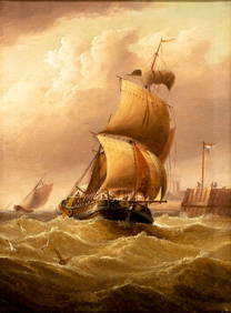
Henry Moore (UK,1831-1895) oil painting antiqueBroward Auction Gallery4.8(277)See Sold PriceMar 10, 2024
Chatelain - 3 Maps of the British Isles (England, Ireland, Scotland)Trillium Antique Prints & Rare Books4.5(30)See Sold PriceFeb 24, 2024
Catherwood - General View of Uxmal, Taken from the Archway of Las Monjas, Looking SouthTrillium Antique Prints & Rare Books4.5(30)See Sold PriceFeb 24, 2024
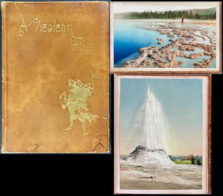
Schmidt's Memoir, A Western Trip - Volume with 12 Photos by William Henry Jackson, 17 by Schmidt andTrillium Antique Prints & Rare Books4.5(30)See Sold PriceFeb 24, 2024
De Jode, Rare, pub. 1593 - Map of the British Isles [England, Scotland, Ireland] (Angliae Scotiae etTrillium Antique Prints & Rare Books4.5(30)See Sold PriceFeb 24, 2024
Map: A 17thC engraved and hand coloured map of Scotland titled Strath-Navernia / Strath Navern afterClaydon Auctioneers Ltd4.3(125)See Sold PriceFeb 26, 2024
Carte d'Afrique. Africa Soudan Zanzibar. LAPIE 1831 old antique map plan chartJasper524.5(9.8k)See Sold PriceFeb 28, 2024
Lot of 19 Military Prints - Swedish & British Arme Uniform - Schwerin leading battle - JuliusProverde Auctions4.3(3)See Sold PriceFeb 28, 2024
Henry Seebohm (1832 - 1895) - Set of 2 British Bird Egg Prints - Pink Footed Goose - Brent Goose -Proverde Auctions4.3(3)See Sold PriceFeb 28, 2024


![De Jode, Rare, pub. 1593 - Map of the British Isles [England, Scotland, Ireland] (Angliae Scotiae et (1 of 2)](https://p1.liveauctioneers.com/6581/319571/171593327_1_x.jpg?height=282&quality=70&version=1707853304)


