ATLAS of ANTIENT GEOGRAPHY by SAMUEL BUTLER 1843John McInnis Auctioneers,LLC4.6(502)See Sold PriceFeb 24, 2024
18TH C. ANTIQUE MAP: FRENCH & INDIAN WAR, FRAMEDThomaston Place Auction Galleries4.4(386)See Sold PriceFeb 24, 2024
Rand McNally Railroad Map Cabinet w/ 21 Railroad MapsRail & Road Auctions4.6(165)See Sold PriceMar 08, 2024
Keith Haring - Ink on New York Map, Best Buddies, Inscribed, Signed, and DatedSapphire Auction Gallery4(67)See Sold PriceMar 02, 2024
LATE 17TH C. FRENCH MAP OF THE NEW WORLD BY ALEXIS-HUBERT JAILLOT (1632-1712)Thomaston Place Auction Galleries4.4(386)See Sold PriceFeb 24, 2024
Central Railroad of New Jersey Map of Sandy Hook Route-ca. 1903JM Hobby Supply and Railroad Artifact Auctions4.4(126)See Sold PriceFeb 24, 2024
Lot of Six Mixed Atlas Box Cars-HO Scale-New in BoxJM Hobby Supply and Railroad Artifact Auctions4.4(126)See Sold PriceFeb 25, 2024
Rand McNally/Santa Fe Railroad Map of Iowa-1912JM Hobby Supply and Railroad Artifact Auctions4.4(126)See Sold PriceFeb 24, 2024
NICOLAES VISSCHER (NETHERLANDS, 1618-1709) MAP OF THE NEW WORLDThomaston Place Auction Galleries4.4(386)See Sold PriceFeb 24, 2024
17TH C. WORLD MAP BY NICOLAES VISSCHER (NETHERLANDS, 1618-1709)Thomaston Place Auction Galleries4.4(386)See Sold PriceFeb 24, 2024
Lot of Six Mixed Atlas Cabooses-HO Scale-New in BoxJM Hobby Supply and Railroad Artifact Auctions4.4(126)See Sold PriceFeb 25, 2024
Duval Map of the MediterraneanRei romanae tabula geographica ex C.I. Caesaris commentarijs de bello civili. Pierre Duval (1618–1683). Engraved Map with Hand Color in Full. Amsterdam: Covens & MortierSee Sold Price
MAP, Mediterranean & Middle East, DuValEastern Mediterranean & Middle East. Pierre DuVal, Expeditionis Alexandri Magni per Europam, Asiam, et Africam Tabula Geographica, 1694 (dated). Black & White. This striking map shows the extent of AlSee Sold Price
Sold1653 DuVal Map of Upper Egypt -- Aegyptus AntiquaTitle/Content of Map: 1653 DuVal Map of Upper Egypt -- Aegyptus Antiqua Divisa in Nomos1653 c. Amsterdam Cartographer: P DuVal Size: 14.8 x 20.5 in. This is an uncommon map of Upper Egypt and part ofSee Sold Price
SoldMexico sive N. Hispania Duval MapMexico sive N. Hispania. Pierre Duval (1618–1683). Engraved map with original hand color. Nuremberg, 1679. 5 x 5 1/2 inches sheet, 14 1/2 x 15 inches framedSee Sold Price
1653 DuVal Map of Upper Egypt -- Aegyptus AntiquaTitle/Content of Map: 1653 DuVal Map of Upper Egypt -- Aegyptus Antiqua Divisa in Nomos Date Printed: 1653 c. Amsterdam Cartographer: P DuVal Size: 14.8 x 20.5 in. This is an uncommon map of Upper EgySee Sold Price
SoldDuval Map of Canada after ChamplainDuval, Pierre (1618-1683). Le Canada facit par le Sr. de Champlain. Engraving with original hand color in part. Paris, 1677. (Sixth State). 17" x 22 3/4" sheet, 29" x 34 1/2" framed Highly important mSee Sold Price
SoldDuval map, L'Asie, Paris: 1684.[Asia]. Du Val. L'Asie Reueue Et Augmentee Par P. Duval Geographe ord du Roy. Double-page engraved map. Paris: 1684. 16 x 20 3/4 in. Duval was a nephew of mapmaker Nicholas Sanson. Near and Far East,See Sold Price
SoldDuval Map of N. America, 1655DUVAL, Pierre (1618-1683). L'Amerique autrement le Nouveau Monde et Indes Occidentales... Engraved map with original hand color in outline. Paris, 1655 (State 9, 1676). 17 1/4" x 23 1/4" sheet, 27" xSee Sold Price
MAP, Mediterranean & Middle East, VisscherEastern Mediterranean & Middle East. Nicolas Visscher, Geographische Beschryvinghe van de Wandeling der Apostelen ende de Reysen Pauli..., 1664 (published). Hand Color. This map portrays the Eastern MSee Sold Price
MAP, Mediterranean & Middle East, PlanciusEastern Mediterranean & Middle East. Plancius/Cloppenburg, Tabula Geographica, in qua Omnes Regiones, Urbes, Oppida, et Loca Describuntur, Quorum Mentio Fit in Actis et Epistolis Apostolorum, et ApocaSee Sold Price
MAP, Mediterranean, OrteliusMediterranean, Roman Empire. Abraham Ortelius, Romani Imperii Imago, 1581 (published). Hand Color. Dramatic map of the Roman Empire centered on the Mediterranean and covering most of Europe, NorthernSee Sold Price
SoldMAP - Mediterranean & Middle East. StoopendaalEastern Mediterranean & Middle East. Daniel Stoopendaal, De Beschryvingh van de Reysen Pauli, en van de Andere Apostelen..., 1729 (published). Hand Color. This beautiful map of the eastern MediterraneSee Sold Price
MAP - Mediterranean & Middle East. ChatelainMediterranean & Middle East. Henry Abraham Chatelain, Carte de l Empire Othoman Consideree dans les Etats de Cette Puissance, et des Etats qui l'Avoisinent ou qui luy sont Tributaires..., 1720 (circa)See Sold Price
Duval Map of the NetherlandsLes XVII Provinces. Pierre Duval (1618–1683). Engraved map with original hand color. Paris, 1679. 23 X 17 inches sheet.See Sold Price
MAP, Mediterranean & Middle East, OrteliusEastern Mediterranean & Middle East. Abraham Ortelius, Turcici Imperii Descriptio, from Theatrum Orbis Terrarum, 1572 (published). Hand Color. This is Ortelius' first map of the Turkish Empire that apSee Sold Price
1682 duVal Maps of Northern Africa -- Barbarie versTitle/Content of Map: 1682 duVal Maps of Northern Africa -- Barbarie vers L'Occident [on sheet with] Barbarie Vers L'Orient Cartographer: P duVal Year/Place: 1682 c., Paris Size: 4 X 4.8 in. This is aSee Sold Price
MAP, Mediterranean Islands, OrteliusMediterranean Islands. Abraham Ortelius, Insularum Aliquot Maris Mediterranei Descriptio, from Theatrum Orbis Terrarum, 1572 (published). Hand Color. This is the first state of this splendid compositeSee Sold Price
1682 duVal Maps of Northern Africa -- Barbarie versTitle/Content of Map: 1682 duVal Maps of Northern Africa -- Barbarie vers L'Occident [on sheet with] Barbarie Vers L'Orient Cartographer: P duVal Year/Place: 1682 c., Paris Size: 4 X 4.8 in. This is aSee Sold Price
MAP, Mediterranean & Middle East, BossuetEastern Mediterranean & Middle East. Jacques Benigne Bossuet, Geographiae Sacrae Tabula, quae Totius Orbis Partes Continet, 1755 (published). Hand Color. While this map covers nearly all of the MediteSee Sold Price
MAP, Mediterranean & Middle East, Homann HeirsEastern Mediterranean & Middle East. Homann Heirs, Imperium Persarum Priorum, vel Achaemenidaru, aut Cajaniorum, Prostatu Potissimu..., 1742 (dated). Hand Color. A handsome small map of the Persian EmSee Sold Price
MAP, Mediterranean & Middle East, StoopendaalEastern Mediterranean & Middle East. Daniel Stoopendaal, De Beschryvingh van de Reysen Pauli, en van de Andere Apostelen..., 1736 (circa). Black & White. This beautiful map of the eastern MediterraneaSee Sold Price
MAP - Mediterranean & Middle East. ChatelainEastern Mediterranean & Middle East. Henry Abraham Chatelain, Carte Geographique de l'Asie Mineure avec un Etat des Premiers Rois qui l'ont Possedee Avant que de Passer sous l'Empire des Romains..., 1See Sold Price
Duval Map of the RhineLe Cours du Rhine...Pierre Duval (1618–1683). Engraved map with original hand color. Paris, 1679. 23 X 17 inches sheet.See Sold Price
DuVal map of the Holy Land on 2 sheets, 1666Title: Terra Sancta quæ et Terra Chanaan, Terra Promissionis. Terra Hebreorum, Terra Israelitarum, Iudæa, et Palestina; ex Veteri et Novo Testamento, et varijs Authoribus desupta... Author: Du Val,See Sold Price
18TH C. ANTIQUE MAP: FRENCH & INDIAN WAR, FRAMEDThomaston Place Auction Galleries4.4(386)See Sold PriceFeb 24, 2024
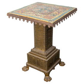
Mediterranean Gothic Revival Faience Top TableAuctions at Showplace4.5(726)See Sold PriceMar 03, 2024
Rand McNally Railroad Map Cabinet w/ 21 Railroad MapsRail & Road Auctions4.6(165)See Sold PriceMar 08, 2024
Willem Blaeu, Etc. 17th C. Antiquarian Maps, 2Auctions at Showplace4.5(726)See Sold PriceMar 17, 2024
Duval - Pair: Map of Georgia & Map of Moscow, RussiaTrillium Antique Prints & Rare Books4.5(30)See Sold PriceFeb 24, 2024
Duval - Pair: Map of India & Map of MaldivesTrillium Antique Prints & Rare Books4.5(30)See Sold PriceFeb 24, 2024
VARIOUS ARTISTS [BRITISH TRAVEL GUIDES]. Group of 6 map booklets and flyers. 1930s.Swann Auction Galleries4.4(65)See Sold PriceFeb 29, 2024
NORTH & WEST AFRICA. Sahara Niger river 'Zaara ou le Desert'. MALLET 1683 mapJasper524.5(9.8k)See Sold PriceFeb 28, 2024
Africa. French Equatorial Africa. Rhodesia. Belgian Congo. TIMES 1956 old mapJasper524.5(9.8k)See Sold PriceFeb 28, 2024
Operation Torch Nov 1942-May 1943. World War 2. Western Mediterranean 1966 mapJasper524.5(9.8k)See Sold PriceFeb 28, 2024
Disney Magic Mediterranean Cruise 2007 Map W CoinsRapid Estate Liquidators and Auction Gallery4.5(1.1k)See Sold PriceMar 01, 2024


![VARIOUS ARTISTS [BRITISH TRAVEL GUIDES]. Group of 6 map booklets and flyers. 1930s. (1 of 2)](https://p1.liveauctioneers.com/199/319703/171640571_1_x.jpg?height=282&quality=70&version=1707943705)


