ATLAS of ANTIENT GEOGRAPHY by SAMUEL BUTLER 1843John McInnis Auctioneers,LLC4.6(502)See Sold PriceFeb 24, 2024
18TH C. ANTIQUE MAP: FRENCH & INDIAN WAR, FRAMEDThomaston Place Auction Galleries4.4(386)See Sold PriceFeb 24, 2024
Rand McNally Railroad Map Cabinet w/ 21 Railroad MapsRail & Road Auctions4.6(165)See Sold PriceMar 08, 2024
Keith Haring - Ink on New York Map, Best Buddies, Inscribed, Signed, and DatedSapphire Auction Gallery4(67)See Sold PriceMar 02, 2024
LATE 17TH C. FRENCH MAP OF THE NEW WORLD BY ALEXIS-HUBERT JAILLOT (1632-1712)Thomaston Place Auction Galleries4.4(386)See Sold PriceFeb 24, 2024
Central Railroad of New Jersey Map of Sandy Hook Route-ca. 1903JM Hobby Supply and Railroad Artifact Auctions4.4(126)See Sold PriceFeb 24, 2024
Lot of Six Mixed Atlas Box Cars-HO Scale-New in BoxJM Hobby Supply and Railroad Artifact Auctions4.4(126)See Sold PriceFeb 25, 2024
Rand McNally/Santa Fe Railroad Map of Iowa-1912JM Hobby Supply and Railroad Artifact Auctions4.4(126)See Sold PriceFeb 24, 2024
NICOLAES VISSCHER (NETHERLANDS, 1618-1709) MAP OF THE NEW WORLDThomaston Place Auction Galleries4.4(386)See Sold PriceFeb 24, 2024
17TH C. WORLD MAP BY NICOLAES VISSCHER (NETHERLANDS, 1618-1709)Thomaston Place Auction Galleries4.4(386)See Sold PriceFeb 24, 2024
Lot of Six Mixed Atlas Cabooses-HO Scale-New in BoxJM Hobby Supply and Railroad Artifact Auctions4.4(126)See Sold PriceFeb 25, 2024
Soldmap, ancient Italy, Jan JanssonFramed map of ancient Italy, ''Italia Antiqua Philippo Cluvero Borusso Designatore,'' 17th century, by Jan Jansson (Dutch, 1588-1644), from ''Atlas'' by G. Mercator, published by Jodocus Hondius, haviSee Sold Price
SDUK: Antique Three-sheet Map of Ancient Italy, 1832Map: Ancient Italy I, II, and III Cartographer: Baldwin & Cradock, Society for the Diffusion of Useful Knowledge Place & Date: London / 1832/1852 Size: 14 7/8" x 11 1/4" (largest of the three maps) CoSee Sold Price
SoldAntique Robert De Vaugondy Map of Ancient ItalyAntique Robert De Vaugondy Map of Ancient Italy. Profesionally matted and framed. 28.75 inches x 31.5 inches.See Sold Price
Sold1797 Map of Ancient ItalyAuthor: Davies Title: 1797 Map of Ancient Italy Medium: Ink on Paper Dimensions: 8"X11" Map of Ancient Italy dated 1797. Engraved by Davies and published by Cadell and Davies in London. Map key locateSee Sold Price
SoldAntique Robert De Vaugondy Map of Ancient ItalyAntique Robert De Vaugondy Map of Ancient Italy. Professionally matted and framed. 28.75 inches x 31.5 inches.See Sold Price
Map of Ancient ItalyANCIENT ITALY. Decorative. 'Ancienne Italie'. MALLET 1683 old antique map Please note that this lot has a confidential reserve. When you leave a bid in advance of the auction, submit your maximum. JasSee Sold Price
Sold1764 d'Anville Map of Ancient Italy -- Tabula ItaliaeTitle/Content of Map: 1764 d'Anville Map of Ancient Italy -- Tabula Italiae Antiquae Geographica . . . MDCCLXIV Date: 1764, London Cartographer: J d'AnvilleSize: 24.2 x 19.2 in. An excellent large forSee Sold Price
SoldDelamarche, Felix 1829 Map of Ancient Italy"Italie Antiquae Mappa Nova" Copper Engraved Map Published 1829, Paris for "Atlas de La Geographie..." by Felix Delamarche. Contemporary outline hand colour. Centre fold as published. Paper Size: 18.5See Sold Price
SoldSDUK: Detailed Map of Ancient Italy in 3 SheetsMap Title: Ancient Italy I, II, and III Cartographer: Baldwin & Cradock, Society for the Diffusion of Useful Knowledge Place/Date: London / 1832/1852 Size: 14 7/8" x 11 1/4" (largest of the three mapsSee Sold Price
1764 d'Anville Map of Ancient Italy -- Tabula ItaliaeTitle/Content of Map: 1764 d'Anville Map of Ancient Italy -- Tabula Italiae Antiquae Geographica . . . MDCCLXIV Date: 1764, London Cartographer: J d'Anville Size: 24.2 x 19.2 in. An excellent large foSee Sold Price
Sold1859 Map of Ancient ItalyTitle: 1859 Map of Ancient Italy Author: Chambers Medium: Ink on Paper Dimensions: 9.5"X11.5" Description: Map of Ancient Italy dated 1859. Part of the Modern & Ancient Geography Atlas. Engraved by J.See Sold Price
SoldMartier: Antique Map of Ancient Italy, 1705Map: Ancient Italy Date Printed: 1705-06 Cartographer: Pierre Martier Material/Medium: Paper Size: 23 3/4" x 17" Condition: Excellent Original hand coloring. Copperplate engraved. Published in AmsterdSee Sold Price
1798 Map of Ancient ItalyAuthor: Anonymous Title: 1798 Map of Ancient Italy Medium: Ink on Paper Dimensions: 14"X19" Description: Map of Ancient Italy dated 1798. Engraved in 2 parts, north and south on hand laid cotton paperSee Sold Price
1869 Map of Ancient Italy and FranceAuthor: Jenotte Title: 1869 Map of Ancient Italy and France Medium: Ink on Paper Dimensions: 18.5"X13" Map of ancient Italy and France dated 1869. Double folio map drawn by Brehier and engraved by JenSee Sold Price
Sold1798 Map of Ancient ItalyAuthor: Anonymous Title: 1798 Map of Ancient Italy Medium: Ink on Paper Dimensions: 14"X19" Map of Ancient Italy dated 1798. Engraved in 2 parts, north and south on hand laid cotton paper. Roman key lSee Sold Price
1764 d'Anville Map of Ancient Italy -- Tabula ItaliaeTitle/Content of Map: 1764 d'Anville Map of Ancient Italy -- Tabula Italiae Antiquae Geographica . . . MDCCLXIV Date: 1764, London Cartographer: J d'Anville Size: 24.2 x 19.2 in. An excellent large foSee Sold Price
1764 d'Anville Map of Ancient Italy -- Tabula ItaliaeReserve Reduced! Title/Content of Map: 1764 d'Anville Map of Ancient Italy -- Tabula Italiae Antiquae Geographica . . . MDCCLXIV Date: 1764, London Cartographer: J d'Anville Size: 24.2 x 19.2 in. An eSee Sold Price
SoldD'anville Map of Ancient ItalyD'Anville, Jean Baptiste Bourguignon (1697-1782). Tabula Italiae Antique... Engraved map. D'Anville, 1764. 24 ¾" x 19 ½" sheet. Very detailed classical map. Small inset of ancient Rome. Round inSee Sold Price
1764 d'Anville Map of Ancient Italy -- Tabula ItaliaeTitle/Content of Map: 1764 d'Anville Map of Ancient Italy -- Tabula Italiae Antiquae Geographica . . . MDCCLXIV Date: 1764, London Cartographer: J d'Anville Size: 24.2 x 19.2 in. An excellent large foSee Sold Price
Map of ancient Italy. Europe 1828.Print of steel engraving titled Italie antique“.Author Fellx Delamarche.Engraved by unknown.From Atlas de la Geographie ancienne du moyen age et moderne“ by Fellx Delamarche. Paris. 1829.Flix DelaSee Sold Price
Sold1697 RARE MAP ITALIA ANTIQUA FRAMED - CLUVERRare engraved map of Ancient Italy, with a very decorative cartouch c. 1697. In near fine condition, folded as issued. It is fully engraved to illustrate topography with ancient place names and was drSee Sold Price
Sold1801 Map of ItalyAuthor: Hall Title: 1801 Map of Italy Medium: Ink on Paper Dimensions: 10.5"X8.5" Description: Map of Ancient Italy dated 1801. Part of the Atlas of Ancient Geography by Samuel Butler. Engraved by S.See Sold Price
1801 Map of Rome and NaplesAuthor: Hall Title: 1801 Map of Rome and Naples Medium: Ink on Paper Dimensions: 10.5"X8.5" Map of Ancient Italy dated 1801. It captures the Central part of the Peninsula from Rome to Naples. Part ofSee Sold Price
SoldORTELIUS, ABRAHAM. Italiae Veteris Specimen.ORTELIUS, ABRAHAM. Italiae Veteris Specimen. Hand-colored double-page engraved map of ancient Italy. 15¼x20½ inches sheet size, ample margins, Latin text on verso; scattered staining and shoSee Sold Price
ANCIENT ITALY ENGRAVING BY J.T. WILLMOREHartzell's Auction Gallery, Inc.4.7(1.2k)See Sold PriceFeb 25, 2024
Cooke, George 1801 Antique Map. Italy, Sicily, Sardinia & CorsicaAlbion Auctions4.6(336)See Sold PriceMar 01, 2024
Blackie (Pub) 1882 Pair of Folio Maps. Italy - North & SouthAlbion Auctions4.6(336)See Sold PriceMar 01, 2024
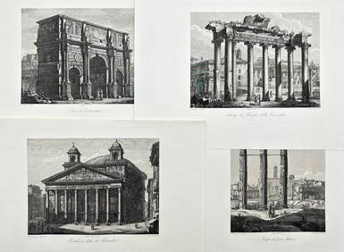
Domenico Amici - Set of 4 prints - Tempio di Giove Statore - Arco di Costantino in Rome, ItalyProverde Auctions4.3(3)See Sold PriceFeb 28, 2024