SoldMap of the US ca 1825 Cadwallader Colden + OtherA 19 x 12" map of the United States, probably from the Memoir of Cadwallader Colden, published in 1825. Edgewear and soiled, mounted on a pegboard-type backing. Together with 2 maps of Russia, 11 x 17See Sold Price
SoldHand-colored geologic map of US, [Ca. 1815-18].[Geology]. Map Of The United States Of America. Designed to illustrate the Geological Memoir of Wm. Maclure Esqr. From ''Transations of the American Philosophical Society,'' Vol I, New Series. (Phila:See Sold Price
Rare pocket map of U.S. 1825Title: Map of the United States Drawn from the most approved Surveys Author: Anonymous Description: Copper-engraved map on banknote paper, hand-colored. 41x51 cm. (16x20"); folding into thin morocco cSee Sold Price
SoldPOCKET MAP OF U.S. 1825POCKET MAP Map of the United States Drawn from the most approved Surveys.[New York?: I. Starr?], 1825. Engraved folding pocket map, hand-colored in outline (16 ½ x 20 inches, 420x510 mm). FoSee Sold Price
Gilman, Map of U.S., ca. 1848The Cartographic Culmination of Manifest Destiny 146. [MAP]. UNITED STATES. GENERAL LAND OFFICE. GILMAN, E. [Untitled map of the United States showing boundaries after the Treaty of Guadalupe Hidalgo]See Sold Price
Sold60 nautical maps: US Coast Survey, [ca. 1858].[Coast Survey]. 60 maps from a United States Coast Survey annual report, most maps dated 1857. [Wash: GPO, c.1858]. 4to. Includes: ++ 3 copies of New England's coast (Map 1). ++ Seacoast of Part of AlSee Sold Price
Sold9" x 10 1/2" hand colored map of Eastern US ca 1859" x 10 1/2" hand colored map of Eastern US ca 1850See Sold Price
SoldPennsylvania silk on linen sampler wrought by EPennsylvania silk on linen sampler wrought by Elizabeth T. Cadwallader, ca. 1825, 15 1/4'' x 15 3/4''.See Sold Price
SoldNY BOOK CELEBRATING COMPLETION OF NY CANALS,1825NEW YORK BOOK CELEBRATING THE COMPLETION OF THE NEW YORK CANALS, 1825 BY CADWALLADER D. COLDEN, ESQ, BOOK PRESENTED TO DAVID THOMPSON,LEATHER BOUND. PROV: GARDINER ESTATE, EASTHAMPTON, NY.See Sold Price
SoldNEW YORK BOOK CELEBRATING THE COMPLETION OF THENEW YORK BOOK CELEBRATING THE COMPLETION OF THE NEW YORK CANALS, 1825 BY CADWALLADER D. COLDEN, ESQ, BOOK PRESENTED TO DAVID THOMPSON, LEATHER BOUND. PROV: GARDINER ESTATE, EASTHAMPTON, NY.See Sold Price
SoldColton's 1849 Map of the US Showing CA Gold FieldsColton's 1849 Map of the U.S. Showing California Gold Fields Approx. 34 x 42 in. (sight) map, dissected and mounted on linen. Hand-colored with inset map of the Atlantic Ocean with a number of shipsSee Sold Price
Buchon: Antique Map of Arkansas, US Midwest, 1825TITLE/CONTENT OF MAP: 'Carte géographique, statistique et historique du territoire d'Arkansas' At the time of publication, the United States consisted of 24 states and a number of unincorporated andSee Sold Price
Soldca 1825 hand colored map of Northern New England &ca 1825 hand colored map of Northern New England & Upper State NY - 20"x23 1/3" sight sizeSee Sold Price
SoldAntique Map of Southwestern US & MexicoTitle/Content of Map: Important Southwestern U.S., Texas to CA with Mexico and Guatemala Date Printed: 1843 Cartographer: Based on the work of H.C. Tanner Material/Medium: Paper Size: 17" x 14" Hand cSee Sold Price
US Map Bed TrayUS Map Bed Tray ca. 1950 masonite/metal/paper 20" W x 9.75" D x 13.25" H Vintage bed tray with folding metal legs, book holders, and map of the United States. Manufactured by Replogle Globes of ChicagSee Sold Price
Sold1727 MAP HISTORY OF FIVE INDIAN NATIONS BY COLDENMap removed from 1727 book by Cadwallader Colden titled "The History of the Five Indian Nations of Canada", 1727 London. It measures 6 by 8 3/4 inches. In very good conditon with minor evidence of folSee Sold Price
SoldCAREY, H. C. & I. LEA. United States of America.Carey & Lea Pocket Map of U.S. extending to the Rockies ca. 1823 39. [MAP]. CAREY, H. C. & I. LEA. United States of America. [Philadelphia, ca. 1823]. Copper-engraved map on onionskin, contempSee Sold Price
Sold[U.S. WALL MAP]. [United States]. Ca.1860 (Ne[U.S. WALL MAP]. [United States]. Ca.1860 (Nebraska and Minnesota territories shown, and presidential vignettes through James Buchanan). Approx 24 x 56, half of that with portraits of each president aSee Sold Price
Western Hemisphere | Eastern HemisphereTitle/Content of Map: Western Hemisphere | Eastern Hemisphere Date: 1825 ca. Cartographer: CHAPIN, WM. Size: Height - 7.6Width Publisher: SAMUEL WALKER Pair of hemisphere world maps from an early editSee Sold Price
Untitled. [Northeast France]Title/Content of Map: Untitled. [Northeast France] Date: 1825 ca. Cartographer: ANONYMOUS. AUSTRIAN. Size: 17.75x20.5 Part of a series of case maps of Europe. Beautifully engraved copperplate foldingSee Sold Price
3 Atlas Portfolios3 Atlas Portfolios To Include National Geographic World, United States and British Columbia Atlas of Resources numbered 179, Plus Loose Maps. Loose Maps of The World, US, Great Lakes, Southern Ca., FlSee Sold Price
Georgian Coalport Porcelain Pitcher Jug ca. 1825MEASURING APPROX 8.5 X 8CM HIGH. Please follow us on Instagram to stay updated with our current and future auctions: @albinus_auctions. Study all photographs carefully to get an accurate representatioSee Sold Price
Georgian Bacchus Fine Porcelain Cup ca. 1825MEASURING APPROX 13 X 7.4 X 11CM. Please carefully study all photographs to get an accurate idea of the object. In good condition, as seen. Shipping is in-house and we ship internationally to US and rSee Sold Price
Myles Birket Foster (UK,1825-1899) watercolor painting antiqueBroward Auction Gallery4.7(292)See Sold PriceMar 10, 2024
Central Railroad of New Jersey Map of Sandy Hook Route-ca. 1903JM Hobby Supply and Railroad Artifact Auctions4.4(127)See Sold PriceFeb 24, 2024
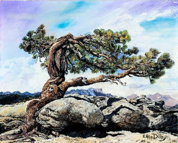
Ken Christensen (MI,CA,OH,b 1951) oil paintingBroward Auction Gallery4.7(292)See Sold PriceMar 17, 2024
1885 CIVIL WAR 1ed Famous Memoirs US Grant Sheridan Sherman 6v RARE LOT MapsSchilb Antiquarian Rare Books4.8(428)See Sold PriceMar 10, 2024
LARGE LATE 17TH C. DUTCH CHART OF CANADA, GREAT LAKES, NEW FRANCE, LABRADOR, HUDSON BAY, BY PIERREThomaston Place Auction Galleries4.4(393)See Sold PriceFeb 24, 2024
EARLY 18TH C. DUTCH CHART OF PACIFIC OCEAN BY FREDERIK DE WIT (1629-1706) WITH CALIFORNIA AS ANThomaston Place Auction Galleries4.4(393)See Sold PriceFeb 24, 2024
EARLY 18TH C. MAP OF ITALY, FRAMEDThomaston Place Auction Galleries4.4(393)See Sold PriceFeb 24, 2024
LATE 16TH C. MAP OF SCOTLAND BY MERCATOR, FRAMEDThomaston Place Auction Galleries4.4(393)See Sold PriceFeb 24, 2024
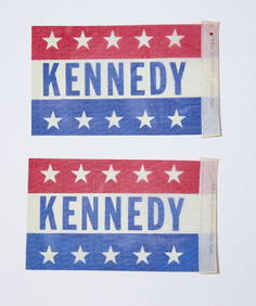
(2) 1960 J.F.K. for US PRESIDENT CAR PENNANTSJohn McInnis Auctioneers,LLC4.5(505)See Sold PriceFeb 25, 2024
Henry Shayer (UK,1825-1864) oil painting antiqueBroward Auction Gallery4.7(292)See Sold PriceApr 14, 2024
ATTRIB Jan Damschroeder (Dutch,German,1825-1905) oil painting antiqueBroward Auction Gallery4.7(292)See Sold PriceApr 14, 2024
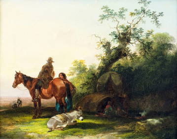
ANTIQUE AMERICAN CIVIL WAR HAND COLORED LITHOGRAPHSAntique Arena Inc.4.5(878)See Sold PriceFeb 24, 2024
[ARCTIC]. BOWEN, Emanuel. A New & Accurate Map of the North...Potter & Potter Auctions4.6(545)See Sold PriceMar 07, 2024
[BUSINESS]. Travel Guide of Negro Hotels and Guest Houses. Published by Afro-American Newspapers ofFreeman's | Hindman4.4(1.6k)See Sold PriceFeb 27, 2024
[BUFFALO SOLDIERS]. A large collection of photographs and documents related to 19th-20th centuryFreeman's | Hindman4.4(1.6k)See Sold PriceFeb 27, 2024
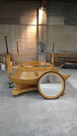
Vintage Italian Biedermeier Style King Canopy Bed Frame, Wall Mirror and 2 Bed Side Chests - BedroomJasper524.5(9.9k)See Sold PriceFeb 28, 2024
EARLY 19TH C. AMERICAN SCHOOL MINIATURE PORTRAIT.William Smith Auctions4.6(147)See Sold PriceMar 06, 2024
19TH C. ANSON DANIELS AMERICAN SCHOOL PORTRAITS.William Smith Auctions4.6(147)See Sold PriceMar 06, 2024


![Hand-colored geologic map of US, [Ca. 1815-18]. (1 of 1)](https://p1.liveauctioneers.com/179/12368/3396998_1_x.jpg?height=282&quality=70&version=1175725014)


![60 nautical maps: US Coast Survey, [ca. 1858]. (1 of 3)](https://p1.liveauctioneers.com/179/14187/4432324_1_x.jpg?height=282&quality=70&version=1194393062)


![[U.S. WALL MAP]. [United States]. Ca.1860 (Ne (1 of 1)](https://p1.liveauctioneers.com/179/10971/2682777_1_x.jpg?height=282&quality=70&version=1162265652)

![Untitled. [Northeast France] (1 of 1)](https://p1.liveauctioneers.com/5584/122553/62377148_1_x.jpg?height=282&quality=70&version=1527639612)


![[ARCTIC]. BOWEN, Emanuel. A New & Accurate Map of the North... (1 of 1)](https://p1.liveauctioneers.com/928/318880/171360917_1_x.jpg?height=282&quality=70&version=1707501302)
![[BUSINESS]. Travel Guide of Negro Hotels and Guest Houses. Published by Afro-American Newspapers of (1 of 4)](https://p1.liveauctioneers.com/197/319238/171467937_1_x.jpg?height=282&quality=70&version=1707520367)
![[BUFFALO SOLDIERS]. A large collection of photographs and documents related to 19th-20th century (1 of 6)](https://p1.liveauctioneers.com/197/319238/171468141_1_x.jpg?height=282&quality=70&version=1707520367)