Early Map of the Coastal North East by Van KeulenPas-Kaart vande zee kusten inde Bocht van Niew Engeland Tusschen de Staaten Hoek en C. de Sable. Johannes Van Keulen (1654-1715). Engraved map. Amsterdam, 1687. 20 3/4 x 23 1/2 inches sheet. State 2 oSee Sold Price
Antique Map 1690 Sea Chart of West Africa Van Keulen Marocco Canary IslandsFine 17th-century sea chart of West Africa, including from the Sierra Leone, Liberia, and Cote d'Ivoire coastlines. The map shows important coastal information that would have been of use to early capSee Sold Price
SoldEARLY MAP OF NORTHEAST & NEW YORKby Nicholas Visscher, ‘NOVI BELGII NOVAEQUE ANGLIAE…’, Amsterdam, 1684 (this being the third edition with Philadelphia added for the first time), engraving with hand-coloring. h. 21 w. 25 in. (sSee Sold Price
Danckerts (Justus) Novi BelgiiDanckerts (Justus) Novi Belgii Nov'que Angli' nec non Pennsylvani' et Virgini' Tabula,second state of this early map of north east North America, with large title cartouche incorporating the fSee Sold Price
SoldEarly American Map of NE Coast & AcadiaEarly American Map of Northeast Coast & Acadia - Continental Origin In Victorian Eastlake Style Frame 13" H X 17" WSee Sold Price
Large Early American Railroad Map Of United StatesA large early American railroad map of north east and central America. Hand colored and highlighted trails around the United States spanning from Wisconsin, Missouri, North Carolina, Maine and parts oSee Sold Price
SoldMap Of The Town Of Northeast New YorkEarly map of "Town Of Northeast/Dutchess Co. N.Y.". Sight 17 1/2" x 14".See Sold Price
1785 AND 1730 ENGRAVED MAPSCARTE DE LA PARTIE NORD, DES ETATS UNIS, DE L'AMERIQUE SEPTENTRIONALE. R. BONNE. PARIS. 1785. Map of early U.S. Northeast, shortly after the Treaty of Paris created the U.S.A. Shows forts Duquesne, NeSee Sold Price
SoldEarly Town Of Northeast MapEarly frame Town Of Northeast map (Millerton). Sight 16 1/2" x 13 1/4.See Sold Price
SoldMap, c. 1640, Northeast SpainMapsc. 1640, ARAGONIA REGNVM, by Blaeu, [Amsterdam], Choice Very Fine. 16.25” x 20.5”, copper-engraved map with early hand coloring. Showing the northeast region of Spain, which was a kingSee Sold Price
SoldEarly Hand Drawn Map Coastal Carolinalate 18th or early 19th Century depicting the coastal state line of North and South Carolina continuing inland to detail cities such as Camden, South Carolina and into North Carolina featuring MecklinSee Sold Price
Soldc. 1684 Hand-Colored American Northeast MapHistoric Maps Stunning Late 17th Century Map of the American Northeast With "Nieuw Yorck. - Nieuw Amsterdam" Cityscape Inset c. 1684 Late 17th Century, Hand-Colored Map of the American Northeast titleSee Sold Price
Soldc 1760 Superb Hand-Colored American Northeast MapHistoric Maps Gorgeous Map of the American Northeast With "Neu Jorck sive Neu Amsterdam" with Cityscape Inset c. 1760 mid 18th Century Colonial Era, Hand-Colored Engraved Map of the American NortheastSee Sold Price
SoldEARLY HAND COLORED MAP. Shows the westerEARLY HAND COLORED MAP. Shows the western half of America as well as parts of Mexico and Canada and the northeast tip of Russia. "Nuove Scoperte de' Russi...si nell' Asia, che nell' America. Venezia 1See Sold Price
Bellin (Nicolas) Carte Reduite des Costes Orientales deBellin (Nicolas) Carte Reduite des Costes Orientales de l'Amérique Septentrionale, detailed coastal chart of northeast North America, from Nova Scotia to south of Long Island, with inset plan of BostSee Sold Price
Soldc 1730 Seutter Map: Novi Belgii, in America ...Historic Maps c. 1730 Historic Rare Earlier State of Seutter's Important American Northeast Map & New York City Restitutio View c. 1730 Hand-Colored Copper-Engraved Map titled, "Recens Edita totius NoSee Sold Price
van Keulen: Antique Coastal Chart of the Carolinas 1780Map: Pas Kaart van de Kust van Carolina Cartographer: van Keulen Place & Date: Amsterdam / 1680/1734/1780 Size: 23" x 20 3/8" Condition: b&w; overall age toning with some browning and minor fraying alSee Sold Price
Sold1786 map of N. America by de la PorteScarce and beautiful double-page early copperplate-engraved map of North America depicting the new country right after America claimed her independence. Early east coast states delineated along with pSee Sold Price
1786 map of N. America by de la PorteReserve Reduced! Scarce and beautiful double-page early copperplate-engraved map of North America depicting the new country right after America claimed her independence. Early east coast states delineSee Sold Price
1786 map of N. America by de la PorteScarce and beautiful double-page early copperplate-engraved map of North America depicting the new country right after America claimed her independence. Early east coast states delineated along with pSee Sold Price
Van Keulen: Rare Venezuela Coastal ChartMap Title: Pas-kaart vande Zee kusten van Veneçuela met de byleggende Eylanden Cartographer: van Keulen Place/Date: Amsterdam / 1700 Size: 22 7/8" x 20 1/4" Johannes van Keulen's rare and superbly deSee Sold Price
Van Keulen: Rare Venezuela Coastal Chart (1700)Map Title: Pas-kaart vande Zee kusten van Veneçuela met de byleggende Eylanden Cartographer: van Keulen Place/Date: Amsterdam / 1700 Size: 22 7/8" x 20 1/4" Condition: original outline color (wash coSee Sold Price
MAP - Northern England. Van KeulenNorthern England. Gerard van Keulen, A New Encreasing Compass Map of Part of the East-Coast of England... / Nieuwe Wassende Gradige Pas-kaart van een Gedeelte der Oost Kust van Engeland..., 1730 (circSee Sold Price
SoldEARLY JONATHAN DICKENSON MAP OF CUBAEARLY JONATHAN DICKENSON MAP OF CUBA Florida, Carolina and Virginia, antique map is an early representation of the east coast of North America and part of the Caribbean, including the entire peninsulaSee Sold Price
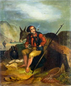
ATTR Henry Perlee Parker (UK,1795-1873) oil painting antiqueBroward Auction Gallery4.8(277)See Sold PriceMar 10, 2024
[ARCTIC]. BOWEN, Emanuel. A New & Accurate Map of the North...Potter & Potter Auctions4.6(539)See Sold PriceMar 07, 2024
1760 MAP CARTE PARTICULIERE DE L'ISLE DE JUAN FERNANDES antique Robinson CrusoeJasper524.5(9.8k)See Sold PriceFeb 27, 2024
1764 Bellin Map of Port Antonio, Jamaica -- Plan des Havres de Port Antonio et de Saint FrancoisJasper524.5(9.8k)See Sold PriceFeb 27, 2024
WEST AFRICA Explorers' routes Senegal Ashanti. Mountains of Kong. SDUK 1857 mapJasper524.5(9.8k)See Sold PriceFeb 28, 2024
AFRICA. Map pre-dating much exploration. Mountains of Kong. SDUK 1851 oldJasper524.5(9.8k)See Sold PriceFeb 28, 2024
WEST AFRICA explorers' routes. Beaufort Gray Park Dochard Caillie. SDUK 1874 mapJasper524.5(9.8k)See Sold PriceFeb 28, 2024
WEST AFRICA I Explorers' routes Senegal Ashanti Ivory Gold Coast. SDUK 1851 mapJasper524.5(9.8k)See Sold PriceFeb 28, 2024
Colonial Africa North-East. Hejaz Kenya Abyssinia Sudan. THE TIMES 1895 mapJasper524.5(9.8k)See Sold PriceFeb 28, 2024
NORTH EAST AFRICA. Libya Egypt Sudan Ethiopia Ubangi-Shari Chad 1952 old mapJasper524.5(9.8k)See Sold PriceFeb 28, 2024
Colonial Africa North-East. Hejaz Kenya Abyssinia Colonial. THE TIMES 1900 mapJasper524.5(9.8k)See Sold PriceFeb 28, 2024
WEST AFRICA showing early explorers' routes & Mountains of Kong. SDUK 1844 mapJasper524.5(9.8k)See Sold PriceFeb 28, 2024
PRE COLONIAL WESTERN AFRICA. Shows Mountains of Kong. Tribes. WELLER 1863 mapJasper524.5(9.8k)See Sold PriceFeb 28, 2024


![[ARCTIC]. BOWEN, Emanuel. A New & Accurate Map of the North... (1 of 1)](https://p1.liveauctioneers.com/928/318880/171360917_1_x.jpg?height=282&quality=70&version=1707501302)


