SoldAssembled Collection of 13 19th C Atlas MapsDESCRIPTION: Assembled collection of 13 atlas maps. Includes: 1) View of Calcutta published in 1842 by Chapman & Hall. 2) Circa 1840 views of Syracuse, Parma, London, and Ireland. Published by The SocSee Sold Price
SoldMaris Pacifici , 19th C map of the Pacific region ,Maris Pacifici , 19th C map of the Pacific region , after Ortelius Abrahamus. PROVENANCE: Francis de Sales McHugh Collection. 13 x 19in. (33 x 48cm)See Sold Price
SoldCOLLECTION OF 19TH C. WABASH RAILROAD LITHOGRAPHSA collection of 19th century Wabash Continental Limited color lithographs circa 1880 clipped from a larger map and nicely matted, no frame. Overall matted size 18 x 24 inches. We happily provide seamlSee Sold Price
SoldCollection of 19th C. Maps. (21).Collection of 19th C. maps, mostly unframed. 17 maps of Russian Empire, 1 each of Caspian Sea, Portugal, Japan and Bay of Cadiz.See Sold Price
SoldIllustrated MapsA collection of (13) 19th and 20th century illustrated maps from around the world. London, Cape Cod, Sicily, and more!See Sold Price
Sold19th C. Massachusetts Themed Books, (3pc)Collection of three 19th C. Boston and Massachusetts themed books: (1) The Late George Apley: A Novel in the Form of a Memoir by John P. Marquand. Boston: Little, Brown, and Company, 1937. Green clothSee Sold Price
SoldCollection of early mapsCollection of 18th,19th and 20th c maps mostly bookplates approx 40 piecesSee Sold Price
Sold[CANADA & NORTH AMERICA] A collection of 13 maps[CANADA & NORTH AMERICA] A collection of 13 engraved maps. Early 19th century. Various dimensions (approx. 30 x 25 cm). Various conditions. Includes: Northern Hemisphere, Illman & Pilbrow. New York. *See Sold Price
SoldFRAMED 19th c. MAP-DUTCHESS COUNTY, 20" X 13"FRAMED 19th c. MAP-DUTCHESS COUNTY, 20" X 13"See Sold Price
Sold6 PCS, 18TH & 19TH C MEDICAL BOOKS, LEATHERBOUNDCollection of medical volumes comprising Smith and Horner "Anatomical Atlas - Illustrative of the Structure of the Human Body" -1845, Thomas Dobson "The Elements of Medicine or a Translation of the ElSee Sold Price
Sold(4) Maps of Palestine 19th c.Includes: A New Map of Palestine of the Holy Land. 12 3/8" x 15" folded, Mitchell 1867. Hocland von Juda 10 5/8" x 16 3/8" Andreas Atlas 1893 (p.109). Palestine 13 5/8" x 20 3/8" folded, Appleton 1891See Sold Price
SoldTexas nach den Besten Quellen Map, 19th CMap: Texas nach den Besten Quellen Cartographer: Bibliographischen Instituts. / Radefeld Place & Date: Hildburghausen / 1849/1857 Size: 13 7/8" x 11 1/2" Condition: original outline color The scarce sSee Sold Price
SoldBritish America, London Printing Co. 19th CTitle: British America Subject: British America Maker: London Printing & Publishing Co. Date: Late 19th Century Materials: Steel engraving Size: 13 x 9.5 inches No Reserve: This lot starts at $1 and hSee Sold Price
SoldEARLY 19TH C. DECORATED MAP OF SUSSEXExtensively hand-colored engraving. Dimensions: (Frame) H 13.25" x W 15.25", (Sight) H 8" x W 10.25" Condition: Somewhat wavy in the frame. Some spots of age toning.See Sold Price
SoldExtremely Rare and Nearly Complete 19th C. Stamp AlbumExtremely rare 19th century stamp collection books; Nearly complete and extremely rare 19th century stamp album; contains over 1000 world stamps categorized by country, including the United States, GrSee Sold Price
SoldLATE 19TH C. STUDENT DRAWN MAP OF NEW BEDFORD, MASS"A Picture Map of New Bedford", graphite and colored pencil on muslin, with handwritten captions, in fatigued panel frame under old glass, OS: 13 3/4" x 11 1/2", SS: 11" x 14 3/4". Creased, stained.See Sold Price
SoldLu Xue (Japanese, 19th C) Sino-Japanese War Woodblock TriptychLu Xue (Japanese, 19th C) Sino-Japanese War Woodblock Triptych. Tohei Anjo Gaiyu Battle Map Komatsuuchi Minister Shigemori Evil Gentai Yoshihei. Framed. Size: 13.5'' x 28'', 34 x 71 cm (sight); 22.25'See Sold Price
SoldThree 19th C. Maps & Two 19th C. Prints**Originally Listed At $100** Europe, Ireland and Germany, ca. 19th century CE. A collection of printed materials: two printed German maps, one print of an older engraved map, and two prints of engravSee Sold Price
Sold19thc J. H. Colton Map of RussiaOriginal 19th Century map of Russia, from an 1857 edition of J. H. Colton's Atlas. pg 86, showing all regions, including the Black Sea, Caspian Sea & Arctic Ocean. 13 1/2" X 16 1/2". Good condition.See Sold Price
SoldAntique Map, City Plan of Brussels, 19th CTitle/Content of Map: Brussels Date Printed: Late 19th century Cartographer: Unknown Material/Medium: Paper Size: 17" x 13 3/4" Published in London Please note that this lot has a confidential reserveSee Sold Price
Three 19th C. Maps & Two 19th C. Prints**First Time At Auction** Europe, Ireland and Germany, ca. 19th century CE. A collection of printed materials: two printed German maps, one print of an older engraved map, and two prints of engravingsSee Sold Price
Engraved and Colored Map of Province of NY And CountryTitle: Engraved and Colored Map of Province of NY And Country of VI Nations Date/Period: 1845 Dimension: 9.75" by 13.5" framed Provenance::Legend includes native tribes. Mid 19th C version of 1771 mapSee Sold Price
Sold[Costume] Costumes Francais, 1830sHerbe. COSTUMES FRANCAIS, AVEC LE STYLE DES MEUBLES ET DE L'ARCHITECTURE…. Paris, 1830s. 13.5" x 10". With 86 leaves of hand-colored lithographed plates, interspersed with text. 19th c. morocco overSee Sold Price
SoldEighty Vintage Greeting Cards and Two ScrapbooksCollection of Eighty Vintage Greeting Cards and Two Scrapbooks, late 19th/early 20th c., chromolithographed Valentine, Christmas, New Years, and Easter cards, many with pop-ups; two Victorian scrapbooSee Sold Price
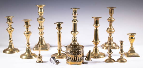
ENGLISH BRASS CANDLESTICK & SNUFFER COLLECTIONThomaston Place Auction Galleries4.4(393)See Sold PriceFeb 24, 2024
TWO (19th c) SCANDINAVIAN PINE PANTRY BOXESJohn McInnis Auctioneers,LLC4.5(505)See Sold PriceFeb 25, 2024
(Early 19th c) CARVED & PAINTED FOLK ART SPOONJohn McInnis Auctioneers,LLC4.5(505)See Sold PriceFeb 25, 2024
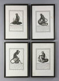
4 19th C. Framed Italian Monkey EngravingsEpic Auctions and Estate Sales4.6(210)See Sold PriceMar 02, 2024
(13) 19th C. Prints Great Homes of Britain PrintsEpic Auctions and Estate Sales4.6(210)See Sold PriceMar 02, 2024
Pr. English 19th C. Floral Botanical PrintsEpic Auctions and Estate Sales4.6(210)See Sold PriceMar 02, 2024
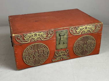
19th C. Chinese Red Lacquered Pigskin ChestEpic Auctions and Estate Sales4.6(210)See Sold PriceMar 02, 2024
[WINTER SPORTS]. Group of 13 Trade Cards. [V.p., ca. 19th c...Potter & Potter Auctions4.6(545)See Sold PriceMar 07, 2024
Map: A 19thC engraved and hand coloured map of St. Petersburg / Sanktpeterburga by W. B. Clarke.Claydon Auctioneers Ltd4.3(125)See Sold PriceFeb 26, 2024
1816 MAP SOUTHERN PART OF RUSSIA or MUSCOVY in EUROPE copper engraving ANTIQUEJasper524.5(9.9k)See Sold PriceFeb 27, 2024
1816 MAP NORTHERN PART OF RUSSIA or MUSCOVY in EUROPE copper engraving ANTIQUEJasper524.5(9.9k)See Sold PriceFeb 27, 2024
COLONIES FRANÇAISES en AFRIQUE. Africa Sénégal Madagascar. LEVASSEUR c1850 mapJasper524.5(9.9k)See Sold PriceFeb 28, 2024
Afrique Ancienne. Ancient North Africa. MALTE-BRUN c1871 old antique map chartJasper524.5(9.9k)See Sold PriceFeb 28, 2024
European Carved And Patinated Wood Santos Figural Grouping, Early 19th C., H 13.5" 3 pcsDuMouchelles4.6(830)See Sold PriceMar 14, 2024
Victorian Inlaid Burlwalnut Lap Desk, Ca. 19th C., H 6" W 13.5" Depth 9"DuMouchelles4.6(830)See Sold PriceMar 14, 2024
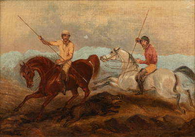
European Oil on Canvas, 19th C., "Boar Hunt", H 13" W 18.75"DuMouchelles4.6(830)See Sold PriceMar 15, 2024
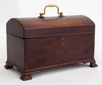
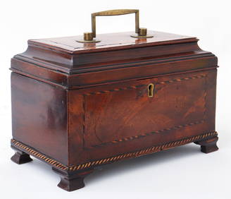
George III Mahogany Domed Lid Tea Caddy, 19th C.Auctions at Showplace4.6(740)See Sold PriceFeb 13, 2025


![[CANADA & NORTH AMERICA] A collection of 13 maps (1 of 2)](https://p1.liveauctioneers.com/1124/187577/94368854_1_x.jpg?height=282&quality=70&version=1607095126)


![[Costume] Costumes Francais, 1830s (1 of 8)](https://p1.liveauctioneers.com/3532/117365/60345233_1_x.jpg?height=282&quality=70&version=1519867546)


![[WINTER SPORTS]. Group of 13 Trade Cards. [V.p., ca. 19th c... (1 of 1)](https://p1.liveauctioneers.com/928/318880/171361478_1_x.jpg?height=282&quality=70&version=1707501302)