MATTHEWS c1856 Map Of Upper Canada Ontario Indian Land Agency Divisions Scarce!Luis Porretta Fine Arts4.3(10)See Sold PriceMar 02, 2024
DEVINE c1856 Dr Salters Map Of Lake Huron Ontario Indian Lands etc. No. 7 ScarceLuis Porretta Fine Arts4.3(10)See Sold PriceMar 02, 2024
DUNLEVIE c1856 Map Counties Of Gaspe & Bonaventure Quebec Canada SCARCE! #1Luis Porretta Fine Arts4.3(10)See Sold PriceMar 02, 2024
DUNLEVIE c1856 Map Counties Of Gaspe & Bonaventure Quebec Canada SCARCE! #2Luis Porretta Fine Arts4.3(10)See Sold PriceMar 02, 2024
Map UNITED COUNTIES LEEDS & GRENVILLE by Walling 1861 Rare Canada Map 5ft x 5ftLuis Porretta Fine Arts4.3(10)See Sold PriceMar 02, 2024
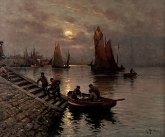
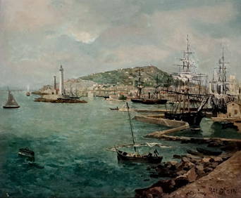
Ambroise TARDIEU c1822 Map Venice Napoleon Italian Campaign 17" x 11"Luis Porretta Fine Arts4.3(10)See Sold PriceMar 02, 2024
SoldMap of Port Royal Harbour Carolina by Herman Moll 1730Map: Plan of Port Royal Harbour in Carolina Maker: Herman Moll Date: 1730-32 Size: 8 x 10.5 inches Hilton Head and Port Royal, South Carolina. Moll notes on the map that it is "the best Country in CarSee Sold Price
SoldMOLL, HERMAN. A Plan of Port Royal - Harbour iMOLL, HERMAN. A Plan of Port Royal - Harbour in Carolina. Engraved map, 210x280 mm, wide margins; hand-colored in outline. London, 1729 All items are offered for sale subject to Swann Galleries' stanSee Sold Price
Map of Port Royal Harbor, SouthCarolina "A. Plan of Port Royal Harbor in Carolina with the proposed forts, depth of water & latitude...", after Herman Moll, Dutch, 1654-1732, 42 original drafts by Herman Moll, published in London bSee Sold Price
SoldPort Royal Harbour, South Carolina 1877 MapFramed, this map measures about 20"Wx20"HSee Sold Price
Port Royal harbor in the Carolina’s. RARE colonial eraTitle: Port Royal harbor in the Carolina’s. RARE colonial era subject Date/Period: 1732/1736 Materials: Copper plate engraved Dimensions: 13 1/2 x 9” By. H. Moll. From. Atlas minor. Published, LonSee Sold Price
SoldMoll, Herman. A Map of the Province of CarolinaMoll, Herman. A Map of the Province of Carolinacopperplate engraving with hand-color (London, 1730), depicting North and South Carolina extending from the Virginia line all the way to Florida, with anSee Sold Price
Sold1776 map, Port Royal, South Carolina,"A Plan of Port Royal in South Carolina - Survey'd by Capn John Gascoigne", by John Gascoigne and Francis Swaine, published in [North American Pilot,] Sayer & Bennett, London, 1777, showing Port RoyalSee Sold Price
18th-Century Map of Carolina by Herman Moll, 18th-Century Map of Carolina by Herman Moll, hand-outlined, 9 x 12.75" (plate area approx. 8 x 10.5"), 1736. Atlas map publ. by Thos. Bowles and John Bowles. (see Rumsey Collection, Image 5580051; hSee Sold Price
Soldc. 1729, Map of CAROLINAMapsBold Early Colonial Printed Map of “Carolina” by H. Moll c. 1729, Map of “CAROLINA,” by Herman Moll, England, Choice Extremely Fine. Map measures 8” x 11”, withSee Sold Price
JAMAICA. Counties/parishes. Sugar Mill & KingstonTITLE/CONTENT OF MAP: 'Jamaica' Vignettes: Port Royal harbour; Kingston; Sugar Mill; Port Antonio. Shows counties & parishes DATE PRINTED: 1851 IMAGE SIZE: Approx 36.5 x 26.5cm, 14.5 x 10.25 inches (LSee Sold Price
JAMAICA. Counties/parishes. Sugar Mill & KingstonTITLE/CONTENT OF MAP: 'Jamaica' Vignettes: Port Royal harbour; Kingston; Sugar Mill; Port Antonio. Shows counties & parishes DATE PRINTED: 1851 IMAGE SIZE: Approx 36.5 x 26.5cm, 14.5 x 10.25 inches (LSee Sold Price
JAMAICA. Counties/parishes. Sugar Mill & Kingston views. RAPKIN/TALLIS 1851 mapTITLE/CONTENT OF MAP: 'Jamaica' Vignettes: Port Royal harbour; Kingston; Sugar Mill; Port Antonio. Shows counties & parishes DATE PRINTED: 1851 IMAGE SIZE: Approx 36.5 x 26.5cm, 14.5 x 10.25 inches (LSee Sold Price
JAMAICA. Counties/parishes. Sugar Mill & Kingston views. RAPKIN/TALLIS 1851 mapTITLE/CONTENT OF MAP: 'Jamaica' Vignettes: Port Royal harbour; Kingston; Sugar Mill; Port Antonio. Shows counties & parishes DATE PRINTED: 1851 IMAGE SIZE: Approx 36.5 x 26.5cm, 14.5 x 10.25 inches (LSee Sold Price
SoldMap of English Empire, Herman Moll, 1730Map of English Empire, Herman Moll, 1730 Title: The English Empire Artist: Herman Moll Engraver: Herman Moll Description: Hand colored map of the English plantations. Date: 1730 Frame: Wood, glass, reSee Sold Price
SoldHerman Moll map: CAROLINA shows NC, SC and FL[Southeast] Herman Moll. CAROLINA map. Shows North and South Carolina and Florida, including what is now Georgia, including their trans- Appalachian regions. The southern Tidewater region of VirginiaSee Sold Price
19TH C. MAPS: MICHIGAN, NEW JERSEY & PENN19TH C. MAPS: MICHIGAN, NEW JERSEY & PENNSYLVANIA & AN EARLY MAP OF PORT ROYAL HARBOR IN CAROLINA, 4:All hand colored & unframed. Michigan, 1850, published by Thomas Cowperthwait, 14 1/2" x 11 5/8", NSee Sold Price
SoldMOLL. Map of Carolina.MAP - MOLL, Herman. Carolina.London: after 1729. Engraved map (200x275 mm plate mark size). Condition: chips and short tears in the margins outside the plate mark. Cartographically the sameSee Sold Price
Sold4 Maps: Carolina + Carte de la Virginie + 2 others[East Coast]. 4 Maps. ++ Herman Moll. 2 maps on 1 sheet: Carolina./ A Map of ye Island of Bermudos Divided into its Tribes, wth. The Castles, Forts &c. (nd). "Appears in Atlas Geographicus London. NutSee Sold Price
SoldPort Royal harbor in the Carolina’s. RARE colonial eraTitle: Port Royal harbor in the CarolinaÂ’s. RARE colonial era subject. Date/Period: 1732/1736 Materials: Copper plate engraved Size: 13 1/2 x 9” Port Royal, Carolina. c1732/1736 from the AtlasSee Sold Price
Port Royal harbor in the Carolina’s. RARE colonial eraTitle:Port Royal harbor in the Carolina’s. RARE colonial era subject Date/Period: 1732/1736 Materials: Copper plate engraved Dimensions: 13 1/2 x 9” Port Royal, Carolina. c1732/1736 from the AtlasSee Sold Price
Port Royal harbor in the Carolina’s. RARE colonial eraTitle: Port Royal harbor in the Carolina’s. RARE colonial era subject Date/Period: 1732/1736 Materials: Copper plate engraved Dimensions: 13 1/2 x 9” Port Royal, Carolina. c1732/1736 from the AtlaSee Sold Price
Port Royal harbor in the Carolina’s. RARE colonial eraTitle: Port Royal harbor in the Carolina’s. RARE colonial era subject Date/Period: 1732/1736 Materials: Copper plate engraved Dimensions: 13 1/2 x 9” Port Royal, Carolina. c1732/1736 from the AtlaSee Sold Price
Sold18th Century Map of Carolina & BermudaMy Herman Moll. Very nicely detailed having some hand tinting. Full margins and not laid down. Good overall condition. Unframed. H7 1/2" W13 1/4"See Sold Price
Sold18th Century British Naval Map of Port Royal, SC18th Century British Naval Map of Port Royal, SCDes Barres, Joseph F. Wallet, PORT ROYAL IN SOUTH CAROLINA TAKEN FROM SURVEYS DEPOSITED AT THE PLANTATION OFFICE, disbound from THE ATLANTIC NEPTUNE (LoSee Sold Price
Royal Family’s Honour Gift of Marie-Louise, Princess-Consort of BulgariaLA GALERIE NUMISMATIQUE4.2(149)See Sold PriceFeb 25, 2024
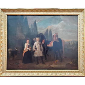
Portfolio of 15 County Maps by Robert Morden (English 1650-1703)Nadeau's Auction Gallery4.7(401)See Sold PriceFeb 24, 2024
Johann Homann Hand-Colored Map Engraving, c. 1730Auctions at Showplace4.5(726)See Sold PriceMar 17, 2024
Carey, pub. 1796 - Map of The State of South CarolinaTrillium Antique Prints & Rare Books4.5(30)See Sold PriceFeb 24, 2024
Carey, pub. 1796 - Map of the Tennassee State formerly part of North Carolina (Tennessee)Trillium Antique Prints & Rare Books4.5(30)See Sold PriceFeb 24, 2024
Wilson - Carolina Parrot & Flycatchers. 26Trillium Antique Prints & Rare Books4.5(30)See Sold PriceFeb 24, 2024
Kent & Sussex.- Moss (W.G.) The History and Antiquities of the Town and Port of Hastings, 1824; andForum Auctions4.3(52)See Sold PriceFeb 29, 2024
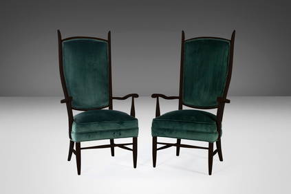
Set of Two (2) Ebonized Maxwell Royal American High Back Upholstered Chairs USA c. 1950sBidhaus4.3(747)See Sold PriceMar 03, 2024
West Indies. South Coast of Jamaica from Port Royal to Pedro Bluff.Jasper524.5(9.8k)See Sold PriceFeb 27, 2024
American White Pelican plate from Audubon's Royal OctavoPBA Galleries4.7(381)See Sold PriceMar 07, 2024
Blue Heron, Audubon Royal Octavo hand-colored lithographPBA Galleries4.7(381)See Sold PriceMar 07, 2024
Jacques Nicolas Bellin - View of the entrance to Zihuatanejo Bay - View of the entrance to the portProverde Auctions4.3(3)See Sold PriceFeb 28, 2024
Map of United States of North America, 1785Antiques Online Auctions4.6(407)See Sold PriceMar 14, 2024
Herman Moll A New Map of Ye North Parts of AmericaWillow Auction House4.5(283)See Sold PriceMar 14, 2024