ATLAS of ANTIENT GEOGRAPHY by SAMUEL BUTLER 1843John McInnis Auctioneers,LLC4.6(504)See Sold PriceFeb 24, 2024
18TH C. ANTIQUE MAP: FRENCH & INDIAN WAR, FRAMEDThomaston Place Auction Galleries4.4(389)See Sold PriceFeb 24, 2024
Rand McNally Railroad Map Cabinet w/ 21 Railroad MapsRail & Road Auctions4.6(165)See Sold PriceMar 08, 2024
Keith Haring - Ink on New York Map, Best Buddies, Inscribed, Signed, and DatedSapphire Auction Gallery4.1(67)See Sold PriceMar 02, 2024
LATE 17TH C. FRENCH MAP OF THE NEW WORLD BY ALEXIS-HUBERT JAILLOT (1632-1712)Thomaston Place Auction Galleries4.4(389)See Sold PriceFeb 24, 2024
Central Railroad of New Jersey Map of Sandy Hook Route-ca. 1903JM Hobby Supply and Railroad Artifact Auctions4.4(126)See Sold PriceFeb 24, 2024
Lot of Six Mixed Atlas Box Cars-HO Scale-New in BoxJM Hobby Supply and Railroad Artifact Auctions4.4(126)See Sold PriceFeb 25, 2024
Rand McNally/Santa Fe Railroad Map of Iowa-1912JM Hobby Supply and Railroad Artifact Auctions4.4(126)See Sold PriceFeb 24, 2024
NICOLAES VISSCHER (NETHERLANDS, 1618-1709) MAP OF THE NEW WORLDThomaston Place Auction Galleries4.4(389)See Sold PriceFeb 24, 2024
17TH C. WORLD MAP BY NICOLAES VISSCHER (NETHERLANDS, 1618-1709)Thomaston Place Auction Galleries4.4(389)See Sold PriceFeb 24, 2024
Lot of Six Mixed Atlas Cabooses-HO Scale-New in BoxJM Hobby Supply and Railroad Artifact Auctions4.4(126)See Sold PriceFeb 25, 2024
SoldSpanish charts of Caribbean harborsHeading: Author: Fidalgo, Joaquin Francisco Title: Plano del Puerto Cabello en la Costa de Tierra Firme... [one sheet with] Plano de la Ensenada de Barcelona en la Costa de Tierra Firme... [on sheetSee Sold Price
SoldSpanish charts of Caribbean harborsHeading: Author: Fidalgo, Joaquin Francisco Title: Four maps, of ports in Cuba, Mexico, & Terra Firme Place Published: Madrid, Spain Publisher: Date Published: c.1818 Description:See Sold Price
Oil on Canvas of a Gaff-Rigged SloopOil on canvas showign a gaff rigged America's Cup yacht under full sail flying the American flag and the New York Yacht Club burgee. The vessel is rigged with a full suit of sails including flying cluSee Sold Price
SoldBellin: Chart of Acapulco Harbor, Mexico, 1754Cartographer: Bellin Place/Date: Leipzig / 1754 Size: 5 7/8" x 7 1/2" Condition: b&w; overall age-toning, some spotting, mostly in the margins A simple but detailed plan of the important Spanish PacifSee Sold Price
Bellin: Chart of Acapulco HarborMap Title: Grundriss des hafens von Acapulco Cartogapher: Bellin Place / Date: Leipzig / 1754Size: 5 7/8" x 7 1/2" A simple but detailed plan of the important Spanish Pacific harbor of Acapulco, withSee Sold Price
Bellin: Chart of Acapulco HarborCartographer: Bellin Place / Date: Leipzig / 1754 Size: 5 7/8" x 7 1/2" Condition: b&w; overall age-toning, some spotting, mostly in the margins A simple but detailed plan of the important Spanish PacSee Sold Price
Bellin: Chart of Acapulco HarborCartographer: Bellin Place/Date: Leipzig / 1754 Size: 5 7/8" x 7 1/2" Condition: b&w; overall age-toning, some spotting, mostly in the margins A simple but detailed plan of the important Spanish PacifSee Sold Price
SoldGulf of Mexico, West Indies and Caribbean Sea from thePublication Date: 1869-04-14 Title: Gulf of Mexico, West Indies and Caribbean Sea from the Most Recent U.S. Coast Survey, Spanish and British Admiralty Charts Sheet I. Cartographer: ANONYMOUS PublisheSee Sold Price
Gulf of Mexico, West Indies and Caribbean Sea. from theReserve Reduced! Title: Gulf of Mexico, West Indies and Caribbean Sea. from the Most Recent Spanish and British Admiralty Charts. Sheet V. Publication Date: 1870-07-01 Cartographer: ANONYMOUS PublisheSee Sold Price
Gulf of Mexico, West Indies and Caribbean Sea. from theTitle: Gulf of Mexico, West Indies and Caribbean Sea. from the Most Recent Spanish and British Admiralty Charts. Sheet V. Publication Date: 1870-07-01 Publisher: U.S. NAVY. HYDROGRAPHIC OFFICE Size: 2See Sold Price
Gulf of Mexico, West Indies and Caribbean Sea. from the Most Recent Spanish and British AdmiraltyPublication Date: 1870-07-01 Title: Gulf of Mexico, West Indies and Caribbean Sea. from the Most Recent Spanish and British Admiralty Charts. Sheet V. Cartographer: ANONYMOUS Publisher: U.S. NAVY. HYDSee Sold Price
Gulf of Mexico, West Indies and Caribbean Sea. from theTitle: Gulf of Mexico, West Indies and Caribbean Sea. from the Most Recent Spanish and British Admiralty Charts. Sheet V. Publication Date: 1870-07-01 Cartographer: ANONYMOUS Publisher: U.S. NAVY. HYDSee Sold Price
Gulf of Mexico, West Indies and Caribbean Sea from theReserve Reduced! Title: Gulf of Mexico, West Indies and Caribbean Sea from the Most Recent U.S. Coast Survey, Spanish and British Admiralty Charts Sheet I. Publication Date: 1869-04-14 Cartographer: ASee Sold Price
Gulf of Mexico, West Indies and Caribbean Sea. from theTitle: Gulf of Mexico, West Indies and Caribbean Sea. from the Most Recent Spanish and British Admiralty Charts. Sheet V. Cartographer: ANONYMOUS Publisher: U.S. NAVY. HYDROGRAPHIC OFFICE Height: 23.8See Sold Price
SoldCaribbean Island Map, by Mount & Page, 1720 (rare &Spectacular sea chart of the Spanish Main to Puerto Rico, from Mount & Page's English Pilot, Fourth Book. Known as the most important English Atlas of Sea Chart covering the Mediterranean and North AmSee Sold Price
Two Very Scarce U.S. Navy Sea Charts of Gulf of MexicoU.S. Navy Hydrographic Office. Gulf of Mexico, West Indies and Caribbean Sea from the Most Recent U.S. Coast Survey Spanish and British Admiralty Charts Sheet I. Lithogaphed map with hand color. 1869.See Sold Price
SoldCentral America Caribbean Gulf of Mexico chart PortsTITLE/CONTENT OF MAP: 'Central American and West Indian Ports; Inset The Pacific Coast from San Diego to Vancouver; San Francisco; Aleutian; The Pacific Coast from Seattle to Dutch Harbor; Bermudas; KSee Sold Price
Central America Caribbean Gulf of Mexico chart PortsTITLE/CONTENT OF MAP: 'Central American and West Indian Ports; Inset The Pacific Coast from San Diego to Vancouver; San Francisco; Aleutian; The Pacific Coast from Seattle to Dutch Harbor; Bermudas; KSee Sold Price
Central America Caribbean Gulf of Mexico chart Ports lighthouses LARGE 1918 mapTITLE/CONTENT OF MAP: 'Central American and West Indian Ports; Inset The Pacific Coast from San Diego to Vancouver; San Francisco; Aleutian; The Pacific Coast from Seattle to Dutch Harbor; Bermudas; KSee Sold Price
Central America Caribbean Gulf of Mexico chart Ports lighthouses LARGE 1918 mapTITLE/CONTENT OF MAP: 'Central American and West Indian Ports; Inset The Pacific Coast from San Diego to Vancouver; San Francisco; Aleutian; The Pacific Coast from Seattle to Dutch Harbor; Bermudas; KSee Sold Price
Central America Caribbean Gulf of Mexico chart PortsTITLE/CONTENT OF MAP: 'Central American and West Indian Ports; Inset The Pacific Coast from San Diego to Vancouver; San Francisco; Aleutian; The Pacific Coast from Seattle to Dutch Harbor; Bermudas; KSee Sold Price
A general chart of the West India Islands… DELAROCHETTE/FADEN Caribbean 1796 mapTitle: A general chart of the West India Islands… DELAROCHETTE/FADEN Caribbean 1796 map Description: A general chart of the West India Islands with the adjacent coasts of the Spanish continent bSee Sold Price
A general chart of the West India Islands… DELAROCHETTE/FADEN Caribbean 1796 mapTITLE/CONTENT OF MAP: 'A general chart of the West India Islands with the adjacent coasts of the Spanish continent by L. S. De La Rochette' DATE PRINTED: 1796 IMAGE SIZE: Approx 55.5 x 78.0cm, 21.75 xSee Sold Price
A general chart of the West India Islands… DELAROCHETTE/FADEN Caribbean 1796 mapTITLE/CONTENT OF MAP: 'A general chart of the West India Islands with the adjacent coasts of the Spanish continent by L. S. De La Rochette' DATE PRINTED: 1796 IMAGE SIZE: Approx 55.5 x 78.0cm, 21.75 xSee Sold Price
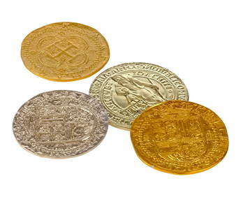
PIRATES OF THE CARIBBEAN: THE CURSE OF THE BLACK PEARL (2003) - Set of Four Spanish CoinsPropstore4.2(6)See Sold PriceMar 13, 2024
PIRATES OF THE CARIBBEAN: THE CURSE OF THE BLACK PEARL (2003) - Set of Four Spanish CoinsPropstore4.2(6)See Sold PriceMar 13, 2024
Windward Islands and Spanish Main from the Latest Surveys 1860Jasper524.5(9.8k)See Sold PriceFeb 27, 2024
1764 Bellin Chart of Three South Haitian Bays -- Carte des Bayes du Mesle des Flamands et deJasper524.5(9.8k)See Sold PriceFeb 27, 2024
Spanish Hand Painted Mugs PotteryRapid Estate Liquidators and Auction Gallery4.5(1.1k)See Sold PriceFeb 29, 2024
Arawak Taino Stone Offering Tablet, Crouching FrogArtemis Fine Arts4.8(1.4k)See Sold PriceFeb 26, 2024