ATLAS of ANTIENT GEOGRAPHY by SAMUEL BUTLER 1843John McInnis Auctioneers,LLC4.6(502)See Sold PriceFeb 24, 2024
18TH C. ANTIQUE MAP: FRENCH & INDIAN WAR, FRAMEDThomaston Place Auction Galleries4.4(386)See Sold PriceFeb 24, 2024
Rand McNally Railroad Map Cabinet w/ 21 Railroad MapsRail & Road Auctions4.6(165)See Sold PriceMar 08, 2024
Keith Haring - Ink on New York Map, Best Buddies, Inscribed, Signed, and DatedSapphire Auction Gallery4(67)See Sold PriceMar 02, 2024
LATE 17TH C. FRENCH MAP OF THE NEW WORLD BY ALEXIS-HUBERT JAILLOT (1632-1712)Thomaston Place Auction Galleries4.4(386)See Sold PriceFeb 24, 2024
Central Railroad of New Jersey Map of Sandy Hook Route-ca. 1903JM Hobby Supply and Railroad Artifact Auctions4.4(126)See Sold PriceFeb 24, 2024
Lot of Six Mixed Atlas Box Cars-HO Scale-New in BoxJM Hobby Supply and Railroad Artifact Auctions4.4(126)See Sold PriceFeb 25, 2024
Rand McNally/Santa Fe Railroad Map of Iowa-1912JM Hobby Supply and Railroad Artifact Auctions4.4(126)See Sold PriceFeb 24, 2024
NICOLAES VISSCHER (NETHERLANDS, 1618-1709) MAP OF THE NEW WORLDThomaston Place Auction Galleries4.4(386)See Sold PriceFeb 24, 2024
17TH C. WORLD MAP BY NICOLAES VISSCHER (NETHERLANDS, 1618-1709)Thomaston Place Auction Galleries4.4(386)See Sold PriceFeb 24, 2024
Lot of Six Mixed Atlas Cabooses-HO Scale-New in BoxJM Hobby Supply and Railroad Artifact Auctions4.4(126)See Sold PriceFeb 25, 2024
Map of Sweden, Norway and Denmark. Scandinavia. 1854.Print of hand colored steel engraving titled „Carte Physiquen et Politique de la Suede de la Norwege et du Danemark”.Drawn by L. Dussieux.Engraved by unknown.From „Atlas General De Geographie phSee Sold Price
1854 Map of Prussian and ScandinaviaAuthor: Johnson Title: 1854 Map of Prussian and Scandinavia Medium: Ink on Paper Dimensions: 26.5"X18" Map of Prussia, Norway, Sweden and Denmark . Double folio map engraved by A.J. Johnson dated 1854See Sold Price
1854 Map of Prussia and ScandinaviaTitle: 1854 Map of Prussia and Scandinavia Author: Johnson Medium: Ink on Paper Dimension: 26.5"X18" Description: Map of Prussia, Norway, Sweden and Denmark . Double folio map engraved by A.J. JohnsonSee Sold Price
SDUK: Antique Map of Scandinavia, 1845Title/Content of Map: 'SWEDEN, NORWAY, AND DENMARK'. Scandinavia. Population table. Date Printed: The map was originally published in 1841. This date is printed on the map. This edition of the map wasSee Sold Price
Antique Map Print - Europe - Map of Sweden, Norway and Denmark - ScandinaviaTitle: Antique Map Print - Europe - Map of Sweden, Norway and Denmark - Scandinavia Date: 1825 Material: Paper Dimensions: 24” x 18,5” inches / 60 cm x 47 cm Descritpion: ”Carte geneSee Sold Price
SCANDINAVIA.Denmark shown without North Schleswig.Norway Sweden.COLLINS 1880 mapTITLE/CONTENT OF MAP: '(Scandinavia) Sweden & Norway Denmark and the Baltic' DATE PRINTED: 1880 IMAGE SIZE: Approx 31.0 x 23.5cm, 12.25 x 9.25 inches (Large); Please note that this is a folding map. TSee Sold Price
SCANDINAVIA.Denmark shown without North Schleswig.Norway Sweden.COLLINS 1880 mapTITLE/CONTENT OF MAP: '(Scandinavia) Sweden & Norway Denmark and the Baltic' DATE PRINTED: 1880 IMAGE SIZE: Approx 31.0 x 23.5cm, 12.25 x 9.25 inches (Large); Please note that this is a folding map. TSee Sold Price
Europe after the Congress of Vienna. 4 sheets. 128x106cm. THOMSON 1817 old mapTITLE/CONTENT OF MAP: 'Scandinavia including Sweden, Norway & Denmark' DATE PRINTED: 1842 IMAGE SIZE: Approx 52.0 x 40.0cm, 20.5 x 15.75 inches (Large); Please note that this is a folding map. TYPE: ASee Sold Price
Scandinavia including Sweden, Norway & Denmark. Iceland. LIZARS 1842 old mapTITLE/CONTENT OF MAP: 'Scandinavia including Sweden, Norway & Denmark' DATE PRINTED: 1842 IMAGE SIZE: Approx 52.0 x 40.0cm, 20.5 x 15.75 inches (Large); Please note that this is a folding map. TYPE: ASee Sold Price
Sold1867 VIKINGS Scandinavia Norse Denmark Sweden Norway1867 VIKINGS Scandinavia Norse Denmark Sweden Norway Illustrated MAP Sinding A rare English edition of Paul Sinding’s ‘History of Scandinavia’. This work covers the entire history of early ScandSee Sold Price
An accurate map of Sweden, Denmark and Norway. BOWEN. Scandinavia 1789 oldTITLE/CONTENT OF MAP: 'Sweden & Norway; Inset maps of Christiania; Stockholm' DATE PRINTED: 1898 IMAGE SIZE: Approx 43.0 x 32.5cm, 16.75 x 12.75 inches (Large); Please note that this is a folding map.See Sold Price
SCANDINAVIA. Sweden, Norway, and Denmark. PopulationTITLE/CONTENT OF MAP: 'SWEDEN, NORWAY, AND DENMARK' Date: The map was originally published in 1841. This date is printed on the map. This edition of the map was published in 1845 IMAGE SIZE: Approx 41See Sold Price
SoldSCANDINAVIA. Sweden, Norway, and Denmark. Populations. SDUK 1857 old mapTITLE/CONTENT OF MAP: 'SWEDEN, NORWAY, AND DENMARK' DATE PRINTED: 1857 IMAGE SIZE: Approx 41.0 x 33.5cm, 16.25 x 13.25 inches (Large) TYPE: Antique steel engraved map with original hand colouring CONDSee Sold Price
Antique Map of Scandinavia - Sweden - Denmark - Finland - Norway - Jean JanvierTitle: Antique Map of Scandinavia - Sweden - Denmark - Finland - Norway - Jean Janvier Date: 1762 Material: Paper Dimensions: 18” x 13” inches / 45 cm x 32 cm Descritpion: This is a stunniSee Sold Price
Johnson's Prussia, Norway, Sweden & Denmark. Scandinavia Baltic Poland 1861 mapCAPTION PRINTED BELOW PICTURE: 'Johnson's Prussia, Norway, Sweden and Denmark' DATE PRINTED: 1861 IMAGE SIZE: Approx 65.0 x 46.0cm, 25.5 x 18 inches (Large); Please note that this is a folding map. TYSee Sold Price
Antique Map - Map of Scandinavia - Map of Sweden, Norway and Denmark - DuvotenayTitle: Antique Map - Map of Scandinavia - Map of Sweden, Norway and Denmark - Duvotenay Date: 1838 Material: Paper Dimensions: 12” x 9” inches / 30 cm x 22 cm Descritpion: Map of Sweden, NSee Sold Price
SCANDINAVIA Sweden Norway Denmark. Baltic Sea Schleswig Holstein SDUK 1874 mapTITLE/CONTENT OF MAP: 'SWEDEN, NORWAY, AND DENMARK including the Baltic Sea and Russian Provinces adjacent' DATE PRINTED: 1874 IMAGE SIZE: Approx 41.5 x 33.5cm, 16.5 x 13.25 inches (Large) TYPE: AntiqSee Sold Price
An accurate map of Sweden, Denmark and Norway. BOWEN. Scandinavia 1789 oldTITLE/CONTENT OF MAP: 'An accurate map of Sweden, Denmark and Norway, from the best authorities by Thos Bowen' DATE PRINTED: 1789 IMAGE SIZE: Approx 22.5 x 29.0cm, 8.75 x 11.5 inches (Large) TYPE: AntSee Sold Price
1892 Black Map of Sweden, Norway and DenmarkTitle: 1892 Black Map of Sweden, Norway and Denmark Cartographer: A&C Black Year / Place: 1892, Edinburgh Map Dimension (in.): 23.3 X 16.7 in. This is a highly detailed map of most of Scandinavia. ShoSee Sold Price
Antique Map Print - Europe - Map of Denmark, Sweden and Norway - ScandinaviaTitle/Artist: Antique Map Print - Europe - Map of Denmark, Sweden and Norway - Scandinavia Date/Period: 1701 Material: Paper Dimensions: 15 cm x 13 cm Description: A detailed small map from ”IntSee Sold Price
SoldThomson: Map of Scandinavia, 1817TITLE/CONTENT OF MAP: 'Scandinavia, or Sweden, Denmark and Norway' The map shows Finland as part of Sweden, although Swedish rule had ended some years earlier with the conquest of Finland by Russia DASee Sold Price
Thomson: Map of Scandinavia & Baltic Sea, 1817Map: 'Scandinavia, or Sweden, Denmark and Norway' Date Printed: c1817 Image Size: Approx 64.0 x 51.5cm, 25.25 x 20.25 inches (Large) Type: Antique early 19th century folding atlas map with original haSee Sold Price
Thomson: Map of Scandinavia-Sweden Denmark Norway, 1817Title/Content of Map: 'Scandinavia, or Sweden, Denmark and Norway' The map shows Finland as part of Sweden, although Swedish rule had ended some years earlier with the conquest of Finland by Russia DaSee Sold Price
Scandinavia, or Sweden, Denmark & Norway Swedish Finland. THOMSON 1830 mapTITLE/CONTENT OF MAP: 'Scandinavia, or Sweden, Denmark and Norway' DATE PRINTED: 1830 IMAGE SIZE: Approx 60.5 x 51.0cm, 23.75 x 20 inches (Large); Please note that this is a folding map. TYPE: AntiqueSee Sold Price
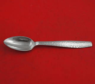
Swedish Modern by Allan Adler Sterling Silver Grapefruit Spoon Original 6"Bidhaus4.3(747)See Sold PriceFeb 25, 2024
Norway Denmark Sterling Silver Enameled JewelryDana J. Tharp Auctions4.7(268)See Sold PriceFeb 24, 2024
1558 SCANDINAVIA SWEDEN ILLUSTRATED HISTORY Gothorum Sveonumque historia antiqueJasper524.5(9.8k)See Sold PriceFeb 27, 2024
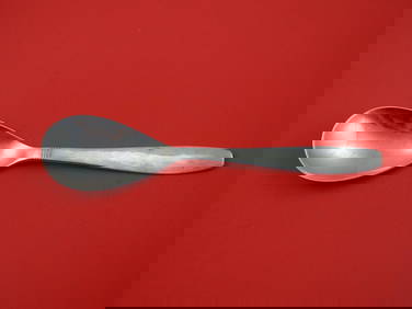
Swedish Modern by Allan Adler Sterling Silver Preserve Spoon 7"Mynt Auctions4.6(680)See Sold PriceMar 01, 2024
Sigvard Bernadotte, Bernadotte flatware serviceToomey & Co. Auctioneers4.7(390)See Sold PriceFeb 29, 2024
Northern & Southern Africa. Maghreb. Orange River Sovereignty. HALL 1854 mapJasper524.5(9.8k)See Sold PriceFeb 28, 2024
Early colonial Africa. Inset Madeira & Aden. SIDNEY HALL 1854 old antique mapJasper524.5(9.8k)See Sold PriceFeb 28, 2024
Cooke, George 1801 Antique Map. Sweden, Denmark, Norway, IcelandAlbion Auctions4.6(336)See Sold PriceMar 01, 2024
BERNADOTTE JEAN BAPTISTE: (1763-1844)International Autograph Auctions Europe S.L.4.5(52)See Sold PriceMar 14, 2024
Carl J. Sundevall (1801 - 1875) Set of 4 Bird Prints - Dove - Woodpecker - DuckProverde Auctions4.3(3)See Sold PriceFeb 28, 2024
Joachim Ferdinand Richardt - Set of 8 Prints - Topographical views of Castels in Sweden - SkabersjöProverde Auctions4.3(3)See Sold PriceFeb 28, 2024
Joachim Ferdinand Richardt - Set of 8 Prints - Topographical views of Castels in Sweden - RosendahlProverde Auctions4.3(3)See Sold PriceFeb 28, 2024
Set of 4 Maps - Netherlands - Seven United Provinces - Germany - Sweden, Denmark, Norway, FinlandProverde Auctions4.3(3)See Sold PriceFeb 28, 2024