SoldColton folding map of Long Island 1872Heading: Author: Colton, George Woolworth and Charles B. Colton Title: Map of Long Island and the Southern Part of Connecticut Place Published: New York Publisher:Published by G.W. & C.G. Colton & CoSee Sold Price
SoldPossibly the largest published map of Long IslandHeading: Author: Colton, G.W. and C.B Title: Colton's New Map of Long Island Place Published: New York Publisher:Colton & Co. Date Published: 1882 Description: Folding map,See Sold Price
SoldBolton's Framed Map of Westchester CountyFramed map of Westchester County, NY. Compiled for Bolton's History of Westchester County, from Colton's "Map of Long Island & The Vicinity of New York." 1848 24" x 17" framedSee Sold Price
SoldGeorge Colton SECTIONAL MAP OF THE STATE OF IOWA ColtonDetails: IOWA - COLTON, George W. (1827-1901) & Charles B. (1832-1916). Colton's Sectional Map of the State of Iowa. New York: G.W. & C.B. Colton, 1872. Folding pocket map, full period hand-colouringSee Sold Price
Sold1872 Colton's Vermont folding map on original boards,1872 Colton's Vermont folding map on original boards, 16 by 13.5 inches, overall excellent conditionSee Sold Price
Sold1886 Beers Wall Map of Long Island51-1/2" x 56" separated into two parts easily repaired. it is linen backed as issued. Some seam splits and tears, and staining. Large scale folding map of Brooklyn and Queens issued by J.B. Beers. RefSee Sold Price
SoldHand Painted Colton Map of New York GeographicusThis lot features a hand painted Colton Map of New York. This is the uncommon 1857 issue of J. H. Colton’s map of New York. Covers the entire state including Lake Ontario, Long Island, and detailedSee Sold Price
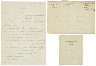
History of Long Island by Benjamin F. ThompsonHistory of Long Island by Benjamin F. Thompson. Limited third edition. Royal octavo. xxiv + 451, 441, 479, 483 pp; 45 gravure plates and 2 folding maps; index. Cloth with gilt spine titles and deckleSee Sold Price
Sold(NEW YORK – LONG ISLAND.) Bonsteel, Jay A., and(NEW YORK – LONG ISLAND.) Bonsteel, Jay A., and Party. Soil Survey of the Long Island Area, New York. 42 pages and 2 large contiguous chromolithographed folding maps. 8vo, 9x5¾ inches, stapSee Sold Price
Sold1778 Revolutionary War Magazine & Map of Hudson's RiverThe January 1778 issue of Gentleman’s Magazine featuring a folding map of “Hudson’s River with the Adjacent Country”, showing area from Lake Ontario to Long Island and Philadelphia. ImportantSee Sold Price
1778 Revolutionary War Map Hudson's River CountryThe January 1778 issue of Gentleman's Magazine featuring a folding map of Hudson's River with the Adjacent Country, showing area from Lake Ontario to Long Island and Philadelphia. Important RevolutionSee Sold Price
Sold2 Vtg Long Island Books in Wraps2 Vintage Pieces of Long Island History in Wraps. Included "The Noyac Cottage Association 1889 Prospectus of Shelter Island" and "Out On Long Island" 1894 with Folding Railroad Map.See Sold Price
Sold3 MAPS- REPORT ON THE PROJECT OF UNITING THE GREAT BAYS3 MAPS- REPORT ON THE PROJECT OF UNITING THE GREAT BAYS OF LONG-ISLAND BY CANALS WITH LARGE FOLDING MAP, 1848; HYDE'S POCKET MAP OF THE BOROUGHS OF MANHATTAN AND THE BRONX NEW YORK CITY, 1905; AND EARSee Sold Price
SoldGoat Island Grant Pamphlet 1872Title: Appeal to the California Delegation in Congress Upon the Goat Island Grant to the Central Pacific R.R. Co. Author: ** Description: 59 pp. Folding map. Modern black cloth, original front wrapperSee Sold Price
SoldRichard Burton ZANZIBAR, 1872. 1st Ed., 2 vols.Burton, Sir Richard F. ZANZIBAR; City, Island, and Coast. 2 Vols. Lon: Tinsely Brothers, 1872. 1st edition. 16 plates/maps: 1 folding map, 4 nonfolding maps (at Vol I pp496-497), 2 frontises, 9 otherSee Sold Price
Sold1872 Colton Map of Kentucky -- ColtonTitle/Content of Map: 1872 Colton Map of Kentucky -- Colton's Kentucky Cartographer: G and C Colton Year/Place: 1872, New York Size: 13.8 X 21.7 in. This is an excellent folding map of the ComnmonwealSee Sold Price
1872 Colton Map of Kentucky -- Colton's KentuckyTitle/Content of Map: 1872 Colton Map of Kentucky -- Colton's Kentucky Cartographer: G and C Colton Year/Place: 1872, New York Size: 13.8 X 21.7 in. This is an excellent folding map of the ComnmonwealSee Sold Price
1872 Colton Map of Kentucky -- Colton's KentuckyTitle/Content of Map: 1872 Colton Map of Kentucky -- Colton's Kentucky Cartographer: G and C Colton Year/Place: 1872, New York Size: 13.8 X 21.7 in. This is an excellent folding map of the ComnmonwealSee Sold Price
Colton (G. Woolworth & C.B.) - Colton's Map of thelarge folding map with peninsular Lower California as part of Mexico, with inset of the Windward Islands, lithographed with full original hand-colouring on 2 joined sheets of India paper, 925 x 1135mmSee Sold Price
SoldRock Island Railroad Timetables 1872, 1875, 1878, 18794 older Rock Island Railroad timetables. All are smaller format folders with folding panels: (1) 1872 with 8x2 fold-out format (2)1875 has 8 panels (3) 1878 long horizontal fold out - unusual (4) 10/1See Sold Price
1876 Colton Folding Map of the Western United States1876 Colton Folding Map of the Western United States -- Colton's Map of the States and Territories West of the Mississippi River to the Pacific Ocean Showing the Overland Routes, Projected Rail Road LSee Sold Price
Colton: Folding Map of the Western United States, 1876Map: 1876 Colton Folding Map of the Western United States -- Colton's Map of the States and Territories West of the Mississippi River to the Pacific Ocean Showing the Overland Routes, Projected Rail RSee Sold Price
1866 Very Rare Colton Folding Map of the United States1866 Very Rare Colton Folding Map of the United States -- Colton's Map of the United States of America J Colton (&Co.) 1866, New York 19.3 X 34.8 in. This is an outstanding and quite rare folding pockSee Sold Price
Sold1876 Colton Folding Map of the Western United States --Title/Content of Map: 1876 Colton Folding Map of the Western United States -- Colton's Map of the States and Territories West of the Mississippi River to the Pacific Ocean Showing the Overland Routes,See Sold Price
19thc Colton Map, Comparitive Size of Lakes & IslandsConnoisseur Auctions3.9(336)See Sold PriceFeb 24, 2024
1853 Colton's Railroad & Township Map of Massachusetts, Rhode Island, and ConnecticutRail & Road Auctions4.6(165)See Sold PriceMar 07, 2024
Group of Ten Railroad Photographs, Maps, and Prints - New Jersey, Long Island, and New YorkRail & Road Auctions4.6(165)See Sold PriceMar 07, 2024
Oyster Bay Long Island NY Vintage Color Reproduction Map 12 x 18Mynt Auctions4.6(697)See Sold PriceFeb 23, 2024
Foulis.- Corsica.- Boswell (James) An Account of Corsica, the journal of a tour to that island; andForum Auctions4.3(53)See Sold PriceFeb 29, 2024
A23 United States in the Caribbean Denoyer-Geppert Social Science MapsJasper524.5(9.9k)See Sold PriceFeb 27, 2024
Le Canal de Mosambique, l'Isle de Madagascar… Mozambique. Africa. BONNE 1788 mapJasper524.5(9.9k)See Sold PriceFeb 28, 2024
Johnson's Africa. Colonies & tribes. Liberia Nile Delta Cape Colony 1866 mapJasper524.5(9.9k)See Sold PriceFeb 28, 2024
Plan de la Baye & Isle d'Arguim'. Mauritania. Arguin island. BELLIN 1746 mapJasper524.5(9.9k)See Sold PriceFeb 28, 2024
Coste d’Afrique…' Guinea-Bissau & Bissagos archipelago. BELLIN 1746 old mapJasper524.5(9.9k)See Sold PriceFeb 28, 2024
Le Canal de Mosambique, l'Isle de Madagascar… Mozambique. Africa. BONNE 1790 mapJasper524.5(9.9k)See Sold PriceFeb 28, 2024
Partie Occidentale de l’Afrique. West Africa coast Canary islands BONNE 1788 mapJasper524.5(9.9k)See Sold PriceFeb 28, 2024
CENTRAL AFRICA. Tanzania, Kenya, Angola, Zambia, Congo, Mozambique 1903 mapJasper524.5(9.9k)See Sold PriceFeb 28, 2024
French West Africa. Gold Coast. Sahara desert sand dunes. TIMES 1956 mapJasper524.5(9.9k)See Sold PriceFeb 28, 2024
Coste d’Afrique…' Guinea-Bissau & Bissagos archipelago. BELLIN/SCHLEY 1747 mapJasper524.5(9.9k)See Sold PriceFeb 28, 2024
Partie Occidentale de l'Ancien Continent… W Africa Macaronesia. BONNE 1780 mapJasper524.5(9.9k)See Sold PriceFeb 28, 2024