SoldNicollet's report with map of Mississippi Basin 1843Heading: Author: Nicollet, Joseph North Title: Report Intended to Illustrate a Map of the Hydrographical Basin of the Upper Mississippi River Place Published: Washington Publisher:Blair and Rives <See Sold Price
SoldJoseph Nicollet, Report Intended to Illustrate a Map ofNICOLLET, Joseph N. (1786-1843, also called Jean N.). Report Intended to Illustrate a Map of the Hydrographical Basin of the Upper Mississippi River. 28th Congress, 2nd Session. January 11th, 1845. WaSee Sold Price
SoldMISSISSIPPI - GOVERNMENT REPORTSMISSISSIPPI - GOVERNMENT REPORTS NICOLLET, I.N. Report intended to illustrate a map of the hydrographical basin of the Upper Mississippi River. Washington: Blair and Rives, 1843. Large foldingSee Sold Price
SoldLarge map of Missouri & Mississippi Basins 1843Title: Hydrographical Basin of the Upper Mississippi River from Astronomical and Barometrical Observations Surveys and Information, by J.N. Nicollet in the years 1836, 37, 38 and 40 assisted 1838, 39See Sold Price
SoldLarge map of Missouri & Mississippi Basins 1843Title: Hydrographical Basin of the Upper Mississippi River from Astronomical and Barometrical Observations Surveys and Information, by J.N. Nicollet in the years 1836, 37, 38 and 40 assisted 1838, 39See Sold Price
SoldLarge map of Missouri & Mississippi Basins 1843Title: Hydrographical Basin of the Upper Mississippi River from Astronomical and Barometrical Observations Surveys and Information, by J.N. Nicollet in the years 1836, 37, 38 and 40 assisted 1838, 39See Sold Price
SoldHydrographical Basin of the Upper Mississippi RivHeading: Author: Nicollet, J.N. Title: Report Intended to Illustrate a Map of the Hydrographical Basin of the Upper Mississippi River Place Published: Washington Publisher:Blair and Rives Date PSee Sold Price
Hydrographical Basin of the Upper Mississippi RivHeading: Author: Nicollet, Joseph North Title: Report Intended to Illustrate a Map of the Hydrographical Basin of the Upper Mississippi River Place Published: Washington Publisher:Blair and Rives <See Sold Price
SoldHydrographical Basin of the Upper Mississippi RivTitle: Report Intended to Illustrate a Map of the Hydrographical Basin of the Upper Mississippi River Author: Nicollet, J.N. Description: 170 pp. Large folding map, 90.3x76.8 cm (35½x30¼"). (8vo), uSee Sold Price
SoldU.S. Coast Survey 1853 Pascagoula River, Mississippi"Entrance to Pascagoula River Mississippi" Electrotype Map Published 1843-65, Washington for "Report of the Superintendent of the U.S. Coast Survey..." Published under the supervision and direction ofSee Sold Price
SoldNICOLLET, JOSEPH N.; and FREMONT, JOHN C. MapNICOLLET, JOSEPH N.; and FREMONT, JOHN C. Map of the Hydrographical Basin of the Upper Mississippi River. Mammoth six-sheet engraved map unjoined, 2040x2415 mm overall; few minor nicks and tears nearSee Sold Price
SoldTanner: Antique Map of Mississippi, 1843Title/Content of Map: Mississippi by Tanner Date Printed: 1843 Cartographer: H.C. Tanner Material/Medium: Paper Size: 17" x 14" Hand colored engraved Map based on the work of H.C. Tanner from the firsSee Sold Price
SoldMap of Mississippi Basin c.1750Title: Cours du Mississipi et la Louisiane Author: De Vaugondy, Robert Description: Copper-engraved map, slight hand-coloring in outline.21.5x16.2 cm. (8½x6½").Map of the Mississippi Basin from theSee Sold Price
SoldScarce French map of Mississippi basin 1803Heading: Author: Poirson, Jean Baptiste Title: Cours Du Mississipi Comprenant La Louisiane, Les 2 Florides, Une Partie Des Etats-Unis, et Pays Adjacents Place Published: Paris Publisher: Date PuSee Sold Price
Tanner: Antique Map of Mississippi, 1843Title/Content of Map: Mississippi by Tanner Date Printed: 1843 Cartographer: based on the work of H.C. Tanner Material/Medium: Paper Size: 17" x 14" Hand colored engraved Map. From the first edition pSee Sold Price
SoldAntique Birds Eye Map of the Mississippi Basin, 1866Title/Content of Map: Antique Birds Eye View of the Mississippi Basin Date Printed: 1866 Cartographer: Anonymous Size (inches): 9 x 14 Condition: Good. Slightly age toned as typical for paper of the eSee Sold Price
SoldMap of upper Mississippi basin 1824Title: Map of the Country Embracing the Route of the Expedition of 1823 Commanded by Major S.H. Long Author: Long, Stephen H. Description: Copper-engraved map. 25x53 cm. (9¾x20¾")Shows the Great LakSee Sold Price
SoldBonne: Antique Map of Louisiana and Florida, 1780Carte de la Louisiane et de la Floride Bonne's detailed map of the Mississippi basin and southeastern North America, from Florida to Virginia. Features good topographical detail, many place names andSee Sold Price
Sold3 Maps of Louisiana and the Mississippi BasinThree Hand-Colored Copper Engraved Maps of Louisiana and the Mississippi Basin by Jacques-Nicolas Bellin (French, 1703-1772), from Le Petit Atlas Maritime, vol. 1, published Paris, 1764, including "SuSee Sold Price
SoldBellin: Louisiana and Florida (Mississippi Basin)Map Title: Carte de la Floride, de la Louisiane, et Pays Voisins Cartographer: Bellin Place & Date: Paris / 1757 Size: 12" x 8 1/2" Condition: b&w; a strong, dark impression; light overall age toningSee Sold Price
SoldBellin: Louisiana and the Mississippi BasinMap: Carte de la Louisiane et Pays Voisins Cartograper: Bellin Place / Date: Paris / 1757/1760 Size: 12" x 8 1/2" Condition: "b&w. light overall age toninga tiny repaired puncture hole in the lower leSee Sold Price
1860s Physical map of the United States, J. H. ColtonFascinating early school atlas map identifies the major physical areas of the country (Mississippi Basin, Gulf Slope, Atlantic Slope, Pacific Slope, Great Basin of the Interior, Hudson Bay Basin and LSee Sold Price
SoldU.S. Coast Survey 1853 Map of Aransas Pass, Texas"Reconnoissance of Aransas Pass Texas" Electrotype Map Published 1843-65, Washington for "Report of the Superintendent of the U.S. Coast Survey..." Published under the supervision and direction of AleSee Sold Price
SoldU.S. Coast Survey 1853 Map of Long Island, New Jersey"Sketch B Showing the progress of Section No. 2" Electrotype Map Published 1843-65, Washington for "Report of the Superintendent of the U.S. Coast Survey..." Published under the supervision and directSee Sold Price
Chicago and Eastern Illinois RR Annual Reports-1878 to 1887JM Hobby Supply and Railroad Artifact Auctions4.4(127)See Sold PriceFeb 24, 2024
Lake Superior and Mississippi River RR 1869 Seven Percent Bonds Book/Report-1869JM Hobby Supply and Railroad Artifact Auctions4.4(127)See Sold PriceFeb 24, 2024
Pair of Early Railroad Maps - 1862 Pittsburgh, Ft. Wayne & Chicago Railway and 1873 PennsylvaniaRail & Road Auctions4.6(165)See Sold PriceMar 07, 2024
Shen Zhouxi Mountain Solitary Residence Map Silk ScrollYakon Auctions4.4(39)See Sold PriceFeb 26, 2024
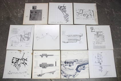
Set of 11 Mid Century Modern Architectural Plans & Site Map RenderingsPUBLIC SALE4.7(226)See Sold PriceMar 02, 2024
Late 18th century map of England and Wales sampler and two printsFellows4.3(159)See Sold PriceMar 05, 2024
[Spokane, Washington State] Maps, Pins & More (8)Grant Zahajko Auctions, LLC4.7(1k)See Sold PriceMar 06, 2024
John Senex Map of Louisiana & Mississippi RiverWillow Auction House4.5(289)See Sold PriceMar 14, 2024


![[Spokane, Washington State] Maps, Pins & More (8) (1 of 5)](https://p1.liveauctioneers.com/5755/320282/172114031_1_x.jpg?height=282&quality=70&version=1708463029)


