SoldJoseph Nicollet, Report Intended to Illustrate a Map ofNICOLLET, Joseph N. (1786-1843, also called Jean N.). Report Intended to Illustrate a Map of the Hydrographical Basin of the Upper Mississippi River. 28th Congress, 2nd Session. January 11th, 1845. WaSee Sold Price
SoldNicollet's report with map of Mississippi Basin 1843Heading: Author: Nicollet, Joseph North Title: Report Intended to Illustrate a Map of the Hydrographical Basin of the Upper Mississippi River Place Published: Washington Publisher:Blair and Rives <See Sold Price
Hydrographical Basin of the Upper Mississippi RivHeading: Author: Nicollet, Joseph North Title: Report Intended to Illustrate a Map of the Hydrographical Basin of the Upper Mississippi River Place Published: Washington Publisher:Blair and Rives <See Sold Price
SoldMISSISSIPPI - GOVERNMENT REPORTSMISSISSIPPI - GOVERNMENT REPORTS NICOLLET, I.N. Report intended to illustrate a map of the hydrographical basin of the Upper Mississippi River. Washington: Blair and Rives, 1843. Large foldingSee Sold Price
SoldHydrographical Basin of the Upper Mississippi RivHeading: Author: Nicollet, J.N. Title: Report Intended to Illustrate a Map of the Hydrographical Basin of the Upper Mississippi River Place Published: Washington Publisher:Blair and Rives Date PSee Sold Price
SoldHydrographical Basin of the Upper Mississippi RivTitle: Report Intended to Illustrate a Map of the Hydrographical Basin of the Upper Mississippi River Author: Nicollet, J.N. Description: 170 pp. Large folding map, 90.3x76.8 cm (35½x30¼"). (8vo), uSee Sold Price
Nimmo. REPORT ON THE INTERNAL COMMERCE... 1879.[US Commerce Maps/Nimmo, Joseph] Joseph Nimmo. REPORT ON THE INTERNAL COMMERCE OF THE UNITED STATES. Wash: GPO, 1879. “Treasury Department” prtd in upper margin of title. 8 folding maps. 8vo. xi,See Sold Price
Nimmo. REPORT ON THE INTERNAL COMMERCE... 1879.[US Commerce Maps/Nimmo, Joseph] Joseph Nimmo. REPORT ON THE INTERNAL COMMERCE OF THE UNITED STATES. Wash: GPO, 1879. “Treasury Department” prtd in upper margin of title. 8 folding maps. 8vo. xi,See Sold Price
SoldNICOLLET, JOSEPH N.; and FREMONT, JOHN C. MapNICOLLET, JOSEPH N.; and FREMONT, JOHN C. Map of the Hydrographical Basin of the Upper Mississippi River. Mammoth six-sheet engraved map unjoined, 2040x2415 mm overall; few minor nicks and tears nearSee Sold Price
SoldAmerica.- Rochefoucauld-Liancourt (François) MapAmerica.- Rochefoucauld-Liancourt (François Alexandre Frédéric, duc de la) Map of the United States, Canada &c, intended to illustrate the Travels of the Duke de la Rochefoucault LiancoSee Sold Price
SoldIVES, JOSEPH C. Report upon the Colorado RiverIVES, JOSEPH C. Report upon the Colorado River of the West. 2 folding maps, 8 folding panoramic views, 26 lithographed plates (including 8 in color), numerous illustrations. 4to, publisher's cloth gilSee Sold Price
SoldIves. Report Upon the Colorado River. 1861.[Americana] Ives, Joseph C. Report Upon the Colorado River of the West, Explored in 1857 and 1858 by Lieutenant Joseph C. Ives…Under the Direction of the Office of Explorations and Surveys, A.A.See Sold Price
Sold1847 Map Chippeway Land District Wisconsin"Provisional Geological Map of Part of the Chippeway Land District of Wisconsin with Part of Iowa & of Minnesota Territory". "To Illustrate the Report of a Geological Reconnoissance made in 1847 by DaSee Sold Price
SoldNIMMO. Report on the Internal Commerce of the USONE OF THE BIG FOUR CATTLE BOOKS 253. NIMMO, Joseph. Treasury Department. Report on the Internal Commerce of the United States. Washington: GPO, 1885. 562 pp., 5 folded lithograph maps with original cSee Sold Price
SoldLand office report with large colored map 1870Heading: Author: Wilson, Joseph S. Title: Bericht des Commissionär des General-Landamtes, der Vereinigten Staaten von America fur das Jahr 1869 Place Published: Washington Publisher:Druck der RegierSee Sold Price
Sold2 maps from Ives' report upon the Colorado RiverTitle: Geological Map No. 1 and Map No. 2 from Report upon the Colorado River of the West Author: Ives, Joseph C. Description: The 2 engraved folding maps from the publication. Sheet size 48x93 cm. (1See Sold Price
SoldLand office report with large colored map 1867Heading: Author: Wilson, Joseph S. Title: Bericht des Commissionär des General-Landamtes, der Vereinigten Staaten von America fur das Jahr 1866 Place Published: Washington Publisher:RegierungsbuchdrSee Sold Price
Report upon the Colorado River... Joseph C. IvesReport upon the Colorado River of the west explored in 1857 and 1858... by Lieutenant Joseph C. Ives, 1861 Washington, DC, GPO, 36th Congress, 1st Session, Senate Executive Document H 194. 4to, Maps,See Sold Price
Principal Transportation Lines East of The MississippiPublication Date: 1884 Title: Principal Transportation Lines East of The Mississippi River Cartographer: NIMMO, JOSEPH, JR. Publisher: G.P.O. "to accompany the report on the Internal Commerce of the USee Sold Price
Map of AsiaMap: Map of Asia Date: 1828 Cartographer: YOUNG, J. H./JOSEPH C. HART Publisher: R. LOCKWOOD, etc. Size (inches): 12.5X14.75 "Drawn & engraved to illustrate HART'S geographical exercises." From the seSee Sold Price
Sold1884 Map of U.S. Western Transportation Lines"The Principal Transportation Lines West of Chicago, St. Louis & New Orleans, To accompany the report on the Internal Commerce of the United States, 1884". Prepared by Joseph Nimmo Jr. Heavy weight paSee Sold Price
SoldYoung: Antique Map of the Interior of Africa, 1828Title/Content of Map: Map of the Interior of Africa Date Printed: 1828 Cartographer: YOUNG, J. H./JOSEPH C. HART Size (inches): 12.5x14.75 "Drawn & engraved to illustrate HART'S geographical exercisesSee Sold Price
SoldFine 1868 Hand Tinted Sandwich Islands MapA good historical document from 1868, Please view yellow sheet info. Edward Wheeler engraver, from a report by Bishop of Honolulu. Original folds are intended, acid free mount.See Sold Price
Hart: Map of World On Mercator's Projection, 1828Title/Content of Map: World On Mercator's Projection Date Printed: 1828 Cartographer: HART, JOSEPH C./J. H. YOUNG Size (inches): 13.8x10.3 "Drawn & engraved to illustrate HART'S geographical exercisesSee Sold Price
Chicago and Eastern Illinois RR Annual Reports-1878 to 1887JM Hobby Supply and Railroad Artifact Auctions4.4(127)See Sold PriceFeb 24, 2024
Hannibal and St Joseph RR 14th Annual Report-January 1861JM Hobby Supply and Railroad Artifact Auctions4.4(127)See Sold PriceFeb 24, 2024
1849 Mitchell School ATLAS 24 MAPS America Holy Land France Africa Egypt AsiaSchilb Antiquarian Rare Books4.8(428)See Sold PriceMar 31, 2024
Pair of Early Railroad Maps - 1862 Pittsburgh, Ft. Wayne & Chicago Railway and 1873 PennsylvaniaRail & Road Auctions4.6(165)See Sold PriceMar 07, 2024
[MAP]. NICHOLLS, Sutton (1668-1729). An Epitome of Sr. Will...Potter & Potter Auctions4.6(545)See Sold PriceMar 07, 2024
Shen Zhouxi Mountain Solitary Residence Map Silk ScrollYakon Auctions4.4(39)See Sold PriceFeb 26, 2024
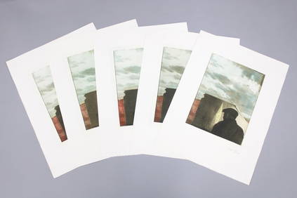
Signed Lot of 5 Joseph Cornell Prints, 'Untitled (Landscape with Figure)'PUBLIC SALE4.7(226)See Sold PriceMar 02, 2024
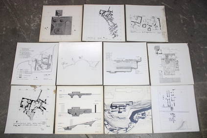
Set of 11 Mid Century Modern Architectural Plans & Site Map RenderingsPUBLIC SALE4.7(226)See Sold PriceMar 02, 2024
Late 18th century map of England and Wales sampler and two printsFellows4.3(159)See Sold PriceMar 05, 2024


![[MAP]. NICHOLLS, Sutton (1668-1729). An Epitome of Sr. Will... (1 of 1)](https://p1.liveauctioneers.com/928/318880/171361281_1_x.jpg?height=282&quality=70&version=1707501302)