SoldMap showing Alaska gold fields 1905Heading: (Alaska) Author: Title: Map of Alaska showing the route of the Alaska Central Railway, with proposed branches; also, water connections with Seattle, Portland, San Francisco, Honolulu, and thSee Sold Price
Map showing Alaska gold fields 1905Heading: (Alaska) Author: Title: Map of Alaska showing the route of the Alaska Central Railway, with proposed branches; also, water connections with Seattle, Portland, San Francisco, Honolulu, and thSee Sold Price
Sold1897 Klondike Gold Rush MapScarce colored folded map 16 x 22 inches with full title ‘Map of Alaska & Surroundings, Showing the Klondike Gold Field, and Routes to the Mining Camp’. This map of all of Alaska, is undaSee Sold Price
SoldMap Of Alaska with guide to gold fields, 1898Title: Map Of Alaska Showing Known Gold-Bearing Rocks with Descriptive Text Containing Sketches of the Geography, Geology, and Gold Deposits and Routes to the Gold Fields Author:** Description:44 pp.See Sold Price
SoldMap of Alaska showing known gold bearing rocks withMap of Alaska showing known gold-bearing rocks with descriptive text containing sketches of the geography, geology, and gold depositis and routes to the gold fields., comp. by Samuel Franklin Emmons.See Sold Price
SoldAlaska Ephemera Lot #12Alaska Ephemera Lot #12: Map of Alaska Showing Known Gold-Bearing Rocks with Descriptive Text Containing Sketches of Geography, Geology, and Routes to the Gold Fields, U.S. Geological Survey, Emmons SSee Sold Price
SoldMap Of Alaska Showing Known Gold-Bearing Rocks wiAuthor: ** Description: 44 pp. Large folding color map. 9¼x5¾, original printed wrappers. The bright color map, "The Gold and Coal Fields of Alaska," 60x72.5 cm., shows all of Alaska and adjacent goSee Sold Price
SoldMap of Alaskan Gold Rush[Map of Alaskan Gold Rush], Map of Alaska Showing Known Gold-Bearing Rocks with Descriptive Text Containing the Sketches of the Geography, Geology, and the Gold Deposits and Routes to the Fields, WashSee Sold Price
SoldMap of Alaskan Gold Rush, 1898[Map of Alaskan Gold Rush], Map of Alaska Showing Known Gold-Bearing Rocks with Descriptive Text Containing the Sketches of the Geography, Geology, and the Gold Deposits and Routes to the Fields, WashSee Sold Price
Sold(lot of 2) Pacific Northwest and Alaska map group,(lot of 2) Pacific Northwest and Alaska map group, consisting of a "Map Showing All Routes to the Gold Fields of the Far Northwest, Also Northern Limits of Forests And Cereals", together with a "Map oSee Sold Price
SoldMILLROY, J. J. Alaska and British ColumbiaYukon Gold Rush Map 50. [MAP]. MILLROY, J. J. Alaska and British Columbia Showing the Yukon, Cariboo, Cassiar, with a Portion of the Kootenay Gold Fields. Authorities Latest Reports & Surveys by tSee Sold Price
Rare German Pocket Map showing CA Gold FieldsRare German Pocket Map with Inset showing California Gold Fields 268. [MAP]. BEYERLEIN, Sigmund. Neueste Post- u. EisenbSee Sold Price
SoldMap of Alaska & Yukon Gold Fields #59348Cartography & color by Lithography by Crowell & Kirkpatrick. This map is of Alaska and part of British America, the Yukon Gold Fields and Routes by which they are reached. There is an inset of Table oSee Sold Price
Sold1897 MAP of ALASKA YUKON GOLD FIELD & ROUTE w BRITISH1897 MAP of ALASKA YUKON GOLD FIELD & ROUTE w BRITISH AMERICA, MINING MINE RUSH 1897 MAP of ALASKA YUKON GOLD FIELD & ROUTE w BRITISH AMERICA, MINING MINE RUSH Description 1897 Antique Alaska Gold RusSee Sold Price
SoldColton's 1849 Map of the US Showing CA Gold FieldsColton's 1849 Map of the U.S. Showing California Gold Fields Approx. 34 x 42 in. (sight) map, dissected and mounted on linen. Hand-colored with inset map of the Atlantic Ocean with a number of shipsSee Sold Price
AUSTRALIA. no Queensland (est 1859). Showing Goldfields. TALLIS/RAPKIN 1851 mapTitle: AUSTRALIA. no Queensland (est 1859). Showing Goldfields. TALLIS/RAPKIN 1851 map Description: Australia' by Map drawn and engraved by J. Rapkin; vignette illustrations drawn by J Marchant & engrSee Sold Price
AUSTRALIA. no Queensland (est 1859). Showing Goldfields. TALLIS/RAPKIN 1851 mapTitle: AUSTRALIA. no Queensland (est 1859). Showing Goldfields. TALLIS/RAPKIN 1851 map Description: Australia' by Map drawn and engraved by J. Rapkin; vignette illustrations drawn by J Marchant & engrSee Sold Price
SoldALASKA FOUR BOOKLETS BOUND VOL 1890'SALASKA, FOUR BOOKLETS BOUND IN ONE VOLUME. RE: ALASKA: INCLUDES "MAP OF ALASKA" SHOWING KNOWN GOLD BEARING ROCKS, WASHINGTON 1898. 44 PGS WITH LARGE FOLD OUT MAPS. "ALASKA HANDBOOK 84", WASHINGTON 189See Sold Price
SoldMap of Alaska with text 1898Heading: (Alaska) Author: [Emmons, S.F.] Title: Map Of Alaska Showing Known Gold-Bearing Rocks with Descriptive Text Containing Sketches of the Geography, Geology, and Gold Deposits and Routes to theSee Sold Price
Map of Alaska with text 1898Heading: Author: United States Geological Survey Title: Map of Alaska Showing Known Gold-Bearing Rocks with Descriptive Text Containing Sketches of the Geography, Geology, and Gold Deposits and RouteSee Sold Price
SoldMap of Alaska with text 1898Heading: Author: United States Geological Survey Title: Map of Alaska Showing Known Gold-Bearing Rocks with Descriptive Text Containing Sketches of the Geography, Geology, and Gold Deposits and RouteSee Sold Price
SoldMap of Alaska with text 1898Heading: Author: United States Geological Survey Title: Map of Alaska Showing Known Gold-Bearing Rocks with Descriptive Text Containing Sketches of the Geography, Geology, and Gold Deposits and RouteSee Sold Price
Soldblue print Map of Gold Fields of Alaska c.1900Title: Map of Gold Fields of Alaska Author: Colorado Blue Print Description: Blueprint map of Alaska. 56.3x86 cm. (22x33¾"), plus margins."For Sale by the Colorado Blue Print, 38 Good Block, Denver."See Sold Price
SoldVICTORIA OR PORT PHILIP showing goldfields. Australia.TITLE/CONTENT OF MAP: 'Victoria or Port Philip' Vignettes: Melbourne; River Glenelg, Victoria; Kangaroo; Aborigines. Counties are shown. DATE PRINTED: 1851 IMAGE SIZE: Approx 36.5 x 26.5cm, 14.5 x 10.See Sold Price
Lake Superior and Mississippi River RR 1869 Seven Percent Bonds Book/Report-1869JM Hobby Supply and Railroad Artifact Auctions4.4(127)See Sold PriceFeb 24, 2024
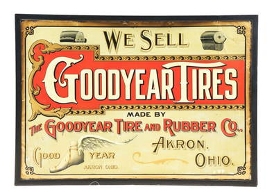
VERY RARE GOODYEAR TIRE & RUBBER COMPANY EMBOSSED TIN SIGN W/ WINGED FOOT GRAPHIC.Dan Morphy Auctions4.2(1.3k)See Sold PriceFeb 24, 2024
Pair of The Gateway to a Continent Books - Grand Central Zone and 1939 World's FairRail & Road Auctions4.6(165)See Sold PriceMar 07, 2024
Four White Pass & Yukon Route Playing Card DecksRail & Road Auctions4.6(165)See Sold PriceMar 08, 2024
Fred Harvey Railroad Souvenir Playing Cards - Indians and Train Smoke and Indians of the SouthwestRail & Road Auctions4.6(165)See Sold PriceMar 08, 2024
Old English by Towle Sterling Silver Pudding Spoon Gold Washed Fancy 10" ServingMynt AuctionsSee Sold PriceFeb 26, 2024
Lancaster by Gorham Sterling Silver Pickle Fork 3-Tine Gold Washed 5 3/4"Mynt AuctionsSee Sold PriceFeb 26, 2024
Richelieu by Tiffany and Co Sterling Silver Sorbet Spoon GW Ruffled Edge 5 1/2"Mynt Auctions4.6(697)See Sold PriceFeb 28, 2024
Louis XV by Whiting-Gorham Sterling Silver Berry Spoon Gold Washed 9" ServingMynt AuctionsSee Sold PriceFeb 28, 2024
Violet by Wallace Sterling Silver Berry Spoon Gold Washed Large 9" ServingBidhaus4.3(762)See Sold PriceFeb 29, 2024
Lily by Whiting Sterling Silver Cocktail Fork Gold Washed 5 7/8" SilverwareMynt AuctionsSee Sold PriceMar 01, 2024
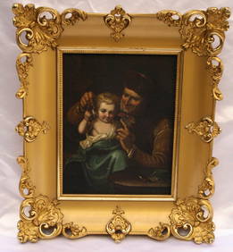
19C EUROPEAN OIL ON BOARD PAINTING WITH ORIGINAL GOLD LEAF FRAMEBidhaus4.3(762)See Sold PriceMar 01, 2024
WEST AFRICA I Explorers' routes Senegal Ashanti Ivory Gold Coast. SDUK 1851 mapJasper524.5(9.9k)See Sold PriceFeb 28, 2024