ATLAS of ANTIENT GEOGRAPHY by SAMUEL BUTLER 1843John McInnis Auctioneers,LLC4.6(504)See Sold PriceFeb 24, 2024
18TH C. ANTIQUE MAP: FRENCH & INDIAN WAR, FRAMEDThomaston Place Auction Galleries4.4(389)See Sold PriceFeb 24, 2024
Rand McNally Railroad Map Cabinet w/ 21 Railroad MapsRail & Road Auctions4.6(165)See Sold PriceMar 08, 2024
Keith Haring - Ink on New York Map, Best Buddies, Inscribed, Signed, and DatedSapphire Auction Gallery4.1(67)See Sold PriceMar 02, 2024
LATE 17TH C. FRENCH MAP OF THE NEW WORLD BY ALEXIS-HUBERT JAILLOT (1632-1712)Thomaston Place Auction Galleries4.4(389)See Sold PriceFeb 24, 2024
Central Railroad of New Jersey Map of Sandy Hook Route-ca. 1903JM Hobby Supply and Railroad Artifact Auctions4.4(126)See Sold PriceFeb 24, 2024
Lot of Six Mixed Atlas Box Cars-HO Scale-New in BoxJM Hobby Supply and Railroad Artifact Auctions4.4(126)See Sold PriceFeb 25, 2024
Rand McNally/Santa Fe Railroad Map of Iowa-1912JM Hobby Supply and Railroad Artifact Auctions4.4(126)See Sold PriceFeb 24, 2024
NICOLAES VISSCHER (NETHERLANDS, 1618-1709) MAP OF THE NEW WORLDThomaston Place Auction Galleries4.4(389)See Sold PriceFeb 24, 2024
17TH C. WORLD MAP BY NICOLAES VISSCHER (NETHERLANDS, 1618-1709)Thomaston Place Auction Galleries4.4(389)See Sold PriceFeb 24, 2024
Lot of Six Mixed Atlas Cabooses-HO Scale-New in BoxJM Hobby Supply and Railroad Artifact Auctions4.4(126)See Sold PriceFeb 25, 2024
SoldMap of Empire of Alexander in 1832. 1835.Print of hand colored steel engraving titled „Empire et marches D‘ Alexandre 1832“.Author C. V. Monin.Engraved by unknown.From the „Atlas Universel de Geography“ by C. V. Monin. Parsi. 1835.See Sold Price
Map of Empire of Alexander in 1832. 1835.Print of hand colored steel engraving titled Empire et marches D‘ Alexandre 1832“.Author C. V. Monin.Engraved by unknown.From the Atlas Universel de Geography“ by C. V. Monin. Parsi. 1835.AlexanSee Sold Price
Map of Roman Empire in 1832. 1835.Print of hand colored steel engraving titled Empire Romain 1832“.Author C. V. Monin.Engraved by unknown.From the Atlas Universel de Geography“ by C. V. Monin. Parsi. 1835.The Roman Empire was theSee Sold Price
Map of Roman Empire in 1832. 1835.Print of hand colored steel engraving titled „Empire Romain 1832“.Author C. V. Monin.Engraved by unknown.From the „Atlas Universel de Geography“ by C. V. Monin. Parsi. 1835.The Roman Empire waSee Sold Price
SoldEmpire of Alexander the Great Territory Map 1857Map Empire of Alexander the Great Territory (Egypt, Persia, Syria, Greece) 1857Engraving Long's Classical Atlas by Sherman & published by Blanchard & Lea, circa 1857. Dimensions: 10" x 13.5" Please noSee Sold Price
Map of Empire Of Alexander. Europe. 1854.Print of hand colored steel engraving titled „Empire D’Alexandre”.Drawn by L. Dussieux. Engraved by unknown.From „Atlas General De Geographie physique, politique et historique par L. Dussieux.See Sold Price
Sold1846 Quin Map of The Empire Of Alexander the Great --Title/Content of Map: 1846 Quin Map of The Empire Of Alexander the Great -- Fifth period : B.C. 323. The Empire Of Alexander Cartographer: E QuinDate: 1846, London Size: 13.2 X 20.3 in. This is a rareSee Sold Price
Sold1812 Map of the Empire of AlexanderThis finely engraved map depicts the empire of Alexander the Great when it was at its greatest. Extending from Greece and Macedonia to Punjab in India, and including Egypt and the entire eastern edgeSee Sold Price
SoldMap of the Empire of Alexander. 1854.Print of hand colored steel engraving titled „De L’Empire D’Alexandre“.Drawn by L. Dussieux.Engraved by unknown.From „Atlas General De Geographie physique, politique et historique par L. DusSee Sold Price
1846 Quin Map of The Empire Of Alexander the Great --Reserve Reduced! Map Title/Content: 1846 Quin Map of The Empire Of Alexander the Great -- Fifth period : B.C. 323. The Empire Of Alexander Cartographer: E Quin Year / Place: 1846, London Map DimensionSee Sold Price
SDUK: Antique Map of Empire of Japan, 1835Map: Empire of Japan Cartographer: Baldwin & Cradock; Society for the Diffusion of Useful Knowledge Place & Date: London / 1835 Size: 12 1/2" x 15 1/2" Condition: b&w; overall age-toning; small nick iSee Sold Price
1846 Quin Map of The Empire Of Alexander the Great --Title: 1846 Quin Map of The Empire Of Alexander the Great -- Fifth period : B.C. 323. The Empire Of Alexander Date: 1846, London Cartographer: E Quin Size: 13.2 X 20.3 in. Additional Information: ThisSee Sold Price
1846 Quin Map of The Empire Of Alexander the Great --Title/Content of Map: 1846 Quin Map of The Empire Of Alexander the Great -- Fifth period : B.C. 323. The Empire Of Alexander Date: 1846, London Cartographer: E Quin Size: 13.2 X 20.3 in. This is a rarSee Sold Price
Empire of JapanTitle/Content of Map: Empire of Japan Date Printed: 1835-12-01 Cartographer: WALKER, J. & C. Size: 15.3X12.25 After authorities Krusenstern and Kaempfer. Map of Japan showing topography, districts, baSee Sold Price
Map of the Empire of the Alexander the Great. 1830.Map of the The empire of Alexander the Great and expeditions. 1829.Print of steel engraving titled Alexandri magni imperium et expeditiones“.Author Fellx Delamarche.Engraved by unknown.From Atlas deSee Sold Price
SoldMap of the Empire of the Alexander the Great. 1830.Victor Lavasseur. Map of the Empire of the Alexander the Great. 1830.Print of hand colored steel engraving titled Empire D‘Alexandre“.Author Victor Lavasseur.Engraved by unknown.From Atlas classiqSee Sold Price
Denoyer-Geppert Breasted Ancient History MapFifth edition, 1923, top map B9 depicting Sequence Map of Greece, and bottom map B10 depicting Alexander's Empire. Attached to roll, 61" H x 43.75" W, bottom with staining and wear.See Sold Price
MAP, Mediterranean & Middle East, BrueEastern Mediterranean & Middle East. Adrien Hubert Brue, Carte de l'Empire d'Alexandre, 1822 (dated). Hand Color. This folio map focuses on the empire of Alexander the Great, from Greece and Turkey toSee Sold Price
EMPIRE OF ALEXANDER AND CYRUS MAP'SEMPIRE OF ALEXANDER, 5TH PERIOD 323 B.C. DATE OF THE MAP 1846. EMPIRE OF CYRUS, 4TH PERIOD. DATE PF THE MAP 1846See Sold Price
SoldImperia Antiqua, pars Orientalis. Empire of AlexanderTITLE/CONTENT OF MAP: 'Imperia Antiqua, pars Orientalis [The Empire of Alexander the Great, eastern part]' DATE PRINTED: 1789 IMAGE SIZE: Approx 36.5 x 25.5cm, 14.25 x 10 inches (Large); Please note tSee Sold Price
SoldImperia Antiqua, pars Media. Empire of Alexander theTITLE/CONTENT OF MAP: Imperia Antiqua, pars Media [The Empire of Alexander the Great, central part] DATE PRINTED: 1789 IMAGE SIZE: Approx 36.5 x 25.0cm, 14.5 x 9.75 inches (Large); Please note that thSee Sold Price
SoldJansson (Jan) Alexandri Magni Macedonis ExpeditioJansson (Jan) Alexandri Magni Macedonis Expeditio,map of Asia minor, depicting the empire of Alexander the Great, from Greece to India, with title cartouche surmounted by numerous soldiers, enSee Sold Price
Imperia Antiqua, pars Orientalis. Empire of AlexanderTITLE/CONTENT OF MAP: 'Imperia Antiqua, pars Orientalis [The Empire of Alexander the Great, eastern part]' DATE PRINTED: 1789 IMAGE SIZE: Approx 36.5 x 25.5cm, 14.25 x 10 inches (Large); Please note tSee Sold Price
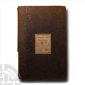
Numismatic Books - Whelan - The Numismatic Atlas of the Roman EmpireTimeLine Auctions Ltd.4.6(182)See Sold PriceMar 09, 2024
Numismatic Books - Whelan - The Numismatic Atlas of the Roman EmpireTimeLine Auctions Ltd.4.6(182)See Sold PriceMar 09, 2024
Sev.Alexander AD 222-235 ROMAN EMPIRE AE Sestertius NGC VF20Mynt Auctions4.6(689)See Sold PriceFeb 28, 2024
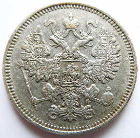
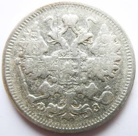
Russian Empire 15 Kopecks - Alexander II 1861 silver coinBazaar of Persia4.4(24)See Sold PriceFeb 24, 2024
Russian Empire 15 Kopecks - Alexander II / III / Nicholas II 1900 Silver coinBazaar of Persia4.4(24)See Sold PriceFeb 24, 2024
THE GREAT COURSES SERIES, ALEXANDER THE GREAT AND THE MACEDONIAN EMPIREThe Rug Life4.3(12)See Sold PriceMar 07, 2024
Mitchell - Map of the City of Washington (Washington, DC)Trillium Antique Prints & Rare Books4.5(30)See Sold PriceFeb 24, 2024
[6] Varied US Coinage (1832, 1835, 1836, 1851, 185Gold Standard Auctions4.5(779)See Sold PriceMar 10, 2024
EARLY COLONIAL WEST AFRICA. Empires of Sokoto Gando Mas.Tribes.Fellatah 1882 mapJasper524.5(9.8k)See Sold PriceFeb 28, 2024
West Africa. Sahara caravan routes. Tribes Kingdoms Empires. LIZARS 1842 mapJasper524.5(9.8k)See Sold PriceFeb 28, 2024
EARLY COLONIAL WEST AFRICA. Empires of Sokoto Gando Mas.Tribes.Fellatah 1886 mapJasper524.5(9.8k)See Sold PriceFeb 28, 2024
Blackie (Pub) 1882 Folio Map. Chinese Empire and JapanAlbion Auctions4.6(341)See Sold PriceMar 01, 2024
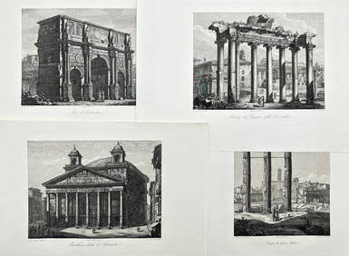
Domenico Amici - Set of 4 prints - Tempio di Giove Statore - Arco di Costantino in Rome, ItalyProverde Auctions4.3(3)See Sold PriceFeb 28, 2024


![[6] Varied US Coinage (1832, 1835, 1836, 1851, 185 (1 of 2)](https://p1.liveauctioneers.com/7261/319205/171835568_1_x.jpg?height=282&quality=70&version=1708530433)