ATLAS of ANTIENT GEOGRAPHY by SAMUEL BUTLER 1843John McInnis Auctioneers,LLC4.6(502)See Sold PriceFeb 24, 2024
18TH C. ANTIQUE MAP: FRENCH & INDIAN WAR, FRAMEDThomaston Place Auction Galleries4.4(386)See Sold PriceFeb 24, 2024
Rand McNally Railroad Map Cabinet w/ 21 Railroad MapsRail & Road Auctions4.6(165)See Sold PriceMar 08, 2024
Keith Haring - Ink on New York Map, Best Buddies, Inscribed, Signed, and DatedSapphire Auction Gallery4(67)See Sold PriceMar 02, 2024
LATE 17TH C. FRENCH MAP OF THE NEW WORLD BY ALEXIS-HUBERT JAILLOT (1632-1712)Thomaston Place Auction Galleries4.4(386)See Sold PriceFeb 24, 2024
Central Railroad of New Jersey Map of Sandy Hook Route-ca. 1903JM Hobby Supply and Railroad Artifact Auctions4.4(126)See Sold PriceFeb 24, 2024
Lot of Six Mixed Atlas Box Cars-HO Scale-New in BoxJM Hobby Supply and Railroad Artifact Auctions4.4(126)See Sold PriceFeb 25, 2024
Rand McNally/Santa Fe Railroad Map of Iowa-1912JM Hobby Supply and Railroad Artifact Auctions4.4(126)See Sold PriceFeb 24, 2024
NICOLAES VISSCHER (NETHERLANDS, 1618-1709) MAP OF THE NEW WORLDThomaston Place Auction Galleries4.4(386)See Sold PriceFeb 24, 2024
17TH C. WORLD MAP BY NICOLAES VISSCHER (NETHERLANDS, 1618-1709)Thomaston Place Auction Galleries4.4(386)See Sold PriceFeb 24, 2024
Lot of Six Mixed Atlas Cabooses-HO Scale-New in BoxJM Hobby Supply and Railroad Artifact Auctions4.4(126)See Sold PriceFeb 25, 2024
Map of Syria and Palestine. Print in 1850.Print of steel engraving titled „Carte de la Syrie et de la Palestine.Author A. Houze.Engraved by unknown.From the „Atlas Universel Historique et Geographique by A. Houze, Paris. 1850.Syria officiSee Sold Price
SoldMap of Palestine. Print in 1850.Print of steel engraving titled „Carte de la Palestine sous Constantin le Grand 33 apres J. C.“.Author A. Houze.Engraved by unknown.From the „Atlas Universel Historique et Geographique“ by A.See Sold Price
SoldOttoman Empire in Asia. Turkey, Iraq, Jordan, Syria,Title: Ottoman Empire in Asia. Turkey, Iraq, Jordan, Syria, Lebanon and Palestine. 1850 by Thomas. Date/Period: c1850. Materials: Hand colored steel engraved Size: 16 1/2 x 13 1/2 inches. c1850 by ThoSee Sold Price
Map of Egypt Palestine Syria and Phoenicia. Africa.1835Print of hand colored steel engraving titled Egypte Palestine Syria et Phoenicie“.Author C. V. Monin.Engraved by unknown.From the Atlas Universel de Geography“ by C. V. Monin. Parsi. 1835.Egypt ofSee Sold Price
SoldThe Inner Life of Syria, Palestine and the Holy LAuthor: Burton, Isabel Arundell 2 volumes. x, 376; [6], 340 pp.; errata slip. With 2 mounted carbon print frontispiece portraits from photographs; 2 chromolithographed plates; folding map (backed withSee Sold Price
SoldCollection of [5] Holy Land travelogues. 1852-1912Five travel books in Eretz Israel, the second half of the 19th century and the beginning of the 20th century. *Â Eight Years in Syria, Palestine and Asia Minor from 1842 to 1850. By F.A. Neale, sectSee Sold Price
Sold[Cartography] "Historical Map of Palestine"after J.T. Assheton (Philadelphia: Mitchell, c.1850) hand-colored lithograph, mounted on original linen backing and wooden rollers, 42 X 32 in.See Sold Price
SoldBartholomew, John 1922 Lot of 5 Maps Egypt & Holy LandIncl Egypt and The Nile, Lower Egypt, Asia Minor/Syria/Mesopotamia, Palestine and Persia. Large Lithograph Maps Published 1922 by The Times, London for "The Times Survey Atlas of the World" Maps by JoSee Sold Price
SoldBartholomew, John 1922 Lot of 3 Maps of the Holy Land"Asia Minor, Syria & Mesopotamia" "Palestine" and "Persia" Large Lithograph Maps Published 1922 by The Times, London for "The Times Survey Atlas of the World" Maps by John George Bartholomew of the EdSee Sold Price
Bartholomew, John 1922 Lot of 5 Maps Egypt & Holy LandIncl Egypt and The Nile, Lower Egypt, Asia Minor/Syria/Mesopotamia, Palestine and Persia. Large Lithograph Maps Published 1922 by The Times, London for "The Times Survey Atlas of the World" Maps by JoSee Sold Price
Bartholomew, John 1922 Lot of 4 Maps. Holy LandIncl Persia, Palestine, Asia Minor/Syria/Mesopotamia, and South Western Asia. Large Lithograph Maps Published 1922 by The Times, London for "The Times Survey Atlas of the World" Maps by John George BaSee Sold Price
Bartholomew, John 1922 Lot of 4 Maps. Holy LandIncl Persia, Palestine, Asia Minor/Syria/Mesopotamia, and South Western Asia. Large Lithograph Maps Published 1922 by The Times, London for "The Times Survey Atlas of the World" Maps by John George BaSee Sold Price
Bartholomew, John 1922 Lot of 4 Maps. Holy LandIncl Persia, Palestine, Asia Minor/Syria/Mesopotamia, and South Western Asia. Large Lithograph Maps Published 1922 by The Times, London for "The Times Survey Atlas of the World" Maps by John George BaSee Sold Price
Israel with inset of Jerusalem, 1850Israel with inset of Jerusalem (Palestine) by Mitchell, 1850 Original engraving by Samuel Augustus Mitchell from Mitchell’s Universal Atlas, 1850. Dimensions: 14 x 17 inchesSee Sold Price
Sold3 Hand Colored Maps of Syria, Palestine & Europe3 Hand Colored Maps of Syria, Palestine & Europe. Dimensions of Largest- Sight- L-15" x W-20", Frame- L- 20" x W-23.5".See Sold Price
SoldMap of Palestine, (Jerusalem), 1850Original engraving by DeSilver & Thomas Cowperthwait, circa 1850. Map features insets of Jerusalem. Dimensions: 13 3/4" x 17 1/4" No Reserve This item ships from Ocean View, DE.See Sold Price
SoldFRAMED 1850 PRINT MAP OF THE UNITED STATESFramed 1850 map of the United States by John Tallis & Company London and New York. Frame measures 18.5 by 14.5 by 1 inches, map measures 14 by 10.5 inches. Some wear to frame, overall in very good conSee Sold Price
Tallis: Map of Syria / Israel, 1850Map: 1850 Tallis Map of Syria / Israel -- Syria Cartographer: J. Tallis Year / Place: 1851 London Map Dimensions: 13 x 10 in. Condition: Very Good. Slight age toning on edges, and the center fold, asSee Sold Price
Tallis: Antique Map of Syria / Israel, 1850Map: 1850 Tallis Map of Syria / Israel -- Syria Cartographer: J. Tallis Year / Place: 1851 London Dimensions: 13 x 10 in. Condition: Very Good. Slight age toning on edges, and the center fold, as issuSee Sold Price
Tallis: Antique Map of Syria / Israel, 1850Title/Content of Map: 1850 Tallis Map of Syria / Israel -- Syria Date Printed: 1851 London Cartographer: J. Tallis Size: 13 x 10 in. This is an ornate and highly decorative map of Syria, filled with dSee Sold Price
1882 Map of Syria and PalestineTitle: 1882 Map of Syria and Palestine Author: Blackie Medium: Ink on Paper Dimensions: 22"X15" Description: Map of Syria and Palestine dated 1882. Part of the Comprehensive Atlas & Geography of the WSee Sold Price
1882 Map of Syria and PalestineAuthor: Blackie Title: 1882 Map of Syria and Palestine Medium: Ink on Paper Dimensions: 22"X15" Map of Syria and Palestine dated 1882. Part of the Comprehensive Atlas & Geography of the World. EngraveSee Sold Price
SoldJapanese Old mapJapanese old map / Japanese old map /Wood Block Print (1850~1910 ?) / very large / size 113 1/2" x 14 1/2"See Sold Price
1850 Map of PalestineAuthor: Cowperthwait Title: 1850 Map of Palestine Medium: Ink on Paper Dimensions: 14"x17.5" Map of Palestine dated 1850. Engraved by Thomas Cowperthwait. Key lower left. Inset of Jerusalem. Color codSee Sold Price
DAVID ROBERTS - Holy Land / Syria / Egypt etc. 3 x Folio Volumes 1849 Very RareLuis Porretta Fine Arts4.3(10)See Sold PriceMar 02, 2024
CLAUDE EDMOND DELBOS (1878-1949) Engraving Meadow Landscape ca1929Luis Porretta Fine Arts4.3(10)See Sold PriceMar 02, 2024
CLAUDE EDMOND DELBOS (1879-1949) Engraving Tree LandscapeLuis Porretta Fine Arts4.3(10)See Sold PriceMar 02, 2024
The Holy Land Tours - Hamburg American Line - 1911Levy Auction House4.3(11)See Sold PriceFeb 27, 2024
18 Booklets Collection - War Graves of Palestine - WWILevy Auction House4.3(11)See Sold PriceFeb 27, 2024
1886 Cities of BASHAN Holy Land SYRIA Palestine Israel Jerusalem History BibleSchilb Antiquarian Rare Books4.8(421)See Sold PriceMar 31, 2024
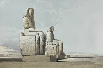
David Roberts - Obelisk of LuxorTrillium Antique Prints & Rare Books4.5(30)See Sold PriceFeb 24, 2024
David Roberts - Approach of the Simoom, Desert of GizehTrillium Antique Prints & Rare Books4.5(30)See Sold PriceFeb 24, 2024
Guinea-Bissau Cacheu town Fortaleza de São José da Amura Preparing cassava 1745Jasper524.5(9.8k)See Sold PriceFeb 28, 2024
Morocco Algeria. French & Spanish West Africa. Sahara sand dunes. TIMES 1956 mapJasper524.5(9.8k)See Sold PriceFeb 28, 2024
West African fruit. Kola nut. Guava fruit. Kalabash Calabash tree 1745 printJasper524.5(9.8k)See Sold PriceFeb 28, 2024
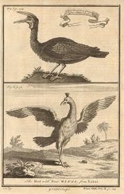
Gambian birds. Monoceros. A bird with four wings. CHILD 1745 old antique printJasper524.5(9.8k)See Sold PriceFeb 28, 2024
Bougainville's 1766 circumnavigation. France-Africa-Réunion. GENTS MAG 1774 mapJasper524.5(9.8k)See Sold PriceFeb 28, 2024
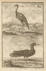
West African Birds. Crane Demoiselle. Alcatrazi or Mad-Bird. Albatross 1745Jasper524.5(9.8k)See Sold PriceFeb 28, 2024
Carte de L'Algérie et de la Régence de Tunis' ANDRIVEAU-GOUJON Algeria 1850 mapJasper524.5(9.8k)See Sold PriceFeb 28, 2024
Central Africa. Map showing great forest traversed by Mr Stanley, 1890Jasper524.5(9.8k)See Sold PriceFeb 28, 2024
ANCIENT NORTH AFRICA Septentrionalis. Mauretania Tripolitana ARROWSMITH 1828 mapJasper524.5(9.8k)See Sold PriceFeb 28, 2024
AFRICA. French North Africa and Morocco 1907 old antique map plan chartJasper524.5(9.8k)See Sold PriceFeb 28, 2024
Vintage Framed Cat Island Nautical Map PrintRapid Estate Liquidators and Auction Gallery4.5(1.1k)See Sold PriceFeb 25, 2024
Framed Tropical West Indies Map PrintRapid Estate Liquidators and Auction Gallery4.5(1.1k)See Sold PriceFeb 26, 2024


![Collection of [5] Holy Land travelogues. 1852-1912 (1 of 3)](https://p1.liveauctioneers.com/2398/102367/52339675_1_x.jpg?height=282&quality=70&version=1491682802)
![[Cartography] "Historical Map of Palestine" (1 of 3)](https://p1.liveauctioneers.com/523/57149/27994417_1_x.jpg?height=282&quality=70&version=1403205694)