SoldMaps of Africa by J.N. BellinTitle: Lot of 15 maps and charts of Africa Author:Bellin, Jacques Nicolas Description:Includes: Carte de la Rade de Benguela ... 20x28 cm. * Plan du Fort et de la Ville du Cap de Bonne Esperance. 20x2See Sold Price
Bellin: Antique Map of South Africa, 1740-70Title/Content of Map: South Africa by Bellin Date Printed: 1740-70's Cartographer: J.N. Bellin & J.F. La Harpe Material/Medium: Paper Size: 15" x 11" Copperplate engraved. Published in Paris. From theSee Sold Price
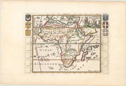
Antique Map of North Western Africa by BellinTitle/Content of Map: North Western Africa by Bellin Date Printed: 1740-70's Cartographer: J.N. Bellin & J.F. La Harpe Material/Medium: Paper Size: 14" x 9" Provenance: New York Copperplate engraved.See Sold Price
Bellin: Antique Map of Southern Africa HottentotsTitle/Content of Map: Southern Africa Hottentots by Bellin Date Printed: 1740-1770's Cartographer: J.N. Bellin & J. F. Harpe Material/Medium: Paper Size: 15 1/2" x 11" Copperplate engraved. PublishedSee Sold Price
SoldAntiuqe Map of Coastal Western Africa by BellinTitle/Content of Map: Coastal Western Africa by Bellin Date Printed: 1740-70's Cartographer: J.N. Bellin & J.F. La Harpe Material/Medium: Paper Size: 14" x 9" Provenance: New York From the 'Abrege deSee Sold Price
Bellin: Antique Map ot North Western Africa, 1740Title/Content of Map: North Western Africa by Bellin Date Printed: 1740-70's Cartographer: J.N. Bellin & J.F. La Harpe Material/Medium: Paper Size: 14" x 9" Copperplate engraved. Published in Paris. FSee Sold Price
Bellin: Antique Map of Southern Eastern Africa, 1740-70Title/Content of Map: Southern Eastern Africa coastline by Bellin Date Printed: 1740-70's Cartographer: J.N. Bellin & J.F. La Harpe Material/Medium: Paper Size: 9" x 12" Provenance: New York From theSee Sold Price
Map of Southern Eastern Africa coastline by BellinTitle/Content of Map: Southern Eastern Africa coastline by Bellin Date Printed: 1740-70's Cartographer: J.N. Bellin & J.F. La Harpe Material/Medium: Paper Size: 9" x 12" Provenance: New York CopperplaSee Sold Price
Antique Map of Coastal Western Africa by BellinTitle/Content of Map: Coastal Western Africa by Bellin Date Printed: 1740-70's Cartographer: J.N. Bellin & J.F. La Harpe Material/Medium: Paper Size: 14" x 9" Provenance: New York Copperplate engravedSee Sold Price
Bellin: Antique Map of South Eastern Africa CoastlineTitle/Content of Map: Southern Eastern Africa coastline by Bellin Date Printed: 1740's-70"s Cartographer: J.N. Bellin & J.F. La Harpe Material/Medium: Paper Size: 9" x 12" Copperplate engraved. PublisSee Sold Price
Antique Map of North Western Africa by BellinTitle/Content of Map: North Western Africa by Bellin Date Printed: 1740-70's Cartographer: J.N. Bellin & J.F. La Harpe Material/Medium: Paper Size: 12" x 9" Provenance: New York From the 'Abrege de L'See Sold Price
Bellin: Antique Map of Coastal Western Africa, 1740-70Title/Content of Map: Coastal Western Africa by Bellin Date Printed: 1740-70's Cartographer: J.N. Bellin& J.F. La Harpe Size: 14" x 9" Copperplate engraved. Published in Paris. From the 'Abrege de L'HSee Sold Price
Bellin: Antique Map of North Western Africa, 1740-70Title/Content of Map: North Western Africa by Bellin Date Printed: 1740-70's Cartographer: J.N. Bellin& J.F. La Harpe Size: 14" x 9" Copperplate engraved. Published in Paris. From the 'Abrege de L'HisSee Sold Price
Bellin: Map of Southern Eastern Africa CoastlineTitle/Content of Map: Southern Eastern Africa Coastline by Bellin Date Printed: 1740-70's Cartographer: J.N. Bellin& J.F. La Harpe Size: 9" x 12" Copperplate engraved. Published in Paris. From the 'AbSee Sold Price
Antiuqe Map of West Coast of Africa by BellinTitle/Content of Map: West Coast of Africa by Bellin Date Printed: 1740-70's Cartographer: J.N. Bellin & J.F. La Harpe Material/Medium: Paper Size: 12" x 11" Provenance: New York From the 'Abrege de LSee Sold Price
Map of Eastern Coast of Africa Somali Coast by BellinTitle/Content of Map: Eastern Coast of Africa Somali Coast by Bellin Date Printed: 1740-70's Cartographer: J.N. Bellin & J.F. La Harpe Material/Medium: Paper Size: 9" x 12" Provenance: New York CopperSee Sold Price
Bellin: Antique Map of West Coast of Africa, 1740-70Title/Content of Map: West Coast of Africa by Bellin Date Printed: 1740-70's Cartographer: J.N. Bellin & J.F. La Harpe Material/Medium: Paper Size: 12" x 11" Copperplate engraved. Published in Paris.See Sold Price
Bellin: Antique Map of West Coast of Africa, 1740-70Title/Content of Map: West Coast of Africa by Bellin Date Printed: c1740-70's Cartographer: J.N. Bellin & J. F. Harpe Material/Medium: Paper Size: 9" x 12 1/2" Copperplate engraved. Published in ParisSee Sold Price
Bellin: Antique Map of South Western Coast of AfricaTitle/Content of Map: South Western Coast of Africa Off St. Helena Date Printed: 1740-1770 Cartographer: J.N. Bellin & J. F. Harpe Material/Medium: Paper Size: 12" x 11" Copperplate engraved. PublisheSee Sold Price
Map of Eastern Coast of Africa Somali Coast by BellinTitle/Content of Map: Eastern Coast of Africa Somali Coast by Bellin Date Printed: 1740-70's Cartographer: J.N. Bellin & J.F. La Harpe Material/Medium: Paper Size: 9" x 13" Provenance: New York From tSee Sold Price
Antique Map of West Coast of Africa by BellinTitle/Content of Map: West Coast of Africa by Bellin Date Printed: c1740-70's Cartographer: J.N. Bellin & J.F. La Harpe Material/Medium: Paper Size: 12" x 11" Provenance: New York Copperplate engravedSee Sold Price
Bellin: Map of Eastern Coast of Africa. Somali CoastTitle/Content of Map: Eastern Coast of Africa. Somali Coast. By Bellin Date Printed: 1740-70's Cartographer: J.N. Bellin& J.F. La Harpe Material/Medium: Paper Size: 9" x 12" Copperplate engraved. PublSee Sold Price
Bellin: Antique Map of West Coast of Africa, 1740-70Title/Content of Map: West Coast of Africa by Bellin Date Printed: 1740-70's Cartographer: J.N. Bellin& J.F. La Harpe Size: 12" x 11" Copperplate engraved. Published in Paris. From the 'Abrege de L'HiSee Sold Price
Bellin: Antique Map of South Eastern Coast of AfricaTitle/Content of Map: Southern Eastern Coast of Africa by Bellin Date Printed: c 1740-70 Cartographer: J.N. Bellin & J. F. Harpe Material/Medium: Paper Size: 12" x 9" Copperplate engraved. Published iSee Sold Price
Coste Occidentale d’Afrique…' Arguin Bay Cap Blanc Mauritania. BELLIN 1746 mapJasper524.5(9.8k)See Sold PriceFeb 28, 2024
Partie de la Coste d'Afrique depuis Tanit…' Southern Mauritania BELLIN 1746 mapJasper524.5(9.8k)See Sold PriceFeb 28, 2024
Carte du Golfe de Guinée'. Gulf of Guinea. Nigeria & Cameroon. BELLIN 1747 mapJasper524.5(9.8k)See Sold PriceFeb 28, 2024
Coste Orientale d’Afrique…' South Africa. Mozambique channel. BELLIN 1746 mapJasper524.5(9.8k)See Sold PriceFeb 28, 2024
Plan du Portendic, appellé aussi…' Portendick Mauritania. BELLIN 1746 old mapJasper524.5(9.8k)See Sold PriceFeb 28, 2024
Coste Occidentale d’Afrique…' West Africa. Gulf of Guinea. BELLIN 1746 mapJasper524.5(9.8k)See Sold PriceFeb 28, 2024
Plan de la Baye & Isle d'Arguim'. Mauritania. Arguin island. BELLIN 1746 mapJasper524.5(9.8k)See Sold PriceFeb 28, 2024
Partie de la Coste de Guinée'. Sierra Leone & Liberia coast. BELLIN 1747 mapJasper524.5(9.8k)See Sold PriceFeb 28, 2024
Coste d’Afrique…' Guinea-Bissau & Bissagos archipelago. BELLIN 1746 old mapJasper524.5(9.8k)See Sold PriceFeb 28, 2024
Coste Orientale d’Afrique…' East Africa Kenya Tanzania Somalia. BELLIN 1746 mapJasper524.5(9.8k)See Sold PriceFeb 28, 2024
Rivières de Sanaga & Gambra'. Senegal Gambia rivers. Guinea. BELLIN 1746 mapJasper524.5(9.8k)See Sold PriceFeb 28, 2024
Plan de Fort d'Arguim'. Mauritania. Arguin fort. BELLIN 1746 old antique mapJasper524.5(9.8k)See Sold PriceFeb 28, 2024
Suite de la Coste de Guinée'. Ghana Togo Benin coast. Whidah. BELLIN 1747 mapJasper524.5(9.8k)See Sold PriceFeb 28, 2024
Coste Occidentale d’Afrique…' Namibia South Africa Angola coast BELLIN 1746 mapJasper524.5(9.8k)See Sold PriceFeb 28, 2024