SoldA Lithograph Map of Bermuda From 1616Framed behind glass a color lithographic map of various points, areas of text, overall 17.5"H X 22.5"W, circa early 20th century.See Sold Price
SoldMAP OF BERMUDA ISLANDS, 1902, HC LITHOGRAPHTitle: Driving and Cycling Map of the Bermuda Islands, Date: 1902, Medium: HC Lithograph, Paper size: 11 1/2 x 28, Inscribed: Publisher inentified within matrix, Condition: Good condition; folds.See Sold Price
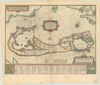
Hondius: Antique Map of West Indies Bermuda, 1600sMap: Mappa Aestiuarum Insularum alias Barmudas Cartographer: H. Hondius Date Printed: 1600's Material/Medium: ink on paper Size: 24 x 19 in It's dated 1616 in bottom center and 1622 at the very bottomSee Sold Price
SoldTallis: Map of Islands of the Atlantic, 1853Islands of the Atlantic - Bermuda, Canary & Azores by Tallis. Original lithograph by John Tallis & Company of London, c. 1853. Map features Azores, Madeira, Bermuda, Canary & Cape Verde Islands. VingnSee Sold Price
SoldBertius: Descriptio Americae Map, 1616Map: Descriptio Americae Maker: Petrus Bertius Date: 1616 Medium: Original handcolored copper plate engraving Size: 3.75 x 5.25 inches A remarkably accurate map of the Americas showing California attaSee Sold Price
SoldOffset Lithograph Map of Long IslandOffset Lithograph Decorative Map of Long Island, title in the lower right corner reads ‘A Map of Long Island’, to the left of the title text reads ‘Drawn by Courtland Smith, From Data compiled bSee Sold Price
SoldHand colored lithograph map, titled Magnae BritaHand colored lithograph map, titled Magnae Britannia by Henrici Hondij and dated 1631, 17'' x 21 1/2''.See Sold Price
SoldVintage Lithograph Map of IsraelVintage lithograph map of Israel, hand colored, map features major landmarks of both the current cities and biblical ones such as Gomorrah, brown wooden frame, measures 33.5 inches tall by 18.5 inchesSee Sold Price
SoldANTIQUE "KAUAI TERRITORY OF HAWAII" LITHOGRAPH MAP C.TRACED FROM GOV'T. SURVEY REG. MAP NO. 1395 BY HERBET E. NEWTON AUG. 1901 - JULIUS BIEN & CO. PHOTO. LITH. (1826 - 1909)See Sold Price
SoldTwo Florida Lithograph MapsMap of Florida. 2 Lithographed maps. Phildelphia: Thomas Cowperthwait & Co., 1850 (right). Unknown (left). 20 1/4 x 17 1/4 inches framed (right). 27 x 24 inches framed (left)See Sold Price
SoldVintage Lithograph Map of Odessa RussiaVintage map of Odessa Russia, map displays various points of interest with an index on the back with corresponding information to each number on the map, lithographic map, some wear and tear to edgesSee Sold Price
SoldGeorge Horatio Derby (1823-1861), lithograph mapGeorge Horatio Derby (1823-1861), lithograph map showing Sacramento City, "The Sacramento Valley from the American River to Battle Creek...", Surveyed and drawn by order of Genl Riley, Cammandg. 10See Sold Price
SoldVintage Lithograph Map of Odessa RussiaVintage map of Odessa Russia, map displays various points of interest with an index on the back with corresponding information to each number on the map, lithographic map, some wear and tear to edgesSee Sold Price
Jasper Johns Offset Lithograph MapMap After Jasper Johns, 1980 Unsigned Offset Lithograph. Paper size is 36.5 x 48 inches, with an image size of 24.25 x 38.5 inches. The Offset Lithograph is from an unknown edition size. and is not frSee Sold Price
SoldFlorida Lithograph MapU.S. Coast Survey Sketch F Showing the Progress of the Survey in Section V. A.D. Bache (1806-1867). Lithographed map. Washington, D.C., 1855. 23 x 16 1/2 inches visible, 27 1/4 x 21 1/2 inches framedSee Sold Price
SoldANTIQUE HAWAII HAWAIIAN ISLANDS LITHOGRAPH MAP AUGUSTTRACED BY F.L. LOWELL HAWAIIAN GOV. SURVEY AUGUST 1901 - "JULIUS BIEN & CO. PHOTO. LITH." (1826 - 1909)See Sold Price
SoldSamuel A. Mitchell Hand Colored Lithograph MapSamuel Augustus Mitchell, American (1792-1868). Hand colored lithograph of Mexico, Central America, West Indies, 1860. Mounted in silver tone wood frame and includes paperwork. Measures 20"H x 27.75"WSee Sold Price
SoldHAND-COLORED LITHOGRAPH MAP PUERTO DE ACAPULCOFramed hand-colored lithograph on paper, "Puerto de Acapulco En El Reino de La Nueva Espana En El Mar del sur" (Port of Acapulco, during the Viceroyalty of New Spain), after the original early 17th ceSee Sold Price
Sold1875 Currier & Ives lithograph map of Philadelphia1875 Currier & Ives lithograph map of Philadelphia, chromolithograph on paper, 22.75" x 34" sight, framed 30.75" x 41"See Sold Price
SoldLithograph Map, New York , James LyneUnframed hand colored lithograph map, ''A Plan of the City of New York from an Actual Survey,'' 19th century, after James Lyne, overall: 18''h x 23''wSee Sold Price
SoldCarl Flemming (1806-1878) Lithograph Map of TexasCarl Flemming (1806-1878) Lithograph Map of Texas, Glogau: Druck und Verlag von C. Flemming, 1842-1853, with hand-colored outline and two insets "(Plan der Galveston Bay" and "Eintheilung" [county legSee Sold Price
SoldLithograph, Map of South CarolinaPublished by John Reid, New York, 1796. Sight size: 15-1/2"h x 17-1/2"w Property from the Estate of Ralph & Roberta Carpenter.See Sold Price
Blackie (Pub) 1882 Folio Map. West USA - Pacific StatesAlbion Auctions4.7(341)See Sold PriceMar 01, 2024
Blackie (Pub) 1882 Folio Map. Chinese Empire and JapanAlbion Auctions4.7(341)See Sold PriceMar 01, 2024
Blackie (Pub) 1882 Folio Map. East Indies - Indian ArchipelagoAlbion Auctions4.7(341)See Sold PriceMar 01, 2024
Blackie (Pub) 1882 Folio Map. United States of North AmericaAlbion Auctions4.7(341)See Sold PriceMar 01, 2024
Blackie (Pub) 1882 Folio Map. West India Islands & Central AmericaAlbion Auctions4.7(341)See Sold PriceMar 01, 2024
Blackie (Pub) 1882 Folio Map. World on Mercators ProjectionAlbion Auctions4.7(341)See Sold PriceMar 01, 2024
Stanford, Edward 1901 Large Map. Geological Map of the British IslesAlbion Auctions4.7(341)See Sold PriceMar 01, 2024
Stanford, Edward 1901 Large Map. Hydrographical Map of the British IslesAlbion Auctions4.7(341)See Sold PriceMar 01, 2024
Stanford, Edward 1901 Large Map. Stereographical Map of The British IslesAlbion Auctions4.7(341)See Sold PriceMar 01, 2024
Perry, Matthew C. 1856 Large Map. Shah Bay, Lew Chew I. JapanAlbion Auctions4.7(341)See Sold PriceMar 01, 2024