ATLAS of ANTIENT GEOGRAPHY by SAMUEL BUTLER 1843John McInnis Auctioneers,LLC4.6(502)See Sold PriceFeb 24, 2024
18TH C. ANTIQUE MAP: FRENCH & INDIAN WAR, FRAMEDThomaston Place Auction Galleries4.4(386)See Sold PriceFeb 24, 2024
Rand McNally Railroad Map Cabinet w/ 21 Railroad MapsRail & Road Auctions4.6(165)See Sold PriceMar 08, 2024
Keith Haring - Ink on New York Map, Best Buddies, Inscribed, Signed, and DatedSapphire Auction Gallery4(67)See Sold PriceMar 02, 2024
LATE 17TH C. FRENCH MAP OF THE NEW WORLD BY ALEXIS-HUBERT JAILLOT (1632-1712)Thomaston Place Auction Galleries4.4(386)See Sold PriceFeb 24, 2024
Central Railroad of New Jersey Map of Sandy Hook Route-ca. 1903JM Hobby Supply and Railroad Artifact Auctions4.4(126)See Sold PriceFeb 24, 2024
Lot of Six Mixed Atlas Box Cars-HO Scale-New in BoxJM Hobby Supply and Railroad Artifact Auctions4.4(126)See Sold PriceFeb 25, 2024
Rand McNally/Santa Fe Railroad Map of Iowa-1912JM Hobby Supply and Railroad Artifact Auctions4.4(126)See Sold PriceFeb 24, 2024
NICOLAES VISSCHER (NETHERLANDS, 1618-1709) MAP OF THE NEW WORLDThomaston Place Auction Galleries4.4(386)See Sold PriceFeb 24, 2024
17TH C. WORLD MAP BY NICOLAES VISSCHER (NETHERLANDS, 1618-1709)Thomaston Place Auction Galleries4.4(386)See Sold PriceFeb 24, 2024
Lot of Six Mixed Atlas Cabooses-HO Scale-New in BoxJM Hobby Supply and Railroad Artifact Auctions4.4(126)See Sold PriceFeb 25, 2024
Map of the Russian Empire. ~1820.Print from steel engraving titled “RUSSIAN EMPIRE”. Drawn by Thomas Kelly. Engraver unknown.Published by Thomas Kelly, London circa 1820 in "Kelly's New System of Universal Geography".The RussianSee Sold Price
Map of the Russian Empire. ~1820.Print from steel engraving titled “RUSSIAN EMPIRE”. Drawn by Thomas Kelly. Engraver unknown.Published by Thomas Kelly, London circa 1820 in "Kelly's New System of Universal Geography".The RussianSee Sold Price
Sold~1820, “RUSSIAN EMPIRE”, Russia.Print from steel engraving titled “RUSSIAN EMPIRE”. Published by Thomas Kelly, London circa 1820 in "Kelly's New System of Universal Geography"A copper engraved antique map of the early 19th centuSee Sold Price
Mathew Carey's Map of the Russian Empire2nd Philadelphia edition, 1820 printed by Thomas Palmer 16" x 20 1/2" imageSee Sold Price
Mathew Carey's Map of the Russian Empire2nd Philadelphia edition, 1820 printed by Thomas Palmer 16" x 20 1/2" imageSee Sold Price
Geographical and Statistical Map of Russia, 1820Title/Content of Map: Geographical and Statistical Map of Russia. Date Printed: 1820 Cartographer: GROS, C. Size (inches): 13.25x12.25 "Map of the Russian Empire. intended for the elucidation of LavoiSee Sold Price
SoldGEOGRAPHICAL & STATISTICAL MAP OF RUSSIA 1820The Russian Empire after the fall of Napolean 1820 by M. Carey & Son, hand-colored map surrounded by statistical data. Sight size 16.5 x 21 inches, overall 26.75 x 29.See Sold Price
Map Russian Empire, 1799, antique"A New Map Of the Russian Empire", 1799, J. Cary, engraverSee Sold Price
SoldLAWRIE & WHITTLE : Antique Map - Russian EmpireLAURIE & WHITTLE - Published in London in 1794 - depicts Asiatic Part of Russian Empire_x000D_ In Original Colors - Many Details and Speculations_x000D_ Size: 18.4 x 25.1 inches _x000D_See Sold Price
LAWRIE & WHITTLE : Antique Map - Russian EmpireLAURIE & WHITTLE - Published in London in 1794 - depicts Asiatic Part of Russian Empire In Original Colors - Many Details and Speculations Size: 18.4 x 25.1 inchesSee Sold Price
1814 ANTIQUE MAP RUSSIAN EMPIRE 21 by 28"Size 21 by 28" Printed in London in 1814 by John Thomson & Co. Very good condition Reserve: $140.00 Shipping: Domestic: Flat-rate of $25.00 to anywhere within the contiguous U.S. International: ForeigSee Sold Price
1814 ANTIQUE MAP RUSSIAN EMPIRE 21 by 28"Size 21 by 28" Printed in London in 1814 by John Thomson & Co. Very good condition (553) PA residents please add sales tax. Reserve: $120.00 Shipping: Domestic: Flat-rate of $15.00 to anywhere withinSee Sold Price
1814 ANTIQUE MAP RUSSIAN EMPIRE 21 by 28"Size 21 by 28" Printed in London in 1814 by John Thomson & Co. Very good condition Reserve: $129.99 Shipping: Domestic: Flat-rate of $10.00 to anywhere within the contiguous U.S. International: ForeigSee Sold Price
1814 ANTIQUE MAP RUSSIAN EMPIRE 21 by 28"Size 21 by 28" Printed in London in 1814 by John Thomson & Co. Very good condition Reserve: $140.00 Shipping: Domestic: Flat-rate of $25.00 to anywhere within the contiguous U.S. International: ForeigSee Sold Price
1814 ANTIQUE MAP RUSSIAN EMPIRE 21 by 28"Size 21 by 28" Printed in London in 1814 by John Thomson & Co. Very good condition Reserve: $140.00 Shipping: Domestic: Flat-rate of $25.00 to anywhere within the contiguous U.S. International: ForeigSee Sold Price
SoldThomson: Map of Russian Empire in Asia & Europe, 1817Title/Content of Map: 'Russian Empire' Russia in Asia & Europe. Siberia Date Printed: 1817 Image Size: Approx 52.0 x 63.5cm, 20.5 x 25 inches (Large); Please note that this is a folding map. Type: AntSee Sold Price
SoldRussian Empire in Europe and Asia.Title/Content of Map: Russian Empire in Europe and Asia. Date: 1795 Size: 8.3Height - 10.8Width Attractive encyclopedia (?) map. Detailed. Polar projection. Reserve: $60.00 Shipping: Domestic: Flat-raSee Sold Price
Russian Empire 1890sTitle/Content of Map: Russian Empire 1890s Date Printed: 1890 Material/Medium: Lithograph Size: 25CM*32CM Provenance: Leipzig Academy of Literature Reserve: $120.00 Shipping: Domestic: Flat-rate of $3See Sold Price
Map of Russian Empire, Empire of Japan. 1904Title/Content of Map: Russian Empire, Empire of Japan and The Far East. Cartographer: HAMMOND, C. S. & CO. Size: 7.5X10.6 War Supplement. The Rochester Post. Saturday, February 27, 1904. Oval coloredSee Sold Price
Russian Empire, Empire of Japan and The Far East.Title/Content of Map: Russian Empire, Empire of Japan and The Far East. Date Printed: 1904 Cartographer: HAMMOND, C. S. & CO. Size: 7.5x10.6 War Supplement. The Rochester Post. Saturday, February 27,See Sold Price
Russian Empire in Europe and AsiaTitle/Content of Map: Russian Empire in Europe and Asia Date: 1795 Cartographer: BARKER, W. Publisher: MATHEW CAREY Size: 11.3Height - 15.75Width From: "The General Atlas for Carey's American editionSee Sold Price
Russian Empire in Europe and AsiaTitle/Content of Map: Russian Empire in Europe and Asia Date: 1795 Cartographer: BARKER, W. Size: 11.3x15.75 From: "The General Atlas for Carey's American edition of Guthrie's Geography improved." TheSee Sold Price
Russian Empire in Europe and Asia.Title/Content of Map: Russian Empire in Europe and Asia. Date: 1795 Cartographer: Size: 8.3x10.8 Attractive encyclopedia (?) map. Detailed. Polar projection. Please note that this lot has a confidentiSee Sold Price
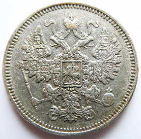
Russian Empire 15 Kopecks - Alexander II 1861 silver coinBazaar of Persia4.3(23)See Sold PriceFeb 24, 2024
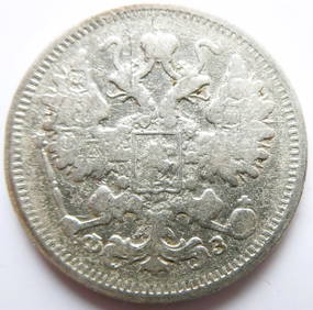
Russian Empire 15 Kopecks - Alexander II / III / Nicholas II 1900 Silver coinBazaar of Persia4.3(23)See Sold PriceFeb 24, 2024
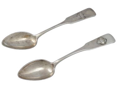
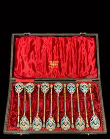
A Set Of Twelve Russian Empire Enamel Silver Spoons, Signed & BoxedFive Star Auctions4.2(3)See Sold PriceFeb 29, 2024
1816 MAP NORTHERN PART OF RUSSIA or MUSCOVY in EUROPE copper engraving ANTIQUEJasper524.5(9.8k)See Sold PriceFeb 27, 2024
ANTIQUE ILLUSTRATED HANDBOOK OF GEOGRAPHY AND TRAVEL IN ASIA, VOLUME 2, 1896NY Elizabeth 4.3(84)See Sold PriceMar 03, 2024
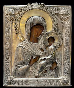
KUTUZOV MIKHAIL: (1745-1813)International Autograph Auctions Europe S.L.4.5(52)See Sold PriceMar 14, 2024
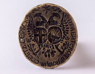
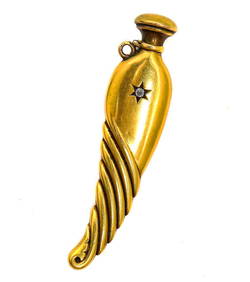
[Russian]. Enameled pendant "Double-headed eagle of Russian Empire", easter egg shaped. - Russia,ARTMAXIMUM4.3(4)See Sold PriceMar 14, 2024
[Russian]. Enameled pendant "Double-headed eagle of Russian Empire", easter egg shaped. - Russia,ARTMAXIMUM4.3(4)See Sold PriceMar 14, 2024
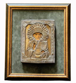
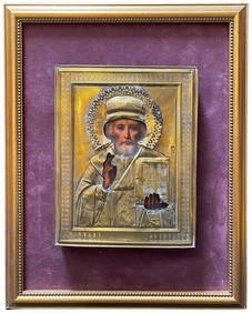
[Russian]. Ober, A.L. Iron figure "Kyrgyz with a pipe on a horse." - Russian Empire, Kasli, 1890. -ARTMAXIMUM4.3(4)See Sold PriceMar 14, 2024
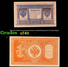
1912-1917 (1898 Issue) Imperial Russia 1 Ruble Banknote P# 1d, Sig. Shipov Grades xfKey Date Coins4.2(1.2k)See Sold PriceFeb 28, 2024


![[Russian]. Enameled pendant "Double-headed eagle of Russian Empire", easter egg shaped. - Russia, (1 of 5)](https://p1.liveauctioneers.com/6171/320219/172084110_1_x.jpg?height=282&quality=70&version=1708525949)
![[Russian]. Enameled pendant "Double-headed eagle of Russian Empire", easter egg shaped. - Russia, (1 of 4)](https://p1.liveauctioneers.com/6171/320219/172084112_1_x.jpg?height=282&quality=70&version=1708525949)
![[Russian]. Ober, A.L. Iron figure "Kyrgyz with a pipe on a horse." - Russian Empire, Kasli, 1890. - (1 of 4)](https://p1.liveauctioneers.com/6171/320219/172084128_1_x.jpg?height=282&quality=70&version=1708525949)