SoldDeutschland: A correct map ...- A correct map of the South East part of Germany (das Gebiet von Dresden bis Triest, von Ulm bis Krakau). Kupferstich mit zeitgenöss. kolorierter dekorativer Kartusche und zeitgenöss. Grenzkolorit.See Sold Price
Deutschland: A correct map of the South East part- A correct map of the South East part of Germany (das Gebiet von Dresden bis Triest, von Ulm bis Krakau). Kupferstich mit zeitgenöss. kolorierter dekorativer Kartusche und zeitgenöss. Grenzkolorit.See Sold Price
Deutschland/Österreich: verschiedene KartenDeutschland. A correct Map of the North West / of the South West part of Germany. 2 Kupferstiche, jeweils mit dekorativer Kartusche und Windrose. Je ca 35 x 43 cm. By Eman(uel) Bowen. Um 1740. AusgezeSee Sold Price
SoldDeutschland new and correct map: A new and correctDeutschland new and correct map - A New and Correct Map of the South West part of Germany ... Kupferstich mit zeitgenöss. kolorierter Waffen-Kartusche, kleiner Windrose und Meilenmesser sowie mit zeiSee Sold Price
SoldA New and Correct Map of the World, circa 1700sA New and Correct Map of the World : laid down according to the newest observations & discoveries in several different projections including the trade winds, monsoons, variation of the compass, and ilSee Sold Price
SoldHerman Moll 1654-1732), "A New And Correct Map of theHerman Moll 1654-1732), "A New And Correct Map of the World," 1710, hand colored, H. - 22 in., W. - 38 in.See Sold Price
T. Kitchen: A Correct Map of Europe, 1749Map: A Correct Map of Europe Maker: Thomas Kitchen Size: Tall Folio - 16.25 H x 19.50 W inches Published: London, 1749 Divided into its empires and kingdoms. Drawn from the most improved maps and charSee Sold Price
Correct Map of Island of Minorca by John Armstrong 1794Map Title: Correct Map of the Island of Minorca by John Armstrong Esqr. Engineer in Ordinary to his Majerty with many Additions and Improvements Artist: John Armstrong Publisher: Laurie & Whittle, No.See Sold Price
SoldElaborate ink and watercolor Correct Map of BucElaborate ink and watercolor Correct Map of Bucks County, ca. 1820, drawn at Mr. Murray's Boarding School by Armstrong I Flomerfelt, 12'' x 15''.See Sold Price
SoldMoll NEW AND CORRECT MAP OF THE WORLD C1730 CopperDetails: MOLL, Herman (1654-1732). A New and Correct Map of the World, Laid Down According to the Newest Discoveries, and From the Most Exact Observations. London: H. Moll, D. Midwinter, T. Bowles, PSee Sold Price
SoldEmanuel Bowen (1693-1767), "A Correct Map of UnitedEmanuel Bowen (1693-1767), "A Correct Map of United States of North America per Treaty of Bankes," 1784, hand colored, H.- 15 in., W.- 19 in.See Sold Price
SoldMoll - Correct Map of the Whole World, 1719Herman Moll (1654?-1732), cartographer and publisher A New & Correct Map of the Whole World Shewing y.e Situation of its Principal Parts. Viz the Oceans, Kingdoms, Rivers, Capes, Ports, Mountains, WooSee Sold Price
SoldCORRECT MAP OF THE SEAT OF WAR AND ADJACENT COUNTRY,CORRECT MAP OF THE SEAT OF WAR AND ADJACENT COUNTRY, COMPILED FROM THE BEST AUTHORITIES, EXTANT BY JOHN LATOURRETTE, NEW ORLEANS, RISSO LITHO, 1846, shows locations of the Mexican and American armiesSee Sold Price
SoldCharles Price (British, active 1680-1720) A Correct MapCharles Price (British, active 1680-1720) A Correct Map of Moscovy. Hand-colored engraving, 1711 38" x 25.25"See Sold Price
Sold2 Maps: Maryland + A Correct Map of Virginia.[United States/Virginia/Maryland]. 2 Maps. ++ Maryland. 11 ¼” x 16 ¾”. ++ A Correct Map Of Virginia. 12 7/8” x 19 1/8”. ++ From an edition of “Carey’s General Atlas,” [ca. 1814]. PhillSee Sold Price
SoldMAP. "A Correct Map of the City of Washington,Capital of the U.S.A." Engraved by W.I. Stone, circa 1820. Framed. From a New Haven, CT home. Dimensions: Map - 21.375" h x 16.25" w; framed - 28.875" h x 23.75" w.See Sold Price
SoldAN ANTIQUE PROMOTIONAL MAP, "Correct Map of Texas,"AN ANTIQUE PROMOTIONAL MAP, "Correct Map of Texas," DECEMBER 28, 1876-1880, newsprint on paper with hand coloring, advertising, "Homes in Texas! The Farmer, Mechanic, Merchant and Laborer should locatSee Sold Price
New and Correct Map of North America With the WestTitle/Content of Map: New and Correct Map of North America With the West India Islands, Cartographer: BOWEN, EMANUEL Date: 1763 ca. Publisher: ROBT. SAYER, opposite Fetter Lane Fleet Street Size: 20HeSee Sold Price
MAP. "A Correct Map of the City of Washington,Capital of the U.S.A." Engraved by W.I. Stone, circa 1820. Framed. From a New Haven, CT home. Dimensions: Map - 21.375" h x 16.25" w; framed - 28.875" h x 23.75" w.See Sold Price
1784 Bowen Map of Greater London -- A New & Correct MapTitle/ Content of Map: 1784 Bowen Map of Greater London -- A New & Correct Map of the Counties upwards of Twenty Miles Round London, Drawn from Modern Surveys and Engrav'd for Thornton's History of LoSee Sold Price
SoldSenex (John) A Correct Map of Spain and PortugalSenex (John) A Correct Map of Spain and Portugal,including Majorca and Minorca, decorative title cartouche lower right, engraved map with outline hand-colouring, on 2 sheets, joined, 920 x 640See Sold Price
SoldA Correct Map of the Seat of War in Mexico, 1847A Correct Map of the Seat of War in Mexico. Being a Copy of Genl. Arista's map, taken at Resaca de la Palma with additions and Corrections; Embellished with Diagrams of the Battles of 8th & 9th May, aSee Sold Price
Rollinson: A Correct Map Chart of the Baltic Sea, 1797Map: A Correct Chart of the Baltic Sea Maker: Spotswood and Nancrede, Rollinson Size: Octavo - 9.25 H x 7.30 W Inches Published: Boston, 1797 "Engraved for Malhams Naval Gazetteer. Rollinson sculpt. NSee Sold Price
Correct Map of the 'Burlington Route' B & M RR in Neb.Reserve Reduced! Title/Content of Map: Correct Map of the 'Burlington Route' B & M RR in Neb. and Connecting Lines Date: 1888 Cartographer: RAND, MCNALLY & CO. Publisher: RAND, MCNALLY & CO. Size: 13.See Sold Price
Central Railroad of New Jersey Map of Sandy Hook Route-ca. 1903JM Hobby Supply and Railroad Artifact Auctions4.4(126)See Sold PriceFeb 24, 2024
Rand McNally/Santa Fe Railroad Map of Iowa-1912JM Hobby Supply and Railroad Artifact Auctions4.4(126)See Sold PriceFeb 24, 2024
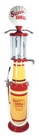
OUTSTANDING CORRECT MEASURE MODEL #10 VISIBLE GAS PUMP RESTORED IN SUPER SHELL GASOLINE.Dan Morphy Auctions4.2(1.3k)See Sold PriceFeb 24, 2024
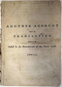
EARL of CHATHAM Scandal Sheet Debate Book c1778 by Dr AddingtonLuis Porretta Fine Arts4.3(10)See Sold PriceMar 02, 2024
WILLIAM LOVETT Social & Political Morality c1853 1st EditionLuis Porretta Fine Arts4.3(10)See Sold PriceMar 02, 2024
17TH C. WORLD MAP BY NICOLAES VISSCHER (NETHERLANDS, 1618-1709)Thomaston Place Auction Galleries4.4(386)See Sold PriceFeb 24, 2024
LATE 17TH C. FRENCH MAP OF THE NEW WORLD BY ALEXIS-HUBERT JAILLOT (1632-1712)Thomaston Place Auction Galleries4.4(386)See Sold PriceFeb 24, 2024
18TH C. ANTIQUE MAP: FRENCH & INDIAN WAR, FRAMEDThomaston Place Auction Galleries4.4(386)See Sold PriceFeb 24, 2024
NICOLAES VISSCHER (NETHERLANDS, 1618-1709) MAP OF THE NEW WORLDThomaston Place Auction Galleries4.4(386)See Sold PriceFeb 24, 2024
OGILVY & BOWEN c1736 Original Map of Oxfordshire Berkshire Etc.Luis Porretta Fine Arts4.3(10)See Sold PriceMar 02, 2024
Portfolio of 15 County Maps by Robert Morden (English 1650-1703)Nadeau's Auction Gallery4.7(398)See Sold PriceFeb 24, 2024
Keith Haring - Ink on New York Map, Best Buddies, Inscribed, Signed, and DatedSapphire Auction Gallery3.9(67)See Sold PriceMar 02, 2024
Rand McNally Railroad Map Cabinet w/ 21 Railroad MapsRail & Road Auctions4.6(165)See Sold PriceMar 08, 2024
Putnam - First Map of the State of Ohio by Rufus PutnamTrillium Antique Prints & Rare Books4.5(28)See Sold PriceFeb 24, 2024
New and Correct Map of North America With the West India Islands,Jasper524.5(9.7k)See Sold PriceFeb 27, 2024