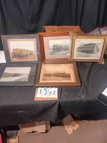
Five Framed Maps, Bohemia & MoraviaFive framed maps comprising four maps of Bohemia by Johann Baptiste Homann (German, 1664-1724) and one of Moravia by Johann Amos Comenius (German, 1592-1670). Sight size: 15" high, 20" wide to 19 1/4"See Sold Price
SoldFive Framed Maps of MoraviaFive framed maps of Moravia, four by Johann Baptiste Homann, (German, 1664-1724), and one by Hendrik Hondius dated 1627. Sight size: 13 1/2" high, 17" wide to 33" high, 23" wide, frame size: 18 1/2" hSee Sold Price
5 framed mapsFive framed maps A New Pocket Plan of London Westminster and Southwark" (stain), La Sicile" (loss), Sate of New York", Windward Islands", North Amerikca"See Sold Price
Five Miscellaneous Framed Maps, 19th century, inclFive Miscellaneous Framed Maps, 19th century, including maps of Palestine, West Africa, North America, and Africa (2).See Sold Price
Five Miscellaneous Framed Maps, 19th century, incluFive Miscellaneous Framed Maps, 19th century, including maps of Palestine, West Africa, North America, and Africa (2).See Sold Price
Map of Bohemia, Moravia, Silesia, Lussatia, With GreatPublication Date: 1756-12-01 Title: Map of Bohemia, Moravia, Silesia, Lussatia, With Great Part of Saxony and Brandenburg; Shewing the Present Seat Of War, in Germany Cartographer: ANONYMOUS PublisherSee Sold Price
Antique Map of Bohemia, Moravia, Silesia, Lussatia 1756Title/Content of Map: Map of Bohemia, Moravia, Silesia, Lussatia, With Great Part of Saxony and Brandenburg; Shewing the Present Seat Of War, in Germany Date Printed: 1756-12-01 Cartographer: ANONYMOUSee Sold Price
c. 1690 map of Bohemia, Moravia, and Lusatia by Nic. 1690 map of Bohemia, Moravia, and Lusatia by Nicolao Visscher. App. 24 1/4" X 20 3/4"See Sold Price
SoldENGLISH ENGRAVED MAP OF BOHEMIA & MORAVIAAN ENGLISH ENGRAVED MAP OF BOHEMIA AND MORAVIA 1801, engraved by John Cary and hand colored. 18.25 X 20.25 inches.See Sold Price
Map of Bohemia, Moravia, Silesia, Lussatia, With GreatTitle: Map of Bohemia, Moravia, Silesia, Lussatia, With Great Part of Saxony and Brandenburg; Shewing the Present Seat Of War, in Germany Cartographer: ANONYMOUS Publication Date: 1756-12-01 PublisherSee Sold Price
SoldVintage Map of MoraviaVintage Framed Moravia Map. Moravia Marchionatus Moraviae, Hondius Family. Frame approx. 22.75 n. H x 28 in. W. Visible approx. 15.5 in. H x 21.25 in. W.See Sold Price
Map of Bohemia, Seat Of War, in Germany, 1756Map: A Map of Bohemia, Moravia, Silesia, Lussatia, With Great Part of Saxony and Brandenburg; Shewing the Present Seat Of War, in Germany Publication Date: 1756-12-01 Maker: GENTLEMEN'S MAGAZINE, ANONSee Sold Price
Ogilby, John (Scottish/British 1600-1676) Strip mapsA Set of five framed strip maps from the Britannia series of 100, first published in 1675. Included in this lot: No. 5. The Road from London to Barwick No. 10. The Road from London to Bristol No. 35.See Sold Price
Ogilby, John (Scottish/British 1600-1676) Strip mapsA set of five framed strip maps from the Britannia series of 100, first published in 1675. Included in this lot: No. 5. The Road from London to Barwick No. 10. The Road from London to Bristol No. 35.See Sold Price
Vintage Map of Moravia Marchionatus Moraviae HondiusVintage Framed Moravia Map. Moravia Marchionatus Moraviae, Hondius Family.See Sold Price
Ogilby, John (Scottish/British 1600-1676) Strip mapsA set of five framed strip maps from the Britannia series of 100, first published in 1675. Included in this lot: No. 5. The Road from London to Barwick No. 10. The Road from London to Bristol No. 35.See Sold Price
Framed Colored Map Of Bohemia.This lot consists of a colored framed map of Bohemia. It is dated 1886. On the upper left corner there is a seal with text surrounding it: "Handkarte Des Konigreiches Bohmen." Keys are found on the loSee Sold Price
SoldSet of five framed Cary's Atlas maps including ChinaSet of five framed Cary's Atlas maps including China Great Provinces, German, Russian Empire in Europe and Asia, Europe, and Asia, all framed and matted. 13 1/2" x 15 1/2" to 16" x 18 1/2" ProvenanceSee Sold Price
SoldSet of five framed Carey's Atlas maps including HollandSet of five framed Carey's Atlas maps including Holland or the Seven United Provinces and the Netherlands, Scotland with the Principal Roads, England and Wales, Ireland, and Africa, all framed and matSee Sold Price
SoldGroup of five J.H. Colton framed maps to includeGroup of five J.H. Colton framed maps to include Vermont, New hampshire, Maine, Ohio, Hawaii.sight sizes 14" x 17" - 16.5" x 14". Provenance: Property from the Credit Suisse Americana CollectionSee Sold Price
SoldFive framed Dutchess County maps, probably from BeersFive framed Dutchess County maps, probably from Beers Atlas, 1860's. Including Dover Plains, Union Vale, Pleasant Valley, Amenia, Channingville. All with newer cherry frames in excellent condition.See Sold Price
Framed Colored Map Of Bohemia.Dated 1886. Framed under glass. Excellent Framed: 17'' x 14-1/4''.See Sold Price
A new map of Bohemia and Moravia from the latest"A new map of Bohemia and Moravia from the latest authorities. kol. Kupferstichkarte. Gestochen von John Cary. London J. Cary engraver & map seller No. 181 Strand 1801. Mae ca. 50 x 58 cm (in der PlatSee Sold Price
SoldAntique Folio of Map--Royaume De BohemeDescription: Very old double page folio copy of antique map--Chorographie du Royaume De Boheme. Decorative and detailed map shows Bohemia, Silesia, Moravia and Lusatia, parts of today's Czech RepublicSee Sold Price
Kilburg Geochron Lighted Scrolling Framed MapNadeau's Auction Gallery4.7(410)See Sold PriceFeb 24, 2024
1855 Map of New York & Erie Railroad and 1917 Trespassing On Railway Property Is A MisdemeanorRail & Road Auctions4.6(165)See Sold PriceMar 07, 2024
Five Framed Railroad Locomotive Art Prints and Original Painting - CNJ, Susquehanna, Texas &Rail & Road Auctions4.6(165)See Sold PriceMar 07, 2024
1867 Map of the Railroads of The State of New YorkRail & Road Auctions4.6(165)See Sold PriceMar 08, 2024
Vintage Framed Pine Island & Lacoste Island MapThe Benefit Shop Foundation Inc.4.3(3k)See Sold PriceMar 06, 2024
1940 Prague Bohemia Moravia First Day Souvenir Cover Postal Stamp CentenaryMynt Auctions4.6(711)See Sold PriceFeb 26, 2024
1941 Iglau Bohemia Moravia Germany Picture Postcard Cover Mother's DayMynt Auctions4.6(711)See Sold PriceFeb 26, 2024
Two (2) Antique 18th C. Copper Engraved Framed Maps - America & EuropeMagnusson Art Group4.5(53)See Sold PriceMar 14, 2024
1940 Pardubitz Bohemia Moravia First Day Cover Postal Stamp CentenaryMynt Auctions4.6(711)See Sold PriceMar 01, 2024
Framed Vintage Map Of Le Port Au Prince In The Island Of Santo DomingoRapid Estate Liquidators and Auction Gallery4.5(1.1k)See Sold PriceMar 01, 2024
Framed Five Millionth Nautical Mile Queen Elizabeth 2 ShipRapid Estate Liquidators and Auction Gallery4.5(1.1k)See Sold PriceMar 01, 2024
Vintage 1920s Rand McNally Auto Trails MapThe Benefit Shop Foundation Inc.4.3(3k)See Sold PriceMar 20, 2024
5 Framed Pages from Musee des Anciens Costumes.Direct Auction Galleries 4.7(339)See Sold PriceFeb 24, 2024