Sold1 piece. Hand-Colored Lithographic Map. Reed, Joh1 piece. Hand-Colored Lithographic Map. Reed, John. Map of The City of Liberties of Philadelphia." Philadelphia: Charles L. Warner, 1870. 30 x 59 inches; 762 x 1498 mm, linen-backed; chipping along edSee Sold Price
Sold1 piece. Hand-Colored Lithographic Map. Mitchell,1 piece. Hand-Colored Lithographic Map. Mitchell, Samuel Augustus. A New Map of Texas, Oregon and California, With the Regions Adjoining." Philadelphia, 1846. 22 1/4 x 20 1/2 inches; 562 x 520 mm, pluSee Sold Price
Sold1 piece. Hand-Colored Lithographic Map. Map of Th1 piece. Hand-Colored Lithographic Map. Map of The State of Florida, Showing the Progress of Survey Accompanying annual Report of the Surveyor General for 1857." [Washington]: (Sen. Ex. Doc. No. II &See Sold Price
Sold1 piece. Hand-Colored Lithographic Map. G.W. & C.1 piece. Hand-Colored Lithographic Map. G.W. & C.B. Calton & Co. Map of the State of Florida. New York, 1882. Approx. 26 x 27 inches; 660 x 685 mm. Some creasing & occasional minor spotting & soiling.See Sold Price
Sold1 piece. Hand-Colored Lithographic Map. Johnson,1 piece. Hand-Colored Lithographic Map. Johnson, publisher. Johnson's Pennsylvania and New Jersey." New York, 1864. 17 1/2 x 24 1/2 inches; 445 x 622 mm. Some darkening & staining at lower corners. FrSee Sold Price
Sold(Hand-Colored Lithographic Map.) "Plan1 piece. (Hand-Colored Lithographic Map.) "Plan of Chelten Hills, Cheltenham Township, Montgomery County, Penn." Philadelphia, 1854. Surveyed by Sidney & Neff. 25 x 25 inches, linen-backed; some stainSee Sold Price
Sold1 piece. Hand-Colored Engraved Map. Morrison, Joh1 piece. Hand-Colored Engraved Map. Morrison, John; [Melish, John?] Map of Huntingdon County, Constructed by Virtue of an Act of The Legislature Passed 19th March, 1816." N.p., n.d. [ca. 1820?] 20 1/2See Sold Price
Sold1 piece. Colton, J.H., pub. Colton's Railroad & T1 piece. Colton, J.H., pub. Colton's Railroad & Township Map of the State of New York." New York, 1865. Hand-colored lithographic map, 26 x 28 inches. Tears along folds but complete. In orig. red clotSee Sold Price
Sold1 piece. Hand-Colored Map. Ortelius, Abraham. Des1 piece. Hand-Colored Map. Ortelius, Abraham. Descriptio Peregrinationis D. Pauli Apostoli." [Antwerp], [ca. 1650]. 14 1/2 x 20 1/4 inches; 368 x 514 mm. Clean. Framed."See Sold Price
Sold1 piece. Hand Colored Engraved Map. Jansson, Jan1 piece. Hand Colored Engraved Map. Jansson, Jan. "Tabula Italia." Amsterdam, 1640. 18 x 21 1/4 inches; 457 x 540 mm. Margins repaired, small vertical tear at upper right edge. Vignette borders.See Sold Price
Sold1 piece. Hand-Colored Engraved Map. Moll, Herman.1 piece. Hand-Colored Engraved Map. Moll, Herman. A New and Exact Map of the Dominions of the King of Great Britain on Ye Continent of North America..." (London), 1715 [but 1755]. 24 x 40 inches; 610See Sold Price
Sold1 piece. Hand-Colored Engraved Map. Speed, John.1 piece. Hand-Colored Engraved Map. Speed, John. The Kingdom of Scotland." (London): Sudbury & Humble, 1610. 15 x 20 1/8 inches; 390 x 511 mm. Old (orig.?) color. Moderately age toned, margins occasioSee Sold Price
Sold1 piece. Hand-Colored Engraved Map. Chatelain, Hen1 piece. Hand-Colored Engraved Map. Chatelain, Henri Abraham. Carte tres Curieuse de la Mer du Sud." [Amsterdam], [ca. 1719]. 32 3/4 x 56 1/2 inches; 832 x 1435 mm, in 4 joined sheets mounted to bd. OSee Sold Price
Sold1 piece. Hand-Colored Engraved Map. A Map of Penn1 piece. Hand-Colored Engraved Map. A Map of Pennsylvania Exhibiting not only the Improved Parts of That Province,... Chiefly from the Late Map of W. Scull... La Pensilvanie en Trois Feuilles..." [ParSee Sold Price
Sold1 piece. Hand-Colored Engraved Map. De1 piece. Hand-Colored Engraved Map. Delisle, Guillaume. "L'Amerique Septentrionalis." Amsterdam: Covens and Mortier, [1730]. 18 7/8 x 22 7/8 inches; 480 x 580 mm, full margins. Old outline color, cartSee Sold Price
Sold1 piece. Hand-Colored Fold. Map. Colton, J.H., pu1 piece. Hand-Colored Fold. Map. Colton, J.H., pub. Nebraska and Kansas." New York, 1854. 29 x 22 inches (736 x 559 mm). Hand-colored vignettes. In orig. gilt-lettered brown cloth casing. A few smallSee Sold Price
Sold1 piece. Hand-Colored Woodcut Map. Muenster, Seba1 piece. Hand-Colored Woodcut Map. Muenster, Sebastian. [Nova Insulae] Tavola dell'isole nuove,..." [Basel or Cologne], [1558-1575]. 10 3/8 x 12 3/8 inches; 263 x 340 mm - map & title, margins. GeneraSee Sold Price
Sold1 piece. Hand-Colored Engraved Map. San1 piece. Hand-Colored Engraved Map. Sanson d'Abbeville, Nicolas. "Amerique Septentrionale." Paris: Pierre Mariette, 1669. 15 5/8 x 22 inches; 395 x 560 mm, margins. Small area of dampstaining in top cSee Sold Price
Sold1 piece. Hand-Colored Engraved Map. Montanus, Arno1 piece. Hand-Colored Engraved Map. Montanus, Arnold; Ogilby, John. Insulae Americanae in oceano Septentrionali, cum Terris adiacentibus." [London], [1671]. 11 1/4 x 14 1/4 inches; 285 x 362 mm, fullSee Sold Price
Sold1 piece. Hand-Colored Engraved Map. Speed, John.1 piece. Hand-Colored Engraved Map. Speed, John. Kent." London: Thomas Basset & Richard Chiswell, [1647]. 15 x 19 1/2 inches; 380 x 500 mm. Orig. color. Clean & bright, with minor age toning."See Sold Price
Sold1 piece. Hand-Colored Engraved Map. Me1 piece. Hand-Colored Engraved Map. Mercator, Gerard. "Taurica Chersones... Nostra Aetata Przecopsca et Gazara dicitur." [Duisburg], [1602]. 12 3/8 x 15 3/4 inches; 315 x 400 mm, full (?) margins. LigSee Sold Price
Sold1 piece. Hand-Colored Engraved Map Fragment. Moll1 piece. Hand-Colored Engraved Map Fragment. Moll, Herman. [A New and Exact Map of the Dominions of the King."] London: Thomas & John Bowles, 1715 [but 1755]. 21 1/4 x 14 inches; 238 x 355 mm. Orig. oSee Sold Price
Sold1 piece. Hand-Colored Engraved Map. Visscher, Nic1 piece. Hand-Colored Engraved Map. Visscher, Nicholas. Insulae Americanae in Oceano Septentrionali." [Amsterdam], [1698]. 18 1/8 x 22 1/2 inches; 460 x 572 mm, narrow margins. Slightly toned, minor sSee Sold Price
Sold1 piece. Hand-Colored Engraved Map. Me1 piece. Hand-Colored Engraved Map. Mercator, Gerard. "Islandia" [Iceland]. [Duisburg], [1602]. 11 x 17 1/8 inches; 280 x 435 mm, full (?) margins. Light age toning & minor offsetting, minor fissure aSee Sold Price
18TH C. ANTIQUE MAP: FRENCH & INDIAN WAR, FRAMEDThomaston Place Auction Galleries4.4(386)See Sold PriceFeb 24, 2024
NICOLAES VISSCHER (NETHERLANDS, 1618-1709) MAP OF THE NEW WORLDThomaston Place Auction Galleries4.4(386)See Sold PriceFeb 24, 2024
Japanese Woodblock hand Colored c19150 6 x Floor PagodaLuis Porretta Fine Arts4.3(10)See Sold PriceMar 02, 2024
Japanese Woodblock Print Hand Colored Sealed Cheery BlossomLuis Porretta Fine Arts4.3(10)See Sold PriceMar 02, 2024
Japanese Woodblock c1950 Hand Colored Kegon Falls 10" x 7" SealedLuis Porretta Fine Arts4.3(10)See Sold PriceMar 02, 2024
Japanese Woodblock c1950 Valley Of Trees Hand Colored 10" x 7"Luis Porretta Fine Arts4.3(10)See Sold PriceMar 02, 2024
Early 1900's Railway Service Map, Illinois, Ohio, Indiana, Kentucky, TennesseeConnoisseur Auctions4(330)See Sold PriceFeb 24, 2024
Currier & Ives Colored Lithograph On the OwagoGlobal Auctions Company4.3(36)See Sold PriceMar 03, 2024
Honore Daumier France 1808 -1879 Lithograph A Respected CitizenGlobal Auctions Company4.3(36)See Sold PriceMar 03, 2024
An early Dutch hand colored engraving map by Georg Balthasar Probst (1732-1801)Ostantix Auctions4.3(9)See Sold PriceFeb 27, 2024
Hamilton - Engraving of a Painting from a Grecian Vase. 1Trillium Antique Prints & Rare Books4.5(28)See Sold PriceFeb 24, 2024
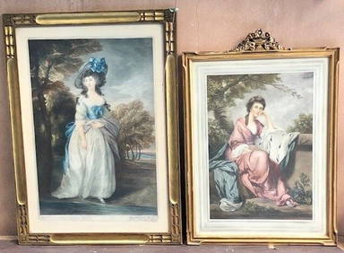
2 PIECES 19C ENGLISH COLORED ENGRAVINGS SIGNED WITH ORIGINAL HANCARVED FRAMESBidhaus4.4(738)See Sold PriceFeb 28, 2024
Two Hand-Colored 19th Century Maps of New Orleans and Louisiana, Larger- H.- 12 1/2 in., W.- 15 1/2Crescent City Auction Gallery4.3(229)See Sold PriceMar 08, 2024
1849 Orr & Co. Hand Colored Southern Germany MapMatthew Bullock Auctioneers4.7(1.8k)See Sold PriceMar 02, 2024
Hand Painted Navajo Native American Sand Wedding VaseRapid Estate Liquidators and Auction Gallery4.5(1.1k)See Sold PriceFeb 26, 2024