Sold1 piece. Hand-Colored Lithographic Map. G.W. & C.1 piece. Hand-Colored Lithographic Map. G.W. & C.B. Calton & Co. Map of the State of Florida. New York, 1882. Approx. 26 x 27 inches; 660 x 685 mm. Some creasing & occasional minor spotting & soiling.See Sold Price
Sold1 piece. Hand-Colored Lithographic Map. Mitchell,1 piece. Hand-Colored Lithographic Map. Mitchell, Samuel Augustus. A New Map of Texas, Oregon and California, With the Regions Adjoining." Philadelphia, 1846. 22 1/4 x 20 1/2 inches; 562 x 520 mm, pluSee Sold Price
Sold1 piece. Hand-Colored Lithographic Map. Map of Th1 piece. Hand-Colored Lithographic Map. Map of The State of Florida, Showing the Progress of Survey Accompanying annual Report of the Surveyor General for 1857." [Washington]: (Sen. Ex. Doc. No. II &See Sold Price
Sold1 piece. Hand-Colored Lithographic Map. Johnson,1 piece. Hand-Colored Lithographic Map. Johnson, publisher. Johnson's Pennsylvania and New Jersey." New York, 1864. 17 1/2 x 24 1/2 inches; 445 x 622 mm. Some darkening & staining at lower corners. FrSee Sold Price
Sold1 piece. Hand-Colored Engraved Map. Lotter, T(obi1 piece. Hand-Colored Engraved Map. Lotter, T(obias) C(onrad). Asia." Augsburg, ca. 1760. 19 x 23 inches; 482 x 584 mm. Slight stress at fold, very minor, very scattered foxing. Generally bright & attSee Sold Price
Sold1 piece. Colton, J.H., pub. Colton's Railroad & T1 piece. Colton, J.H., pub. Colton's Railroad & Township Map of the State of New York." New York, 1865. Hand-colored lithographic map, 26 x 28 inches. Tears along folds but complete. In orig. red clotSee Sold Price
Sold1 piece. Hand-Colored Engraved Map. Cary, John. A1 piece. Hand-Colored Engraved Map. Cary, John. A New Map of Part of The United States of North America Containing the Carolinas and Georgia, also The Floridas and Part of The Bahama Islands & C." LonSee Sold Price
Sold1 piece. Hand-Colored Engraved Map. Melish, John.1 piece. Hand-Colored Engraved Map. Melish, John. Northern Section of the United States including Canada & C." N.p., 1816. 21 1/4 x 15 1/2 inches; 540 x 393 mm. Occasional creasing."See Sold Price
Sold2 pieces. Hand-Colored Engraved Maps &2 pieces. Hand-Colored Engraved Maps & C: Sanson d'Abbeville, Nicolas (Guillaume - son). "Geographia Synodica..." Paris: Pierre Mariette, 1667. Hand-colored engraved map, 16 1/8 x 22 1/2 inches; 410 xSee Sold Price
Sold[Texas Map][Texas Map], "Colton's New Map of the State of Texas Compiled from De Cordova's Large Map", published by G.W. and C.B. Colton, New York, 1859, hand-colored lithograph, 16 1/2 in. x 25 in., framedSee Sold Price
Sold5 pieces. Hand-Colored Engraved Maps - North Amer5 pieces. Hand-Colored Engraved Maps - North America: Moll, Herman. New England, New York, New Jersey and Pennsylvania & C." [London], [ca. 1740]. 7 x 10 1/2 inches; 200 x 270 mm. Old color. Framed. *See Sold Price
SoldMAP OF NEW YORK CITY, 1865, HAND COLORED, FRAMED,PUBLISHED BY G.W. & C.B. COLTON, 172 WILLIAM ST, NEW YORK. SHOWS CREASE IN CENTER WITH SOME STAINING AND FOXING. 23 1/2" X 16".See Sold Price
Sold1 piece. Hand-Colored Map. Ortelius, Abraham. Des1 piece. Hand-Colored Map. Ortelius, Abraham. Descriptio Peregrinationis D. Pauli Apostoli." [Antwerp], [ca. 1650]. 14 1/2 x 20 1/4 inches; 368 x 514 mm. Clean. Framed."See Sold Price
SoldUnited States: 1882 Hand-Colored Map by G.W. & CUnited States: 1882 Hand-Colored Map by G.W. & C. Colton & Co., in Vintage Frame, See Sold Price
Sold1 piece. Hand Colored Engraved Map. Jansson, Jan1 piece. Hand Colored Engraved Map. Jansson, Jan. "Tabula Italia." Amsterdam, 1640. 18 x 21 1/4 inches; 457 x 540 mm. Margins repaired, small vertical tear at upper right edge. Vignette borders.See Sold Price
Sold1 piece. Hand-Colored Engraved Map. Moll, Herman.1 piece. Hand-Colored Engraved Map. Moll, Herman. A New and Exact Map of the Dominions of the King of Great Britain on Ye Continent of North America..." (London), 1715 [but 1755]. 24 x 40 inches; 610See Sold Price
Sold1 piece. Hand-Colored Engraved Map. Speed, John.1 piece. Hand-Colored Engraved Map. Speed, John. The Kingdom of Scotland." (London): Sudbury & Humble, 1610. 15 x 20 1/8 inches; 390 x 511 mm. Old (orig.?) color. Moderately age toned, margins occasioSee Sold Price
Sold1 piece. Hand-Colored Engraved Map. Chatelain, Hen1 piece. Hand-Colored Engraved Map. Chatelain, Henri Abraham. Carte tres Curieuse de la Mer du Sud." [Amsterdam], [ca. 1719]. 32 3/4 x 56 1/2 inches; 832 x 1435 mm, in 4 joined sheets mounted to bd. OSee Sold Price
Sold1 piece. Hand-Colored Engraved Map. A Map of Penn1 piece. Hand-Colored Engraved Map. A Map of Pennsylvania Exhibiting not only the Improved Parts of That Province,... Chiefly from the Late Map of W. Scull... La Pensilvanie en Trois Feuilles..." [ParSee Sold Price
Sold1 piece. Hand-Colored Engraved Map. De1 piece. Hand-Colored Engraved Map. Delisle, Guillaume. "L'Amerique Septentrionalis." Amsterdam: Covens and Mortier, [1730]. 18 7/8 x 22 7/8 inches; 480 x 580 mm, full margins. Old outline color, cartSee Sold Price
Sold1 piece. Hand-Colored Fold. Map. Colton, J.H., pu1 piece. Hand-Colored Fold. Map. Colton, J.H., pub. Nebraska and Kansas." New York, 1854. 29 x 22 inches (736 x 559 mm). Hand-colored vignettes. In orig. gilt-lettered brown cloth casing. A few smallSee Sold Price
Sold1 piece. Hand-Colored Woodcut Map. Muenster, Seba1 piece. Hand-Colored Woodcut Map. Muenster, Sebastian. [Nova Insulae] Tavola dell'isole nuove,..." [Basel or Cologne], [1558-1575]. 10 3/8 x 12 3/8 inches; 263 x 340 mm - map & title, margins. GeneraSee Sold Price
Sold1 piece. Hand-Colored Engraved Map. San1 piece. Hand-Colored Engraved Map. Sanson d'Abbeville, Nicolas. "Amerique Septentrionale." Paris: Pierre Mariette, 1669. 15 5/8 x 22 inches; 395 x 560 mm, margins. Small area of dampstaining in top cSee Sold Price
Sold1 piece. Hand-Colored Engraved Map. Montanus, Arno1 piece. Hand-Colored Engraved Map. Montanus, Arnold; Ogilby, John. Insulae Americanae in oceano Septentrionali, cum Terris adiacentibus." [London], [1671]. 11 1/4 x 14 1/4 inches; 285 x 362 mm, fullSee Sold Price
GILBERT & BARKER TEN GALLON VISIBLE GAS PUMP RESTORED IN SHELL GASOLINE.Dan Morphy Auctions4.2(1.3k)See Sold PriceFeb 24, 2024
LARGE LATE 17TH C. DUTCH CHART OF CANADA, GREAT LAKES, NEW FRANCE, LABRADOR, HUDSON BAY, BY PIERREThomaston Place Auction Galleries4.4(393)See Sold PriceFeb 24, 2024
EARLY 18TH C. DUTCH CHART OF PACIFIC OCEAN BY FREDERIK DE WIT (1629-1706) WITH CALIFORNIA AS ANThomaston Place Auction Galleries4.4(393)See Sold PriceFeb 24, 2024
17TH C. ANTIQUE MAP SIEGE OF LA ROCHELLE, FRANCE, FRAMEDThomaston Place Auction Galleries4.4(393)See Sold PriceFeb 24, 2024
EARLY 18TH C. MAP OF ITALY, FRAMEDThomaston Place Auction Galleries4.4(393)See Sold PriceFeb 24, 2024
18TH C. ANTIQUE MAP: FRENCH & INDIAN WAR, FRAMEDThomaston Place Auction Galleries4.4(393)See Sold PriceFeb 24, 2024
17TH C. ENGLISH LINEAR MAP BY OGILBY, FRAMEDThomaston Place Auction Galleries4.4(393)See Sold PriceFeb 24, 2024
Currier & Ives Colored Lithograph On the OwagoGlobal Auctions Company4.3(36)See Sold PriceMar 03, 2024
Honore Daumier France 1808 -1879 Lithograph A Respected CitizenGlobal Auctions Company4.3(36)See Sold PriceMar 03, 2024
An early Dutch hand colored engraving map by Georg Balthasar Probst (1732-1801)Ostantix Auctions4.4(11)See Sold PriceFeb 27, 2024
Andreas Cellarius (1596-1665) Hand Colored 20th C Etching on Paper, Harmonica MacrocosmicaHughes Auctions4.4(166)See Sold PriceFeb 25, 2024
Johann Homann Hand-Colored Map Engraving, c. 1730Auctions at Showplace4.6(740)See Sold PriceMar 17, 2024
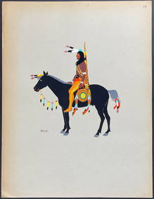
Kiowa Indian Art - Mopope: Kiowa Warrior on HorsebackTrillium Antique Prints & Rare Books4.5(32)See Sold PriceFeb 24, 2024
Kiowa Indian Art - Mopope: Kiowa Warrior and wifeTrillium Antique Prints & Rare Books4.5(32)See Sold PriceFeb 24, 2024


![[Texas Map] (1 of 2)](https://p1.liveauctioneers.com/268/96530/49221576_1_x.jpg?height=282&quality=70&version=1479397972)