Sold[ARABIC MAPS]. 3 manuscript maps from unknown[ARABIC MAPS]. 3 manuscript maps from unknown work, ca.late 19th century. Text in Farsi on front and verso. Margins lightly soiled, occasional foxing and few other defects, sold as is. ++ Map of the wSee Sold Price
Manuscript Map of French Island Belle IsleUNKNOWN ARTIST. Carte Generale de Belle Isle. Manuscript map in ink with original wash. French, c. late 18th century. 27" x 44 3/4" sheet. Belle-Isle is an island off the coast of Brittany in northwesSee Sold Price
SoldFairfax Lands Potomac River Source Manuscript MapsFAIRFAX DOCUMENTS, 3 Manuscript Maps delignating the Land of Lord Thomas sixth Lord Fairfax of Cameron (1693-1781) 1.WINSLOW, Benjamin. A Plan of the Upper Part of Potomack River called Cohongorooto,See Sold Price
Abstract of title for land in Los AngelesTitle: Abstract of title for land in Los Angeles with ms. maps Author: ** Description: 72 pp. Ink manuscript. With 3 manuscript maps, 2 of them with color. 33x22 cm. (13x8¾"), brad-bound in half leatSee Sold Price
Abstract of title for land in Los AngelesTitle: Abstract of title for land in Los Angeles with ms. maps Author: ** Description: 72 pp. Ink manuscript. With 3 manuscript maps, 2 of them with color. 33x22 cm. (13x8¾"), brad-bound in half leatSee Sold Price
Sold(MANUSCRIPT MAP--ARABIC.) Extraordinary large(MANUSCRIPT MAP--ARABIC.) Extraordinary large manuscript map of the Mediterranean, on two large sheets unjoined, 1185x2520 mm overall; land portions colored, all place names in Arabic; numerous repairSee Sold Price
Sold[MAP]. Manuscript map of North and South America231. [MAP]. Anonymous manuscript map in Arabic (?) on heavy laid paper of North and South America, within gilt border, map proper with background painting in slate blue, outlines of countries in greenSee Sold Price
SoldEARLY MANUSCRIPT MAPS ACTUAL SURVEYSH/P LOT (3) EARLY MANUSCRIPT MAPS ACTUAL SURVEYS W/ SECTION LOT/PLOT SIGNED SAMUEL PRESTON-WM. SIMPSON, C. 1791, LARGEST 10" X 16"See Sold Price
SoldMS. world map with Arabic scriptHeading: (Arabic Manuscript - World Map) Author: Title: Manuscript map of the World, with Arabic script legends Place Published: No place Publisher: Date Published: 18th century? DescSee Sold Price
Siege of Petersburg (Jerusalem Plank Road) Ms MapLot of 3, including manuscript map, 9.5 x 7.75 in., showing the position of Brigadier General Francis C. Barlow's division during the Battle of Jerusalem Plank Road on June 22, 1864. Barlow was in chaSee Sold Price
Sold3 Antique maps3 Antique maps- Italy- make unknown; Roman Empire ''Orbis Romanus Seu Divisio Romani''- maker unknown, fair condition with paper tonining and some staining; and ''Nieuwe Grondtekening der Stad, Veere'See Sold Price
Manuscript Map of the West Indies showing the Southern Coast of the Dominican Republic[West Indies, Dominican Republic] Plano dela Bahya de Ocoa Situado en la Banda del sux dela Isla Espanola... Manuscript Map in pen and ink. ca. 1780. 14 7/8" x 19 3/8" sheet. Manuscript Map of the SouSee Sold Price
Manuscript Map of Wismar, Germany*** START PRICE IS THE RESERVE *** [Europe] Unknown Artist. [Battle of Wismar, 1771] Plan von die Situation und vesting Wismar... Manuscript map in pen and ink with original hand color. Germany, c. 17See Sold Price
Sold[Bourset (Marie)] - Album de Geographie et dea collection of 29 manuscript maps, pen and brown ink, over pencil, with watercolour, 25 of which are maps with 3 sectional title leaves, 6 double hemisphere maps, 5 cartes generales, 9 cartes particuSee Sold Price
Sold18TH/19TH C. WORKS ON PAPERThree hand illuminated works: music sheet on vellum, manuscript page with map, and manuscript page in Latin (all framed separately); Manuscript page with map: 14 3/4" x 9 1/4" (sight)See Sold Price
SoldSpanish Exploration in the Southwest, 1542-1706xii, [2], 487 + [4] ad pp. Illustrated with 3 folding maps, 2 being facsimiles of 17th century manuscript maps. 8½x5½, dark blue cloth lettered in gilt on front cover & spine. First Edition. ImportaSee Sold Price
SoldBarry Docks & Railways. - Description of Undertaking,large folding map in blue and black, original printed boards, rubbed and soiled, [not in Ottley], 1896 § Robinson (J.) The Barry Dock Works, offprint, 3 folding plates, folding map, manuscript notesSee Sold Price
SoldLot 3 Vintage Map And EtchingsLot 3 Vintage Map And Etchings. Unframed and unmatted paper with reproduction of color map of the North American continent, marked as North America, by Matthew Seutter, 1735. Print date unknown. Two rSee Sold Price
Sold18th-Century Philadelphia Manuscript La1 piece. 18th-Century Philadelphia Manuscript Land Patent on Vellum with Color Manuscript Map. Deed Roll, Joseph Cowperthwait, Philadelphia, May 3, 1786. Includes contemp. color manuscript map, "PlanSee Sold Price
SoldA mixed group of 10 manuscript maps,3 similar decorative French maps of the British Isles, France and Italy, 5 others, similar, of Africa, North America, Brazil, Scandinavia and Switzerland, with one of Europe and another of Italy, penSee Sold Price
SoldRARE JAPANESE WOODBLOCK MAP; AUTHOR UNKNOWNColor woodblock strip map of Japan, Edo Period. Date: 1854 [Ansei Yon Nen]. Approx. 350x38 cm. (137x15”); folding to 7 1/4 x3 3/4”. Captivating strip map of the Japanese home islands produced justSee Sold Price
SoldMARTIER & J. COVENS ET FILS HAND COLORED MAPMARTIER & J. COVENS ET FILS, HAND COLORED PRINTED MAP, H 16 3/4", W 22 3/4", "CARTE GENERALE DES TREIGE ETATS UNIS":DATE PRINTED IS UNKNOWN; ARNOLD KLEIN, ROYAL OAK FRAMING LABEL.See Sold Price
SoldMARTIER & J. COVENS ET FILS COLORED PRINTED MAPMARTIER & J. COVENS ET FILS, HAND COLORED PRINTED MAP, H 16 3/4", W 22 3/4", "CARTE GENERALE DES TREIGE ETATS UNIS"DATE PRINTED IS UNKNOWN; ARNOLD KLEIN, ROYAL OAK FRAMING LABEL.See Sold Price
SoldLondon, Poplar & Stepney.- Board of Works, 6 vol., manuscripts, numerous folding street maps,London, Poplar & Stepney.- Board of Works, 6 vol. only (vol. 2, 4,5 & 7 Poplar & vol. 2 & 3 Stepney), manuscripts, numerous pp., numerous folding street maps, some loose or working loose, repairs withSee Sold Price
DUNLEVIE c1856 Map Counties Of Gaspe & Bonaventure Quebec Canada SCARCE! #1Luis Porretta Fine Arts4.3(10)See Sold PriceMar 02, 2024
c1700s RARE Arabic Handwritten Manuscript Middle East Persia Journal ARABIASchilb Antiquarian Rare Books4.8(428)See Sold PriceMar 10, 2024
United States Map with American Flag 3-D Wall Mount PaintingWeatherham Estate Treasures3.9(159)See Sold PriceFeb 29, 2024
HERMES Clipper CL4.210 Quartz Date Arabic Index 3 Hands White Ladies WatchBidhaus4.4(762)See Sold PriceFeb 24, 2024
[JUNEAU, Solomon (1793-1856), association]. Land Deed for J...Potter & Potter Auctions4.6(545)See Sold PriceMar 07, 2024
Oyster Bay Long Island NY Vintage Color Reproduction Map 12 x 18Mynt Auctions4.6(697)See Sold PriceFeb 23, 2024
Chatelain - 3 Maps of the British Isles (England, Ireland, Scotland)Trillium Antique Prints & Rare Books4.5(32)See Sold PriceFeb 24, 2024
1675 ELZEVIER JULIUS CAESAR antique ILLUSTRATED w/ MAPS ROMAN HISTORYJasper524.5(9.9k)See Sold PriceFeb 27, 2024
1738 BIBLE in DUTCH ILLUSTRATED w/ MAPS antique MASSIVE FOLIO BIBLIAJasper524.5(9.9k)See Sold PriceFeb 27, 2024
Emory's Notes of a Military Reconnoissance larger issuePBA Galleries4.7(385)See Sold PriceMar 07, 2024
ANTIQUE 1686 OPERA OMNIA BY JOHN LIGHTFOOT TELLIMA BOUND FOLIO WITH ISRAEL MAPNY Elizabeth 4.2(86)See Sold PriceMar 03, 2024
1675: ANTIQUE ILLUSTRATED JULIUS CAESAR MAPS OF ROMAN HISTORYNY Elizabeth 4.2(86)See Sold PriceMar 03, 2024
Set of 3 Maps - Netherlands - Belgien - Switzerland - J. BarlowProverde Auctions4.3(3)See Sold PriceFeb 28, 2024
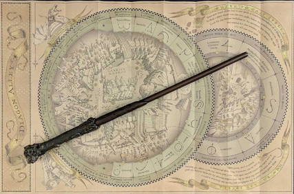
Universal Studios Harry Potter Wand BRapid Estate Liquidators and Auction Gallery4.5(1.1k)See Sold PriceFeb 28, 2024
![[ARABIC MAPS]. 3 manuscript maps from unknown First Image](https://p1.liveauctioneers.com/179/10971/2682680_1_x.jpg?height=282&quality=95&version=1162265652&width=282)
![[ARABIC MAPS]. 3 manuscript maps from unknown (1 of 3)](https://p1.liveauctioneers.com/179/10971/2682680_1_x.jpg?height=282&quality=70&version=1162265652)
![[ARABIC MAPS]. 3 manuscript maps from unknown First Image](https://p1.liveauctioneers.com/179/10971/2682680_1_x.jpg?height=282&quality=1&version=1162265652&width=282)


![[MAP]. Manuscript map of North and South America (1 of 6)](https://p1.liveauctioneers.com/514/38480/16487066_1_x.jpg?height=282&quality=70&version=1363614971)


![[Bourset (Marie)] - Album de Geographie et de (1 of 1)](https://p1.liveauctioneers.com/410/53515/25783823_1_x.jpg?height=282&quality=70&version=1396443931)


![[JUNEAU, Solomon (1793-1856), association]. Land Deed for J... (1 of 2)](https://p1.liveauctioneers.com/928/318880/171361009_1_x.jpg?height=282&quality=70&version=1707501302)