SoldIdaho mining mapsLot of 5: Maps vary in size largest measures 18 1/2" to only 9 1/4" in length, they show the following areas.1) Pine Creek Coeur D' Alene Mining District Wallace Idaho. 2) Silver Belt, Coeur D' AleneSee Sold Price
SoldIDAHO MINING MAP LOT OF 5Maps vary in size largest measures 18 1/2" to only 9 1/4" in length, they show the following areas.1) Pine Creek Coeur D' Alene Mining District Wallace, Idaho. 2) Silver Belt, Coeur D' Alene Mining DiSee Sold Price
SoldIdaho Territorial Mining Maps & Letter Sheet - Boise,c1883 Lot of 3: 2 are mining map of the Boise and southwestern Caldwell mining districts. The Boise map appears to be hand-drawn and colorized, quite unique. The Caldwell area map is dated 1883, and hSee Sold Price
Map of Idaho by Hardesty (59349)Double truck pp. 168 & 169. This map shows mining regions of Idaho. Graphics & color by Lithography. Beautiful condition. On Mat Board (not adhered) with plastic covers. If mats are shipped then additSee Sold Price
Map of Idaho by Hardesty #59349Double truck pp. 168 & 169. This map shows mining regions of Idaho. Graphics & color by Lithography. Beautiful condition. On Mat Board (not adhered) with plastic covers. If mats are shipped then additSee Sold Price
SoldMap of Idaho by Hardesty (59349)Double truck pp. 168 & 169. This map shows mining regions of Idaho. Graphics & color by Lithography. Beautiful condition. On Mat Board (not adhered) with plastic covers. If mats are shipped then additSee Sold Price
SoldRare mining map of Pacific Northwest.Heading: Author: Amerine, C. H. Title: Map of the Different Mining Countries of the Northwest / Map of Washington with Adjacent Parts of British Columbia, Montana and Idaho Place Published: Spokane FSee Sold Price
Copper Creek mining maps 1923 (120608)These are two mining maps of Copper Creek and Troy, Idaho; both are hand drawn on velum written by Joseph B. Wiply and E. J. Jones.Date: 1923Country if not USA: State: IdahoCity: Provenance:See Sold Price
SoldMap of Mining Claims on Mammoth Mountain, Idaho 3483117" x 22" "Map of Mammoth Mountain. Showing the Banner, Little Giant, Rescue, Mammoth and Charity Mines; also the direction and length of tunnel which is being constructed by the Consolidated Junior TSee Sold Price
Queen Milling and Mining maps (112341)Four maps for the Queen Mining and Milling property Elmore County Idaho. Original pen and ink on paper. Survey J.L. McPherson 1926. Three other smaller maps meant for illustrations in a report. A) plaSee Sold Price
Quenn Milling and Mining maps (112341)Four maps for the Queen Mining and Milling property Elmore County Idaho. Original pen and and ink on paper. Survey J.L. McPherson 1926. Three other smaller maps meant for illustrations in a report. A)See Sold Price
Quenn Milling and Mining maps (112341)Four maps for the Queen Mining and Milling property Elmore County Idaho. Original pen and and ink on paper. Survey J.L. McPherson 1926. Three other smaller maps meant for illustrations in a report. A)See Sold Price
Copper Creek mining maps 1923 (120608)These are two mining maps of Copper Creek and Troy, Idaho; both are hand drawn on velum written by Joseph B. Wiply and E. J. Jones.Date: 1923Country (if not USA): State: IdahoCity: Provenance: ATTENTISee Sold Price
Map of Mining Claims on Mammoth Mountain, Idaho (34831)17" x 22" "Map of Mammoth Mountain. Showing the Banner, Little Giant, Rescue, Mammoth and Charity Mines; also the direction and length of tunnel which is being constructed by the Consolidated Junior TSee Sold Price
SoldMining claim map in Colorado 1901Heading: (Colorado) Author: Underhill, James Title: Map of portions of lower Clear Creek and Gilpin Counties showing mining claims in the vicinity of Idaho Springs, Colorado, prepared from official suSee Sold Price
Mining claim map in Colorado 1901Heading: (Colorado) Author: Underhill, James Title: Map of portions of lower Clear Creek and Gilpin Counties showing mining claims in the vicinity of Idaho Springs, Colorado, prepared from official suSee Sold Price
Mining Prospectus's / Idaho / 2 Items. 109654Here we have a really good pair. They are mining prospectus from Idaho. Item #1 of 2: Central Idaho/ Gold Mining Company. Which includes mines at Rocky Bar, & Elmore Co. It shows maps, mine claims,newSee Sold Price
SoldMining Prospectus's / Idaho / 2 Items #109654Here we have a really good pair. They are mining prospectus from Idaho. Item #1 of 2: Central Idaho/ Gold Mining Company. Which includes mines at Rocky Bar, & Elmore Co. It shows maps, mine claims,newSee Sold Price
SoldNorth American City and Industry Works on Paper, Lot ofNorth American City and Industry Works on Paper, Lot of Five Four maps and one industrial landscape drawing, including: American, 19th century. Bonanza Bar / Argile Mining District / Idaho, u.c. A scaSee Sold Price
SoldLOWE, THEODORE H. Map of the Mining DistrictsLOWE, THEODORE H. Map of the Mining Districts surrounding the Townsite of Idaho Springs. Situate in Clear Creek County, Colorado. Large hand-colored lithographed folding pocket map, 890x1370 mm overalSee Sold Price
Map of Silver Lead Mines in Coeur D'Alene (120887)This enormous 62"x 32" map on linen, shows the surveyed location of mining operations in Shoshone County, Idaho. The map is dated 1908 and still reads very sharp, considering its age. There's tearingSee Sold Price
***WITHDRAWN***Heading: (Colorado) Author: Underhill, James Title: Map of portions of lower Clear Creek and Gilpin Counties showing mining claims in the vicinity of Idaho Springs, Colorado, prepared from official suSee Sold Price
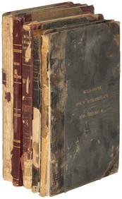
Mining Books/ Montana & Wyoming /5 items. 109684Item # 1 of 5: Geological Reconnaissance Northern Idaho & Northwestern Montana/ Bulletin # 384 / ( 2 Plates w/ 1 fold out map, 112 pages , 1909 ). Item #2 of 5 :Geology of the Lewistown Coal Field / BSee Sold Price
Battle Mountain Mining StockShares issued in 1919 from the U-Nev-Ida Gold Mining Company. Mines in three western states of Nevada, Idaho and Utah located at Battle Mountain, NV, Caribou, Idaho and Beaver, Utah. Round map vignettSee Sold Price
Northern Pacific RR Washington and Northern Idaho Map Folder-1941JM Hobby Supply and Railroad Artifact Auctions4.4(126)See Sold PriceFeb 24, 2024
JOHN FULTON Coke Coal Mining Rare c1895 1st Edition TreatiseLuis Porretta Fine Arts4.3(10)See Sold PriceMar 02, 2024
1885 CIVIL WAR 1ed Famous Memoirs US Grant Sheridan Sherman 6v RARE LOT MapsSchilb Antiquarian Rare Books4.8(421)See Sold PriceMar 10, 2024
Large lot of assorted prints. 18th-20th century. To include: North American and other maps, CivilTremont Auctions4.6(293)See Sold PriceFeb 25, 2024
Rand McNally Railroad Map Cabinet w/ 21 Railroad MapsRail & Road Auctions4.6(165)See Sold PriceMar 08, 2024
Willem Blaeu, Etc. 17th C. Antiquarian Maps, 2Auctions at Showplace4.5(726)See Sold PriceMar 17, 2024
Putnam - First Map of the State of Ohio by Rufus PutnamTrillium Antique Prints & Rare Books4.5(30)See Sold PriceFeb 24, 2024
De Jode, Rare, pub. 1593 - Map of Africa (Africae Vera Forma, et Situs)Trillium Antique Prints & Rare Books4.5(30)See Sold PriceFeb 24, 2024
Francis McNally - Antique Map of Washington, Oregon, Idaho, Nevada, Utah & ArizonaProverde Auctions4.3(3)See Sold PriceFeb 28, 2024