SoldOGILBY, JOHN. Nova Virginiae Tabula.OGILBY, JOHN. Nova Virginiae Tabula. Double-page engraved map, 300x365 mm, ample margins; several small light stains; small discreet embossed institutional stamp in lower left corner. London, 1671 AlSee Sold Price
Sold[AMERICA]. A lot of 3 maps sold together[AMERICA]. A lot of 3 maps sold together. Including: OGILBY, John. NOVA VIRGINIAE TABULA. 28.5 x34.5cm. [1671]. ** Anonymous. BATTLE OF GERMANTOWN. 22 x 14 cm. 19th Century **Universal Magazine, Vol.See Sold Price
SoldJohn Ogilby. "Nova Virginiae Tabula," map(British, 1600-1676). Hand colored engraved map, London, 1671, plate size: 11 1/2 x 13 3/4 in., framedSee Sold Price
Sold1671 VIRGINIA AND THE CHESAPEAKE BAY REGION HAND-1671 VIRGINIA AND THE CHESAPEAKE BAY REGION HAND-COLORED MAP, "Nova Virginiae Tabula", John Ogilby and Arnoldus Montanus, three large cartouches, not framed. Second half 17th century. 11 3/4" x 14 1/4See Sold Price
Soldc. 1671, Hand-Colored RARE MAP OF VIRGINIA NOVA VIRGINIAE TABULAHistoric Maps RARE MAP OF VIRGINIA: "NOVA VIRGINIAE TABUL" 1671, Beautiful Hand-Colored Map titled, "NOVA VIRGINIAE TABULA", by Cartographer John OGILBY, London, Choice Extremely Fine. A vibrant, decoSee Sold Price
Sold17th Century Map of the Southeast[Nova Virginiae Tabula], by Arnoldus Montanus or John Ogilby, Amsterdam/London, 1671 (published the same year in two different atlases), based on the Hondius-Blaeu version of John Smith's 1612 map ofSee Sold Price
Terrae- Mariae Virginiae Tabula, Ogilby & Montanus 1671Title: (Terrae- Mariae) Nova (et) Virginiae Tabula Subject: Virginia/ Maryland Maker: J. Ogilby and A. Montanus Date: 1671, Amsterdam Size: 11.4 x 13.8 inches Edition of Capt. John Smith's landmark maSee Sold Price
SoldEarly Map of Virginia afterJohn White [Nova Virginiae Tabula], by Willem Blaeu, Amsterdam, circa 1640, engraved after Jodocus Hondius' derivation of John White's 1612 map of Virginia, intricately detailed map of the ChesapeakeSee Sold Price
SoldJodocus Hondius II - Nova Virginiae TabulaJodocus Hondius II (1594-1629), after a work by Captain John Smith (1580-1631) Nova Virginiae Tabula, 1618, Dirck Grijp engraver, black and white line engraving on laid paper, 15 x 18-3/4 in. (plate),See Sold Price
Hondius Map of Virginia, 1630HONDIUS, Henricus (1573 –1650), after John Smith (1580-1631). Nova Virginiae Tabula. Engraving with original hand color. Amsterdam, c. 1630. 19” x 23” sheet, 24” x 27 3/4&rdquSee Sold Price
Sold(Maps and Charts, North America), Ogilby, John (16(Maps and Charts, North America), Ogilby, John (1600-1676), Nova Terrae-Mariae Tabula, [London, 1671 or later], derived from the anonymous 1635 "Lord Baltimore Map," uncolored, sheet size 470 x 405 mmSee Sold Price
Nova Virginiae Tabula by Hondius, 1633 (John Smith)Nova Virginiae Tabula. This framed map was printed in 1633. It was engraved in a copper plate, inked and printed on handmade laid cotton paper. It is the 3rd map created of the Chesapeake Bay, as theSee Sold Price
Nova Virginiae Tabula by Hondius, 1633 (John Smith)Nova Virginiae Tabula. This framed map was printed in 1633. It was engraved in a copper plate, inked and printed on handmade laid cotton paper. It is the 3rd map created of the Chesapeake Bay, as theSee Sold Price
Sold1671 Colored Map of Chesapeake Bay and VirginiaHistoric Maps Rare 1671 Hand-Colored Map of Chesapeake Bay and Virginia Titled “Nova Virginia Tabula” by John Ogilby (1671) Hand-Colored Engraved Map Titled, “Nova Virginia Tabula,” by John OgSee Sold Price
Sold1671 Colored Map of Chesapeake Bay and VirginiaHistoric Maps 1671 Hand-Colored Map of Chesapeake Bay and Virginia Titled “Nova Virginia Tabula” by John Ogilby, London (1671) Hand-Colored Engraved Map Titled, “Nova Virginia Tabula” by JohnSee Sold Price
SoldMap,rare, "Nova Virginiae Tabula" by HondiusMap printed from a copper engraving Age: C. 1647 Maker: Henricus Hondius Description: Henricus Hondius' derivative of John Smith's highly important 1612 map of Virginia.Hondius's map of the ChesapeakeSee Sold Price
SoldHondius Map of VA - Nova Virginiae Tabula, 1636-1641NOVA VIRGINIAE TABULA by Hondius, Amsterdam, copper-engraved map of Virginia based on the 1612 Virginia map by John Smith, engraved on laid paper. Framed with double sided glass showing English text eSee Sold Price
SoldColor engraved map of Virginia Nova Virginiae Tabulacolor engraved map of Virginia {Nova Virginae Tabula} by Henricus Hondius Amsterdam, 1631, based on John Smith's map of 1612. DOA 17.25 x 22 in.See Sold Price
SoldWillem Blaeu Nova Virginiae TabulaDutch, c. 1640, Nova Virginiae Tabula, original engraving by Jodocus Hondius, after John Smith's 1612 map of Virginia, two sheets, black and white engraving with hand-colored highlights, decorative caSee Sold Price
SoldNOVA VIRGINIAE TABULA. Spanish verso. [1653-1666].[Virginia]. NOVA VIRGINIAE TABULA. Amstelodami, ex officinal Henrici Hondii. “This is Henricus Hondius’ derivative of John Smith’s highly important map of Virgnia, 1612… drawn from his deceaseSee Sold Price
Sold1633 Map Nova Virginiae Tabula - Henricus HondiusNova Virginiae Tabula map by Henricus Hondius (1597-1651). Undated, published circa 1633. This map is the 5th derivative of John Smith's 1612 map of Virginia, which was the first printed map of the ChSee Sold Price
SoldWillem Blaeu - Nova Virginiae TabulaWillem Janszoon Blaeu (1571 -1638) Nova Virginiae Tabula, 1662, based on the 1612 map of Virginia by Captain John Smith (1580 - 1631), black and white line engraving with vibrant period hand color, 14See Sold Price
SoldNova Virginiae Tabula. Map. 1630.[Virginia] Nova Virginiae Tabula. Engraved by Petrus Kaerius [van den Keere]. This is Joannes Jansson’s map of the Chesapeake, based on John Smith’s map. The map is undated, but the plate was engrSee Sold Price
Soldc 1650 Color Map, NOVA VIRGINIAE TABULA, MontanusHistoric Maps "NOVA VIRGINIAE TABULA" by Arnoldus Montanus c. 1650, Early Hand-Colored Map of America titled, "NOVA VIRGINIAE TABULA", by Arnoldus Montanus, after John Smith's Map, Choice Very Fine. TSee Sold Price
LATE 18TH C. VERY LARGE CHART OF NORTHEAST CANADA BY DES BARRES (1721-1824), 1780, FRAMEDThomaston Place Auction Galleries4.4(389)See Sold PriceFeb 24, 2024
17TH C. ENGLISH LINEAR MAP BY OGILBY, FRAMEDThomaston Place Auction Galleries4.4(389)See Sold PriceFeb 24, 2024
GROUPING OF STERLING & COIN SILVER SPOONSJohn McInnis Auctioneers,LLC4.6(504)See Sold PriceFeb 24, 2024
PAIR (18th c) OF FLINTLOCK DUELING PISTOLSJohn McInnis Auctioneers,LLC4.6(504)See Sold PriceFeb 24, 2024
PAIR T KETLAND of LONDON .60 CAL FLINTLOCK PISTOLSJohn McInnis Auctioneers,LLC4.6(504)See Sold PriceFeb 25, 2024
AMERICAN SCHOOL (Early 20th c) Two WorksJohn McInnis Auctioneers,LLC4.6(504)See Sold PriceFeb 25, 2024
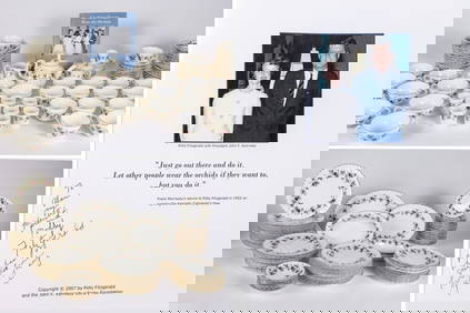
THE FITZGERALD FAMILY TEA and DINNER SERVICEJohn McInnis Auctioneers,LLC4.6(504)See Sold PriceFeb 25, 2024
Nova Totius Full Color Geographical World MapThe Benefit Shop Foundation Inc.4.3(2.9k)See Sold PriceFeb 28, 2024
Shepard Fairey (b. 1970), "Dark Wave," 2010, Screenprint, collage, and hand-painted (HPM) on paper,John Moran Auctioneers, Inc.4.7(459)See Sold PriceFeb 27, 2024
John Ogilby (Scottish, 1600-1676) engraving and signed folio dated 1671CV Auction LLC4.4(34)See Sold PriceMar 09, 2024
Anatomy.- Collins (Samuel) A Systeme of Anatomy, treating of the Body of Man, Beasts, Birds, Fish,Forum Auctions4.3(53)See Sold PriceFeb 29, 2024
3 Vintage The World Lithographs, By JanssonThe Benefit Shop Foundation Inc.4.3(2.9k)See Sold PriceMar 13, 2024
ANTIQUE 1686 OPERA OMNIA BY JOHN LIGHTFOOT TELLIMA BOUND FOLIO WITH ISRAEL MAPNY Elizabeth 4.3(85)See Sold PriceMar 03, 2024


![[AMERICA]. A lot of 3 maps sold together (1 of 1)](https://p1.liveauctioneers.com/1124/187577/94368839_1_x.jpg?height=282&quality=70&version=1607095126)


![NOVA VIRGINIAE TABULA. Spanish verso. [1653-1666]. (1 of 5)](https://p1.liveauctioneers.com/179/60065/29840496_1_x.jpg?height=282&quality=70&version=1409176421)