SoldEdward Wells Map, "A New Map of Ancient Germany, RhaEdward Wells Map, "A New Map of Ancient Germany, Rhaetia, Vindelicia and Noricum", England, c. 1700, from a series devoted to the classical world and dedicated to William, Duke of Gloucester, hand-colSee Sold Price
SoldA New Map of Antient Germany, Rhaetia, VindeliciaEdward Wells, A New Map of Antient Germany, Rhaetia, Vindelicia and Noricum. Shewing...Dedicated to...William Duke of Glocester, engraving, ca. 1700-1738, 19 x 14.5 19 x 14.5See Sold Price
Wells (Edward) A New Map of Antient Germany, RhaetWells (Edward) A New Map of Antient Germany, Rhaetia, Vindelicia, and Noricum...,from 'A New Sett of Maps both of Antient and Present Geography', engraved map with hand-colouring, 370 x 480mm.See Sold Price
Sold-. Wells (Edward) A New Map of Antient Germany, Rh-. Wells (Edward) A New Map of Antient Germany, Rhaetia, Vindelicia, and Noricum...,from 'A New Sett of Maps both of Antient and Present Geography', engraved map with hand-colouring, 370 x 480See Sold Price
SoldGrp: Maps of Western EuropeLot of seven maps of Western Europe. Includes Edward Wells (1667–1727), "A New Map of Present Germany, Shewing Its Principal Divisions, Cities, Towns, Rivers, Mountains, &c. Dedicated to His HiSee Sold Price
Edward Wells map of Gaul British (1667-1727) "A NeEdward Wells map of Gaul British (1667-1727) "A New Map of Ancient Gaul or Gallia Transalpina" engraving. (Good condition, trimmed) paper size: H17 1/2" W25"See Sold Price
SoldA Map of Asia, Edward Wells,Edward Wells, c.1738, cartouche reads 'A New Map of Ancient Asia ..', copper plate, hand coloured, Note: from "A New Sett of Maps both of Ancient and Present Geography" by Edward Wells. c.1738See Sold Price
SoldWells (E) A New Map of Denmark, Norway,Wells (Edward) A New Map of Denmark, Norway, Sweden, & Moscovy,with A New Map of Ancient Scandinavia together with as much more of ye Northern Part of Ancient Europe, as Answers to Present DenSee Sold Price
Sold-. Wells (Edward) A New Map of Iberia, Europaea Al-. Wells (Edward) A New Map of Iberia, Europaea Aloas Celtiberia or Ancient Spain,title in decorative cartouche lower right, engraved map, 375 x 490mm., central vertical fold, handling creasesSee Sold Price
SoldWells (E) A New Map of Iberia, EuropaeaWells (Edward) A New Map of Iberia, Europaea aloas Celtiberia or Ancient Spain, shewing its principall divisions, chief Cities, Towns, rivers, mountains etc, with decorative title cartouche, SSee Sold Price
SoldWells (Edward) A New Map of Iberia EuropæaWells (Edward) A New Map of Iberia Europæa aliàs Celtiberia or Ancient Spain,Shewing its Principal Divisions, Chief Cities, Townes, Rivers, Mountains &c. Spain, Portugal and the Balearic IslanSee Sold Price
SoldEdward Wells Map of Ancient Greece, Thrace, MoesiEdward Wells (1667–1727) "A New Map of Antient Greece, Thrace, Moesia, Illyricum, and the Isles adjoyning," London: J. and J. Bonwicke, S. Birt, T. Osborne, E. Wicksteed and T. Cooper, ca. 1726See Sold Price
SoldWells (Edward) A New Map of EuropeWells (Edward) A New Map of Europe according To The Present General Divisions and Names of its Countries together with their Capital Cities chief Rivers Mountains & c.with Ancient Europe and ASee Sold Price
SoldWells (Edward) A New Map of EuropeWells (Edward) A New Map of Europe according To The Present General Divisions and Names of its Countries together with their Capital Cities chief Rivers Mountains & c.with Ancient Europe, andSee Sold Price
SoldEdward Wells, 13 Maps incl. AfricaThirteen (13) Edward Wells (English, 1667-1727) maps plus title page from his rare atlas, A NEW SET OF MAPS BOTH OF ANCIENT AND PRESENT GEOGRAPHY, circa 1700-1712. All with decorative cartouches, dediSee Sold Price
SoldWells (E) Netherlands or Low CountriesWells (Edward) A New Map of The Netherlands or Low Countries, shewing their principal divisions, Cities, Towns, rivers, &c, from Amiens to Emden, with inset map of the ancient coast of HollandSee Sold Price
New Map of the Terraqueous GlobeTitle: New Map of the Terraqueous Globe Cartographer: WELLS, EDWARD | M. BURGHERS sculp. Publisher: OXFORD UNIVERSITY Height: 14.5 Width: 20 "according to the Ancient Discoveries and most general DiviSee Sold Price
SoldNew Map of the Western Parts of Asia Minor LargelyTitle: New Map of the Western Parts of Asia Minor Largely Taken: Publication Date: 1704 Cartographer: WELLS, EDWARD/R. SPOFFORTH Publisher: E. WELLS Size: 14.25Height - 19.3Width shewing their ancientSee Sold Price
New Map of the Western Parts of Asia Minor LargelyTitle: New Map of the Western Parts of Asia Minor Largely Taken: Publication Date: 1704 Cartographer: WELLS, EDWARD/R. SPOFFORTH Publisher: E. WELLS Size: 14.25X19.3 "shewing their ancient divisions,See Sold Price
SoldEdward Wells MapEdward Wells, "A New Map of North America Shewing its Principal Divisions, Chief Cities, Townes, Rivers, Mountains", Oxford, 1700, hand-colored map, dedicated to the Duke of Gloucester, notably showinSee Sold Price
SoldEdward Wells, MapEdward Wells, "A New Map of North America Shewing its Principal Divisions, Chief Cities, Townes, Rivers, Mountains", Oxford, 1700, hand-colored map, dedicated to the Duke of Gloucester, notably showinSee Sold Price
SoldMAP, France, WellsFrance. Edward Wells, A New Map of France Shewing Its Principal Divisions Cheif Cities, Townes, Ports Rivers, Mountains, &c..., 1701 (circa). Hand Color. This boldly engraved map divides France into iSee Sold Price
SoldWells (Edward) - A New Map of the most considerabldedicated to His Highness William Duke of Gloucester, with inset views of the islands of Jamaica, Barbados and the Bermudas, engraved map with hand-colouring, 365 x 480 mm, central vertical fold, somSee Sold Price
1892 Adams and Bowles New Road Map of the State of New YorkJM Hobby Supply and Railroad Artifact Auctions4.4(127)See Sold PriceFeb 24, 2024
American Express/New York Central Railroad Map of the United States-1934JM Hobby Supply and Railroad Artifact Auctions4.4(127)See Sold PriceFeb 24, 2024
Central Railroad of New Jersey Map of Sandy Hook Route-ca. 1903JM Hobby Supply and Railroad Artifact Auctions4.4(127)See Sold PriceFeb 24, 2024
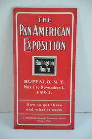
Chicago Burlington and Quincy RR Pan-American Exposition Flyer-1901JM Hobby Supply and Railroad Artifact Auctions4.4(127)See Sold PriceFeb 24, 2024
LATE 17TH C. FRENCH MAP OF THE NEW WORLD BY ALEXIS-HUBERT JAILLOT (1632-1712)Thomaston Place Auction Galleries4.4(393)See Sold PriceFeb 24, 2024
Vintage County Map Of NY State Plate EngravingThe Benefit Shop Foundation Inc.4.3(2.9k)See Sold PriceFeb 28, 2024
Keith Haring - Ink on New York Map, Best Buddies, Inscribed, Signed, and DatedSapphire Auction Gallery4(67)See Sold PriceMar 02, 2024
17th Century Hand Colored Engraved Map of GermanyGlobal Auctions Company4.3(36)See Sold PriceMar 03, 2024
Keith Haring Artwork Signed on a Shell Oil New York Road Map 18 in. x 24 in.Donny Malone Auctions4.4(1.8k)See Sold PriceMar 04, 2024
Kent & Sussex.- Moss (W.G.) The History and Antiquities of the Town and Port of Hastings, 1824; andForum Auctions4.3(53)See Sold PriceFeb 29, 2024
1750 Bowen Map of Bermuda and St. Kitts -- A New & Accurate Map of Bermudas or Sommer's Islands...Jasper524.5(9.9k)See Sold PriceFeb 27, 2024
Georg Bockler Map of Ancient Jerulsaem EtchingAuctions at Showplace4.6(740)See Sold PriceApr 07, 2024
New Fantasyland Special Editon Eyes And Ears 2012Rapid Estate Liquidators and Auction Gallery4.5(1.1k)See Sold PriceFeb 26, 2024
Antique Pennsylvania Map Fragment incl Wellersburg and New CentervilleCordier Auctions & Appraisals4.4(1.5k)See Sold PriceMar 02, 2024