SoldWells (Edward) A New Map of Iberia EuropæaWells (Edward) A New Map of Iberia Europæa aliàs Celtiberia or Ancient Spain,Shewing its Principal Divisions, Chief Cities, Townes, Rivers, Mountains &c. Spain, Portugal and the Balearic IslanSee Sold Price
Sold-. Wells (Edward) A New Map of Iberia, Europaea Al-. Wells (Edward) A New Map of Iberia, Europaea Aloas Celtiberia or Ancient Spain,title in decorative cartouche lower right, engraved map, 375 x 490mm., central vertical fold, handling creasesSee Sold Price
SoldWells (E) A New Map of Iberia, EuropaeaWells (Edward) A New Map of Iberia, Europaea aloas Celtiberia or Ancient Spain, shewing its principall divisions, chief Cities, Towns, rivers, mountains etc, with decorative title cartouche, SSee Sold Price
SoldWells (Edward) - A New Map of the most considerabldedicated to His Highness William Duke of Gloucester, with inset views of the islands of Jamaica, Barbados and the Bermudas, engraved map with hand-colouring, 365 x 480 mm, central vertical fold, somSee Sold Price
SoldWELLS, EDWARD. A New Map of the Terraqueous Globe.WELLS, EDWARD. A New Map of the Terraqueous Globe. Hand-colored double-page engraved double-hemispheric world map. 17½x21½ inches sheet size, wide margins; light marginal soiling and small rSee Sold Price
SoldWells (Edward) A New Map fo Present PolandWells (Edward) A New Map fo Present Poland, Hungary, Walachia, Moldavia, Little Tartary &c.,decorative cartouches in upper corners, engraved by Benjamin Cole, with hand-colouring in outline, 3See Sold Price
Sold(MAP) WELLS, EDWARD. A New Map of Europe ... Dedicated(MAP) WELLS, EDWARD A New Map of Europe according to the Present General Divisions and Names ... Capital Cities, Chief Rivers, Mountains, &c. ... Dedicated to His Highness William Duke of Gloucester.See Sold Price
SoldWells, Edward. A New Map of Gallia Cisalpina & Graceia(London: E. Wells, n.d., early 18th century), copperplate engraving with outline color showing northern Italy and the country's extreme south. From A New Sett of Maps as dedicated to the Duke of GloucSee Sold Price
SoldWells (Edward) A New Map of Asia MinorWells (Edward) A New Map of the Western Parts of Asia Minor,Shewing their Antient Divisions, Countries or People.., engraved map by Robert Spofforth, with original hand-colouring in outline, 3See Sold Price
SoldWells (Edward) A New Map of Present Italy, TogetheWells (Edward) A New Map of Present Italy, Together with the Adjoyning Islands of Sicily, Sardinia, and Corsica,engraved map with outline hand-colouring, 370 x 495mm, c.1700 ? Ortelius (AbrahaSee Sold Price
Wells (Edward) A New Map of Antient Germany, RhaetWells (Edward) A New Map of Antient Germany, Rhaetia, Vindelicia, and Noricum...,from 'A New Sett of Maps both of Antient and Present Geography', engraved map with hand-colouring, 370 x 480mm.See Sold Price
SoldWells (Edward) A New Map of Antient Italy ...Wells (Edward) A New Map of Antient Italy ...,including the islands of Sicily, Sardinia, and Corsica, engraved map with hand-colouring, 370 x 485mm., blank verso, central vertical fold, minorSee Sold Price
SoldWells (Edward) A New Map of Antient Thrace ...Wells (Edward) A New Map of Antient Thrace ...,also showing the northern part of Old Greece, engraved map, by Sutton Nicholls, with hand-colouring, 370 x 475mm., central vertical fold, minor sSee Sold Price
Sold-. Wells (Edward) A New Map of Antient Germany, Rh-. Wells (Edward) A New Map of Antient Germany, Rhaetia, Vindelicia, and Noricum...,from 'A New Sett of Maps both of Antient and Present Geography', engraved map with hand-colouring, 370 x 480See Sold Price
SoldFAFR Wells (Edward) A New Map of Libya or Old AfriFAFR Wells (Edward) A New Map of Libya or Old AfrickShewing its General Divisions, Most Remarkable Countries or People, Cities, Townes, Rivers, Mountains &c., showing the whole continent,See Sold Price
SoldWells (Edward) A New Map of EuropeWells (Edward) A New Map of Europe according To The Present General Divisions and Names of its Countries together with their Capital Cities chief Rivers Mountains & c.with Ancient Europe and ASee Sold Price
SoldWells (Edward) A New Map of the Islands of the AegWells (Edward) A New Map of the Islands of the Aegaean Sea,Together with the Island of Crete, and the Adjoining Islands, engraved map, decorative title vignette, outline hand-colouring, centraSee Sold Price
SoldWells (Edward) A New Map of EuropeWells (Edward) A New Map of Europe according To The Present General Divisions and Names of its Countries together with their Capital Cities chief Rivers Mountains & c.with Ancient Europe, andSee Sold Price
SoldWell, Edward. A New Map of the British Isles, Shewing...Division, Cities, and such other Towns or Places as answer to the Towns, of note, in the time of the Romans (London: T. W., 1700), copperplate engraving, blank back, color to border and figural carSee Sold Price
SoldWells (E) A New Map of Denmark, Norway,Wells (Edward) A New Map of Denmark, Norway, Sweden, & Moscovy,with A New Map of Ancient Scandinavia together with as much more of ye Northern Part of Ancient Europe, as Answers to Present DenSee Sold Price
SoldWells (E) A New Map of Present Poland, HunWells (Edward) A New Map of Present Poland, Hungary, Walachia, Moldavia, Little Tartary, shewing their principall divisions, chief Cities, Towns, rivers etceastern Europe from Dantzig to BelgrSee Sold Price
SoldWells (E) Netherlands or Low CountriesWells (Edward) A New Map of The Netherlands or Low Countries, shewing their principal divisions, Cities, Towns, rivers, &c, from Amiens to Emden, with inset map of the ancient coast of HollandSee Sold Price
SoldWells (E) Eastern Parts of Asia MinorWells (Edward) A New Map of The Eastern Parts of Asia Minor Largely Taken as Also of Syria, Armenia, Mesopotamie & c.,with A New Map of Turky in Europe, A New Map of Samartia Europaea PannoniaSee Sold Price
SoldWells (E) The North Part of Antient AfricaWells (Edward) A New Map of The North Part of Antient Africa, Shewing the Chiefe People, Cities, Towns, Rivers, Mountains, & C., in Mauretania, Numidia, Africa propria, Libya propria, and EgypSee Sold Price
1892 Adams and Bowles New Road Map of the State of New YorkJM Hobby Supply and Railroad Artifact Auctions4.4(126)See Sold PriceFeb 24, 2024
American Express/New York Central Railroad Map of the United States-1934JM Hobby Supply and Railroad Artifact Auctions4.4(126)See Sold PriceFeb 24, 2024
New York Central RR The Adirondacks Brochure 1916-1917JM Hobby Supply and Railroad Artifact Auctions4.4(126)See Sold PriceFeb 24, 2024
PETRUS LANGENDULT New Testament Commentary c1687 Full Calf Dutch AmsterdamLuis Porretta Fine Arts4.3(10)See Sold PriceMar 02, 2024
LIFE MAGAZINE UNPUBLISHED TED KENNEDY PHOTOGRAPHJohn McInnis Auctioneers,LLC4.6(502)See Sold PriceFeb 25, 2024
Illustrated Sabbath Cloth - Holy Sites of Eretz IsraelLevy Auction House4.3(11)See Sold PriceFeb 27, 2024
Early Pennsylvania Railroad Literature - 1881 New York and Chicago Limited Timetable Brochure andRail & Road Auctions4.6(165)See Sold PriceMar 07, 2024
U.S. NAVY - A Complete History by Goodspeed, M. Hill 2003 MintNorth American Artifact Auctions4.6(182)See Sold PriceApr 20, 2024
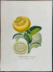
Risso - Lemon or Citrus Fruit. 73Trillium Antique Prints & Rare Books4.5(30)See Sold PriceFeb 24, 2024
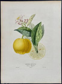
Risso - Lemon or Citrus Fruit. 71Trillium Antique Prints & Rare Books4.5(30)See Sold PriceFeb 24, 2024
Kent & Sussex.- Moss (W.G.) The History and Antiquities of the Town and Port of Hastings, 1824; andForum Auctions4.3(52)See Sold PriceFeb 29, 2024
1750 Bowen Map of Bermuda and St. Kitts -- A New & Accurate Map of Bermudas or Sommer's Islands...Jasper524.5(9.8k)See Sold PriceFeb 27, 2024
New Fantasyland Special Editon Eyes And Ears 2012Rapid Estate Liquidators and Auction Gallery4.5(1.1k)See Sold PriceFeb 26, 2024