SoldHermann Moll (1654-1732)Hermann Moll (1654-1732), "A Map of the West-Indies or the Islands of America in the North Sea...", [London]: Moll, n.d., c. 1720, copper-engraved map, with hand-coloring in outline, inset view of MexSee Sold Price
SoldHermann Moll (c 1654 - 1732)Philippine Islands, Agreeable to Modern History, A scarce map of the Philippines 1708 hand-colored copperplate engraving 9” x 11 1/2” (23 cm x 29 cm)See Sold Price
SoldHermann Moll, (Dutch, 1654-1732), A New Map of theHermann Moll (Dutch, 1654-1732) A New Map of the North Parts of America hand colored engraved map 8 x 10 inches.See Sold Price
SoldHERMANN MOLL (BRITISH, 1654-1732) MAP OF THE WORLDHERMANN MOLL (BRITISH, 1654-1732) MAP OF THE WORLD, engraving on laid paper, double hemispheric form with North Pole inset, showing California as an island, titled "A NEW MAP OF THE WORLD according toSee Sold Price
SoldMOLL, HERMANN. 1654-1732 [after]. Europe, by H. Moll Geographer.MOLL, HERMANN. 1654-1732 [after]. Europe, by H. Moll Geographer. Engraved map with hand coloring, on two sheets joined matted, circa 1720. 9 1/4 x 13 in. Toned. For further information on this lot pleSee Sold Price
SoldHerman Moll (1654 - 1732) The Turkish Empire in EuroHerman Moll (1654 - 1732) The Turkish Empire in Europe, Asia and Africa Copper engraving, two sheets, mounted on a canvas and watercolored in a later date 600x1000 mm. (defects) IT The Turkish EmpireSee Sold Price
SoldHerman Moll (1654? - 1732), by, The North Part of GreatHerman Moll (1654? - 1732), by, The North Part of Great Britain called Scotland, With Considerable Inprovements (sic) and many Remarks not Extant in any Map, According to the Newest and Exact ObservatSee Sold Price
SoldLocal Interest - Herman Moll (1654 - 1732), by andLocal Interest - Herman Moll (1654 - 1732), by and after, a map, Derby Shire (sic, Derbyshire), inset named-views of Pooles Hole (sic) and The Devils Arse (sic) to margin, with fossils and geologicalSee Sold Price
SoldCarolina & Bermuda 1716Map Title: Carolina & The Island Bermudos Maker: Herman Moll Date: 1716 Origin: Atlas Geographicus Size: 13 x 16 inches Medium: Copperplate engraving Herman Moll (1654-1732) was a London cartographer,See Sold Price
SoldAmerica by Herman Moll 1716Map Title: America, According to the Newest and Most Exact Observations Maker: Herman Moll Date: 1716 Origin: Atlas Geographicus Size: 13 x 16 inches Medium: Copperplate engraving Herman Moll (1654-17See Sold Price
SoldHerman Moll 1654-1732), "A New And Correct Map of theHerman Moll 1654-1732), "A New And Correct Map of the World," 1710, hand colored, H. - 22 in., W. - 38 in.See Sold Price
SoldHerman Moll (1654-1732), hand colored engraving mapHerman Moll (1654-1732), hand colored engraving map "A New and Correct Map of the WHOLE WORLD, Showing Y. e situation of its principal parts viz the oceans, Kingdoms, rivers, capes, ports, mountainsSee Sold Price
SoldTwo American Maps, H. Moll & Bellin, 1695 and 1757Grouping of two maps of America including, Item 1: Herman Moll (1654 -1732) "A Map of the English Plantations in America." Depicts the Americas from New England to South America. Published London, 169See Sold Price
SoldHerman Moll (1654-1732), London cartographer engraverHerman Moll (1654-1732), London cartographer engraver and publisher, A Map of the East Indies and the adjacent countries, with the settlements, factories and territories explaining what belongs to EngSee Sold Price
SoldMoll - Correct Map of the Whole World, 1719Herman Moll (1654?-1732), cartographer and publisher A New & Correct Map of the Whole World Shewing y.e Situation of its Principal Parts. Viz the Oceans, Kingdoms, Rivers, Capes, Ports, Mountains, WooSee Sold Price
SoldHerman Moll (1654-1732), "A New Map of Newfoundland,Herman Moll (1654-1732), "A New Map of Newfoundland, New Scotland..fishing banks," c. 1725, H. - 9 in., W. - 13 1/2 in.See Sold Price
SoldDenmark, Herman Moll 1700Title: Denmark Subject: Denmark Maker: Herman Moll Date: 1700 Materials: Hand colored copperplate engraving Size: 7.5 x 10.5 inches Herman Moll (1654-1732) was a London cartographer, engraver, and pubSee Sold Price
SoldGrp: 3 Maps of EuropeGroup of three maps of Europe. Includes one hand colored map of the Netherlands by Herman Moll (1654-1732), "A New Map of the United Provinces of Netherlands &c." London: Herman Moll, ca. 1701; one DuSee Sold Price
Map of the Island of Jamaica by Herman MollMap: A New Map of the Island of Jamaica Maker: Herman Moll Size: Double Octavo - 7 inches high x 10.1 inches wide Date: 1716 "By H. Moll, geographer." Herman Moll (1654-1732) was a London cartographerSee Sold Price
SoldMoll Engraved Map of AmericaA new map of the north parts of America claimed by France under ye names of Louisiana, Mississipi, Canada, and New France with ye adjoining territories of England and Spain. Herman Moll (1654-1732). ESee Sold Price
SoldSCARCE C.1720 MAP, NORTH AMERICA, MOLL, COD FISHFramed map, Herman Moll (1654-1732) "John, Lord Sommers...Map of North America", also known as the "Cod Fish Map", hand colored, c. 1720, western North America shown as "Parts Unknown", California shoSee Sold Price
SoldHerman Moll (1654-1732)Herman Moll (1654-1732), "To the Right Honourable John Lord Sommers...this Map of North America according to ye newest and most exact observations...", London, "Printed for I. Bowles... T. Bowles... PSee Sold Price
SoldHerman Moll (1654-1732) - A New and correct map of theHerman Moll (1654-1732) A New and Correct map of the Whole World, engraving 1719, on joined sheets with old folds, some hand-colouring, 71 x 120cm (visible)See Sold Price
SoldHerman Moll Map of South America, c.1711-1730A New and Exact Map of the Coast, Countries and Islands within the limits of the South Sea Company, by Herman Moll (1654-1732), copperplate engraving with hand coloring, (likely later). London, 1711.See Sold Price
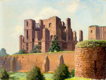
Hermann Dudley Murphy (MA,1867-1945) oil painting antiqueBroward Auction Gallery4.8(277)See Sold PriceMar 31, 2024
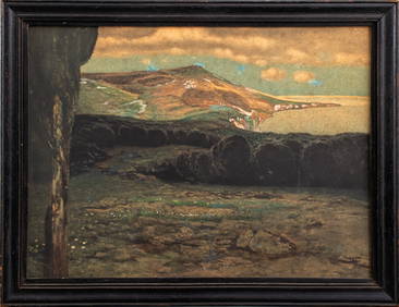
Hermann Urban "Lake Summer" Mixed Media on PaperAuctions at Showplace4.5(726)See Sold PriceMar 12, 2024
Emil Hermann (TX,OH,Austrian,1871-1966) oil paintingBroward Auction Gallery4.8(277)See Sold PriceApr 14, 2024
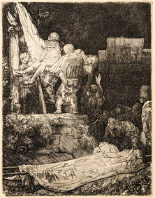
Rembrandt van Rijn. The Descent from the Cross by Torchlight (1654). New Hollstein 286, III/IV OnTremont Auctions4.6(293)See Sold PriceFeb 25, 2024
Albert Einstein. Portrait engraving by Hermann Struck, ca. 1920. Signed and dated 1923 by AlbertTremont Auctions4.6(293)See Sold PriceFeb 25, 2024
BALCK, Hermann (1893-1982, German General). Autograph Lette...Potter & Potter Auctions4.6(539)See Sold PriceMar 07, 2024
Hermann Sondermann (German,1832-1901) oil painting antiqueBroward Auction Gallery4.8(277)See Sold PriceMay 05, 2024
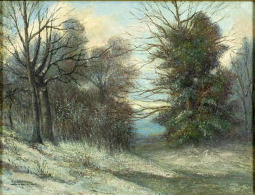
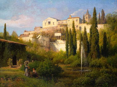
HERMANN OTTOMAR HERZOG (1832-1932) "GARDEN LANDSCAPE".Amelia Jeffers, Auctioneers & Appraisers4.6(101)See Sold PriceMar 07, 2024
LUDWIG HOHLWEIN (1874-1949) HERMANN SCHERRER / BREECHESMAKER. 1907.Swann Auction Galleries4.4(65)See Sold PriceFeb 29, 2024
Signed Hermann Wendelborg Hansen (1854-1924) Medium Ink on Paper GatewayBKG Antique Mall4.3(420)See Sold PriceFeb 25, 2024
Hermann Herzog, Morning Fisherman - Oil on CanvasDallas Auction Gallery4.5(124)See Sold PriceMar 05, 2024
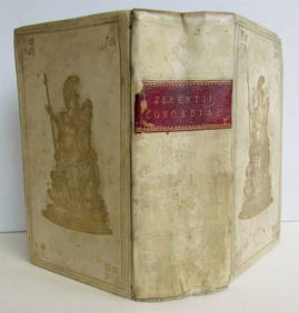
1732 TERENCE PRIZED VELLUM BINDING ANTIQUE AFRI COMOEDIAE SEXNY Elizabeth 4.3(84)See Sold PriceMar 03, 2024
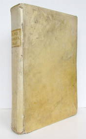
1732 CALMET VELLUM FOLIO ANTIQUE OLD TESTAMENT COMMENTARY BIBLENY Elizabeth 4.3(84)See Sold PriceMar 03, 2024
Oil on Canvas Board Seascape Painting by HermannRay's Premier Auction4.5(72)See Sold PriceMar 15, 2024
Herman Moll A New Map of Ye North Parts of AmericaWillow Auction House4.5(283)See Sold PriceMar 14, 2024
Centers from 3/32" - 17/32"M.J. Stasak Jr. Auction and Appraisal Service4.8(2.1k)See Sold PriceMar 10, 2024


![MOLL, HERMANN. 1654-1732 [after]. Europe, by H. Moll Geographer. (1 of 1)](https://p1.liveauctioneers.com/1043/315399/169913467_1_x.jpg?height=282&quality=70&version=1706001851)