MAP - PIETER SCHENK / VALK / JANSSEN Hand Colored superb Map Central Italy c1702Luis Porretta Fine Arts4.3(10)See Sold PriceMar 02, 2024
CHARLES ROLLIN c1828 Ceasar Hand Colored Africa Military MapLuis Porretta Fine Arts4.3(10)See Sold PriceMar 02, 2024
MAP - Dufour, A. H. ( Malte / Brun ) :MAP - ESPAGNE PARTIE SUD DIVISEE EN PROVINCES ANCIENNES ( MAPLuis Porretta Fine Arts4.3(10)See Sold PriceMar 02, 2024
RIGOBERT BONNE c1787 Original Colored Map Germany & Region 15" x 12"Luis Porretta Fine Arts4.3(10)See Sold PriceMar 02, 2024
AMBROISE TARDIEU c1822 Napoleonic War Map GermanyLuis Porretta Fine Arts4.3(10)See Sold PriceMar 02, 2024
MAP - AMBROISE TARDIEU c1822 Napoleonic Miltary Map GermanyLuis Porretta Fine Arts4.3(10)See Sold PriceMar 02, 2024
1822 Rare Map by Ambroise Tardieu Napoleon Caldiero Battle of Vento 17" x 11Luis Porretta Fine Arts4.3(10)See Sold PriceMar 02, 2024
PIETER SCHENK / VALK / JANSSEN Hand Colored Map of Rhodes Greece ca1702 vgcLuis Porretta Fine Arts4.3(10)See Sold PriceMar 02, 2024
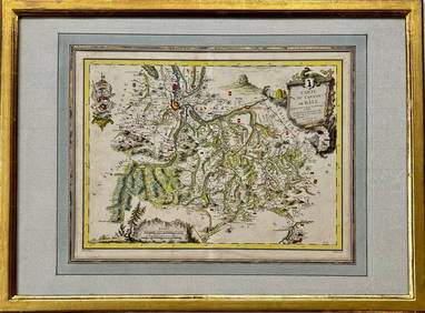
Map: Carte du Canton de Bale, Jacques Clermont, Paris, 1788Kensington Estate Auction4.6(216)See Sold PriceFeb 26, 2024
SoldCharle & Darmet Map of France, CorseCHARLE et DARMET (19th Century). Corse. Engraved map with original hand color. Paris, 1835 from Nouvel Atlas National de la France. 17 1/2" x 22 1/2" sheet.See Sold Price
SoldCharle & Darmet Map of France, SieneCHARLE et DARMET (19th Century). Siene. Engraved map with original hand color. Paris, 1835 from Nouvel Atlas National de la France. 17 1/2" x 22 1/2" sheet.See Sold Price
SoldCharle & Darmet Map of France, Pas de CalaisCHARLE et DARMET (19th Century). Pas de Calais. Engraved map with original hand color. Paris, 1835 from Nouvel Atlas National de la France. 17 1/2" x 22 1/2" sheet.See Sold Price
SoldAN 1851 MAP OF FRANCE BY CHARLELarge map, French legend, matted, 23.75 x 20 inch sight size.See Sold Price
CORSICA. 'Isle de Corse'. Elba. Decorative. France. MALLET 1683 old mapTITLE OF THE MAP: 'I(sle) de Corse' (De L'Europe) DATE PRINTED: 1683 IMAGE SIZE: Approx Overall page size 13 x 21cm approximately (5 x 8 inches); image size 10.5 x 14.5cm approximately (4 x 5.5 inchesSee Sold Price
SoldFRAMED FRENCH MILITARY ARMED FORCES MAPFramed French map, late 19th/ early 20th c., by Henri Bressler, decorative map of France surrounded by images of the French armed forces, over inset map of Corse and Algeria, published by de VaugirardSee Sold Price
SoldCharle. Carte Routière de la FranceCharle (J.B.L.) Carte Routière & Administrative de la France,engraved map in original outline hand-colouring, dissected and linen-backed, 570 x 840mm., 36 marginal views and other vignette vieSee Sold Price
France Vignobles. Languedoc Roussillon Provence Corse. SOPEXA/CNVF Wine map 1969Title: France Vignobles. Languedoc Roussillon Provence Corse. SOPEXA/CNVF Wine map 1969 Description: Les Vignobles de France - Languedoc - Roussillon - Côtes de Provence et Corse' by ComitéSee Sold Price
Levasseur: Dept. de la Corse MapDetailed and decorative Corsica maps from Levasseur's illustrated Atlas National Illustré des 86 Départements de des Possessions de la France. As opposed to the earlier edition of the map (K1448), NSee Sold Price
Sold(ATLAS) CHARLE, J. B. L. Nouvel atlas national de la Fr(ATLAS) CHARLE, J. B. L. Nouvel atlas national de la France. Paris: Dauty, 1833. Folio, quarter calf over marbled boards. With double-page engraved title and 78 double-page engraved maps hand-coloredSee Sold Price
SoldFRANCE et pays divers. Environ 630 cartes postales,FRANCE et pays divers. Environ 630 cartes postales, époques diverses. FRANCE environ 500 cartes postales, la majorité semi-modernes, Corse une quarantaine de cartes, Maghreb, Amérique..See Sold Price
SoldGallia Color Map [France]Galliae Regni Potentiss Color Map with written description in Latin on verso. Map of France with boarders to Germany, Spain and Italy. Appears to be a page from an atlas. Undated. Measures 14 in. x 20See Sold Price
SoldJean Jolivet Map, FranceGalliae Regni Potentiss", hand colored engraving by Jean Olivet, with text verso. Toning, spotting, tears, pencil marks at the lower right, other wear. 18.5" x 23See Sold Price
SoldLevasseur, Victor 1869 Lot 6 HC Decorative Maps FranceHand Colored Steel Engraved Decorative Map Published C1850, Paris for "Atlas National Illustre" by Victor Levasseur. Paper Size: 20.5 x 14.5 inch (52 x 37cm) Good ConditionSee Sold Price
SoldLevasseur, Victor 1869 Lot 6 HC Decorative Maps FranceHand Colored Steel Engraved Decorative Map Published C1850, Paris for "Atlas National Illustre" by Victor Levasseur. Paper Size: 20.5 x 14.5 inch (52 x 37cm) Good ConditionSee Sold Price
SoldWWII D-DAY TOP SECRET MAP FRANCE NORTH COASTWWII D-DAY TOP SECRET MAP FRANCE NORTH COAST From Rear Admiral George B.H. Stallings Archive; WWII US and British Armed Forces, Top Secret British map of France North Coast, Cape Levi to Fecamp. RearSee Sold Price
Sold[Map] France, 1586"Nouvelle Description Du Royaulme De France." Paris, par Francois de Gourmont, 1586. Image including heading and lower caption measures 497 x 383mm ( 19.5" x 15"). Several short marginal tears, one piSee Sold Price
SoldLevasseur, Victor 1869 Lot 6 HC Decorative Maps FranceHand Colored Steel Engraved Decorative Map Published C1850, Paris for "Atlas National Illustre" by Victor Levasseur. Paper Size: 20.5 x 14.5 inch (52 x 37cm) Good ConditionSee Sold Price
SoldTallis, John (Pub) 1852 Map. FranceSteel Engraved Map with Original Outline Hand Color Published 1852-56 by John Tallis, London for "The Universal Pronouncing Dictionary" by Thomas Wright. Drawn & Engraved by John Rapkin. Centre fold aSee Sold Price
SoldLevasseur, Victor 1869 Lot 6 HC Decorative Maps FranceHand Colored Steel Engraved Decorative Map Published C1850, Paris for "Atlas National Illustre" by Victor Levasseur. Paper Size: 20.5 x 14.5 inch (52 x 37cm) Good ConditionSee Sold Price
SoldGuthrie, William 1790 Antique Map. FranceCopper Engraved Map Published 1790, London for "A New Geographical, Historical and Commercial Grammar..." by William Guthrie. The maps are by John Senex, Thomas Kitchin and others. Folds as issued. EaSee Sold Price
SoldLevasseur, Victor 1869 Lot 6 HC Decorative Maps FranceHand Colored Steel Engraved Decorative Map Published C1850, Paris for "Atlas National Illustre" by Victor Levasseur. Paper Size: 20.5 x 14.5 inch (52 x 37cm) Good ConditionSee Sold Price
SoldLevasseur, Victor 1869 Lot 6 HC Decorative Maps FranceHand Colored Steel Engraved Decorative Map Published C1850, Paris for "Atlas National Illustre" by Victor Levasseur. Paper Size: 20.5 x 14.5 inch (52 x 37cm) Good ConditionSee Sold Price
SoldLevasseur, Victor 1869 Lot 6 HC Decorative Maps FranceHand Colored Steel Engraved Decorative Map Published C1850, Paris for "Atlas National Illustre" by Victor Levasseur. Paper Size: 20.5 x 14.5 inch (52 x 37cm) Good ConditionSee Sold Price
17TH C. ANTIQUE MAP SIEGE OF LA ROCHELLE, FRANCE, FRAMEDThomaston Place Auction Galleries4.4(386)See Sold PriceFeb 24, 2024
ABRAHAM ORTELIUS (1527-1598) MAP OF ROMAN GAUL (FRANCE)Thomaston Place Auction Galleries4.4(386)See Sold PriceFeb 24, 2024
1849 Mitchell School ATLAS 24 MAPS America Holy Land France Africa Egypt AsiaSchilb Antiquarian Rare Books4.8(421)See Sold PriceMar 31, 2024
Framed Hand Colored Antique Map of the Department of Nord, FranceDonny Malone Auctions4.5(1.7k)See Sold PriceMar 04, 2024
Disney Magic Mediterranean Cruise 2007 Map W CoinsRapid Estate Liquidators and Auction Gallery4.5(1.1k)See Sold PriceMar 01, 2024
Antique Map of France, 1703 by Gillaume Del Isle PrintAntiques Online Auctions4.6(407)See Sold PriceMar 14, 2024
Galliae Regionis Nova Descriptio Hand Colored Map of France on Laid Paper, Ca. 16th Century, H 10" WDuMouchelles4.6(825)See Sold PriceMar 15, 2024


![Gallia Color Map [France] (1 of 6)](https://p1.liveauctioneers.com/5755/154409/77936853_1_x.jpg?height=282&quality=70&version=1573094011)


![[Map] France, 1586 (1 of 4)](https://p1.liveauctioneers.com/3532/111460/57224350_1_x.jpg?height=282&quality=70&version=1509131847)


![Vintage Airplane Desk Model [Air France] (1 of 7)](https://p1.liveauctioneers.com/5755/320282/172113951_1_x.jpg?height=282&quality=70&version=1708463029)


