SoldMoll, Hermann Sammlung von 36 Kupferstichen aus: AtlasMoll, Hermann Collection with 36 copper engravings. The collection represents beautiful geographic maps with rare maps of Persia, North Pole, Japan and China, Peru, Mexico, Barbados, Great Tartary, JaSee Sold Price
Moll, Hermann. Charta Cod Fishery MapMoll, Hermann Charta Cod Fishery Map 1720 Copperplate engraving; outline coloured Printed area: 96.5 x 71.5 cm; 38 x 28.1 in One of the most recognisable maps of the 18th century, noted for its well-dSee Sold Price
SoldMoll, Hermann The South Part of Great Britain calledMoll, Hermann The South Part of Great Britain called England and Wales. Containing all the Cities, Market Towns, Boroughs ... Handkol. Kupferstichkarte auf 2 zusammmengesetzten Bll. mit figurativer TiSee Sold Price
Moll, HermannKarte Braunschweig - Lüneburg mit Herzogtum Lauenburg, colorierter Stich mit großer Kartusche darin Widmung für King George mit Wahlspruch britischer Könige "dieu et mon droit" (Gott und mein RechSee Sold Price
SoldMOLL, HERMANN. 1654-1732 [after]. Europe, by H. Moll Geographer.MOLL, HERMANN. 1654-1732 [after]. Europe, by H. Moll Geographer. Engraved map with hand coloring, on two sheets joined matted, circa 1720. 9 1/4 x 13 in. Toned. For further information on this lot pleSee Sold Price
Sold5 Framed maps of France and the West Indies.[Various] 5 maps. (1) Moll, Hermann. “The Island of Jamaica.” c.1720. (2) Bellin, Jacques. “Carte Des Isles Lucayes.” Paris, 1764. (3) “The Bermudas or Summer Islands.&rdSee Sold Price
Moll, H. Map of Dominions of the King of Great BritainMoll, Hermann A New and Exact Map of the Dominions of the King of Great Britain on the Continent of North America 1715 Copperplate engraving; outline coloured Printed area: 69 x 110 cm; 27.2 x 43 in MSee Sold Price
HERMANN MOLL, 1714Cartina dell'Italia. Incisione in quattro fogli, recante riserve raffiguranti il Vesuvio, l'Etna e L'Etna in eruzione, nella riserva in alto a destra in cartiglio fiorito con i simboli papali la dicitSee Sold Price
MAP OF WEST-INDIES, HERMANN MOLL 23" X 40"MAP OF WEST-INDIES, HERMANN MOLL 23" X 40":"A Map of the West-Indies or the Islands of America in the North Sea with adjacent countries; explaining what belongs to Spain, England, France, Holland & c.See Sold Price
SoldHermann Moll, ''Carolina,'' 1729.[United States: Southeast]. Hermann Moll. Carolina. Double-page engraved map showing North Carolina, South Carolina, and Georgia, extending to northern Florida and eastern portion of Ozarks. Dated 172See Sold Price
SoldHermann Moll (1654-1732)Hermann Moll (1654-1732), "A Map of the West-Indies or the Islands of America in the North Sea...", [London]: Moll, n.d., c. 1720, copper-engraved map, with hand-coloring in outline, inset view of MexSee Sold Price
SoldHermann Moll (c 1654 - 1732)Philippine Islands, Agreeable to Modern History, A scarce map of the Philippines 1708 hand-colored copperplate engraving 9” x 11 1/2” (23 cm x 29 cm)See Sold Price
SoldHermann Moll map of ItalyCartographer: Herman Moll Title: A New Map of Italy Distinguishing All the Sovereignties in it, Whether States, Kingdoms, Dutchies, Principalities, Republicks &c. with the Post Roads . Subject: ItalySee Sold Price
SoldHermann Moll, (Dutch, 1654-1732), A New Map of theHermann Moll (Dutch, 1654-1732) A New Map of the North Parts of America hand colored engraved map 8 x 10 inches.See Sold Price
SoldHERMANN MOLL (BRITISH, 1654-1732) MAP OF THE WORLDHERMANN MOLL (BRITISH, 1654-1732) MAP OF THE WORLD, engraving on laid paper, double hemispheric form with North Pole inset, showing California as an island, titled "A NEW MAP OF THE WORLD according toSee Sold Price
SoldA NEW AND CORRECT MAP OF THE WORLD, HERMANN MOLLEtching with coeval coloring on two joined sheets. Restored tears and losses. 24.41 x 39.76 in.See Sold Price
Hermann Moll 1688 - 1745 - 'A New & Exact Map...Hermann Moll 1688 - 1745 - 'A New & Exact Map of the Electorate of Brunswick-Lunenburg' - Kolor. Kupferstich. 3 Faltze. 61 x 101,5 cm. 64 x 105,5 cm. - Zustand: Rest. Moll war deutscher Geograf, KartoSee Sold Price
SoldHermann Moll map of FranceCartographer: Herman Moll Title: A New and Exact Map of France Dividid into All its Provinces and Acquisitions, According to the Newest Observations, and that Accurate Survey Made by the King's CommanSee Sold Price
Hermann Moll - Philippine Islands Agreable toHermann Moll - Philippine Islands Agreable to Philippine History Dimensions: 20 x 26 cm (8 x 10 1/4 in) Medium: Circa:1730See Sold Price
SoldHERMANN MOLL. NUOVO MAPO DEL MONDO Venice, 1762World map with contemporary coloring, from the volume entitled "Elementi generali dell'antica, e moderna geografia" printed by Antonio Zatta in 1762. In gilded frame. Browning. 7.9 x 114.2 in. - Tags:See Sold Price
SoldHermann MollHermann Moll,A new Map of Ireland divided into Provinces, Counties and Baronies etc... ,According to the newest and most exact observations, 1714 (actually 1740) 64 x 105 cm.See Sold Price
SoldMoll, Herman 1724 Hand Coloured Map of Somerset"Somersetshire" Hand Coloured Copper Engraved Map Published 1724, London for "A New Description of England and Wales" by Hermann Moll. Paper Size: 12.5 x 8 inch (32 x 20cm) A few discrete wormholes, oSee Sold Price
SoldMoll, Virginia and Maryland.[Virginia/Maryland]. Hermann Moll. Virginia And Maryland. [C. 1730's to 1740's]. Phillips (Maps) p980, Stephenson & McKee p77. 10 5/8" x 7 1/2". Sight condition very good. Matted and framed under glasSee Sold Price
SoldA Dr. Halley Terrestrial Pocket Globe in a ShagrA Dr. Halley Terrestrial Pocket Globe in a Shagreen Case After Hermann Moll, 1775-1798 Marks to case: A Correct Globe with ye New Constelations of Dr. Halley & c. 2-3/4 inches (7.0 cm) (globe) 2-7See Sold Price
Hermann Dudley Murphy (MA,1867-1945) oil painting antiqueBroward Auction Gallery4.8(277)See Sold PriceMar 31, 2024
Hermann Urban "Lake Summer" Mixed Media on PaperAuctions at Showplace4.5(726)See Sold PriceMar 12, 2024
Emil Hermann (TX,OH,Austrian,1871-1966) oil paintingBroward Auction Gallery4.8(277)See Sold PriceApr 14, 2024
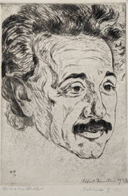
Albert Einstein. Portrait engraving by Hermann Struck, ca. 1920. Signed and dated 1923 by AlbertTremont Auctions4.6(293)See Sold PriceFeb 25, 2024
BALCK, Hermann (1893-1982, German General). Autograph Lette...Potter & Potter Auctions4.6(539)See Sold PriceMar 07, 2024
Hermann Sondermann (German,1832-1901) oil painting antiqueBroward Auction Gallery4.8(277)See Sold PriceMay 05, 2024
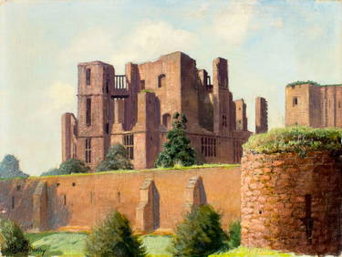
HERMANN OTTOMAR HERZOG (1832-1932) "GARDEN LANDSCAPE".Amelia Jeffers, Auctioneers & Appraisers4.6(101)See Sold PriceMar 07, 2024
LUDWIG HOHLWEIN (1874-1949) HERMANN SCHERRER / BREECHESMAKER. 1907.Swann Auction Galleries4.4(65)See Sold PriceFeb 29, 2024
Signed Hermann Wendelborg Hansen (1854-1924) Medium Ink on Paper GatewayBKG Antique Mall4.3(420)See Sold PriceFeb 25, 2024
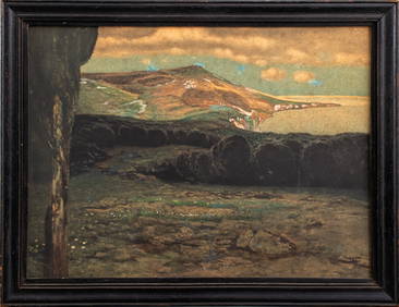
Hermann Herzog, Morning Fisherman - Oil on CanvasDallas Auction Gallery4.5(124)See Sold PriceMar 05, 2024
Axel Hermann Haig Etching "Buckingham Palace" SIGNED Framed COAKCM Galleries4.7(164)See Sold PriceFeb 25, 2024
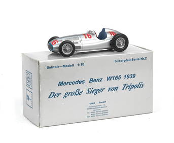
A boxed 1:18 scale die-cast model of Hermann Lang's 1939 Tripoli Grand Prix Mercedes-Benz W165 b...Bonhams4.1(305)See Sold PriceMar 01, 2024
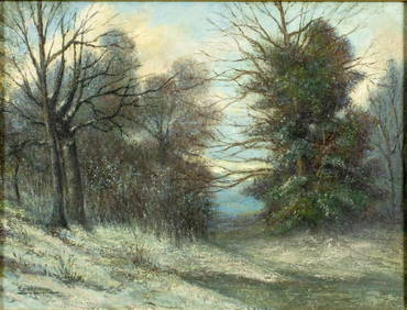
Oil on Canvas Board Seascape Painting by HermannRay's Premier Auction4.5(72)See Sold PriceMar 15, 2024
Herman Moll A New Map of Ye North Parts of AmericaWillow Auction House4.5(283)See Sold PriceMar 14, 2024
Otl Aicher; Hermann Ay, Olympia mascot 'Waldi', c. 1971Quittenbaum Kunstauktionen GmbH4.4(63)See Sold PriceMar 19, 2024


![MOLL, HERMANN. 1654-1732 [after]. Europe, by H. Moll Geographer. (1 of 1)](https://p1.liveauctioneers.com/1043/315399/169913467_1_x.jpg?height=282&quality=70&version=1706001851)