


Popular Searches
Popular Searches

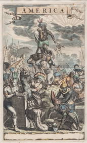
Descrittione… Santa Croce Mondo Nuovo PORCACCHI North America New World 1590 map
You May Also Like


Similar Sale History


Sold

Sold


Sold

Sold

Sold

Sold

Sold

Sold

Sold

Sold

Sold

Sold

Sold

Sold

Sold

Sold

Sold

Sold

Sold


Upcoming Sales
View All

![[ARCTIC]. BOWEN, Emanuel. A New & Accurate Map of the North... (1 of 1)](https://p1.liveauctioneers.com/928/318880/171360917_1_x.jpg?height=282&quality=70&version=1707501302)


TOP