ATLAS of ANTIENT GEOGRAPHY by SAMUEL BUTLER 1843John McInnis Auctioneers,LLC4.6(502)See Sold PriceFeb 24, 2024
18TH C. ANTIQUE MAP: FRENCH & INDIAN WAR, FRAMEDThomaston Place Auction Galleries4.4(386)See Sold PriceFeb 24, 2024
Rand McNally Railroad Map Cabinet w/ 21 Railroad MapsRail & Road Auctions4.6(165)See Sold PriceMar 08, 2024
Keith Haring - Ink on New York Map, Best Buddies, Inscribed, Signed, and DatedSapphire Auction Gallery4(67)See Sold PriceMar 02, 2024
LATE 17TH C. FRENCH MAP OF THE NEW WORLD BY ALEXIS-HUBERT JAILLOT (1632-1712)Thomaston Place Auction Galleries4.4(386)See Sold PriceFeb 24, 2024
Central Railroad of New Jersey Map of Sandy Hook Route-ca. 1903JM Hobby Supply and Railroad Artifact Auctions4.4(126)See Sold PriceFeb 24, 2024
Lot of Six Mixed Atlas Box Cars-HO Scale-New in BoxJM Hobby Supply and Railroad Artifact Auctions4.4(126)See Sold PriceFeb 25, 2024
Rand McNally/Santa Fe Railroad Map of Iowa-1912JM Hobby Supply and Railroad Artifact Auctions4.4(126)See Sold PriceFeb 24, 2024
NICOLAES VISSCHER (NETHERLANDS, 1618-1709) MAP OF THE NEW WORLDThomaston Place Auction Galleries4.4(386)See Sold PriceFeb 24, 2024
17TH C. WORLD MAP BY NICOLAES VISSCHER (NETHERLANDS, 1618-1709)Thomaston Place Auction Galleries4.4(386)See Sold PriceFeb 24, 2024
Lot of Six Mixed Atlas Cabooses-HO Scale-New in BoxJM Hobby Supply and Railroad Artifact Auctions4.4(126)See Sold PriceFeb 25, 2024
SoldAustralian state maps; New South Wales, Victoria & WestAustralian state maps; New South Wales, Victoria & West Australia, late 19th & 20th century. (20 items)See Sold Price
Sold[MAPS] New South Wales & VictoriaLot of 16 maps of New South Wales, Victoria, and the ACT, though mostly regional NSW. Includes Macalister River Watershed, Newcastle, Watersheds of the King, Howqua, & Jamieson Rivers, Warwick, UlladuSee Sold Price
SoldBartholomew: Map of New South Wales, Victoria, 1898Map of New South Wales, Victoria, John Bartholomew, The Citizen's Atlas, 1898, 14 x 18 inches No Reserve: This lot starts at $1 and has no reserve as a courtesy so that collectors can determine the trSee Sold Price
Original Antique Map - Map of Australia - New South Wales - Victoria, QueenslandTitle/Artist: Original Antique Map - Map of Australia - New South Wales - Victoria, Queensland Date: c. 1888 Material: Paper Dimensions: 67 cm x 43 cm Additional Information: Map "Australia" created bSee Sold Price
SoldMap of South Australia & New South Wales, Victoria, andColor map by Keith Johnston, F.R.S.E., of South Australia & New South Wales, Victoria, and Queensland. Engraved, printed, and published by W. & A.K. Johnston, Edinburgh & London. Set on backing boardSee Sold Price
Map of South Australia & New South Wales, Victoria, andColor map by Keith Johnston, F.R.S.E., of South Australia & New South Wales, Victoria, and Queensland. Engraved, printed, and published by W. & A.K. Johnston, Edinburgh & London. Set on backing boardSee Sold Price
Map of South Australia & New South Wales, Victoria, andColor map by Keith Johnston, F.R.S.E., of South Australia & New South Wales, Victoria, and Queensland. Engraved, printed, and published by W. & A.K. Johnston, Edinburgh & London. Set on baSee Sold Price
SoldMap of South Australia & New South Wales, Victoria, andColor map by Keith Johnston, F.R.S.E., of South Australia & New South Wales, Victoria, and Queensland. Engraved, printed, and published by W. & A.K. Johnston, Edinburgh & London. Set on backing boardSee Sold Price
Map of South Australia & New South Wales, Victoria, andColor map by Keith Johnston, F.R.S.E., of South Australia & New South Wales, Victoria, and Queensland. Engraved, printed, and published by W. & A.K. Johnston, Edinburgh & London. Set on backing boardSee Sold Price
Map of South Australia & New South Wales, Victoria, andColor map by Keith Johnston, F.R.S.E., of South Australia & New South Wales, Victoria, and Queensland. Engraved, printed, and published by W. & A.K. Johnston, Edinburgh & London. Set on backing boardSee Sold Price
Map of South Australia & New South Wales, Victoria, andColor map by Keith Johnston, F.R.S.E., of South Australia & New South Wales, Victoria, and Queensland. Engraved, printed, and published by W. & A.K. Johnston, Edinburgh & London. Set on backing boardSee Sold Price
Map of South Australia & New South Wales, Victoria, andColor map by Keith Johnston, F.R.S.E., of South Australia & New South Wales, Victoria, and Queensland. Engraved, printed, and published by W. & A.K. Johnston, Edinburgh & London. Set on baSee Sold Price
Map of South Australia & New South Wales, Victoria, andColor map by Keith Johnston, F.R.S.E., of South Australia & New South Wales, Victoria, and Queensland. Engraved, printed, and published by W. & A.K. Johnston, Edinburgh & London. Set on backing boardSee Sold Price
Map of South Australia & New South Wales, Victoria, andColor map by Keith Johnston, F.R.S.E., of South Australia & New South Wales, Victoria, and Queensland. Engraved, printed, and published by W. & A.K. Johnston, Edinburgh & London. Set on backing boardSee Sold Price
Map of South Australia & New South Wales, Victoria, andColor map by Keith Johnston, F.R.S.E., of South Australia & New South Wales, Victoria, and Queensland. Engraved, printed, and published by W. & A.K. Johnston, Edinburgh & London. Set on backing boardSee Sold Price
SoldSands Atlas Australia 1886The New Atlas of Australia The Complete Work Containing Over 100 Maps, and Full Descriptive Geography of New South Wales, Victoria, Queensland, South Australia and Western Australia, together with NumSee Sold Price
SoldAustralia.- Tallis (John) & John Rapkin. Seven maps ofAustralia.- Tallis (John) & John Rapkin. Seven maps of Australia, including a general map of Australia, the others of New South Wales, Victoria or Port Phillip, Western Australia, Part of South AustraSee Sold Price
SoldJOHN ARROWSMITH [1790-1873]: "Sketch Shewing theJOHN ARROWSMITH [1790-1873]: "Sketch Shewing the Squatting Districts in NEW SOUTH WALES. 1844." hand coloured, 42 x 37.5cm; map of part of Queensland, New South Wales and Victoria, showing the squattiSee Sold Price
SoldJohnson: Map of Australia, 18611861 Johnson's Map of Australia -- Johnson's Australia. An eloquent map showing six territories of Australia at the time: New South Wales, Victoria, Van Diemen Land, and West, North and South AustraliSee Sold Price
SoldBartholomew, John 1922 Lot of 7 Maps. AustraliaIncl Australia Political, Australia West, Eastern Queensland, South Australia, New South Wales, Victoria/Tasmania, and Australia East. Large Lithograph Maps Published 1922 by The Times, London for "ThSee Sold Price
SoldAustralasia - Sidney (Samuel), The Three Colonies ofAustralasia - Sidney (Samuel), The Three Colonies of Australia: New South Wales, Victoria, South Australia; their Pastures, Copper Mines, & Gold Fields, with Numerous Engravings, Ingram, Cooke, & Co.,See Sold Price
SoldAllodi (Pietro) OceaniaAllodi (Pietro) Oceania, showing Indonesia, the Philippines, Australia, New Zealand, Melanesia, Mirconesia and Polynesia, with inset map of Victoria and New South Wales, engraved map with origSee Sold Price
1892 Black Map of Australia [on Separate Sheet] New South Wales [on Separate Sheet] VictoriaTitle: 1892 Black Map of Australia [on Separate Sheet] New South Wales [on Separate Sheet] Victoria Cartographer: A&C Black Year / Place: 1892, Edinburgh Map Dimension (in.): 16.2 X 21.7 in. Largest TSee Sold Price
Westgarth (William) Victoria;Westgarth (William) Victoria; late Australia Felix, or Port Phillip District of New South Wales,folding map, coloured in outline, folding table, 8 pp. advertisments at end, [Ferguson 18415], ESee Sold Price
Southern Pacific RR Book West By South-Half South-1890JM Hobby Supply and Railroad Artifact Auctions4.4(126)See Sold PriceFeb 24, 2024
ASSOCIATED MOTORWAYS "LONDON TO NEW SOUTH WALES" BOOKING OFFICE TIN FLANGE SIGN.Dan Morphy Auctions4.2(1.3k)See Sold PriceFeb 24, 2024
LARGE LATE 17TH C. DUTCH CHART OF CANADA, GREAT LAKES, NEW FRANCE, LABRADOR, HUDSON BAY, BY PIERREThomaston Place Auction Galleries4.4(386)See Sold PriceFeb 24, 2024
LARGE EARLY 18TH C. DUTCH CHART OF UPPER NORTH AMERICA, PIERRE MORTIER (1661-1711), FRAMEDThomaston Place Auction Galleries4.4(386)See Sold PriceFeb 24, 2024
Portfolio of 15 County Maps by Robert Morden (English 1650-1703)Nadeau's Auction Gallery4.7(401)See Sold PriceFeb 24, 2024
Nostalgia #401 New South Wales Mounted RiflesOld Toy Soldier Auctions USA4.8(1.1k)See Sold PriceMar 15, 2024
Nostalgia #254 New South Wales Irish RiflesOld Toy Soldier Auctions USA4.8(1.1k)See Sold PriceMar 15, 2024
Nostalgia #291 New South Wales Lancers 1900Old Toy Soldier Auctions USA4.8(1.1k)See Sold PriceMar 15, 2024
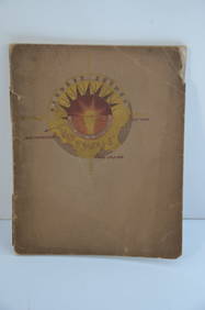
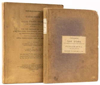
Astronomy.- Richardson (William) A Catalogue of 7385 Stars, chiefly in the Southern Hemisphere,Forum Auctions4.3(52)See Sold PriceFeb 29, 2024
South Namibia coast. Walvis Bay-Orange River ADMIRALTY sea chart 1881 (1954) mapJasper524.5(9.8k)See Sold PriceFeb 28, 2024
Framed New South Wales 6th Hole Golf PhotographRapid Estate Liquidators and Auction Gallery4.5(1.1k)See Sold PriceFeb 29, 2024
Vintage Australia Airplane Ashtray [Kangaroo]Grant Zahajko Auctions, LLC4.8(1k)See Sold PriceMar 06, 2024
![[MAPS] New South Wales & Victoria First Image](https://p1.liveauctioneers.com/8597/296734/157735918_1_x.jpg?height=282&quality=95&version=1690170365&width=282)

![[MAPS] New South Wales & Victoria First Image](https://p1.liveauctioneers.com/8597/296734/157735918_1_x.jpg?height=282&quality=1&version=1690170365&width=282)


![[MAPS] New South Wales & Victoria (1 of 6)](https://p1.liveauctioneers.com/8597/296734/157735918_1_x.jpg?height=282&quality=70&version=1690170365)


![JOHN ARROWSMITH [1790-1873]: "Sketch Shewing the (1 of 1)](https://p1.liveauctioneers.com/1466/81355/42225537_1_x.jpg?height=282&quality=70&version=1446089537)


![1892 Black Map of Australia [on Separate Sheet] New South Wales [on Separate Sheet] Victoria (1 of 3)](https://p1.liveauctioneers.com/5584/275309/144584450_1_x.jpg?height=282&quality=70&version=1673994422)


![Vintage Australia Airplane Ashtray [Kangaroo] (1 of 7)](https://p1.liveauctioneers.com/5755/320282/172113950_1_x.jpg?height=282&quality=70&version=1708463029)


