ATLAS of ANTIENT GEOGRAPHY by SAMUEL BUTLER 1843John McInnis Auctioneers,LLC4.6(504)See Sold PriceFeb 24, 2024
18TH C. ANTIQUE MAP: FRENCH & INDIAN WAR, FRAMEDThomaston Place Auction Galleries4.4(389)See Sold PriceFeb 24, 2024
Rand McNally Railroad Map Cabinet w/ 21 Railroad MapsRail & Road Auctions4.6(165)See Sold PriceMar 08, 2024
Keith Haring - Ink on New York Map, Best Buddies, Inscribed, Signed, and DatedSapphire Auction Gallery4.1(67)See Sold PriceMar 02, 2024
LATE 17TH C. FRENCH MAP OF THE NEW WORLD BY ALEXIS-HUBERT JAILLOT (1632-1712)Thomaston Place Auction Galleries4.4(389)See Sold PriceFeb 24, 2024
Central Railroad of New Jersey Map of Sandy Hook Route-ca. 1903JM Hobby Supply and Railroad Artifact Auctions4.4(126)See Sold PriceFeb 24, 2024
Lot of Six Mixed Atlas Box Cars-HO Scale-New in BoxJM Hobby Supply and Railroad Artifact Auctions4.4(126)See Sold PriceFeb 25, 2024
Rand McNally/Santa Fe Railroad Map of Iowa-1912JM Hobby Supply and Railroad Artifact Auctions4.4(126)See Sold PriceFeb 24, 2024
NICOLAES VISSCHER (NETHERLANDS, 1618-1709) MAP OF THE NEW WORLDThomaston Place Auction Galleries4.4(389)See Sold PriceFeb 24, 2024
17TH C. WORLD MAP BY NICOLAES VISSCHER (NETHERLANDS, 1618-1709)Thomaston Place Auction Galleries4.4(389)See Sold PriceFeb 24, 2024
Lot of Six Mixed Atlas Cabooses-HO Scale-New in BoxJM Hobby Supply and Railroad Artifact Auctions4.4(126)See Sold PriceFeb 25, 2024
SoldLarge Map of Illinois Iowa & MissouriMap of Illinois With map of Iowa and Missouri [separately] on versos Cartographer: George Franklin Cram Dated: Circa 1900 Type: Color LithographSee Sold Price
Large Map of Illinois Iowa & MissouriMap of Illinois With map of Iowa and Missouri [separately] on versos Cartographer: George Franklin Cram Dated: Circa 1900 Type: Color LithographSee Sold Price
USA MIDWEST. Missouri Illinois Indiana Iowa. Railways.TITLE/CONTENT OF MAP: 'NORTH AMERICA, SHEET IX., Parts of Missouri, Illinois, Iowa and Indiana' DATE PRINTED: 1874 IMAGE SIZE: Approx 33.5 x 39.5cm, 13.25 x 15.5 inches (Large) TYPE: Antique steel engSee Sold Price
US MIDWEST. Missouri Illinois Indiana Iowa Chicago.TITLE/CONTENT OF MAP: 'Eastern United States No 5' DATE PRINTED: 1883 IMAGE SIZE: Approx 36.0 x 41.0cm, 14.25 x 16.25 inches (Large); Please note that this is a folding map. TYPE: Antique colour atlasSee Sold Price
1891 Mitchell Map of Illinois, Missouri, Iowa, Wisconsin, Minnesota -- Map of Illinois, Missouri,Title: 1891 Mitchell Map of Illinois, Missouri, Iowa, Wisconsin, Minnesota -- Map of Illinois, Missouri, Iowa, Wisconsin, Minnesota Cartographer: S Mitchell Year / Place: 1891, Philadelphia Map DimensSee Sold Price
Sold* COLTON, George Woolworth. Colton's County and* COLTON, George Woolworth (1827-1901). Colton's County and Township Rail Road Map of Wisconsin, Illinois, Missouri, & Iowa. New York and Chicago: G. Woolworth Colton, Rufus Blanchard, 1863. EngravedSee Sold Price
SoldColton's Traveler and Tourist's Guide-Book througAuthor: [Smith, John Calvin] 99, [1] + 36 ad pp. Folding, hand-colored lithographed map. 5¾x3½, original gilt-decorated cloth. The large map shows Ohio, Michigan, Indiana, Illinois, Missouri, WisconSee Sold Price
Map of Iowa, Illinois and Missouri 1853Map of Iowa, Illinois and Missouri Hand colored. Map No 8 United States Cartographer: Jules Sherman Smith Publisher Daniel Burgess Dated: 1853 Type: Hand Colored LithogSee Sold Price
SoldAntique Map of Central East United StatesFramed and matted Antique Map of Delaware, Illinois, Indiana, Iowa, Kentucky, Maryland, Missouri, New Jersey, North Carolina, Ohio, Pennsylvania, Tennessee, and West Virginia. Map is in very good condSee Sold Price
Map of Dakota, Nebraska, Minnesota +Map of Ohio, Kentucky, Indiana, Illinois, Iowa and Missouri PLUS Michigan and Wisconsin [1 half sheet side] & Minnesota, Dakota Territory and Nebraska [1 half sheet side]See Sold Price
Map of Dakota, Nebraska, Minnesota +Map of Ohio, Kentucky, Indiana, Illinois, Iowa and Missouri PLUS Michigan and Wisconsin [1 half sheet side] & Minnesota, Dakota Territory and Nebraska [1 half sheet side]See Sold Price
Map of Dakota, Nebraska, Minnesota +Map of Ohio, Kentucky, Indiana, Illinois, Iowa and Missouri PLUS Michigan and Wisconsin [1 half sheet side] & Minnesota, Dakota Territory and Nebraska [1 half sheet side]See Sold Price
Map of Dakota, Nebraska, Minnesota +Map of Ohio, Kentucky, Indiana, Illinois, Iowa and Missouri PLUS Michigan and Wisconsin [1 half sheet side] & Minnesota, Dakota Territory and Nebraska [1 half sheet side]See Sold Price
Map of Dakota, Nebraska, Minnesota +Map of Ohio, Kentucky, Indiana, Illinois, Iowa and Missouri PLUS Michigan and Wisconsin [1 half sheet side] & Minnesota, Dakota Territory and Nebraska [1 half sheet side]See Sold Price
SoldMap of Dakota, Nebraska, Minnesota +Map of Ohio, Kentucky, Indiana, Illinois, Iowa and Missouri PLUS Michigan and Wisconsin [1 half sheet side] & Minnesota, Dakota Territory and Nebraska [1 half sheet side]See Sold Price
Map of Dakota, Nebraska, Minnesota +Map of Ohio, Kentucky, Indiana, Illinois, Iowa and Missouri PLUS Michigan and Wisconsin [1 half sheet side] & Minnesota, Dakota Territory and Nebraska [1 half sheet side] ThSee Sold Price
SoldRARE Coltons County and Township Map J H COLTON 1864Details: UNITED STATES - COLTON, J.H. (1800-1893). Colton's County and Township Map of the States of Illinois, Wisconsin, Minnesota, Iowa and Missouri, with parts of Indiana, Michigan, Kansas and NebSee Sold Price
SoldDRAKE, IRA S. Map of the States of Missouri, IDRAKE, IRA S. Map of the States of Missouri, Illinois, Iowa and Wisconsin; The Territory of Minnesota, and the Mineral Lands of Lake Superior. Hand-colored engraved folding pocket map, 735x550 mm overSee Sold Price
SoldIllinois and Missouri by Benjamin Tanner 1832Title: Illinois and Missouri Author: Tanner, Henry Schenck Description: Copper-engraved map, hand-colored. 71x57 cm. (28x22½"),Large, well-engraved map of the states of Illinois and Missouri, from TaSee Sold Price
1869 Mitchell Map of US Midwest -- XIV Ohio, Kentucky,Title: 1869 Mitchell Map of US Midwest -- XIV Ohio, Kentucky, Indiana, Illinois, Iowa and Missouri [verso] XV Michigan and Wisconsin Cartographer: S Mithchell Year / Place: 1869, Philadelphia Map DimeSee Sold Price
1869 Mitchell Map of US Midwest -- XIV Ohio, Kentucky,Title: 1869 Mitchell Map of US Midwest -- XIV Ohio, Kentucky, Indiana, Illinois, Iowa and Missouri [verso] XV Michigan and Wisconsin Cartographer: S Mithchell Year / Place: 1869, Philadelphia Map DimeSee Sold Price
1869 Mitchell Map of US Midwest -- XIV Ohio, Kentucky, Indiana, Illinois, Iowa and Missouri [verso]Title: 1869 Mitchell Map of US Midwest -- XIV Ohio, Kentucky, Indiana, Illinois, Iowa and Missouri [verso] XV Michigan and Wisconsin Cartographer: S Mithchell Year / Place: 1869, Philadelphia Map DimeSee Sold Price
1869 Mitchell Map of US Midwest -- XIV Ohio, Kentucky,Title/Content of Map: 1869 Mitchell Map of US Midwest -- XIV Ohio, Kentucky, Indiana, Illinois, Iowa and Missouri [verso] XV Michigan and Wisconsin Cartographer: S Mithchell Year/Place: 1869, PhiladelSee Sold Price
Johnson's Midwestern States [Midwestern Maps]Four Johnson's Midwestern States Maps. Includes Illinois, Indiana, Missouri and Kansas, Iowa and Nebraska. Alvin Jewett Johnson Cartographer. Published by A. J. Johnson, New York. Stamped 'Entered accSee Sold Price
Chicago and Eastern Illinois RR Annual Reports-1878 to 1887JM Hobby Supply and Railroad Artifact Auctions4.4(126)See Sold PriceFeb 24, 2024
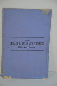
Chicago Danville and Vincennes RR Gold Bond Prospectus Book-1872JM Hobby Supply and Railroad Artifact Auctions4.4(126)See Sold PriceFeb 24, 2024
Early 1900's Railway Service Map, Illinois, Ohio, Indiana, Kentucky, TennesseeConnoisseur Auctions3.9(335)See Sold PriceFeb 24, 2024
War Diary of 354th Infantry - 89th Division 1919North American Artifact Auctions4.6(184)See Sold PriceApr 20, 2024
1736 LARGE MAP OF SILESIA POLAND OPPAVIENSIS antique 25 by 34 3/4"Jasper524.5(9.8k)See Sold PriceFeb 27, 2024
1736 LARGE MAP OF SILESIA POLAND KARNOVIENSIS antique 25 x 4 3/4" Duchy of KrnovJasper524.5(9.8k)See Sold PriceFeb 27, 2024
Nice Grouping of Illinois & Missouri found ArrowheadsHeartland Artifact Auctions4.6(783)See Sold PriceMar 10, 2024
Emory's Notes of a Military Reconnoissance larger issuePBA Galleries4.7(383)See Sold PriceMar 07, 2024
Stanford, Edward 1901 Large Map. Geological Map of the British IslesAlbion Auctions4.6(341)See Sold PriceMar 01, 2024
Stanford, Edward 1901 Large Map. Hydrographical Map of the British IslesAlbion Auctions4.6(341)See Sold PriceMar 01, 2024
Stanford, Edward 1901 Large Map. Stereographical Map of The British IslesAlbion Auctions4.6(341)See Sold PriceMar 01, 2024
Perry, Matthew C. 1856 Large Map. Shah Bay, Lew Chew I. JapanAlbion Auctions4.6(341)See Sold PriceMar 01, 2024
Francis McNally - Antique Map of Illinois, Missouri & IowaProverde Auctions4.3(3)See Sold PriceFeb 28, 2024
1910 USGS Topographic Map of Iowa-IllinoisRapid Estate Liquidators and Auction Gallery4.5(1.1k)See Sold PriceFeb 29, 2024


![1869 Mitchell Map of US Midwest -- XIV Ohio, Kentucky, Indiana, Illinois, Iowa and Missouri [verso] (1 of 2)](https://p1.liveauctioneers.com/5584/274166/143946233_1_x.jpg?height=282&quality=70&version=1673389176)

![Johnson's Midwestern States [Midwestern Maps] (1 of 5)](https://p1.liveauctioneers.com/5755/154409/77936943_1_x.jpg?height=282&quality=70&version=1573094011)